- Pettigo
Infobox Irish Place
name = Pettigo
gaeilge = Poiteagó
crest
motto =
map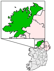
pin coords = left: 61px; top: 109px
north coord = 55.08
west coord = -18.06
irish grid =
area =
elevation =
province =Ulster
county =County Donegal
dailconstituency =
stdcode =
town pop = | rural pop = | census yr =
web =
|Pettigo (also spelt Pettigoe; Irish: "Poiteagó") is a small picturesque village on the border of
County Donegal andCounty Fermanagh . It is bisected by the Termon River which forms the border between Donegal in theRepublic of Ireland and Fermanagh inNorthern Ireland . The portion of the village in Northern Ireland is officially calledTullyhommon , but is locally known as 'High Street' due to its hillside position overlooking the remainder of the village. The rest of the village in the Republic includes Main Street, Mill Street and Station Street, all of which meet in the The Diamond at the centre of the village. There are also two relatively modern housing estates on the northern outskirts, namely Termon Villas and St. Patrick's Terrace along with new developments such as Mill Grove.Economy
Once a thriving market village on the Great Northern railway line, the village suffered from partition in 1922, the demise of the railway in the 1950s and from the closure of numerous cross-border roads by the
British army at the height ofthe Troubles in Northern Ireland. The latter had the effect of cutting Pettigo off from much of its rural hinterland in counties Fermanagh and Tyrone. In recent years economic prospects have improved with the reopening of many of the cross-border roads, improving access for tourists and locals alike.Agriculture , particularly the rearing ofsheep andcattle , forms the mainstay of the local economy. The quality of the local land (marsh y, with muchblanket bog ) renders it largely unsuitable forgrain crops . There are also expansive forestry plantations in the surrounding townlands, owned and operated byCoillte Teoranta , the Republic's Forestry Service. Many of the plantations occupy land unsuitable for other commercial uses, or wherepeat extraction has been completed, leaving poor quality thinsoil cover behind. TheSitka Spruce andLodgepole Pine softwood varieties comprise 90% of the canopy.Pettigo has traditionally been the 'gateway' to
St. Patrick's Purgatory , aChristian pilgrimage site, situated on an island in Lough Derg. During the mid-late 20th century, the popularity of the pilgrimage brought a significant boost to the local economy as tens of thousands of pilgrims from all overIreland and abroad traveled through the village on their way to and from Lough Derg. Although the popularity of the pilgrimage has dwindled in recent years, it is still an important driver of tourism in the area.History
In June 1922, at the tail end of the
Irish War of Independence , Pettigo was occupied by anIrish Republican Army unit who had arrived there from Donegal, in what was now the newIrish Free State . Abattalion ofBritish Army was sent to retake the village. In the ensuing fighting, in which the British bombarded the village and then stormed it, the IRA lost seven men killed, six wounded and four captured before being forced to retreat back to Donegal. One British soldier was also killed in the fighting. The number of civilian dead is not known.The Troubles
Although relatively unscathed by the Troubles conflict (1969-1998) compared with many border towns and villages, Pettigo did suffer from a number of bomb attacks during the 1970s such as the bomb at Brittons of the Cross in 1972 along with the explosions at the bridge at Mullinagoad when the British army were closing the borders. There was also a failed
Provisional Irish Republican Army bomb attack on a Boy's Brigade paradeFact|date=January 2008 on the8 November 1987 in the Fermanagh side of the village. - the same day as theEnniskillen Remembrance Day Bombing . Fortunately the bomb failed to detonate and no lives were lost.Religion
The local area has a mixed religious make-up, with the village containing Roman Catholic,
Church of Ireland , Presbyterian andMethodist Churches.Transport
*Pettigo railway station opened on
13 June 1866 and finally closed on1 October 1957 . [cite web | title=Pettigo station | work=Railscot - Irish Railways | url=http://www.railscot.co.uk/Ireland/Irish_railways.pdf | accessdate=2007-11-22|format=PDF]ee also
* List of towns and villages in Ireland
References
External links
* [http://www.fermanagh.org.uk/genealogy/focus/pettigo/history.htm Pettigo History]
* [http://www.pettigogaa.com/ Pettigo GAA Home Page]
* [http://www.geocities.com/pdoogon/pettigo.html Visit Pettigo]
Wikimedia Foundation. 2010.