- Netcong, New Jersey
-
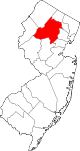
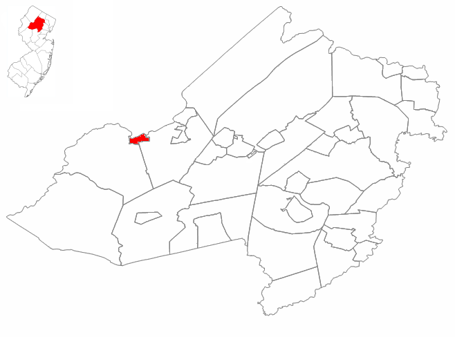
Netcong, New Jersey — Borough — Netcong highlighted in Morris County. Inset map: Morris County highlighted in the State of New Jersey. Census Bureau map of Netcong, New Jersey
Coordinates: 40°53′51″N 74°42′16″W / 40.8975°N 74.70444°WCoordinates: 40°53′51″N 74°42′16″W / 40.8975°N 74.70444°W Country United States State New Jersey County Morris Incorporated October 23, 1894 Government[1] – Type Borough – Mayor Joseph Nametko Area – Total 0.9 sq mi (2.3 km2) – Land 0.8 sq mi (2.2 km2) – Water 0.1 sq mi (0.1 km2) Elevation[2] 938 ft (286 m) Population (2007)[3] – Total 3,241 – Density 3,066.8/sq mi (1,184.1/km2) Time zone Eastern (EST) (UTC-5) – Summer (DST) EDT (UTC-4) ZIP code 07857 Area code(s) 973 FIPS code 34-50130[4][5] GNIS feature ID 0885316[6] Website http://www.netcong.org Netcong is a Borough in Morris County, New Jersey, United States. As of the United States 2000 Census, the borough population was 2,580. Its estimated population in 2006 was 3,292. Netcong lies on the shores of Lake Musconetcong.
Netcong was incorporated as a borough by an Act of the New Jersey Legislature on October 23, 1894, from portions of both Mount Olive Township and Roxbury Township, based on the results of a referendum held the previous day.[7]
Contents
Geography
Netcong is located at 40°53′51″N 74°42′16″W / 40.897548°N 74.704356°W (40.897548, -74.704356).[8]
According to the United States Census Bureau, the borough has a total area of 0.9 square miles (2.3 km2), of which, 0.8 square miles (2.1 km2) of it is land and 0.1 square miles (0.26 km2) of it (6.67%) is water.
Netcong borders Mt. Olive Twp, Roxbury Twp, and Stanhope.
Transportation
Major roadways that pass through include the Bergen-Passaic Expressway (Interstate 80/U.S. Route 206), U.S. Route 46 and Route 183. I-80/US 206 intersect with US 46 in the southwest corner of the borough at Exit 26.
Demographics
Historical populations Census Pop. %± 1930 2,097 — 1940 2,157 2.9% 1950 2,284 5.9% 1960 2,765 21.1% 1970 2,858 3.4% 1980 3,557 24.5% 1990 3,311 −6.9% 2000 2,580 −22.1% Est. 2007 3,241 [3] 25.6% Population 1930 - 1990.[9] As of the census[4] of 2000, there were 2,580 people, 1,008 households, and 681 families residing in the town. The population density was 3,066.8 people per square mile (1,185.9/km2). There were 1,043 housing units at an average density of 1,239.8 per square mile (479.4/km2). The racial makeup of the borough was 94.30% White, 1.20% African American, 0.04% Native American, 1.67% Asian, 1.43% from other races, and 1.36% from two or more races. Hispanic or Latino of any race were 7.13% of the population.
There were 1,008 households out of which 30.5% had children under the age of 18 living with them, 50.3% were married couples living together, 11.8% had a female householder with no husband present, and 32.4% were non-families. 26.3% of all households were made up of individuals and 9.6% had someone living alone who was 65 years of age or older. The average household size was 2.56 and the average family size was 3.10.
In the borough the population was spread out with 23.0% under the age of 18, 7.2% from 18 to 24, 32.7% from 25 to 44, 22.5% from 45 to 64, and 14.6% who were 65 years of age or older. The median age was 38 years. For every 100 females there were 96.5 males. For every 100 females age 18 and over, there were 92.5 males.
The median income for a household in the borough was $55,000, and the median income for a family was $65,833. Males had a median income of $42,179 versus $36,458 for females. The per capita income for the borough was $23,472. About 2.5% of families and 3.1% of the population were below the poverty line, including 1.2% of those under age 18 and 5.4% of those age 65 or over.
Government
Local government
Netcong is governed under the Borough form of New Jersey municipal government. The government consists of a Mayor and a Borough Council comprising six council members, with all positions elected at large. A Mayor is elected directly by the voters to a four-year term of office. The Borough Council consists of six members elected to serve three-year terms on a staggered basis, with two seats coming up for election each year.[1]
As of 2008[update], the Mayor of Netcong is Joseph Nametko; Members of the Borough Council are Council President Elmer “Bub” M. Still, James Arbolino, Ben Dellamo, Edward Koster, Cecilia G. Laureys, John "Jack" Sylvester, Jr.[10]
Federal, state and county representation
Netcong is in the 11th Congressional district. New Jersey's Eleventh Congressional District is represented by Rodney Frelinghuysen (R, Harding Township). New Jersey is represented in the United States Senate by Frank Lautenberg (D, Cliffside Park) and Bob Menendez (D, Hoboken).
Netcong is in the 24th Legislative District of the New Jersey Legislature, which is represented in the New Jersey Senate by Steve Oroho (R, Franklin) and in the New Jersey General Assembly by Gary R. Chiusano (R, Augusta) and Alison Littell McHose (R, Franklin).[11]
Morris County is governed by a seven-member Board of Chosen Freeholders, who are elected at-large to three-year terms of office on a staggered basis, with two or three seats coming up for election each year.[12] As of 2011, Morris County's Freeholders are Freeholder Director William J. Chegwidden (Wharton),[13] Deputy Freeholder Director Douglas R. Cabana (Boonton Township),[14] Gene F. Feyl (Denville),[15] Ann F. Grassi (Parsippany-Troy Hills),[16] Thomas J. Mastrangelo (Montville),[17] John J. Murphy (Morris Township)[18] and Margaret Nordstrom (Washington Township).[19][20]
History
Netcong received its name from the Musconetcong River, named by the Lenape Native Americans and meaning "grass creek", "swamp stream" or "rapid stream".[21] Along with the river, the proximity of the old Morris and Sussex Turnpike, which passed through the region shortly after 1801, and the coming of the Morris Canal, in 1831, made the site a favorable one for development.
After becoming a Borough, the residents had to elect the first Governing Body. The first Mayor was Abraham J. Drake, elected November 14, 1894. A census of Netcong taken July 1895 showed a population of 877 people.
Netcong derived much of its business from the Delaware, Lackawanna and Western Railroad, which had its last stop in Morris County in the heart of the Borough. The DL&W's Sussex Branch to Branchville also stopped at Netcong Station, with the Sussex Branch coming into the opposite side of the station from where New Jersey Transit's line is today. The big railroad roundhouse in Port Morris also supplied many jobs for the town residents.[22] NJ Transit currently operates weekday rail service between Netcong and Hoboken Terminal, with service to Penn Station in New York City via Midtown Direct.
In view of Netcong's rich railroad history, the town has been named as a site for the NJ State Railroad and Transportation Museum (jointly with Phillipsburg). Given that the site envisioned for this museum in Phillipsburg has been sold for development as a townhouse complex and college campus annex, it is unclear what role Phillipsburg will play in this museum. No matter what, funding will need to be secured in order to build and operate this museum.
As such, several major highways also pass through Netcong: Interstate 80, U.S. Route 46 and Route 183, the latter two highways meeting at the Netcong Circle. Interesting, despite its small size, Netcong is widely known, not only due to its distinct name, but also because the New Jersey Department of Transportation (NJDOT) uses the town's name as a control city on directional signage on its highways throughout northern New Jersey, and as far away as the George Washington Bridge.
Education
Netcong is home to the Netcong School District, a Pre-K to grade 8 school district, serving 295 students at Netcong Elementary School.[23] Netcong's school offers small class sizes that allow teachers to offer personalized attention not possible in larger schools.
For grades 9 - 12, public school students attend Lenape Valley Regional High School, which serves Netcong and the Sussex County communities of Stanhope and Byram Township.[24]
St. Michael School is a Catholic school operated under the auspices of the Roman Catholic Diocese of Paterson.[25]
References
- ^ a b 2005 New Jersey Legislative District Data Book, Rutgers University Edward J. Bloustein School of Planning and Public Policy, April 2005, p. 110.
- ^ U.S. Geological Survey Geographic Names Information System: Borough of Netcong, Geographic Names Information System, accessed November 5, 2007.
- ^ a b Census data for Netcong borough, United States Census Bureau. Accessed November 22, 2008.
- ^ a b "American FactFinder". United States Census Bureau. http://factfinder.census.gov. Retrieved 2008-01-31.
- ^ A Cure for the Common Codes: New Jersey, Missouri Census Data Center. Accessed July 14, 2008.
- ^ "US Board on Geographic Names". United States Geological Survey. 2007-10-25. http://geonames.usgs.gov. Retrieved 2008-01-31.
- ^ "The Story of New Jersey's Civil Boundaries: 1606-1968", John P. Snyder, Bureau of Geology and Topography; Trenton, New Jersey; 1969. p. 195.
- ^ "US Gazetteer files: 2010, 2000, and 1990". United States Census Bureau. 2011-02-12. http://www.census.gov/geo/www/gazetteer/gazette.html. Retrieved 2011-04-23.
- ^ New Jersey Resident Population by Municipality: 1930 - 1990, Workforce New Jersey Public Information Network. Accessed March 1, 2007.
- ^ Netcong Elected Officials, Borough of Netcong. Accessed February 27, 2008.
- ^ "Legislative Roster: 2010-2011 Session". New Jersey Legislature. http://www.njleg.state.nj.us/members/roster.asp. Retrieved 2010-08-04.
- ^ What is a Freeholder?, Morris County, New Jersey. Accessed January 5, 2011.
- ^ William J. Chegwidden, Morris County, New Jersey. Accessed January 9, 2011.
- ^ Douglas R. Cabana, Morris County, New Jersey. Accessed January 9, 2011.
- ^ Gene F. Feyl, Morris County, New Jersey. Accessed January 9, 2011.
- ^ Ann F. Grossi, Morris County, New Jersey. Accessed January 9, 2011.
- ^ Thomas J. Mastrangelo, Morris County, New Jersey. Accessed January 9, 2011.
- ^ John J. Murphy, Morris County, New Jersey. Accessed January 9, 2011.
- ^ Margaret Nordstrom, Morris County, New Jersey. Accessed January 9, 2011.
- ^ Meet the Freeholders, Morris County, New Jersey. Accessed January 9, 2011.
- ^ Netcong, New Jersey community profile, Epodunk. Accessed November 5, 2007.
- ^ Netcong: A Brief History, accessed August 3, 2006
- ^ Data for the Netcong Public Schools, National Center for Education Statistics. Accessed February 27, 2008.
- ^ Lenape Valley Regional High School 2007 Report Card narrative, New Jersey Department of Education. Accessed February 27, 2008. "Blending a traditional program with a vision for the future, Lenape Valley Regional High School located in the town of Stanhope is a high school of significant prominence in our geographic region. Serving the communities of Byram Township, Netcong Boro, and Stanhope Borough, and bridging Morris and Sussex counties..."
- ^ Morris County Elementary / Secondary Schools, Roman Catholic Diocese of Paterson. Accessed July 26, 2008.
External links
- Borough of Netcong website
- Netcong School District
- Netcong School District's 2009–10 School Report Card from the New Jersey Department of Education
- Data for the Netcong School District, National Center for Education Statistics
- Lenape Valley Regional High School
- Regional area newspaper
- Netcong High School Mixed Chorus, circa 1951-53 (photo)
Municipalities and communities of Morris County, New Jersey Boroughs Butler | Chatham | Chester | Florham Park | Kinnelon | Lincoln Park | Madison | Mendham | Morris Plains | Mount Arlington | Mountain Lakes | Netcong | Riverdale | Rockaway | Victory Gardens | Wharton
Towns Boonton | Dover | Morristown
Townships Boonton | Chatham | Chester | Denville | East Hanover | Hanover | Harding | Jefferson | Long Hill | Mendham | Mine Hill | Montville | Morris | Mount Olive | Parsippany-Troy Hills | Pequannock | Randolph | Rockaway | Roxbury | Washington
CDPs Unincorporated
communitiesBrookside | Cedar Knolls | Cedar Lake | Convent Station | Flanders | Gillette | Green Pond | Green Village | Hibernia | Lake Hiawatha | Lake Swannanoa | Landing | Ledgewood | Millington | Mount Freedom | Mount Tabor | New Vernon | Oak Ridge | Pine Brook | Port Morris | Schooley's Mountain | Shongum | Speedwell | Stirling | Towaco | Union Hill | Vasa Park | Whippany
Categories:- Boroughs in Morris County, New Jersey
- Place names in New Jersey of Native American origin


Wikimedia Foundation. 2010.