- Succasunna-Kenvil, New Jersey
Infobox Settlement
official_name = Succasunna-Kenvil, New Jersey
settlement_type = CDP
nickname =
motto =
imagesize =
image_caption =
image_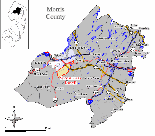
mapsize = 250x200px
map_caption = Map of Succasunna-Kenvil CDP in Morris County
mapsize1 =
map_caption1 =subdivision_type = Country
subdivision_name =United States
subdivision_type1 = State
subdivision_name1 =New Jersey
subdivision_type2 = County
subdivision_name2 = Morris
government_footnotes =
government_type =
leader_title =
leader_name =
leader_title1 =
leader_name1 =
established_title =
established_date =area_footnotes =
area_magnitude =
area_total_km2 = 17.6
area_land_km2 = 17.3
area_water_km2 = 0.3
area_total_sq_mi = 6.8
area_land_sq_mi = 6.7
area_water_sq_mi = 0.1population_as_of = 2000
population_footnotes =
population_total = 12569
population_density_km2 = 727.5
population_density_sq_mi = 1884.3timezone = Eastern (EST)
utc_offset = -5
timezone_DST = EDT
utc_offset_DST = -4
elevation_footnotes =
elevation_m =
elevation_ft =
latd = 40 |latm = 51 |lats = 41 |latNS = N
longd = 74 |longm = 38 |longs = 48 |longEW = Wpostal_code_type =
postal_code =
area_code =
blank_name = FIPS code
blank_info = 34-71385GR|2
blank1_name =
blank1_info =
website =
footnotes =Succasunna-Kenvil is a
census-designated place and unincorporated area located within Roxbury Township, in Morris County,New Jersey . As of theUnited States 2000 Census , the CDP population was 12,569.History
The name of Succasunna comes from the Lenni-Lenape Native American word for "Black Rock", most likely due to the rich iron-ore deposits in the area. The community was established circa 1740.
The Hercules Powder Co. in Kenvil has had explosions in 1934, killing 6 people; in 1940, killing 51 people; and in 1989, shattering windows across town.
U.S. Route 46 and Route 10 pass through the area. TheMorristown and Erie Railway runs rail freight service through the area 2-5 times per week on its High Bridge Branch.Geography
Succasunna-Kenvil is located at coor dms|40|51|41|N|74|38|48|W|city (40.861496, -74.646603)GR|1.
According to the
US Census Bureau , the CDP has a total area of 17.6km² (6.8 mi²). 17.3 km² (6.7 mi²) of it is land and 0.3 km² (0.1 mi²) of it (1.77%) is water.Government
Federal, state and county representation
Succasunna-Kenvil, and the rest of Roxbury Township, is in the Eleventh Congressional District and is part of New Jersey's 25th Legislative District.
Demographics
USCensusPop
1990=11781
2000=12569
footnote=source: [cite web
url=http://factfinder.census.gov/servlet/SAFFPopulation?_event=Search&geo_id=06000US3402764980&_geoContext=01000US%7C04000US34%7C05000US34027%7C06000US3402764980&_street=&_county=Succasunna&_cityTown=Succasunna&_state=&_zip=&_lang=en&_sse=on&ActiveGeoDiv=geoSelect&_useEV=&pctxt=fph&pgsl=060&_submenuId=population_0&ds_name=null&_ci_nbr=null&qr_name=null®=null%3Anull&_keyword=&_industry=
title=Population Finder: Succasunna-Kenvil CDP, New Jersey
publisher=U.S. Census Bureau
accessdate=2007-03-18] As of thecensus GR|2 of 2000, there were 12,569 people, 4,138 households, and 3,475 families residing in the CDP. Thepopulation density was 727.6/km² (1,884.3/mi²). There were 4,184 housing units at an average density of 242.2/km² (627.3/mi²). The racial makeup of the CDP was 92.99% White, 1.34% Black or African American, 0.1% Native American, 4.11% Asian, 0.0% Pacific Islander, 0.67% from other races, and 0.81% from two or more races. 3.87% of the population were Hispanic or Latino of any race.There were 4,138 households out of which 43.6% had children under the age of 18 living with them, 74.5% were married couples living together, 6.9% had a female householder with no husband present, and 16.0% were non-families. 13.3% of all households were made up of individuals and 5.4% had someone living alone who was 65 years of age or older. The average household size was 3.02 and the average family size was 3.33.
In the CDP the population was spread out with 28.4% under the age of 18, 5.8% from 18 to 24, 30.1% from 25 to 44, 26.0% from 45 to 64, and 9.6% who were 65 years of age or older. The median age was 38 years. For every 100 females there were 97.9 males. For every 100 females age 18 and over, there were 93.4 males.
The median income for a household in the CDP was $83,614, and the median income for a family was $90,015. Males had a median income of $64,188 versus $37,841 for females. The
per capita income for the CDP was $31,923. About 1.9% of families and 2.4% of the population were below thepoverty line , including 2.4% of those under age 18 and 1.9% of those age 65 or over.Education
[http://www.saintthereseschool.org/ St. Therese School] is a
Catholic school operated under the auspices of theRoman Catholic Diocese of Paterson . [ [http://www.patersondiocese.org/moreinfo.cfm?Web_ID=43 Morris County Elementary / Secondary Schools] ,Roman Catholic Diocese of Paterson . AccessedJuly 26 ,2008 .]Notable residents
Notable current and former residents of Succasunna-Kenvil include:
*Doug Miller (born 1969), soccer player and coach. [ [http://www.dougmillersoccer.com/aboutdoug.cfm About Doug] , Doug Miller Soccer. AccessedMarch 6 ,2008 .]References
External links
* [http://www.roxburynewjersey.com/hercules.htm Kenvil NJ Hercules Explosion of 1940]
* [http://www.allplaces.us/t.cgi?z=07847 Kenvil NJ 07847]
Wikimedia Foundation. 2010.