- Budd Lake, New Jersey
Infobox Settlement
official_name = Budd Lake, New Jersey
settlement_type = CDP
nickname =
motto =
imagesize =
image_caption =
image_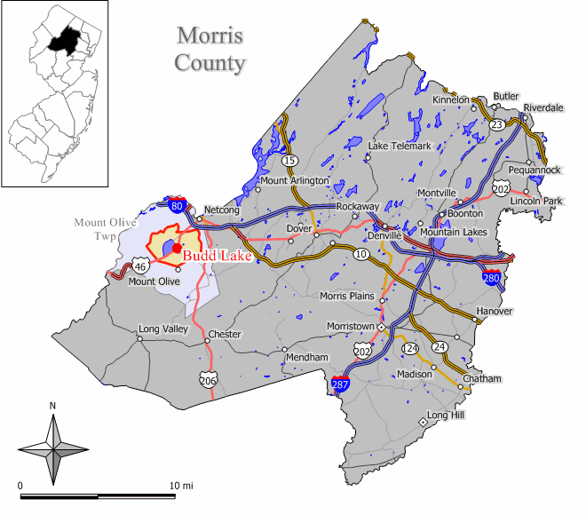
mapsize = 250x200px
map_caption = Map of Budd Lake CDP in Morris County
mapsize1 =
map_caption1 =subdivision_type = Country
subdivision_name =United States
subdivision_type1 = State
subdivision_name1 =New Jersey
subdivision_type2 = County
subdivision_name2 = Morris
government_footnotes =
government_type =
leader_title =
leader_name =
leader_title1 =
leader_name1 =
established_title =
established_date =area_footnotes =
area_magnitude =
area_total_km2 = 16.7
area_land_km2 = 15.2
area_water_km2 = 1.5
area_total_sq_mi = 6.4
area_land_sq_mi = 5.9
area_water_sq_mi = 0.6population_as_of = 2000
population_footnotes =
population_total = 8100
population_density_km2 = 534.3
population_density_sq_mi = 1383.8timezone = Eastern (EST)
utc_offset = -5
timezone_DST = EDT
utc_offset_DST = -4
elevation_footnotes =
elevation_m = 291
elevation_ft = 955
latd = 40 |latm = 52 |lats = 4 |latNS = N
longd = 74 |longm = 44 |longs = 26 |longEW = Wpostal_code_type =
ZIP code
postal_code = 07828
area_code = 973
blank_name = FIPS code
blank_info = 34-08620GR|2
blank1_name = GNIS feature ID
blank1_info = 0875014GR|3
website =
footnotes =Budd Lake is a
census-designated place and unincorporated area located within Mount Olive Township, in Morris County,New Jersey . As of theUnited States 2000 Census , the CDP population was 8,100.Geography
Budd Lake is located at coor dms|40|52|4|N|74|44|26|W|city (40.867809, -74.740666)GR|1.
According to the
United States Census Bureau , the CDP has a total area of 16.7km² (6.4 mi²). 15.2 km² (5.8 mi²) of it is land and 1.5 km² (0.6 mi²) of it (9.15%) is water.Lake
Budd Lake, the lake, is a glacial lake with an elevation of 933feet, and a surface area of 374 acres. It is the largest natural lake in New Jersey. [ [http://nj.gov/dep/njnlt/buddlakebog.htm Budd Lake Bog Preserve] , New Jersey Natural Lands Trust. Accessed
October 15 ,2007 .] It is 7-12 feet deep, and can have large algal blooms. It is recharged through groundwater seepage through a series of wetlands, and serves as the headwaters of the Raritan River's South Branch. [http://www.anjec.org/pdfs/Fall2002ANJECReport.pdf ANJEC Report: Fall 2002 (PDF)] , accessedJuly 17 ,2006 ] It is closely bordered byU.S. Route 46 to the south, and Sand Shore Road to the east. [ [http://www.google.com/maps?f=q&hl=en&geocode=&q=&ie=UTF8&ll=40.871858,-74.744711&spn=0.031543,0.075617&z=14&om=1 Google Maps] Google. Retrieved on2007 -07-15 .]History
Budd Lake was named for John Budd [ [http://www.mountolivetownship.com/town_history2.html The History of Mt. Olive] , accessed
July 17 ,2006 ] . Prior to that, it was called Hattacawanna Lake [ [http://www.jerseyhistory.org/findingaid.php?aid=1187 Manuscript Group 1187, Forest House Hotel, Hattacawanna Lake, NJ] , accessedJuly 17 ,2006 ] .Demographics
USCensusPop
1990=7272
2000=8100
footnote=source: [cite web |url=http://factfinder.census.gov/servlet/SAFFPopulation?_event=Search&geo_id=16000US3448480&_geoContext=01000US%7C04000US34%7C16000US3448480&_street=&_county=budd+lake&_cityTown=budd+lake&_state=&_zip=&_lang=en&_sse=on&ActiveGeoDiv=geoSelect&_useEV=&pctxt=fph&pgsl=160&_submenuId=population_0&ds_name=null&_ci_nbr=null&qr_name=null®=null%3Anull&_keyword=&_industry=|title=Population Finder: Budd Lake CDP, New Jersey|publisher=U.S. Census Bureau |accessdate=2007-03-16]As of the
census GR|2 of 2000, there were 8,100 people, 2,851 households, and 2,169 families residing in the CDP. Thepopulation density was 534.6/km² (1,383.8/mi²). There were 2,994 housing units at an average density of 197.6/km² (511.5/mi²). The racial makeup of the CDP was 87.11% White, 3.54% African American, 0.07% Native American, 5.80% Asian, 1.47% from other races, and 2.00% from two or more races. Hispanic or Latino of any race were 6.62% of the population.There were 2,851 households out of which 43.7% had children under the age of 18 living with them, 62.7% were married couples living together, 9.4% had a female householder with no husband present, and 23.9% were non-families. 18.4% of all households were made up of individuals and 3.9% had someone living alone who was 65 years of age or older. The average household size was 2.83 and the average family size was 3.25.
In the CDP the population was spread out with 28.7% under the age of 18, 6.9% from 18 to 24, 37.5% from 25 to 44, 21.2% from 45 to 64, and 5.8% who were 65 years of age or older. The median age was 34 years. For every 100 females there were 99.0 males. For every 100 females age 18 and over, there were 96.5 males.
The median income for a household in the CDP was $62,540, and the median income for a family was $70,585. Males had a median income of $44,631 versus $35,316 for females. The
per capita income for the CDP was $24,581. About 1.9% of families and 3.3% of the population were below thepoverty line , including 2.4% of those under age 18 and 3.9% of those age 65 or over.References
External links
* [http://www.flanders-nj.com Local News]
Wikimedia Foundation. 2010.