- New Jersey Route 183
-
Route 183
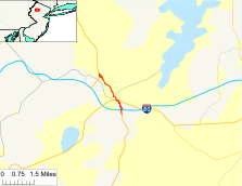
Route information Maintained by New Jersey Department of Transportation Length: 2.12 mi[1] (3.41 km) Existed: 1973 – present Major junctions South end: 
 US 206 / I-80 in Roxbury
 US 46 in Netcong
North end: US 206 in StanhopeHighway system New Jersey State Highway Routes
Interstate and US←  Route 182
Route 184  →
→Route 183 is a 2.12-mile (3.41 km) long state highway in the northern regions of New Jersey. The southern end of NJ 183 is at an interchange with Interstate 80 and U.S. Route 206 near Netcong, while the northern end is at an interchange with US 206 in Stanhope. The route heads northward through downtown Netcong and along the shores of Lake Musconetcong and enters Sussex County, New Jersey. The route is a former alignment of US 206 bypassed in 1973.
The highway dates back to the designations of State Highway Route 31, which was main north–south highway in New Jersey. The Netcong Circle, a traffic circle in Netcong between NJ 183 and U.S. Route 46 has been present for the entire lifetime of NJ 183, and is slated to be replaced by a signalized intersection. A nearby bridge over a New Jersey Transit line is also going to be replaced.
Contents
Route description
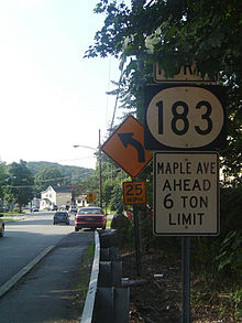
 NJ 183 northbound heading into Stanhope
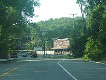
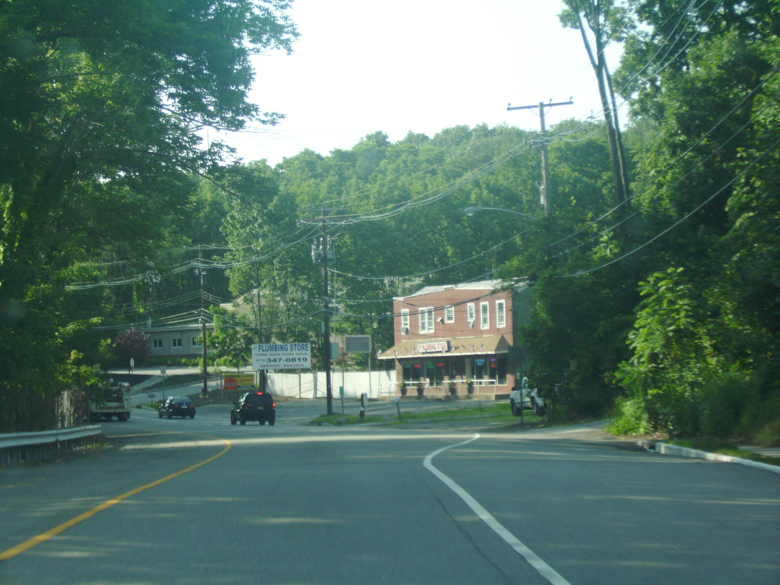
Route 183 begins at a partial cloverleaf interchange with U.S. Route 206 and Interstate 80 in the community of Roxbury, New Jersey. The route heads northward, intersecting with local dead-end streets deep in the forests of rural Morris County. Route 183 passes a nearby factory and reaches into the Netcong Circle, where the highway intersects with U.S. Route 46. Because of the circle, there is a short concurrency between Routes 46 and 183, before Route 183 turns to the north at the end of the circle. The route continues northward, crossing over a creek and entering downtown Netcong. Downtown Netcong is highly developed, and Route 183 serves as the main street through the community. The highway intersects with Allen Street (Morris County Route 631) before running along the shores of Lake Musconetcong and into Sussex County.[1][2]
Upon entering Sussex County, Route 183 enters the community of Stanhope. At the intersection with Musconetcong Avenue, the highway turns to the northwest, leaving the shores of the lake. Route 183 continues through the residential developments in Stanhope, working its way into the mountains above the lake. At the intersection with Dell Road, Route 183 becomes intertwined with the interchange on U.S. Route 206 northbound, and the highways merge a short distance later in Stanhope.[1][2]
History
 NJ 183 heading northbound into downtown Netcong
Designation
The original designation in the area of Netcong along NJ 183's alignment is State Highway Route 31, which consisted much of the alignment of current-day U.S. Route 206. The route was first assigned in the 1927 state highway renumbering as a co-designation to US 206.[3] This alignment remained in place for about two and half decades, when in the 1953 state highway renumbering, the State Highway Route 31 designation was dropped in favor of using U.S. Route 206.[4] The route in Netcong stayed the same for several years after the decommissioning until the Regional Plan Association proposed a freeway realignment of US 206 in 1962.[5] The highway was to serve local recreation areas and relieve traffic on Interstate 287 to the east.[6] The route was advocated through 1972, and after the fiscal year budgets went sour, the proposal was dropped.[7] The Netcong Bypass was built as a piece of this freeway and U.S. Route 206 was realigned off the Netcong alignment, which became NJ 183 in 1973.[8]
Netcong Circle elimination
In 2007, the New Jersey Department of Transportation proposed the elimination of the Netcong Traffic Circle, located at the intersections of U.S. Route 46 and Route 183 just north of the interchange with Interstate 80. The project is to produce two outcomes: replacement of the New Jersey Transit bridge that Route 183 crosses, and the elimination of the Netcong Circle with a signalized intersection. The project currently has issues dealing with the vertical clearance of the overpass for U.S. Route 46 westbound. The removal of the circle will eliminate this bridge, and the land will go to use as the new signalized intersection, with pedestrian and bicycle fittings. The entire project will cost about $13.3 million (2009 USD) of state and local funds to construct until completion in 2010.[9]
The circle itself dates back to construction in 1938, and is one of the 24 remaining traffic circles in New Jersey. The circle itself cannot handle the 17,000 vehicles a year that use the large roadway daily, and has become the site of several accidents, including 45 in 2007 alone. The entire traffic circle conversion will eliminate two businesses in the area and is still slated for construction.[10]
Major intersections
County Location Mile[1] Destinations Notes Morris Roxbury 0.00 US 206 / I-80Exit 27 (I-80) Netcong 0.47 US 46Netcong Circle Sussex Stanhope 2.12 US 206Interchange 1.000 mi = 1.609 km; 1.000 km = 0.621 mi See also
 U.S. Roads portal
 New Jersey portal
References
- ^ a b c d "Route 183 straight line diagram". New Jersey Department of Transportation. 2009. http://www.state.nj.us/transportation/refdata/sldiag/00000183__-.pdf. Retrieved March 26, 2007.
- ^ a b Yahoo! Inc. Yahoo! Maps – Overview map of NJ Route 183 (Map). Cartography by NAVTEQ. http://maps.yahoo.com/#mvt=h&lat=40.914679&lon=-74.711305&zoom=17&q1=40.892671%2C-74.697787&w0=40.904447466696126%2C-74.70664501190186&q2=40.91596%2C-74.716669. Retrieved July 5, 2009.
- ^ New Jersey Highway Department (1927). Sketch Map Showing Approximate Locations of State Highway Routes (Map). http://www.jimmyandsharonwilliams.com/njroads/1920s/route05.htm. Retrieved July 5, 2009.
- ^ 1953 renumbering. New Jersey Department of Highways. http://en.wikisource.org/wiki/1953_New_Jersey_state_highway_renumbering. Retrieved July 31, 2009.
- ^ Regional Highways: Status Report. Tri-State Transportation Commission. 1962.
- ^ Transportation 1985: A Regional Plan. Tri-State Transportation Commission. 1966.
- ^ Master Plan for Transportation. New Jersey Department of Transportation. 1972.
- ^ Anderson, Steve (2009). "U.S. Route 206 Freeway — New Jersey". Eastern Roads. pp. 1. http://www.nycroads.com/roads/US-206N_NJ/. Retrieved July 5, 2009.
- ^ "FY 2007-10 Capital Improvement Projects". New Jersey Department of Transportation. 2006. pp. 15. http://www.nj.gov/transportation/capital/stip0710/sec3/counties/morris.pdf. Retrieved July 5, 2009.
- ^ Drobness, Tanya (April 5, 2009). "Netcong Circle in Morris County near end of road". The Star-Ledger. http://www.nj.com/news/index.ssf/2009/04/netcong_circle_in_morris_count.html. Retrieved July 5, 2009.
External links
Categories:- State highways in New Jersey
- Transportation in Morris County, New Jersey
- Transportation in Sussex County, New Jersey


Wikimedia Foundation. 2010.