- Wharton, New Jersey
Infobox Settlement
official_name = Wharton, New Jersey
settlement_type = Borough
nickname =
motto =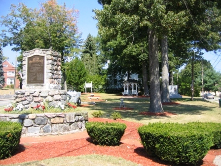
imagesize =
image_caption = Memorial Park in central Wharton
image_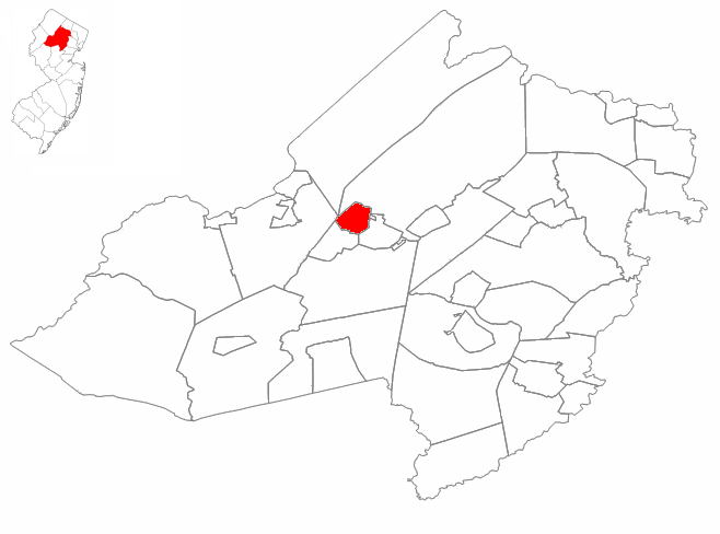
mapsize = 250 px
map_caption = Wharton highlighted in Morris County. Inset
mapsize1 =
map_caption1 =subdivision_type = Country
subdivision_name =United States
subdivision_type1 = State
subdivision_name1 =New Jersey
subdivision_type2 = County
subdivision_name2 = Morris
government_footnotes =
government_type =Borough (New Jersey)
leader_title =Mayor
leader_name = Bill Chegwidden
leader_title1 =
leader_name1 =
established_title1 = Incorporated
established_date1 =June 26 ,1895 as "Port Oram"
established_title2 = Renamed
established_date2 =April 16 ,1902 as "Wharton"unit_pref = Imperial
area_footnotes =
area_magnitude =
area_total_km2 = 5.7
area_land_km2 = 5.7
area_water_km2 = 0.1
area_total_sq_mi = 2.2
area_land_sq_mi = 2.2
area_water_sq_mi = 0.0population_as_of = 2006
population_footnotes =
population_total = 6298
population_density_km2 = 1112.9
population_density_sq_mi = 2882.4timezone = Eastern (EST)
utc_offset = -5
timezone_DST = EDT
utc_offset_DST = -4
elevation_footnotes = [Gnis|885443|Borough of Wharton,Geographic Names Information System , accessedJanuary 4 ,2008 .]
elevation_m = 204
elevation_ft = 669
latd = 40 |latm = 53 |lats = 58 |latNS = N
longd = 74 |longm = 34 |longs = 55 |longEW = Wpostal_code_type =
ZIP code
postal_code = 07885
area_code = 973 and 862
blank_name = FIPS code
blank_info = 34-80390GR|2 [ [http://mcdc2.missouri.edu/webrepts/commoncodes/ccc_nj.html A Cure for the Common Codes: New Jersey] , Missouri Census Data Center. AccessedJuly 14 ,2008 .]
blank1_name = GNIS feature ID
blank1_info = 0885443GR|3
website = http://www.whartonnj.com
footnotes =Wharton is a Borough in Morris County,
New Jersey ,United States . As of theUnited States 2000 Census , the borough population was 6,298.What is now Wharton was originally incorporated as the borough of Port Oram by an Act of the
New Jersey Legislature onJune 26 ,1895 , from portions of Randolph Township and Rockaway Township, subject to the results of a referendum passed on the previous day. The name was changed to Wharton as ofApril 16 ,1902 , based on a referendum held that day."The Story of New Jersey's Civil Boundaries: 1606-1968", John P. Snyder, Bureau of Geology and Topography; Trenton, New Jersey; 1969. p. 196.]Geography
Wharton is located at coor dms|40|53|53|N|74|34|49|W|city (40.898098, -74.580151)GR|1.
According to the
United States Census Bureau , the borough has a total area of 2.2square mile s (5.7km² ), of which, 2.2 square miles (5.7 km²) of it is land and 0.04 square miles (0.1 km²) of it (1.36%) is water.Demographics
USCensusPop
1930=3683
1940=3854
1950=3853
1960=5006
1970=5535
1980=5485
1990=5405
2000=6298
estimate= 6211
estyear=2006
estref= [http://factfinder.census.gov/servlet/SAFFPopulation?_event=Search&geo_id=16000US3463300&_geoContext=01000US%7C04000US34%7C16000US3463300&_street=&_county=wharton&_cityTown=wharton&_state=04000US34&_zip=&_lang=en&_sse=on&ActiveGeoDiv=geoSelect&_useEV=&pctxt=fph&pgsl=160&_submenuId=population_0&ds_name=null&_ci_nbr=null&qr_name=null®=null%3Anull&_keyword=&_industry= Census data for Wharton borough] ,United States Census Bureau . AccessedOctober 12 ,2007 .]
footnote=Population 1930 - 1990. [ [http://www.wnjpin.net/OneStopCareerCenter/LaborMarketInformation/lmi01/poptrd6.htm Jersey Resident Population by Municipality: 1930 - 1990] , Workforce New Jersey Public Information Network. AccessedMarch 1 ,2007 .] As of thecensus GR|2 of 2000, there were 6,298 people, 2,328 households, and 1,599 families residing in the borough. Thepopulation density was 2,882.4 people per square mile (1,110.4/km²). There were 2,394 housing units at an average density of 1,095.6/sq mi (422.1/km²). The racial makeup of the borough was 82.09% White, 4.40% African American, 0.44% Native American, 3.14% Asian, 7.21% from other races, and 2.72% from two or more races. Hispanic or Latino of any race were 23.21% of the population.There were 2,328 households out of which 34.6% had children under the age of 18 living with them, 52.1% were married couples living together, 12.0% had a female householder with no husband present, and 31.3% were non-families. 26.5% of all households were made up of individuals and 10.4% had someone living alone who was 65 years of age or older. The average household size was 2.70 and the average family size was 3.28.
In the borough the population was spread out with 26.0% under the age of 18, 6.8% from 18 to 24, 34.0% from 25 to 44, 21.9% from 45 to 64, and 11.3% who were 65 years of age or older. The median age was 36 years. For every 100 females there were 93.5 males. For every 100 females age 18 and over, there were 88.8 males.
The median income for a household in the borough was $56,580, and the median income for a family was $64,957. Males had a median income of $42,311 versus $36,016 for females. The
per capita income for the borough was $25,168. About 6.4% of families and 8.3% of the population were below thepoverty line , including 15.0% of those under age 18 and 4.2% of those age 65 or over.History
On
June 28 ,1895 , voters from the settlements of Port Oram, Irondale, Luxemburg, Maryville and Mount Pleasant voted 143 to 51 to incorporate as a town under the name of Port Oram, the largest member of the group. These localities, covering an area of two and a quarter square miles west ofDover, New Jersey , were basically mine camps or housing for blast furnace and silk mill workers. A mayor, six councilmen, an assessor and a collector were elected to govern this new borough which had started life as an ore shipping port on theMorris Canal . These elected officials -- mine superintendents, store owners, a railroad superintendent and a school teacher -- represented the leaders of these settlements where iron ore was mined, smelted and shipped.In 1831 the Morris Canal was completed from Newark to Phillipsburg, New Jersey across the
Delaware River from the terminus of theLehigh Canal . On the way, it passed through Boonton, Dover and Port Oram all connected with iron. On this route it tapped the Morris County ore fields and became a carrier for both ore andpig iron . Its main purpose, however, was as an extension of the Lehigh Canal to furnish a route foranthracite coal from thePennsylvania mines to seaboard. Any local traffic was a gain to supplement the through anthracite freight and iron ore and its products soon became important sources of revenue. Sites on the canal were selected for docks and industry, including iron worksBorn in 1826 in Philadelphia to an old Quaker family,
Joseph Wharton first studied at a local Friend's school but did not attend college, rather he went to live on a farm because his parents wanted him to mature "Joseph Wharton: Quaker Industrial Pioneer", W. Ross Yates, 1987, Lehigh University Press, pp 31-35.] , and during the winter studied chemistry at the laboratory of Martin Boye in Philadelphia. He entered into themanufacture ofzinc andnickel , and gradually bought a controlling interest in Bethlehem Iron Works. As his business interests expanded he purchased substantial shares of several railroads involved in the coal and iron trade,also purchasing iron mines and furnaces near Port Oram. After selling his interest in Bethlehem Iron Works in 1901 and his nickel works toCVRD Inco in 1902, he continued to actively acquire and manage a large and diverse business empire that included iron smelting in Wharton until just before his death in January, 1909. Wharton is best known for the namesake school he endowed, theWharton School of theUniversity of Pennsylvania . The town was named after him at after a referendum in 1902. [ [http://www.whartonnj.com/general_information/history/default.htm Wharton History] , Borough of Wharton. AccessedMay 25 ,2007 .]Government
Local government
Wharton is governed under the Borough system of municipal government. A Mayor is elected directly by the voters. The Borough Council consists of six members elected to serve three-year terms on a staggered basis, with two seats coming up for election each year.
The
Mayor of Wharton is Bill Chegwidden, whose term of office ends in 2007. Members of the Borough Council are Council President David Young, Vincent Binkoski, Glenn Corbett, Brian Gillen, Scott Hutchins and Tom Yeager. [ [http://www.whartonnj.com/general_information/townhall/townhall.htm Town Hall: Governing Body] , Wharton Borough. AccessedFebruary 27 ,2008 .]Federal, state and county representation
Wharton is in the Eleventh Congressional District and is part of New Jersey's 25th Legislative District. [ [http://www.lwvnj.org/pubs/CG06.pdf 2006 New Jersey Citizen's Guide to Government] , New Jersey
League of Women Voters , p. 63. AccessedAugust 30 ,2006 .]Education
The
Wharton Borough School District serves public school students in Kindergarten through eighth grade. Schools in the district (with 2005-06 enrollment data from theNational Center for Education Statistics [ [http://nces.ed.gov/ccd/schoolsearch/school_list.asp?Search=1&DistrictID=3417880 Data for the Wharton Borough Public Schools] ,National Center for Education Statistics . AccessedFebruary 27 ,2008 .] ) are the [http://www.wbps.org/pages/Duffy.htm Marie V. Duffy Elementary School] (529 students in grades K - 5) and [http://www.wbps.org/pages/Mack.htm Alfred C. MacKinnon Middle School] (251 students in grades 6 - 8).Public school students in grades 9 - 12 attend
Morris Hills High School , in Rockaway Borough, which also serves the residential community of Rockaway Township. [ [http://education.state.nj.us/rc/rc07/narrative/27/3370/27-3370-050.html Morris Hills High School 2007 School Report Card] ,New Jersey Department of Education . AccessedFebruary 27 ,2008 . "Morris Hills High School is a comprehensive four-year public school located in the heart of Morris County.... The school serves the local communities of Wharton, Rockaway Township, and Rockaway Borough where the school resides."] The current enrollment is 1,087 students. The high school is part of theMorris Hills Regional High School District , which also includes students from Denville Township.Trivia
*
Cyndi Lauper 's "Time after Time" video was filmed in 1984 Wharton. [ [http://nynjctbotany.org/njhltofc/whartonboro.html History of Wharton Borough] , accessedNovember 2 ,2006 .]Notable residents
Notable current and former residents of Wharton include:
*Kirk Alyn (1910-1999), the first on-screenSuperman , was born in Wharton, the son of Hungarian immigrants. [ [http://www.whartonnj.com/general_information/history/superman.htm Wharton's Own Superman: Kirk Alyn] , Borough of Wharton. AccessedFebruary 27 ,2008 .]
*Bonnie Lee Bakley (1956-2001), murdered wife of actor Robert Blake.Fact|date=September 2008ee also
*
Hungarian Presbyterian Church of Wharton, NJ References
External links
* [http://www.whartonnj.com/ Wharton Borough website]
* [http://www.wbps.org Wharton Borough Public Schools]
*NJReportCard|27|5770|0|Wharton Borough Public Schools
* [http://nces.ed.gov/ccd/schoolsearch/school_list.asp?Search=1&DistrictID=3417880 Data for the Wharton Borough Public Schools] ,National Center for Education Statistics
* [http://www.dailyrecord.com Daily Record: Regional area newspaper]
* [http://nynjctbotany.org/njhltofc/whartonboro.html History of Wharton Borough]
* [http://www.abandonedmines.net/ Abandoned Mines of NJ]

Wikimedia Foundation. 2010.