- New Jersey Route 15
-
Route 15
Route information Maintained by NJDOT Length: 19.16 mi[1] (30.84 km) Existed: 1953 – present Major junctions South end:  US 46 in Dover
 I-80 in Wharton
 Route 181 in Sparta
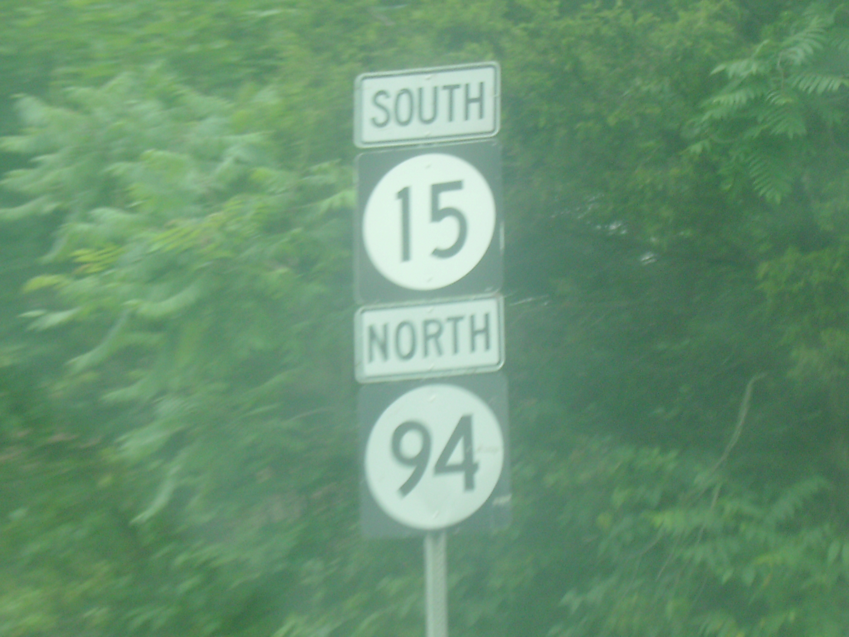
 Route 94 in Lafayette
North end: 
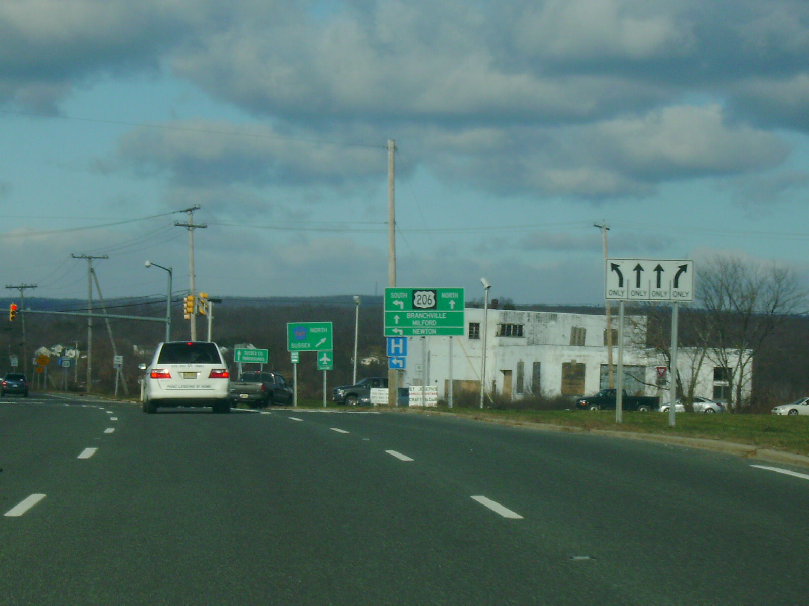
 US 206 / CR 565 in Frankford Township
Highway system New Jersey State Highway Routes
Interstate and US←  Route 14
Route 17  →
→ NJ 15 just north of Houses Corner Road
Route 15 is a state highway in Morris and Sussex County, New Jersey. The route heads for 19.16 miles (30.84 km) from East McFarland Street (U.S. Route 46) in Dover to an intersection with U.S. Route 206 in Frankford Township. The route becomes a divided highway in Jefferson Township until becoming a freeway bypass near Sparta. Route 15 was originally Route 6A from 1927 until 1953, when a renumbering occurred. The route was eventually bypassed around the community of Sparta which became New Jersey Route 181.
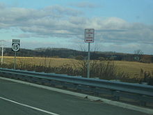
Since the finishing of the Sparta Bypass, the New Jersey Department of Transportation and North Jersey Transportation Planning Authority have considered more bypasses and alignment changes for 15. The speed limit along Route 15 is as high as 55 miles per hour (89 km/h).[2]
Contents
Route description
 NJ 15 at its final stretch northbound
Route 15 begins at an interchange with U.S. Route 46, slightly to the east of the underpass Route 15 used to use to pass under U.S. Route 46 and access Dover. Route 15 then winds through Dover concurrent with several streets. The road remains two lanes past the turn for the Rockaway Townsquare Mall, in the township of Rockaway. For a very short distance Route 15 becomes a freeway as it crosses the Interstate 80 interchange. A mile north, the road becomes a four lane divided highway with exits for a few businesses and Picatinny Arsenal. At that point, Route 15 leaves Rockaway Township and enters Jefferson Township. In Jefferson Township, the northbound and southbound lanes become about a quarter mile apart as it climbs up a steep mountain.[1] The Southbound lanes have businesses, easy access to them, and a speed limit of 40 mph as this was the original lanes of Route 15 when it was only a 2 lane highway. The northbound lanes are nearly a freeway with limited access to businesses on the southbound lanes. The northbpund lanes have a spees limit of 50 mph as well. These two lanes were built in the late 1960's.
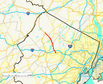
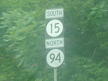
Slightly farther north, Route 15 becomes a freeway and the northbound and southbound lanes come closer together. At this point, the original two-lane Route 15 breaks off into Route 181, heading through Jefferson Township and into downtown Sparta. Several miles north, the freeway leaves Morris County in Jefferson Township and enters Sussex County and Sparta Township, bypassing downtown Sparta.[1] After bypassing downtown Sparta, Route 181 ends and merges onto Route 15. The freeway then ends and Route 15 becomes a two-lane road. After Route 15 leaves Sparta and enters Lafayette Township, it merges with Route 94. Routes 15 and 94 run as a concurrency until Route 94 turns off to the southeast while Route 15 heads northwest. It continues into Frankford Township and comes to an end at U.S. Route 206 and County Route 565.[1]
History
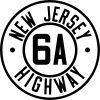 Route 6A (1927-1953)
Before the 1953 New Jersey state highway renumbering, NJ 15 was designated as State Highway Route 6A, beginning in 1927.[3] In the renumbering, NJ 15 was assigned. Originally route 15 was a 2 lane road all the way down to Picitinny Arsenal. The road originally went through downtown Sparta and today that road is known as route 181. In the mid 1960's, Route 15 was to expand and become 4 lanes several miles into Jefferson Township. But businesses were on both sides of this road making a widening difficult. So the additional 2 lanes were built behind the businesses on the left side of the road heading south. In 1974, a bypass freeway was built around the Sparta Business district and into Jefferson Township. The freeway began several miles into Sparta and would extend to the area where 15 was divided into 4 lanes back in the 60's.
In Sparta, New Jersey Department of Transportation commissioner Jack Lettire and state senator Robert Littell announced the completion of a project of restructuring the NJ 15-Houses Corner Road intersection, which began ground breaking in 2002 by James E. McGreevey, then-governor of New Jersey. The project was completed in August 2004. The original intersection was a signalized intersection with a blinking light and no left turn-off lanes from NJ 15. Because of heavy traffic, turning left onto Houses Corner Road became dangerous for motorists. The intersection has a full traffic light. The project cost a total of $15.5 million.[4]
There is an ongoing local grassroots movement to honor the late U.S. President Ronald Reagan by renaming Route 15 after him. Most recently on January 12, 2010, a bill was introduced in the New Jersey General Assembly by Assemblymen Michael Patrick Carroll, Jay Webber, Gary R. Chiusano and Assemblywoman Alison Littell McHose to designate Route 15 as the "Ronald Reagan Memorial Highway".[5]
 NJ 15/NJ 94 on wrong-way concurrency in Laffayette
Wilson Drive and White Lake Road were also realigned to form one signalized intersection, with completion expected in 2008. The intersection was improved, with construction finishing on June 1, 2009, after eight months of work starting in October 2008. The project cost the state $2.3 million (2009 USD) to fund for construction by the North Jersey Transportation Planning Authority.[6][7] Studies are being made to improve the Route 15 corridor from I-80 to U.S. Route 206. Concepts include widening, the addition of climbing lanes, and a potential bypass of Lafayette.[8] The residents of the small rural village are widely in favor of the bypass, instead of a road widening through their town. If the bypass is constructed it may be a Super 2 freeway (the second so far in New Jersey), and run from the current northern freeway terminus to an interchange with U.S. Route 206.
Major intersections
County Location Mile[1] Destinations Notes Morris Dover 0.00 US 46 (McFarlan Street)Wharton 1.69 I-80Exit 34 (I-80 EB), Exits 34A-B (WB) Jefferson Township South end of freeway 6.93 Route 181 north / Weldon Road – Woodport, Lake Forest, Milton, Oak RidgeSussex Sparta Township 10.34 Blue Heron Road - Sparta, Lake Mohawk Business District 12.52  CR 517 (Sparta Bypass) – Sparta, Franklin
North end of freeway 13.76 Route 181 southLafayette Township 16.24 Route 94 north (Sunset Inn Road)Begin/end concurrency 16.52 Route 94 south (Morris Farm Road)Begin/end concurrency Frankford Township 19.16 US 206 / CR 565 north1.000 mi = 1.609 km; 1.000 km = 0.621 mi See also
 U.S. Roads portal
 New Jersey portal
References
- ^ a b c d e New Jersey Department of Transportation. "Route 15 straight line diagram". http://www.state.nj.us/transportation/refdata/sldiag/00000015__-.pdf. Retrieved 2007-04-08.
- ^ New Jersey Department of Transportation (2007). "Route 15 Speed Limits". New Jersey Department of Transportation. http://www.state.nj.us/transportation/refdata/traffic_orders/speed/rt15.shtm. Retrieved 2007-09-29.
- ^ State of New Jersey, Laws of 1927, Chapter 319.
- ^ New Jersey Department of Transportation (2007). "Route 15 and Houses Corner Road project completed in Sussex County". New Jersey Department of Transportation. http://www.state.nj.us/transportation/about/press/2004/080504-2.shtm. Retrieved 2007-09-29.
- ^ New Jersey Assembly Bill 1393, introduced January 12, 2010.
- ^ "NJDOT announces completion of intersection improvements at Route 15, Wilson Drive and White Lake Road in Sparta". New Jersey Department of Transportation. June 1, 2009. http://www.state.nj.us/transportation/about/press/2009/060109.shtm. Retrieved September 10, 2009.
- ^ North Jersey Transportation Planning Authority (2007). "Route 15 Improvements". North Jersey Transportation Planning Authority. Archived from the original on June 21, 2007. http://web.archive.org/web/20070621031504/http://www.njtpa.org/capital_programming/WebTables/column3/Morris.pdf. Retrieved 2007-09-29.
- ^ New Jersey Department of Transportation (2007). "Route 15 bypass study". New Jersey Department of Transportation. http://www.state.nj.us/transportation/works/studies/rt15/. Retrieved 2007-09-28.
External links
Categories:- State highways in New Jersey
- Limited access New Jersey state routes
- Transportation in Morris County, New Jersey
- Transportation in Sussex County, New Jersey


Wikimedia Foundation. 2010.