- New Jersey Route 181
-
Route 181

Route information Maintained by NJDOT Length: 7.47 mi[1] (12.02 km) Existed: 1974 – present Major junctions South end:  Route 15 in Jefferson Township
North end: Route 15 in Sparta TownshipLocation Counties: Morris, Sussex Highway system New Jersey State Highway Routes
Interstate and US←  Route 180
Route 182  →
→Route 181 is a 7.47-mile (12.02 km) state highway in Jefferson Township and Sparta Township in New Jersey, which is in the United States. The highway begins in Jefferson Township at an interchange with New Jersey Route 15 and Weldon Road, where that road changes from a divided surface road to a four-lane freeway. The highway heads through Sparta Township, and indirectly interchanges several times with Route 15. The highway continues through downtown Sparta, where it intersects with several county highways. Route 181 continues north out of Sparta, ending at an intersection with Route 15 at the northern end of the NJ 15 freeway in Sparta Township.
Route 181 is a former alignment of Route 15, which remained on that alignment for 21 years. In 1974, construction began on a new bypass of downtown Sparta. Route 15 was reassigned onto the bypass, and Route 181 was assigned onto the former alignment of Route 15.
Contents
Route description
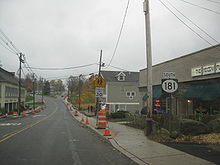
 Route 181 signage at its southern terminus. Route 181 is signed with Massachusetts-style signage
Route 181 begins at a partial cloverleaf interchange with New Jersey Route 15 in Jefferson Township. Also present at the southern terminus and interchange is Espanong Road, which heads westward towards Lake Hopatcong. The route heads to the north, approaching another interchange, this time with Route 15 southbound only, where it turns to the northeast and heads into deeper into Jefferson Township. The route, which is moderately developed, runs along the easternmost shores of Lake Hopatcong, serving several marinas. The route crosses over the lake a short distance before intersecting with Prospect Point Road (Morris County Route 609). After this intersection, Route 181 crosses the Morris–Sussex county line and into the community of Sparta Township.[1][2]
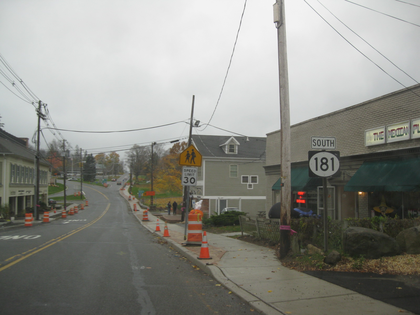
 Route 181 heading southbound through Sparta near County Route 613
After crossing the county line, Route 181 is known locally as Woodport Road as it continues to the north. Past Lake Hopatcong, the highway is primarily surrounded by dense woodlands and very little development. Residential homes begin to follow the highway around the point where Route 15, the roadway to the east begins to parallel perpendicularly to the north. At an intersection with Blue Heron Drive, Route 181 approaches another interchange with Route 15. Shortly after the interchange, Route 181 turns to the northeast along Woodport Road and into downtown Sparta. At an intersection with East Mountain Road, the highay heads northward, where the commercial development begins. Past an intersection with Birch Tree Road, Route 181 turns eastward and northeastward, entering the Sparta Business District.[1][2]
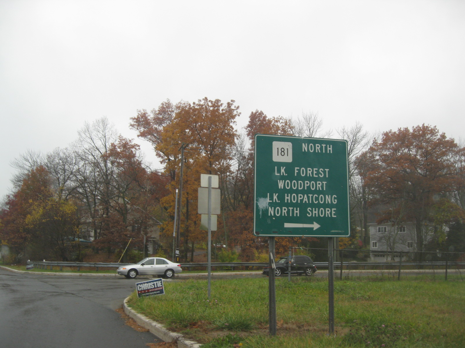
After passing a large commercial development, Route 181 intersects with Stanhope Road (Sussex County Route 605), a major highway in Sparta. The route turns northward at the intersection, intersecting with Mohawk Avenue (Sussex County Route 613). After the intersection, with Route 181 northbound makes a sudden spike to the east, north and west, turning off Woodport Road and onto Sparta Avenue. Route 181 Southbound heads along Woodport Avenue without the highway turn. The route continues through the development of Sparta, intersecting with County Route 517 (Sparta Avenue). Route 181 continues northward, heading out of the business district and into the undeveloped woodlands once again. After an intersection with Madison Drive, the highway turns to the northeast, paralleling Route 15 for another mile. Passing the Sky View Country Club, Route 181 turns northward, coming to a partial trumpet interchange, where the designation ends at Route 15.[1][2]
History
Route 181 originated as an alignment of State Highway Route 6-A, a spur of State Highway Route 6 (now U.S. Route 46) from Dover to Ross Corner. The designation was assigned in 1938, eleven years after the then-current highway system in New Jersey was started.[3] The state highway route designation remained intact for fifteen years, until January 1, 1953, when the routes in state of New Jersey underwent a large renumbering. Route 6-A became Route 15, running along NJ 181's alignment from Jefferson to Sparta.[4][5] The Sparta Bypass was constructed in 1974, and upon completion, Route 15 was taken off of the Jefferson–Sparta alignment, which was re-designated Route 181.[6]
Major intersections
County Location Mile[1] Destinations Notes Morris Jefferson Township 0.00 Route 15Southern terminus of NJ 181, interchange. Sussex Sparta Township 5.82  CR 517 (Sparta Avenue)
7.47 Route 15Northern terminus of NJ 181. 1.000 mi = 1.609 km; 1.000 km = 0.621 mi See also
 U.S. Roads portal
 New Jersey portal
References
- ^ a b c d e New Jersey Department of Transportation (2009). "Route 181 straight line diagram". http://www.state.nj.us/transportation/refdata/sldiag/00000181__-.pdf. Retrieved February 9, 2008.
- ^ a b c Yahoo! Inc. Yahoo! Maps – Overview map of NJ Route 181 (Map). Cartography by NAVTEQ. http://maps.yahoo.com/#mvt=h&lat=41.062208&lon=-74.646962&zoom=18&q1=40.973407%2C-74.602491&q2=40.989443%2C-74.613263&q3=41.036106%2C-74.636609&q4=41.061998%2C-74.648926. Retrieved July 7, 2009.
- ^ Legislation Route 6-A, New Jersey State Legislature, 1938
- ^ 1953 renumbering, New Jersey Department of Highways, http://en.wikisource.org/wiki/1953_New_Jersey_state_highway_renumbering, retrieved July 31, 2009
- ^ Legislation Route 15, New Jersey State Legislature, 1966
- ^ New Jersey State Highway Department (1974). New Jersey State Map (Map).
External links
Categories:- State highways in New Jersey
- Transportation in Sussex County, New Jersey


Wikimedia Foundation. 2010.