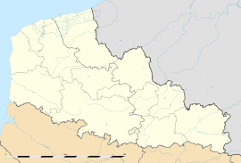
- Nordausques
-
Nordausques
Administration Country France Region Nord-Pas-de-Calais Department Pas-de-Calais Arrondissement Saint-Omer Canton Ardres Intercommunality Région d'Ardres et de la Vallée de la Hem Mayor Jean-Michel Marcotte Statistics Elevation 12–98 m (39–322 ft)
(avg. 85 m/279 ft)Land area1 5.94 km2 (2.29 sq mi) Population2 825 (2006) - Density 139 /km2 (360 /sq mi) INSEE/Postal code 62618/ 62890 1 French Land Register data, which excludes lakes, ponds, glaciers > 1 km² (0.386 sq mi or 247 acres) and river estuaries. 2 Population without double counting: residents of multiple communes (e.g., students and military personnel) only counted once. Coordinates: 50°49′06″N 2°04′57″E / 50.8183333333°N 2.0825°E
Nordausques is a commune in the Pas-de-Calais department in the Nord-Pas-de-Calais region of France.
Contents
Geography
Nordqusques lies about 10 miles (16 km) northwest of Saint-Omer, at the junction of the N43, the D191 and the D218 roads, half a mile from junction 2 of the A26 autoroute, on the banks of the small river Hem.
Population
Population history 1962 1968 1975 1982 1990 1999 2006 429 434 514 527 588 633 825 Census count starting from 1962: Population without duplicates Places of interest
- The church of St. Martin, dating from the nineteenth century.
- The manor house at Welle, dating from the sixteenth century.
See also
References
External links
- Official Tourist office website (French)
- Nordausques on the Quid website (French)
Categories:- Communes of Pas-de-Calais
- Pas-de-Calais geography stubs
Wikimedia Foundation. 2010.


