- Duisans
-
Duisans
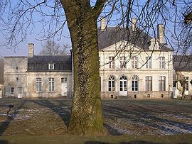
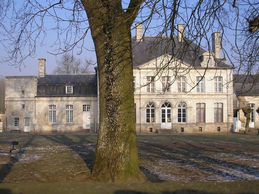
Château de Duisans 

 DuisansLocation within Nord-Pas-de-Calais region
 Duisans
Administration Country France Region Nord-Pas-de-Calais Department Pas-de-Calais Arrondissement Arras Canton Beaumetz-lès-Loges Intercommunality Val de Gy Mayor Éric Poulain
(2008–2014)Statistics Elevation 56–107 m (184–351 ft)
(avg. 68 m/223 ft)Land area1 10.72 km2 (4.14 sq mi) Population2 1,091 (1999) - Density 102 /km2 (260 /sq mi) INSEE/Postal code 62279/ 62161 1 French Land Register data, which excludes lakes, ponds, glaciers > 1 km² (0.386 sq mi or 247 acres) and river estuaries. 2 Population without double counting: residents of multiple communes (e.g., students and military personnel) only counted once. Coordinates: 50°18′30″N 2°41′07″E / 50.3083333333°N 2.68527777778°E
Duisans is a commune in the Pas-de-Calais department in the Nord-Pas-de-Calais region of France.
Contents
Geography
A farming village 5 miles (8.0 km) northwest of Arras at the junction of the D55 and D56 roads. The small river Gy, a tributary of the Scarpe river, flows through the village.
Population
Historical population of Duisans 1962 1968 1975 1982 1990 1999 669 716 881 993 1022 1091 From the year 1962 on: population without double counting—residents of multiple communes (e.g. students and military personnel) are counted only once. Places of interest
- The church of St.Leger, dating from the fifteenth century.
- The eighteenth century chateau, built by Antoine-Guillaume Dubois de Hanovre.
- Two 17th century chapels.
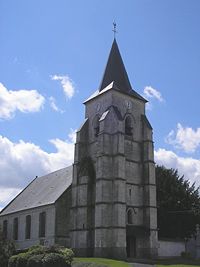 Duisans church
See also
References
External links
- Website of the château de Duisans (French)
- Duisans on the Quid website (French)
Categories:- Communes of Pas-de-Calais
- Arras arrondissement geography stubs


Wikimedia Foundation. 2010.