- List of Philadelphia neighborhoods
-
 Unofficial map of Philadelphia neighborhoods
 Philadelphia Planning Analysis Sections
The following is a list of neighborhoods, districts, and other places located in the city of Philadelphia, Pennsylvania, USA. The list is organized by broad geographical sections within the city. While there is no official list of neighborhoods, districts, and places, this list was compiled from the sources listed in the External links section, as well as from information compiled from residents of Philadelphia.
Common usage for Philadelphia's neighborhood names does not respect "official" borders used by the city's police, planning commission or other entities. Therefore some of the places listed here may overlap geographically, and residents do not always agree where one neighborhood ends and another begins.
Historically, many neighborhoods were defined by Catholic parishes. Others were incorporated townships (Blockley, Roxborough), districts (Belmont, Kensington, Moyamensing, Richmond), or boroughs (Bridesburg, Frankford, Germantown, Manayunk) before being incorporated into the city with the Act of Consolidation of 1854.[1] Adding further complication is the fact that in some parts of Philadelphia, especially the central areas of North, West, and South Philadelphia, residents have long been more likely to identify with the name of their section of the city than with any specific neighborhood name. Today, community development corporations, neighborhood watches, and other civic organizations are influential in shaping the use of neighborhood names and approximate boundaries.
For planning purposes, the city is divided into 12 Planning Analysis Sections.[1]
Contents
Center City
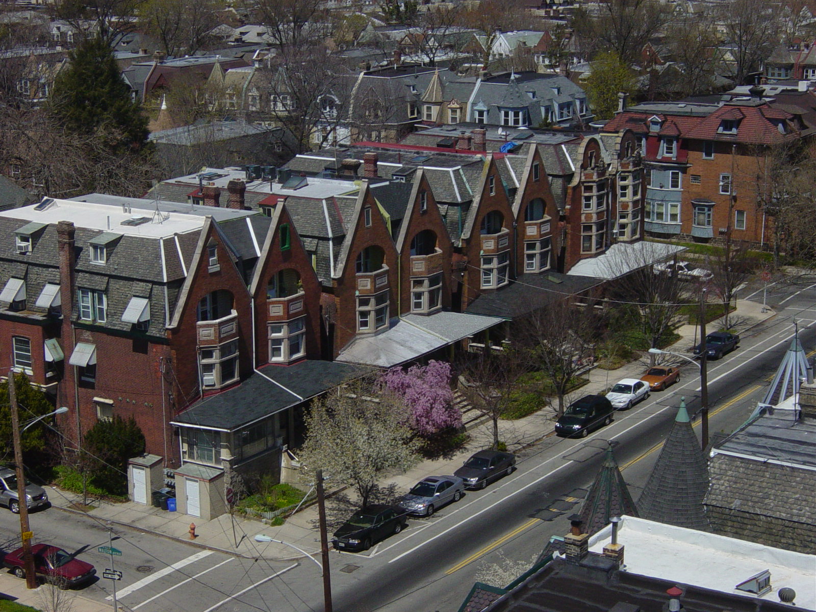
 Historic rowhouses in Center City Philadelphia
The Center City Planning Analysis Section extends from South Street on the south to Vine Street on the north, and from the Delaware River on the east to the Schuylkill River on the west.[1]
- Avenue of the Arts
- Callowhill
- Chinatown
- Elfreth's Alley
- Fitler Square: north to Locust Street, south to South Street, east to 21st Street, west to the Schuylkill River.[2]
- Franklintown
- Logan Square
- Jewelers' Row
- Market East
- Old City
- Museum District
- Penn Center
- Penn's Landing: encompassed by the Delaware Riverfront.
- Rittenhouse Square
- Society Hill: north to Walnut St., south to Lombard St, east to Front Street, west to 8th St.[3]
- South Street: along South Street from Front Street in the east to Seventh Street in the west.
- Washington Square West: north to Market St., south to South St., east to 7th St, west to Broad St. The name derives simply from the fact that this area extends west of Washington Square. Recently, this name is used in conjunction with a new name for the neighborhood- Midtown Village. The Gayborhood[4] is entirely within this area.
South Philadelphia
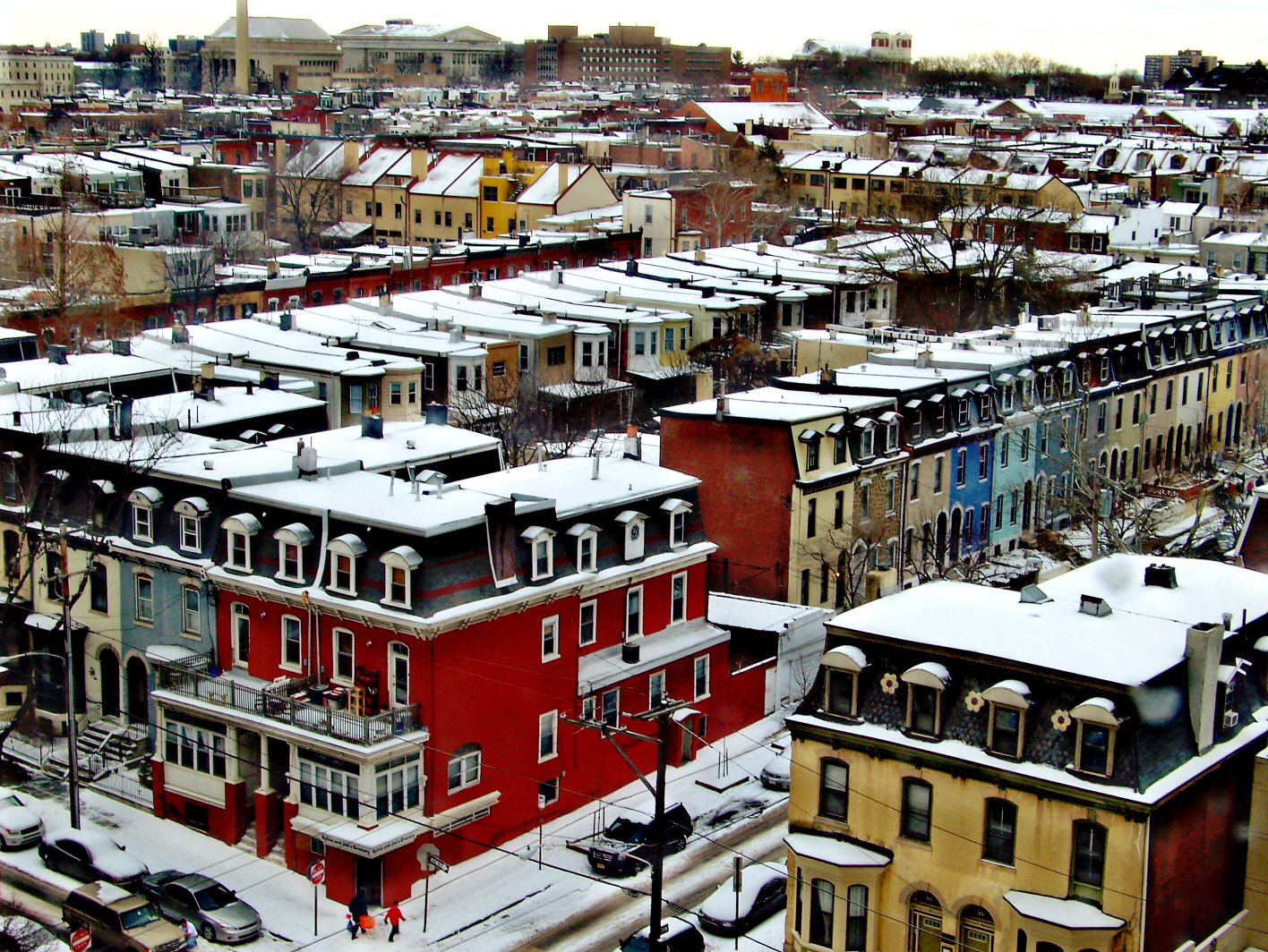
 Broad & Ritner, Central South Philadelphia
 Rowhouses in South Philadelphia
The South Philadelphia Planning Analysis Section is bounded by South Street on the north and the Delaware and Schuylkill Rivers to their confluence.[1]
- Bella Vista: North to South Street, South to Washington Avenue, West to 11th Street, East to 6th Street[5]
- Central South Philadelphia
- Devil's Pocket: Irish neighborhood west of Grays Ferry Avenue
- Dickinson Narrows - Diverse neighborhood. Washington to Miflin, 4th to 6th. [1] [2]
- East Passyunk Crossing: North to Tasker Street, South to Snyder Avenue, West to Broad Street, East to 9th Street
- Franklin Delano Roosevelt Park
- Girard Estate
- Greenwich
- Grays Ferry: north to Gray's Ferry Ave., south to Passyunk Ave., west to the Schuylkill River, east to 24th St.
- Hawthorne: from South St. to Washington Ave., Broad St. to 11th St.[6]
- Italian Market: along 9th St. from Fitzwater St. in the north to Wharton St. in the south.
- Lower Moyamensing
- Marconi Plaza
- Moyamensing
- Newbold: Washington Ave. to Passyunk Ave., and Broad St. to 18th St.[3]
- Packer Park
- Passyunk Square: Washington Ave. to Tasker St., 6th St. to Broad St.[4]
- Pennsport: locally referred to as "Two Street", Penn's Port is a predominantly Irish-American Catholic neighborhood.
- Point Breeze
- Queen Village: north to Lombard St., south to Washington Ave., east to the Delaware River, west to 6th St.[7]
- Schuylkill
- Southwark:The limits of the district started on Cedar (South) St. and the Delaware River, and proceeded west to Passyunk Ave.; along the latter to Moyamensing Ave.; then by Keeler’s Lane to Greenwich Road; then to the Delaware River, and along the several courses of the same until reaching the beginning point again.
- Southwest Center City / Graduate Hospital: north to South St. (Rittenhouse/Fitler), south to Washington Ave., east to Broad St. (Hawthorne), west to 24th St. (Gray's Ferry))[8]
- Sports Complex
- Tasker
- Wharton
- Whitman
- Wilson Park
- West Passyunk
Southwest Philadelphia
- Angora
- Bartram Village
- Clearview
- Kingsessing
- Eastwick
- Elmwood Park
- Hedgerow
- Hog Island: historically the home to a major shipyard, now home to the Philadelphia International Airport
- Mount Moriah
- Paschall
- Philadelphia International Airport
- Penrose
- Southwest Schuykill
West Philadelphia
 "Twin Homes," 48th & Walton, Cedar Park
- Belmont District: defunct
- Belmont Village
- Carroll Park
- Cathedral Park
- Cedar Park
- Cobbs Creek: East to 52nd Street, west to Cobbs Creek, north to Market Street, south to Baltimore Avenue
- Dunlap
- Garden Court
- Haddington
- Haverford North
- Mantua
- Mill Creek
- Overbrook
- Overbrook Park
- Overbrook Farms
- Parkside
- Powelton Village
- Saunders Park
- Spruce Hill
- Squirrel Hill
- University City
- Walnut Hill
- Woodland Terrace
- Wynnefield: East to 53rd Street and Fairmount Park, West to 59th Street, North to City Avenue, south to Fairmount Park
- Wynnefield Heights
University City
Generally speaking, University City is the section of West Philadelphia surrounding Drexel University and the University of Pennsylvania. More specifically, it runs East to the Schuylkill River and Interstate 76 (Schuylkill Expressway), North to Powelton Ave., South to the Schuylkill river and the Media line railroad (R3), and West to around 52nd Street.
- Black Bottom: Not current; formerly around the area of 38th and Market Sts.
- Cedar Park: north to Larchwood Ave., south to Baltimore Ave., east to 46th St., west to 52nd St.
- Garden Court: north to Locust St., south to Cedar Ave., east to 46th St., west to 52nd St.
- Powelton Village: north to Spring Garden St., south to Market St., east to 32nd St., west to 44th St.
- Spruce Hill: North to Market, South to Baltimore Ave., East to 40th, West to around 46th.
- Squirrel Hill: North to Baltimore Ave., South to Woodland Ave., East to 45rd St., West to 50th St.
- Walnut Hill: North to Market St., South to Larchwood Ave., East to 46th St., West to 52nd St.
- Woodland Terrace: North to Baltimore Ave., South to Woodland Ave., East to 40th St., West to 43rd St.
Northwest Philadelphia
 Ridge & Midvale, East Falls
Germantown, Chestnut Hill Planning Analysis Section
- Chestnut Hill
- Germantown
- Morton
- Wister
- West Oak Lane
- Cedarbrook
- West Mount Airy
Roxborough, Manayunk Planning Analysis Section
- Andorra
- East Falls
- Manayunk
- Roxborough
- Wissahickon
- East Mount Airy
North Philadelphia
 26th & Aspen, Fairmount
Lower North Philadelphia Planning Analysis Section
- Brewerytown
- Cabot
- Fairhill
- Fairmount: North to Girard Avenue, South to Vine Street, East to Broad Street, West to Schuylkill River
- Francisville
- Hartranft
- Ludlow
- North Central
- Northern Liberties: North to Girard Avenue, South to Spring Garden Street, East to Delaware River, West to 6th Street
- Poplar
- Sharswood
- Spring Garden
- South Lehigh
- Stanton
- Strawberry Mansion
- Templetown (Temple University Area)
- Yorktown
Upper North Philadelphia Planning Analysis Section
Olney, Oak Lane Planning Analysis Section
- East Oak Lane
- Feltonville
- Fern Rock
- Logan
- Melrose Park
- Ogontz
- Olney
- West Oak Lane
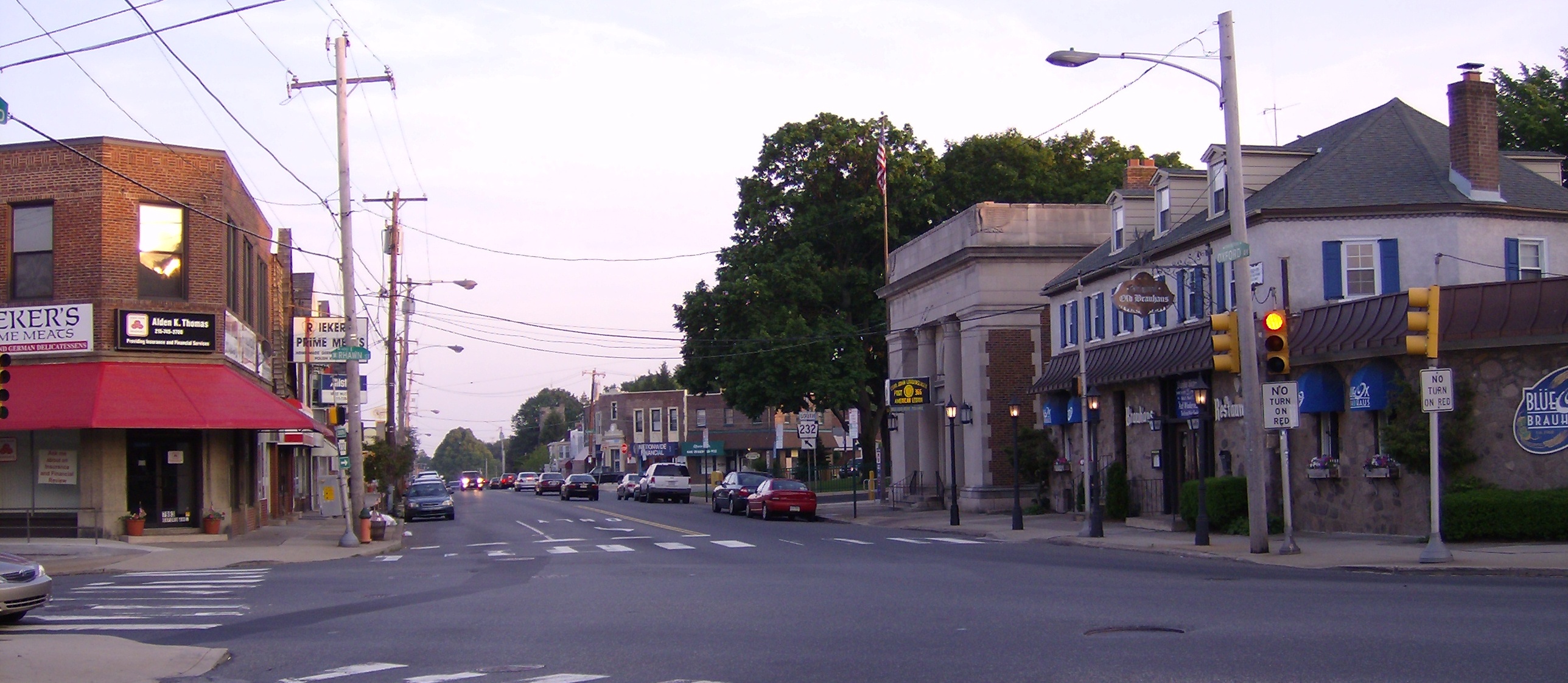
The Northeast
 Bustleton & Byberry, Somerton
 Oxford & Rhawn, Fox Chase
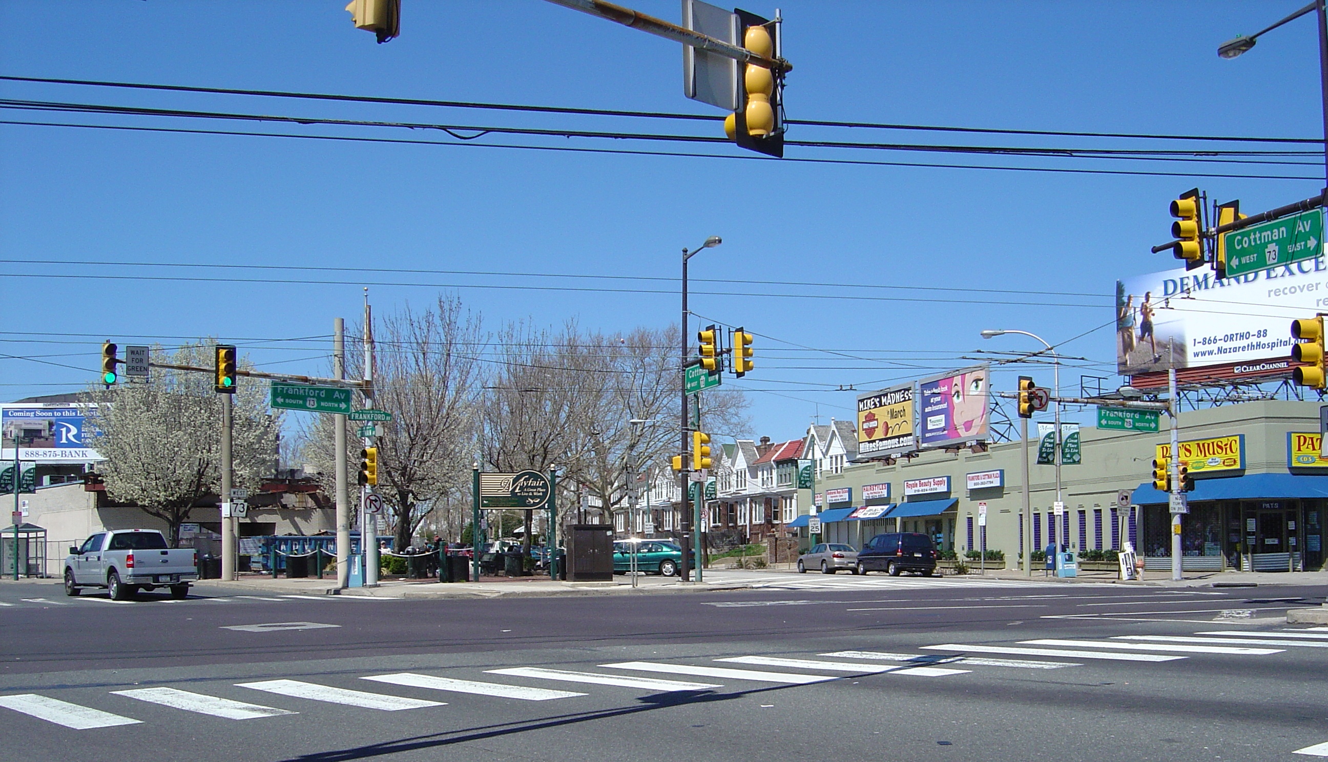
 Frankford & Cottman, Mayfair
 Rhawn & Castor, Rhawnhurst
 Kensington
 Salmon St., Port Richmond
The Far Northeast
- Academy Gardens
- Ashton-Woodenbridge
- Bustleton
- Byberry
- Crestmont Farms
- Krewstown
- Millbrook
- Modena Park
- Morrell Park
- Normandy
- Parkwood
- Pennypack
- Somerton
- Torresdale
- Upper Holmesburg
- Winchester Park
The Near Northeast
- Burholme
- Castor Garden
- Crescentville
- Fox Chase
- Frankford
- Holme Circle
- Holmesburg
- Juniata
- Lawncrest
- Lawndale
- Lexington Park
- Mayfair
- Northwood
- Oxford Circle
- Rhawnhurst
- Ryers
- Tacony
- Wissinoming
Kensington, Port Richmond, Bridesburg Planning Analysis Section
References
- ^ a b c d The Political and Community Service Boundaries of Philadelphia, Philadelphia City Planning Commission, June 2004.
- ^ Fitler Square Improvement Association. Accessed 4 February 2009.
- ^ Society Hill Civic Association. "About SHCA". Accessed 2 February 2009.
- ^ 11th to Broad streets, and from Pine to Locust
- ^ Bella Vista Town Watch. "Map of Bella Vista". Accessed 2 February 2009.
- ^ South Philly Review. "The Place Where You Live: Hawthorne". Accessed 4 February 2009.
- ^ Queen Village Neighbor's Association. "Life in Queen Village". Accessed 4 February 2009.
- ^ Plan Philly. Accessed 4 February 2009.
- Finkel, Kenneth (ed) (1995). Philadelphia Almanac and Citizens' Manual (1995 edition ed.). Philadelphia: Library Company of Philadelphia. pp. 156–170. ISBN 0-914076-89-2.
- Philadelphia Neighborhoods and Place Names—A list adapted and expanded from Finkel 1995:156-170 by the Philadelphia City Archives staff
External links
- Spruce Hill Community Association
- Philadelphia Neighborhoods and Place Names
- University City District
- Center City Residents' Association
- Ferrick, Tom (2011-02-11). "Median Household Income 1999-2009 (by Neighborhood)". Philadelphia Metropolis (The Public Media Lab). http://www.phlmetropolis.com/post.php. Retrieved 2011-02-15.
- Ferrick, Tom (2011-02-11). "Percent of Individuals Living in Poverty (by Neighborhood)". Philadelphia Metropolis (The Public Media Lab). http://www.phlmetropolis.com/percent-of-individuals-living-in-poverty.php. Retrieved 2011-02-15.
- Ferrick, Tom (2011-02-11). "Median Home Values 2000-2009 (by Neighborhood)". Philadelphia Metropolis (The Public Media Lab). http://www.phlmetropolis.com/post-1.php. Retrieved 2011-02-15.
City of Philadelphia Architecture · Companies · Culture · Cuisine · Demographics · Education · Fire department · History · Language · Law enforcement · Mayors · Media · Music · Neighborhoods · Notable people · Region · Sites of interest · Skyscrapers · Sports · Transportation
 Categories:
- Neighborhoods in Philadelphia, Pennsylvania
- Lists of neighborhoods in U.S. cities


Wikimedia Foundation. 2010.