- Marconi Plaza, Philadelphia, Pennsylvania
-
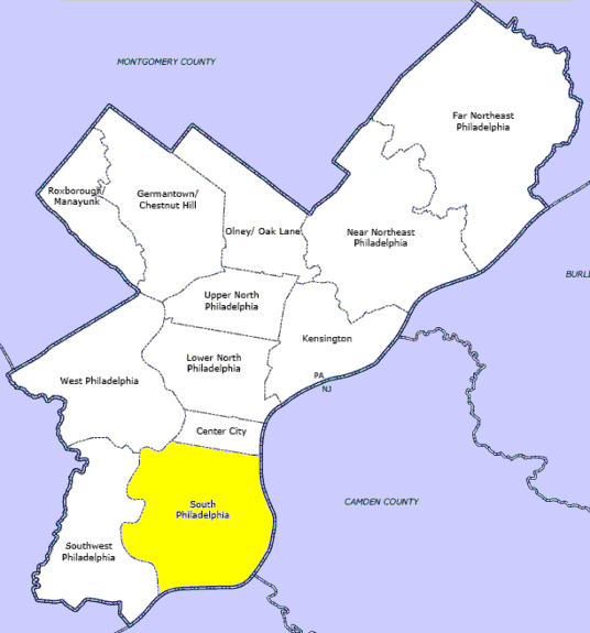
Marconi Plaza Type Urban park Location Philadelphia, Pennsylvania Area 19 acres (7.7 ha) Created 1914 Operated by City Parks & Recreation Visitors 150,000 Status Open all year Marconi Plaza is a neighborhood located in South Philadelphia, Philadelphia, Pennsylvania.
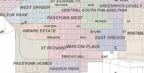
An Italian-American enclave, Marconi Plaza has two main halves, East and West, which are divided in the middle by Broad Street. It is located at the most southern end of the city and within the northern border of the Philadelphia Sports Complex Special District. The neighborhood is accessible via the Oregon Avenue Station of the Broad Street Subway.
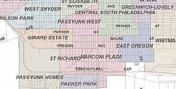

Boundaries of Marconi Plaza Neighborhood:
Western Half Eastern Half Broad Street to 20th St.
from Oregon Avenue to Packer Avenue
including Moyamensing BlvdBroad Street to 8th St.
from Oregon Avenue to Packer AvenueThe urban park Plaza itself, from which the neighborhood derives its namesake, is a 19-acre (77,000 m2) rectangle park. The Roman styled Plaza is divided in the center by Broad Street with four borders of 13th street, 15th street, Bigler Street, and Oregon Avenue.
Contents
History
The plaza was originally designed by the architects Olmsted Brothers in 1914–1916 and was built as the grand entrance for the 1926 Sesquicentennial Exposition, leading visitors south along a tree lined Southern Boulevard (now South Broad Street) to the exhibition grounds that started at Packer Avenue and League Island. This neighborhood twin park mirrored on both sides of Broad Street became property of the Fairmount Park system and held the common name of Oregon Plaza until October 18, 1937 when it was officially named Marconi Plaza in honor of the Nobel Prize Laureate Guglielmo Marconi, the inventor of Radio.
Architecture & art
The original design of the Plaza was a terrace styled with influences of Roman gardens. The east and west plaza reflected the same winding pathways leading to a raised stepped terrace surrounded by stone railings and entrance sculptures of large urns with two small pools of water facing Broad Street at the center point, which at that time was cut away from the curbline of half circles both on the east and west. The park is lushly covered with 25% trees adorned with park benches, open areas for two tot lots, a baseball field, basketball court, and country cotttage style enclosed bocce court. The sidewalk border surrounding the park is densely lined with large maple trees aged at over 100 years with heights of 30–50 feet high.
Over the years many of the fine details have been erased including the half circled indented curbline on either side of Broad Street at the center. This location also had on both sides of the plaza, two reflecting pools of water. The pools were filled in to provide the foundation for the two statues that were later erected to support the immigrant Italian community and respond to Anti-Italianism. A statue of Guglielmo Marconi was erected on the east Plaza though the efforts of the Marconi Memorial Association headed by Dr. Frank P. DiDio. The statue was dedicated on April 25, 1980, to commemorate the 106th anniversary of the birthday of the world famous Italian scientist and inventor.
A statue of Christopher Columbus was erected on the west plaza in 1982. This work was originally located along Belmont Avenue in Fairmount Park, having been erected on October 12, 1876. Thought to be the work of Emanuele Caroni, this is said to be first publicly funded monument to Christopher Columbus in the United States. It was purchased for $18,000 with money raised by Italian-Americans and the Columbus Monument Association, through the efforts of Alonzo Viti of Philadelphia and his brothers. The statue's initial installation began an annual tradition for the colony of mostly Italian Americans in South Philadelphia to march each year on Columbus Day to the statue in Fairmount Park. The 6-mile (9.7 km) journey was found to be too exhausting and in 1920 the celebration changed locations.
Marconi East
Mollbore Terraces of Marconi: The 1930s Mollbore Terrace was a unique urban change from the densely lined row houses that characterized most of South Philadelphia. The design included front porches and a rear yard with an access service roadway for trash pick-up. Three separate Mollbore Terrace sections were constructed east of the plaza within the boundaries of 13th Street to 7th Street, and from Oregon Ave to Johnston Street. The layout departed from the standard street grid, offsetting the numbered streets that permitted placing a "mini-public-square" of green space for houses to face inward on all four sides and directions. The center large rectangular common parks space was originally designated as a "Terrace" that included pathways, grass and trees with an octagon-shaped wading pool at the west end and a raised octagon sand pit platform with a flag pole at the east end.
Marconi West
Roman Terraces of Marconi: The Greco-Roman accented homes west of the plaza from 15th to 19th street using the same concept but on a smaller scale include two oval-shaped Terrrace streets at Smedley and Colorado. The terrace at Colorado Street became well known City wide for its annual decorations and street lighting during the Christmas holidays from 1950-2000.
Moyamensing Boulevard Park of Marconi: This main angluar dual street with an approximately 50 foot center medial park, crosses the standard grid and was designed as an alternative roadway access to the 1926 Sesquicentennial Exposition. It begins at Oregon Avenue, what once a headhouse entrance, through to the intersection of 20th Street, Penrose Avenue and Packer Avenue. An architectural design for a grand public square like the squares of center City Philadelphia was planned at the boulevard park's end point of Penrose Avenue which was viewed by city planners to be the significant southern gateway to the City. The 1926 square was never developed.
Boundaries
In 2002 the City of Philadelphia legislated boundaries of the Sports Complex Special Service District. The residential communities defined included Marconi Plaza. The Special District established an overlay providing the basis for a new definition to Marconi East as community "three" and Marconi West as community "four".
References
- Philadelphia City Planning Commission - Neighborhood Boundaries
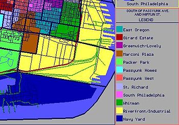
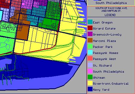
- University of Pennsylvania Library, South Philadelphia Neighborhoods - See Map: Neighborhoods south of Passyunk Avenue and Mifflin Street
External links
- Sports Complex Special District
- Sports Complex Community Boundaries
- Statues of Marconi and Columbus
- Philly History 1906-1926 Plaza and landscaping South of Oregon Avenue concept design by Olmsted Brothers
Coordinates: 39°54′56″N 75°10′17″W / 39.91559°N 75.17135°W
Neighborhoods of the South Philadelphia section of Philadelphia, Pennsylvania Bella Vista • Central South Philadelphia • Devil's Pocket • Dickinson Narrows • East Passyunk Crossing • FDR Park • Girard Estate • Grays Ferry • Greenwich • Hawthorne • Italian Market • Lower Moyamensing • Marconi Plaza • Moyamensing • Newbold • Packer Park • Passyunk Square • Pennsport • Point Breeze • Queen Village • Schuykill • Southwark • Southwest Center City • Sports Complex • Tasker • West Passyunk • Wharton • Whitman • Wilson Park
 Categories:
- Neighborhoods in Philadelphia, Pennsylvania
- Little Italys in the United States
- Italian-American history
- Guglielmo Marconi
Wikimedia Foundation. 2010.