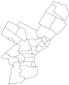
- Northwood, Philadelphia, Pennsylvania
-
Northwood is bounded on the north by Roosevelt Boulevard, on the northeast by Cheltenham Avenue, on the west by Oakland Cemetery and Greenwood Cemetery, Juniata Park and Frankford Creek, and on the southeast by Frankford Avenue. To the northeast are Oxford Circle and Mayfair and to the southeast is Frankford.[1]
References
- ^ "Planning Analysis Section K, Neighborhoods" (PDF). The Political and Community Service Boundaries of Philadelphia. Philadelphia City Planning Commission. 2004. p. 81. http://www.philaplanning.org/data/boundaries.pdf. Retrieved 2010-09-30.
Coordinates: 40°01′27″N 75°05′10″W / 40.024129°N 75.085993°W U.S. Geological Survey Geographic Names Information System: Northwood, Philadelphia, Pennsylvania
City of Philadelphia Architecture · Companies · Culture · Cuisine · Demographics · Education · Fire department · History · Language · Law enforcement · Mayors · Media · Music · Neighborhoods · Notable people · Region · Sites of interest · Skyscrapers · Sports · Transportation

Incorporated Districts, Boroughs, and Townships in the County of Philadelphia, Pennsylvania prior to the Act of Consolidation, 1854 Aramingo Borough | Belmont District | Blockley Township | Bridesburg Borough | Bristol Township | Byberry Township | Delaware Township | Frankford Borough | Germantown Borough | Germantown Township | Kensington District | Kingsessing Township | Lower Dublin Township | Manayunk Borough | Moreland Township | Moyamensing District | Northern Liberties District | Northern Liberties Township | Oxford Township | Passyunk Township | Penn District | Penn Township | Philadelphia City | Roxborough Township | Richmond District | Southwark District | Spring Garden District | West Philadelphia Borough | Whitehall Borough
 Categories:
- Pennsylvania geography stubs
- Neighborhoods in Philadelphia, Pennsylvania
Wikimedia Foundation. 2010.
