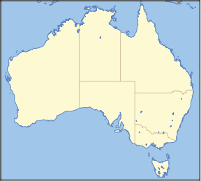
- New England National Park
-
New England National Park Nearest town/city Dorrigo Coordinates 30°35′34″S 152°27′30″E / 30.59278°S 152.45833°E Area 736 km² Established 1937 Managing authorities New South Wales National Parks and Wildlife Service Official site New England National Park New England National Park is situated on the Northern Tablelands in the New England region of New South Wales, Australia, 560 km north of Sydney. It is about 10 km south of Waterfall Way, just 85 km east of Armidale and 65 km west of Coffs Harbour.[1] Ebor, 20 km away, is the closest village to New England National Park.
Contents
History
In the 1920s Philip Wright of Wollomombi led the push to have this area declared a National Park. Most of the area was declared a reserve in 1931 and in 1935 dedicated for public recreation. Between 1934 and 1956 mining leases for antimony were granted.[2]
The national park was officially opened by the Governor General Lord Gowrie in 1937,[3] although the wilderness area was recognised for its beauty as early as the 1920s.
New England National Park (NENP) was World Heritage listed in 1986 and forms part of the New England Group of the Gondwana Rainforests of Australia (previously the Central Eastern Rainforest Reserves of Australia) (CERRA).[4] Gondwana Rainforests of Australia was added to the Australian National Heritage List in 2007.
Geography
Located on the precipitous escarpment on the east of the undulating Northern Tablelands plateau, the wilderness consists of impressive cliffs, rugged ridges, spurs and streams. To the west the Nymboida, Guy Fawkes and Styx Rivers drain across the tablelands.[5] To the east is the thickly forested Bellinger River valley.
The Cunnawarra National Park adjoins the New England National Park on the north-western boundary and the Bellinger River National Park joins it on the north-eastern corner.[6]
Public access to the park focuses on the Point Lookout area (1,563 m above sea level), from where on a clear day the Pacific Ocean is visible. This lookout is the second tallest mountain in the region and one of the highest places north of the Snowy Mountains.
Flora and fauna
The park lies within the Eastern Australian temperate forests ecoregion.[7] It is noted for the wide variety of plant and animal species. The diverse vegetation in the park includes sub-tropical, warm temperate and cool temperate rainforest in the higher altitudes. There are also areas of sclerophyll forest, sub-alpine woodland, heathland and swampland.[5] Heathland is found at Wrights Lookout and in other patches. Estimates of the number of different plant species in the park place the figure at 500.[4] This includes snow gums (Eucalyptus pauciflora), Antarctic Beech, tree ferns and red cedars (Toona ciliata).
Dingos, Koalas, Tiger Quolls, Common Bentwing Bats, Brown Antechinuses, and Northern Brown Bandicoots are some of the mammals found in the park.
Birds
At least 100 species of birds have been recorded.[4] Larger species include the Wedge-tailed Eagle, Greater Sooty Owl, Sulphur-crested Cockatoo and Superb Lyrebird.[8] Eastern Whipbirds, Eastern Bristlebirds, Crimson Rosellas, Australian King Parrots and several kinds of honeyeaters also inhabit the reserve.[4][5]
The park has been identified by BirdLife International as an Important Bird Area (IBA) because it supports one of five remaining populations of Rufous Scrub-birds, as well as of Flame and Pale-yellow Robins, Paradise Riflebirds, Green Catbirds, Regent Bowerbirds and Australian Logrunners.[9]
Facilities
There is an extensive walking track system that traverses the higher areas of the park.
Limited accommodation is available in the park at Banksia Point. If visiting in winter it is a good idea to bring warm clothes because at such a high altitude the region experiences frequent snow falls and cold temperatures.
Yaraandoo Eco-Lodge Function Centre located about 500 metres in along the Point Lookout road also offers accommodation and conference facilities in a peaceful bush style setting.
See also
References
- ^ NSW NPWS "New England National Park", December 2007
- ^ Donald, J.Kay, Exploring the North Coast and New England, Kangaroo Press, Kenthurst, 1978, ISBN 0864171218
- ^ New England National Park: A brief history. 1982. New South Wales National Parks and Wildlife Service
- ^ a b c d Hema Maps (1997). Discover Australia's National Parks. Milsons Point, New South Wales: Random House Australia. pp. 144. ISBN 1975992472.
- ^ a b c New England National Park Plan Of Management. NSW National Parks and Wildlife Service. 1991. ISBN 0730523144.
- ^ National Parks of the Waterfall Way, NSW NPWS, 2002
- ^ Olson, D. M, E. Dinerstein, et al (2001). "Terrestrial Ecoregions of the World: A New Map of Life on Earth". BioScience 51 (11): 933–938. doi:10.1641/0006-3568(2001)051[0933:TEOTWA]2.0.CO;2. http://gis.wwfus.org/wildfinder/.
- ^ New England National Park Information brochure. 1984. New South Wales National Parks and Wildlife Service
- ^ "IBA: New England". Birdata. Birds Australia. http://www.birdata.com.au/iba.vm. Retrieved 2011-08-30.
Categories:- IUCN Category Ib
- National parks of New South Wales
- Northern Tablelands, New South Wales
- Forests of New South Wales
- Protected areas established in 1937
- Gondwana Rainforests of Australia
- 1937 establishments in Australia
- Important Bird Areas of Australia
Wikimedia Foundation. 2010.


