- New England (Australia)
Infobox Australian Place | type = region
name = New England
state = nsw
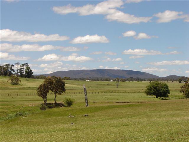
caption = Mt Duval in the New England
lga =
pop = 175,883 cite web
url = http://www.business.nsw.gov.au/region/profiles/newengland-northwest.htm
title = Department of State and Rural Development -New England-Northwest
format = html
publisher =New South Wales Government
accessdate = 1 September
accessyear = 2007]
stategov = Tamworth, Northern Tablelands, Lismore, Liverpool Plains,
fedgov = New EnglandNew England is the name given to a region in the north of the state of
New South Wales ,Australia .The two traditional centres of New England are Armidale and Tamworth. Armidale is the home of the University of New England, Australia's oldest regional university, and has many beautiful parks in the city and is the gateway to the gorge country. Tamworth is now best known as the centre of Australia's
country music industry and the national equine events capital of Australia. Today, however, the fast-growing coastal centres of Ballina, Coffs Harbour, and Port Macquarie are outstripping these inland centres.The inland region contains some of Australia's richest
wool -growing areas. The coastal regions support semi-tropical agriculture such as sugarcane growing, and are also major tourist areas, particularly the far north coast towns such asByron Bay andMurwillumbah .Geography
New England has no defined boundaries, and the term has several possible definitions.
The narrowest definition of New England consists of the highland areas which form part of the
Great Dividing Range , between theLiverpool Range in the south and the border ofQueensland in the north. This region includes substantial areas more than 800m above sea-level, with a distinctive cold climate, distinctive vegetation and a characteristic granite landscape. This highland region is often referred to as the New England Tableland, New England Plateau, or Northern Tablelands. There are widespread high points over 1000m and the highest point atRound Mountain is almost 1600m above sea level. This definition of "New England" includes the towns and districts of Tenterfield, Glen Innes, Inverell, Armidale and Walcha.A broader definition of the New England Region, includes areas beyond the highlands which can also be considered to be the Western Slopes Region and the
Liverpool Plains . This definition includes the valleys of the westward flowingGwydir River andNamoi River and their tributaries, and the foothills and spur ranges which generally form the western side of the central New England tablelands. Towns and districts such as Moree, Narrabri, Gunnedah, Manilla, Tamworth, and Quirindi, are included in the New England Region according to this basis. The adjacentGranite Belt area ofQueensland , which is a geological continuation of the New England Plateau, can also be considered to be part of the region.At its broadest definition, the New England Region has been considered to include the northern coastal lowlands of New South Wales, known as the North Coast or Northern Rivers region, and including cities such as Lismore and Grafton. A State of New England, which has been proposed at various times, included the North Coast region in the boundaries of the proposed new State. Apart from this usage, the North Coast region is not usually considered to be part of New England.
The New England region is traversed by the
New England Highway , which links Tamworth, Armidale, Glen Innes, andTenterfield , and is a major route linking New South Wales andQueensland . The Main North railway line following the same route toWallangarra, Queensland was the first railway link between the states, however the coastal railway is now used and the New England line is disused north of Armidale. TheOxley Highway ,Gwydir Highway , andBruxner Highway traverse the New England Region from west to east.The topography of the region is dominated by the Northern Tablelands plateau. The eastern side of the plateau is drained by the various headwaters and tributaries of the
Clarence River and theMacleay River . In many places these rivers form deep gorges and waterfalls. Notable waterfalls includeEbor Falls andWollomombi Falls which are both east of Armidale. These gorges fragment the eastern side of the plateau, which in some areas such asDorrigo, New South Wales approach quite close to the coast. There are many National Parks along the rugged eastern fringes of the highlands which includesNew England National Park , which includes the region's second highest peak, Point Lookout.The western side of the plateau is somewhat less rugged, and is drained towards the west by the tributaries of the Severn River, the
Gwydir River and theNamoi River . These rivers form part of the Murray-Darling Basin. There are large dams atCopeton Dam on the Gwydir and atKeepit Dam ,Chaffey Dam andSplit Rock Dam in the Namoi catchment. TheNandewar Range is a major western spur of the highlands, culminating inMount Kaputar near Narrabri.National Parks on the rugged eastern fringe of the region include:
*Washpool National Park
*Guy Fawkes River National Park
*Dorrigo National Park
*Cathedral Rock National Park which includes the highest peak in the region, Round Mountain
*New England National Park
*Oxley Wild Rivers National Park
*Werrikimbe National Park Pre-History
The region has been occupied by
Indigenous Australians for thousands of years, notably in the west were theKamilaroi people. In the highlands, the original languages, which are now extinct, were Anaiwan (or Nganaywana) to the south of Guyra and Ngarrabal and Marabal to the north of Guyra.History
The first European person to explore the New England area was English explorer
John Oxley , who crossed the southern part of the New England Range and discovered and named Port Macquarie in 1818. In 1827 Allan Cunningham traveled north along the western edge of the Range until he reached theDarling Downs inQueensland . The area was opened up for settlement in the 1830s, although the semi-tropical coastal areas remained undeveloped for many years.On 22 May 1839 the New England District was gazetted thus: “New England District’: Bounded on the east by a line north by compass from the top of Werrikimber Mountain which is at the head of the Hastings River; on the south by a line west by compass from the top of Werrikimber Mountain to the Great Dividing Range; on the west by the western extreme of the Great Dividing Range so as to include the Tableland and on the north the boundary is indefinite”. [Starr, Joan and Mike Nicholas, Pioneering New England, Rigby, Adelaide, 1978]
Police stations in New England LAC are: Armidale, Ashford, Bundarra, Deepwater, Delungra, Emmaville, Glen Innes, Guyra, Inverell, Tenterfield, Tingha, Uralla and Yetman. Bendemeer, Nowendoc, Walcha and Walcha Road are in the Oxley LAC. [Oxley LAC: http://images.google.com.au/imgres?imgurl=http://www.police.nsw.gov.au/__data/assets/image/0020/64136/oxley.gif&imgrefurl=http://www.police.nsw.gov.au/about_us/structure/operations_command/local_area_commands/western_region/oxley&h=326&w=508&sz=10&hl=en&start=1&sig2=i4pGjjBkiX55G_ifjC7V6w&tbnid=jkXJByWQAtxhDM:&tbnh=84&tbnw=131&ei=Aq1QSMbWNoS4pgTjzZQ3&prev=/images%3Fq%3DOxley%2BLAC%26hl%3Den%26rls%3DGGIG,GGIG:2007-26,GGIG:en]
New State Movement
New England has been the home of Australia's most persistent attempt to form a new state within the Australian commonwealth. Many New England people long resented being governed from
Sydney , especially when, as is usually the case, there is a Labor government in New South Wales, dominated by urban interests. In the 1930s and again in the 1960s, theNew England New State Movement campaigned for New England to be separated from New South Wales. The movement was closely allied with the Country Party, which could have expected to form the government of such a new state.On 29 April 1967 a referendum in the region on the creation of a new state in northern NSW returned a 'no' vote of 54%. [Farrell, John J., ‘Opting Out and Opting In: secession and the new state movements’, "Armidale and District Historical Society Journal", No. 40, April 1997, pp. 139-148. quoted in [http://www.archivists.org.au/files/Conference_Papers/2006/Logan_ASAConference2006.pdf] ]
Chapter VI of the
Australian Constitution allows new states to be formed, but only with the consent of the Parliament of the state in question. It has never been likely that the New South Wales Parliament would consent to the separation of New England.Fact|date=December 2007Image gallery
ee also
*
List of regions in Australia
*Northern Tablelands, New South Wales
*Robertson Land Acts References
External links
* [http://psephos.adam-carr.net/countries/a/australia/constitutions/const11.html Chapter VI of the Australian Constitution]
* [http://www.abc.net.au/newengland/about.htm Australian Broadcasting Corporation - About ABC New England North West NSW]
Wikimedia Foundation. 2010.