- Mallee Cliffs National Park
-
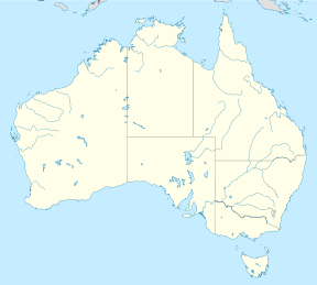
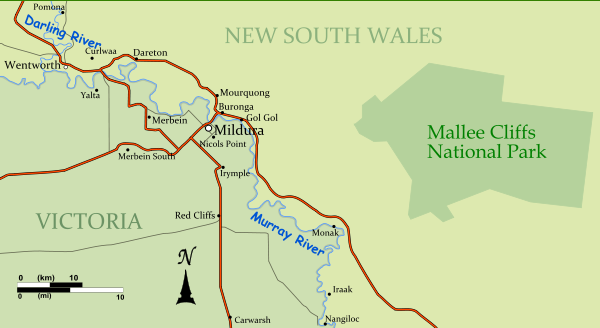
Mallee Cliffs National Park IUCN Category Ia (Strict Nature Reserve)Nearest town/city Mildura Coordinates 34°10′31″S 142°34′39″E / 34.17528°S 142.5775°E Area 580 km² Established 22 April 1977 Managing authorities New South Wales National Parks and Wildlife Service Official site Mallee Cliffs National Park Mallee Cliffs is a national park in the south-west of New South Wales, Australia. It lies 789 km west of Sydney and 30 km east of the Murray River city of Mildura, Victoria. Mallee Cliffs National Park is managed to protect the sand plain and sand dune land systems and ecological communities known colloquially as ‘Mallee Country’. Emphasis is placed on the value of Mallee Cliffs National Park as a wildlife conservation area and it was established primarily to protect the habitat of the mallee fowl, leipoa ocellata.[1]
The park is closed to the public as part of an ongoing policy to protect the mallee fowl and other endangered animals, and to assist in meeting other conservation objectives.[2] Access is limited to educational activities by schools and colleges, and research activities which are relevant to the management of the park and compatible with conservation policies.[3]
It was established in 1977, when the entire 57,969 hectares of the park was purchased by the Foundation for National Parks & Wildlife.[4]
Contents
Geography
Mallee Cliffs National Park preserves the original clay red plains of south west New South Wales, protecting extensive areas of flat to undulating sandy red plains and linear sand dunes formed during arid periods from 350,000 to 500,000 years ago.[3]
Flora
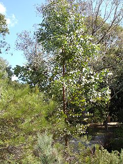
The park preserves undisturbed tracts of mallee vegetation, and rosewood-belah woodland. Mallee are small eucalyptus trees and shrubs with many small stems and thick underground roots that retain water. Before irrigation farming began, dense thickets of mallee characterized most of northwestern Victoria, and areas of south-western New South Wales.[1] The park contains an important representation of mallee communities, including both bull mallee and whipstick mallee. These flora types are continuing to be extensively cleared on private property for grazing both immediately outside the park and throughout the country. The park contains a number of isolated, relict plant communities that demonstrate shifts in the pattern of vegetation arising from long-term environmental change.[4]
In January 1975 a bushfire ravaged the region which later became national park, making the average age of the vegetation considerably younger than similar protected areas. This makes the park a less attractive option for release of certain animals such as the Black-eared Miner, manorina melanotis, which use older trees and mallee bushes as habitat.[5]
Fauna
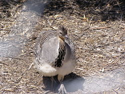
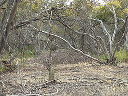
The park lies within the Southern NSW Mallee Important Bird Area, identified by BirdLife International as supporting a significant population of the vulnerable Malleefowl.[6] The park is the only reserve in New South Wales with Malleefowl habitat. The Malleefowl is found in arid areas only where the mallee grows. The males build a nest for the eggs by digging a large pit in winter and filling it with leaves and grass over the nest four months, where the female lays one egg per day for several days in the spring. He then covers the resulting mound with sand. As the compost heap rots it generates heat. The male keeps watch over the mound, and tests the temperature of the mound with his tongue, adding or removing sand. When the chick hatches, it digs its way out, and once they emerge at the top of the mound are renowned for standing stationary at the top for up to twenty minutes before racing/staggering off into the bush. The chicks hatch with feathers and are immediately independent, never needing any parental care. Malleefowl grow to a length of around 60 cm/23 in. [7]
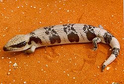
Several species of small birds are found in the area, as well as emus. Mammals include a significant population of Western Grey Kangaroos as well as Pygmy possums and the Little Pied Bat and Greater Long-eared Bat which use older trees as nesting hollows. The mallee spinifex of the park is the main habitat for the Western blue-tongue and southern spinifex slender blue-tongue lizards.[1][8]
See also
- Protected areas of New South Wales (Australia)
References
- ^ a b c "Fire Management Plan, Mallee Cliffs National Park Feb 2006 - Feb 2011". NSW Government. p. 4. http://www.environment.nsw.gov.au/resources/parks/FMSMaleeCliffsNP.pdf.
- ^ "Mallee Cliffs National Park Plan of Management". NSW National Parks and Wildlife Service. p. 21. http://www.environment.nsw.gov.au/resources/parks/pomfinalmalleecliffs.pdf.
- ^ a b "Mallee Cliffs National Park". NSW Government. http://www.environment.nsw.gov.au/NationalParks/parkHome.aspx?id=N0044.
- ^ a b "Mallee Cliffs National Park". Foundation for National Parks & Wildlife. http://fnpw.org.au/OurProjects/LandAcquisition/Mallee_Cliffs_National_Park.htm.
- ^ "National recovery plan for the Black-eared Miner Manorina melanotis 2002 - 2006". Australian Government Department of the Envornment, Water, Heritage and the Arts. http://www.environment.gov.au/biodiversity/threatened/publications/recovery/m-melanotis/existing.html.
- ^ "IBA: Southern NSW Mallee". Birdata. Birds Australia. http://www.birdata.com.au/iba.vm. Retrieved 2011-10-19.
- ^ "More about the Mallee Fowl". The Victorian Malleefowl Recovery Group, Inc. http://www.malleefowlvictoria.org.au/malleefowl2.html.
- ^ "Mallee slender blue-tongue lizard - endangered species listing". NSW Government. http://www.environment.nsw.gov.au/determinations/MalleeSlenderBluetongueLizardEndSpListing.htm.
Categories:- IUCN Category Ia
- National parks of New South Wales
- Protected areas established in 1977
- 1977 establishments in Australia
- Important Bird Areas of Australia
Wikimedia Foundation. 2010.

