- Dooragan National Park
-
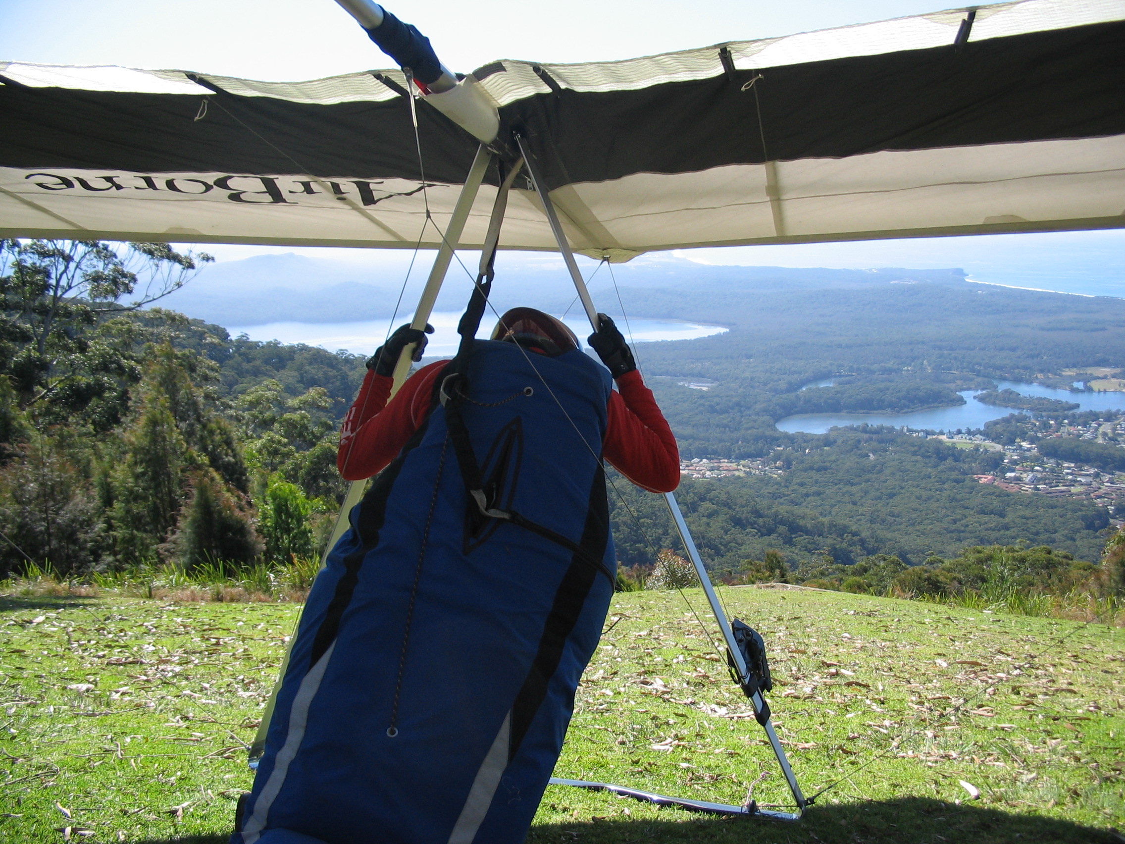
Dooragan National Park IUCN Category II (National Park)A hang glider prepared for flight from North Brother Mountain
Coordinates 31°39′52″S 152°46′26″E / 31.66444°S 152.77389°ECoordinates: 31°39′52″S 152°46′26″E / 31.66444°S 152.77389°E Area 11 km2 (4.25 sq mi) Established 1997 Managing authorities NSW National Parks and Wildlife Service Dooragan is a national park near Laurieton, New South Wales, Australia, approximately 365 km northeast of Sydney.
Contents
Three Brothers
The local aboriginal people tell a dreamtime story of three brothers of the Birpai tribe who were killed by a witch called Widjirriejuggi and were buried where the mountains stand. The youngest of the three was Dooragan, for whom the park is named.[1]
By amazing coincidence, when Captain Cook passed the area on 12 May 1770 he named the mountains Three Brothers, since "these Hills bore some resemblance to each other".[2] Cook had earlier (25 January 1769) written of the Three Brothers hills west of Cape St Diego, so perhaps he was inspired by them too.
North Brother Mountain (Dooragan) supports a wide range of vegetation communities – including some of the best examples of old growth blackbutt forest in the area and pockets of sub-tropical rainforest – that provide habitat for gliders, bats and koalas. The park has a weed problem with the spreading of lantana.
The mountain was made a timber reserve in 1892 and later called the Camden Haven State Forest. Portions of the mountain were logged but large sections were untouched due to the terrain. It was opened to the public in 1970 when a road to the summit was constructed.[1] The steep windy road has now been sealed, but it is unsuitable for caravans. Viewing platforms, which have wheelchair access, offer good views up and down the coast. Picnic, barbecue and toilet facilities are available. There are walks of varying length and difficulty.[3]
See also
References
- ^ a b Dooragan National Park Culture & history at the [[National Parks and Wildlife Service (New South Wales)|]] website
- ^
- ^ Greater Port Macquarie Map, Edition 5, Cartoscope Touring Maps
External links
- Dooragan National Park page at the National Parks and Wildlife Service website
Australian places named on the First voyage of James Cook in 1770 Victoria 
New South Wales 21st April: Mount Dromedary · Batemans Bay · 22nd: Pigeon House · 25th: Red Point · 28th: Botany Bay*·
6th May: Port Jackson · Broken Bay · 11th: Point Stephens · Port Stephens · Cape Hawke · 12th: The Three Brothers · 13th: Smoky Cape · 15th: Solitary Isles · Cape Byron · 16th: Mount WarningQueensland 16th May: Point Danger · 17th: Point Lookout · Cape Moreton · Morton Bay · The Glass Houses · 18th: Double Island Point · 19th: Indian Head · Sandy Cape · 21st: Herveys Bay · 23rd: Bustard Bay* · 25th: Cape Capricorn · 26th: Keppel Isles · 27th: Keppel Bay · 27th: Cape Manyfold · 28th: Shoal Water Bay · Northumberland Isles · 1st June: Long Isle · Broad Sound · 2nd: Slade Point · 4th: Whitsundays Passage · Cape Gloucester · 6th: Magnetical Island · Palm Isles · 8th: Halifax Bay · Dunk Island · 9th: Frankland Islands · Fitzroy Island · 10th: Green Isle · Trinity Bay · Cape Tribulation
11th Aug: Lizard Island* · Eagle Island* · 18th: Sir Charles Hardy's Isles · 19th: Cape Grenville · 21st: York Cape · 22nd: Possession Island*· Prince of Wales's Isles · 23rd: Booby Island*
14th June - 4th August: Endeavour River**Places where Cook landedCategories:- IUCN Category II
- National parks of New South Wales
- Protected areas established in 1997
- 1997 establishments in Australia
- Mid North Coast
- New South Wales protected area stubs
Wikimedia Foundation. 2010.