- Cottan-Bimbang National Park
-
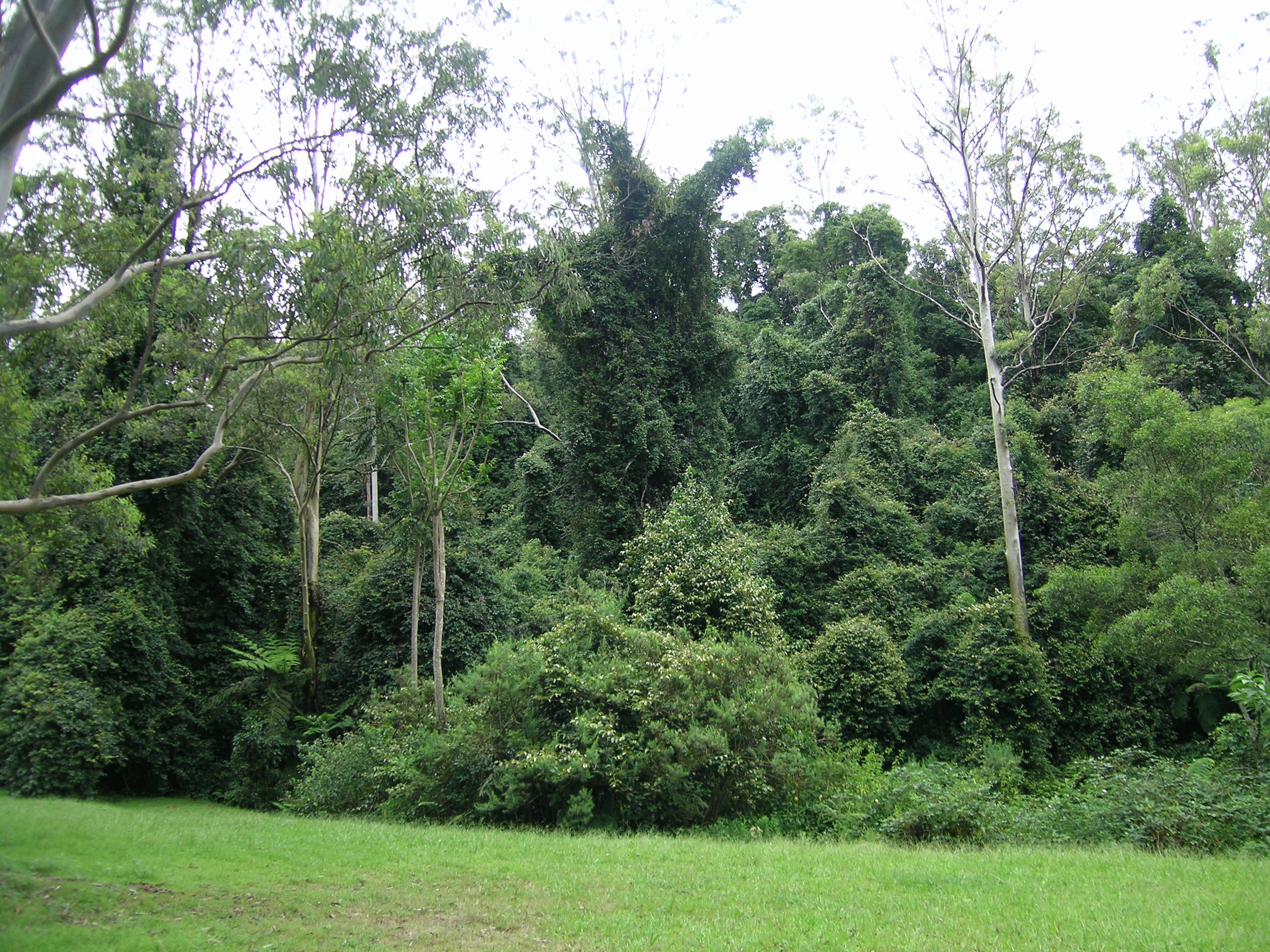
Cottan-Bimbang National Park IUCN Category II (National Park)Rainforest in Cottan-Bimbang National Park at the Stockyard Creek picnic area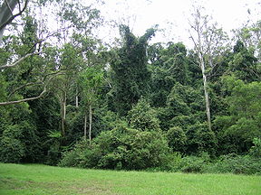
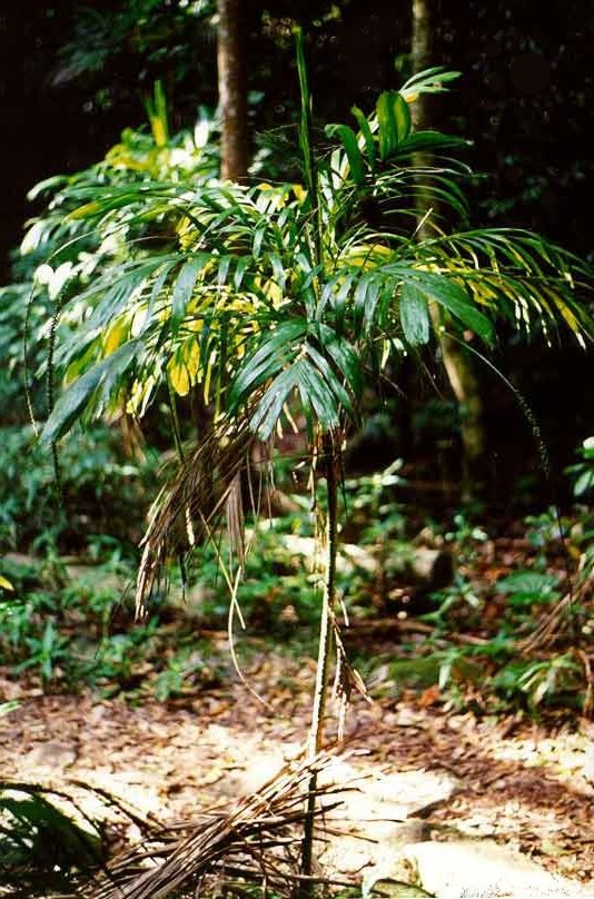
Nearest town/city Walcha Coordinates 31°21′02″S 152°08′02″E / 31.35056°S 152.13389°ECoordinates: 31°21′02″S 152°08′02″E / 31.35056°S 152.13389°E Area 269 km2 (103.9 sq mi) Established 1999 Managing authorities NSW National Parks and Wildlife Service Official site http://www.nationalparks.nsw.gov.au 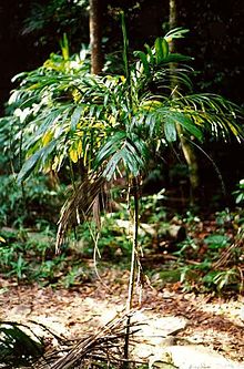 Linospadix monostachya (walking stick palm)
Cottan-Bimbang is a national park in New South Wales, Australia, 443 km[1] north of Sydney and 65 km south east of Walcha and was formerly a state forest. The Oxley Highway crosses the park south of Werrikimbe National Park. Myrtle Scrub Road is a 15 kilometre circuit in the west of the park that connects with the Oxley Highway.
Flora and fauna
This park is situated on the eastern escarpment with extensive tall old-growth eucalypt forest, rainforest, threatened frog species, yellow-bellied gliders (Petaurus australis) and koalas. 'Cottan-bimbang' is the local Aboriginal word for the walking stick palm (Linospadix monostachya), which grows in the park's temperate rainforests.
Blackberries (Rubus) are creating a serious weed problem in the park.
There is a barbecue area, picnic area and public toilets at Stockyard Creek on the Oxley Highway[2] and a cleared area for picnics next to Cells River on Myrtle Scrub Road. There is a cleared area for camping at Maxwells Flat on the Causeway Road, and a long drop toilet.
See also
References
Categories:- IUCN Category II
- National parks of New South Wales
- Protected areas established in 1999
- Australian Aboriginal placenames
- 1999 establishments in Australia
- New South Wales protected area stubs
Wikimedia Foundation. 2010.