- Oxley Highway
-
Oxley Highway
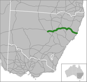
Route information Length: 656 km (408 mi) History: Proposed _to_replace_  to replace
  [1]
[1]Major junctions Southwest end:  Mitchell Highway,
Nevertire, New South Wales Newell Highway

 Castlereagh Highway
Newell Highway
 Kamilaroi Highway
 New England Highway
 Fossickers Way
New England Highway
Thunderbolts Way
 Pacific Highway
To: Gordon Street,
Port Macquarie, New South WalesLocation Primary
destinations:Warren, Gilgandra, Coonabarabran, Gunnedah, Carroll, Tamworth, Kootingal, Moonbi, Bendemeer, Walcha, Yarrowitch, Wauchope Highway system Highways in Australia
National Highway • Freeways in Australia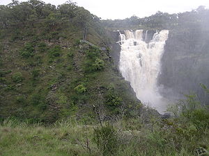
The Oxley Highway[2] is a rural highway in New South Wales, Australia. It starts at Nevertire where it joins the Mitchell Highway. It links Warren, Gilgandra, Coonabarabran, Gunnedah, Carroll, Tamworth, Bendemeer, Walcha, Yarrowitch, Ellenborough, Long Flat, Wauchope and ends at Port Macquarie on the coast of the Tasman Sea.
The Oxley Highway links with the Castlereagh Highway at Gilgandra, from where it is duplexed with the Newell Highway to Coonabarabran, the New England Highway at Tamworth, with which it is duplexed to Bendemeer, the Thunderbolts Way at Walcha, and the Pacific Highway near Port Macquarie.
Contents
History
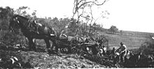 A road gang at Honeysuckle Creek, Oxley Highway, Yarrowitch, NSW
Work commenced in 1838 with the use of convicts working from Port Macquarie towards a spot known as “Prisoners’ Garden” about 20 km from Yarrowitch. Here it is said that the convicts were chained up each night. In 1842 the track from the Northern Tablelands to Port Macquarie was opened for the first time. Wool carried along this new route reduced the travelling time to 10 days, as opposed to 12-14 weeks for the trip to Maitland. The section from Walcha to Bendemeer existed as a mapped road in 1857, was surveyed in 1867, and proclaimed a Parish Road in c.1889. West of Walcha the road was only suitable for bullock teams and they too had difficulties, espescially with the ranges.[3]
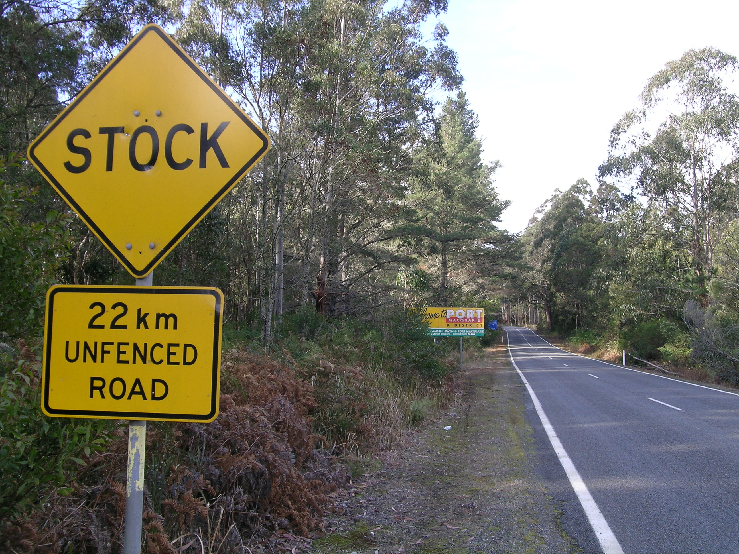
 Signs, Oxley Highway, NSW
The steep range section from Yarras to Yarrowitch was in serious need of repair in 1925 when the Main Roads Board was formed. Following a re-survey in 1927 the road was altered between Yarras and Tobins Camp. The Highway was named in 1928 to commemorate John Oxley who was the first European to explore much of inland New South Wales in 1818. On 30 September 1933 the Highway section between Walcha and Port Macquarie was officially opened. Walcha Shire maintained 106 km of the Highway until July 1966 when this part was taken over by the Department of Main Roads.
About 45 kilometres of the Yarrowitch to Wauchope section is unfenced and livestock (cattle) may be encountered there, along with other wild animals on most of the highway. Kangaroos are the most likely of those to be spotted, but wombats and other marsupials may be found.
Attractions
The Wauchope to Walcha section and southwards along Thunderbolts Way is a very popular motorcycle ride in Australia as these roads wind their way up and down the scenic mountains of the Great Dividing Range.[4] [5]
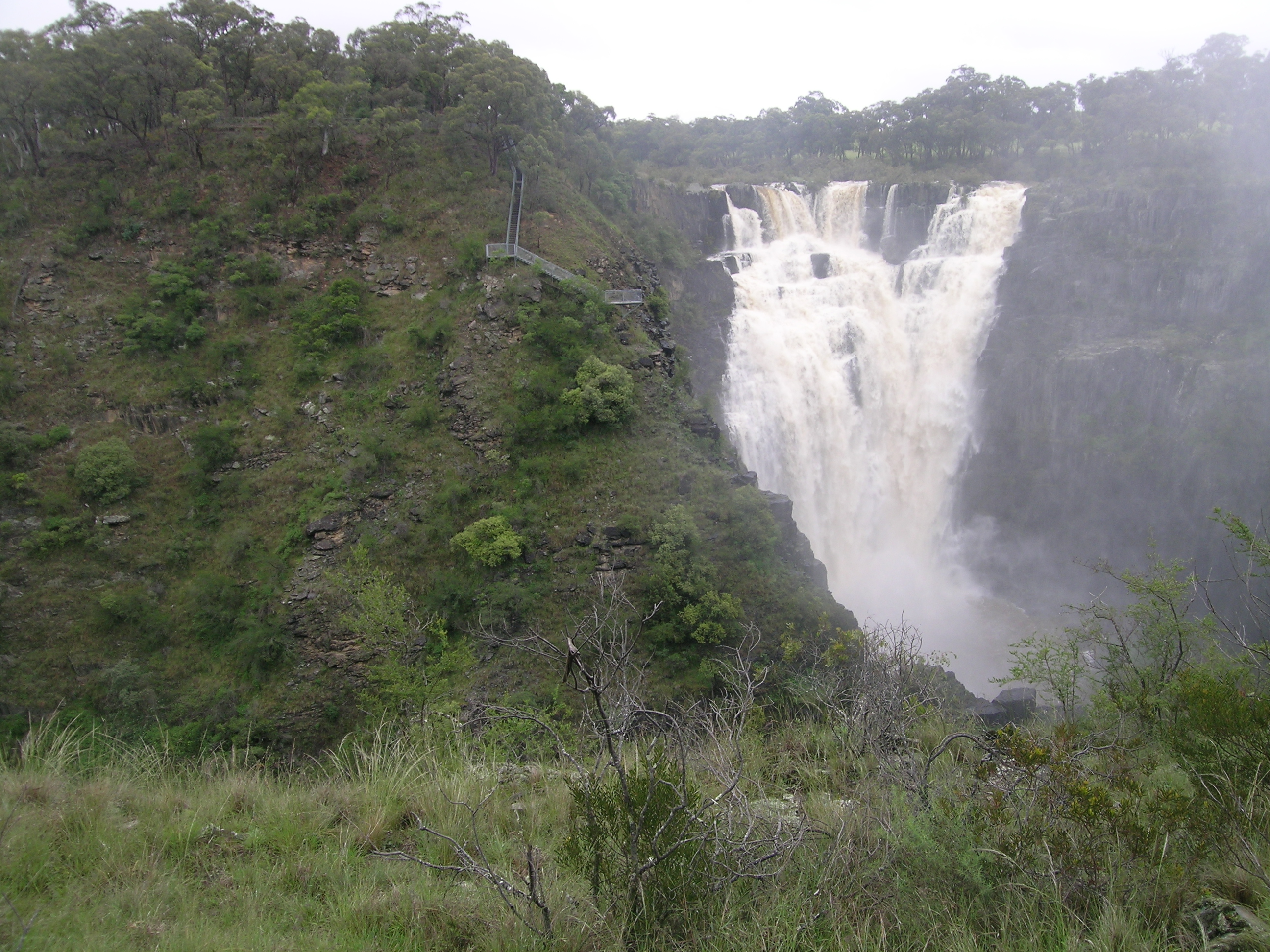
A major attraction at Wauchope is the Timbertown Pioneer Village which is a very good old timber town of the 1880s set on 87 acres (350,000 m2). West of Timbertown the highway passes along the northern boundary of the Bago Bluff National Park. After leaving Ellenborough the highway traverses through the Cottan-Bimbang National Park and the northern edge of the Mummel Gulf National Park.[6] The Apsley Falls are easily accessible on a 1 km sealed side road and the Tia Falls and are quite spectacular, too, with good facilities available at each. Walcha has the unique Open Air Gallery, fossicking opportunities, Amaroo Museum & Cultural Centre, Pioneer Cottage museum and the local history archives.
The Gunnedah Rural Museum, containing farm machinery, equipment, a gun collection, photography and other artefacts is located on the Oxley Highway, 1 km west of the post office.
Near Coonabarabran, 2 km west of the town centre, on the National Park Road, is the Skywatch Observatory. Its attractions include hands-on usage of powerful telescopes. Hickey's Falls are located at the end of a short walking track which departs from a roadside stop, 42 km south-west of Coonabarabran on the Oxley Highway, en route to Gilgandra. Picnic and barbecue facilities are available.
References
- ^ Alpha-Numeric Route Numbering for NSW. It is here!, Ozroads: the Australian Roads Website. Retrieved on 25 May 2008.
- ^ Oxley Highway, Great Road Rides - New South Wales. Retrieved on 25 May 2008.
- ^ Donald, J.Kay, Exploring the North Coast and New England, Kangaroo Press, Kenthurst, 1978
- ^ Southern Sojourn Retrieved 2010-12-20
- ^ Oxley Highway mountain magic Retrieved 2010-12-20
- ^ NRMA Central & North West map 5, 06/07
- Walcha - 100 Years of Local Government, Walcha Shire Council, Newprint Industries, Walcha, 1989.
See also
Categories:- Australian highways


Wikimedia Foundation. 2010.