- Coonabarabran, New South Wales
-
Coonabarabran
New South Wales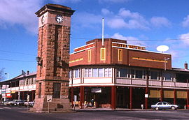
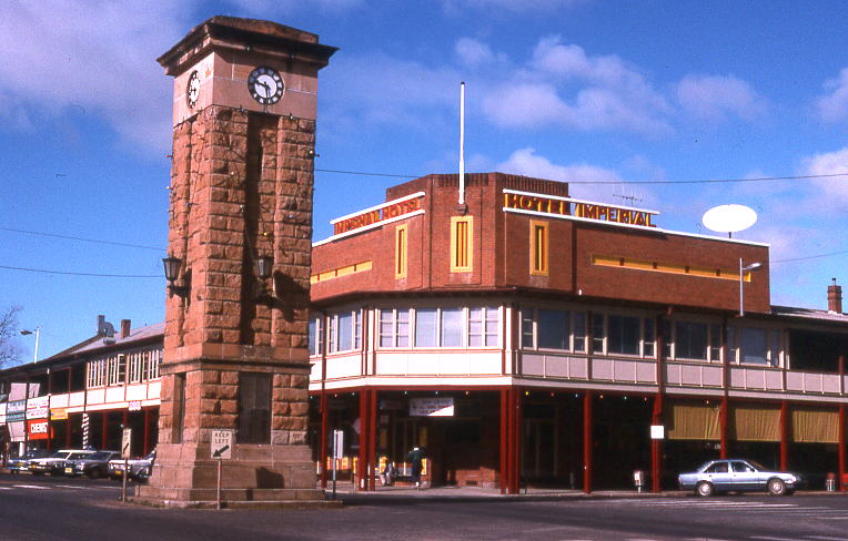
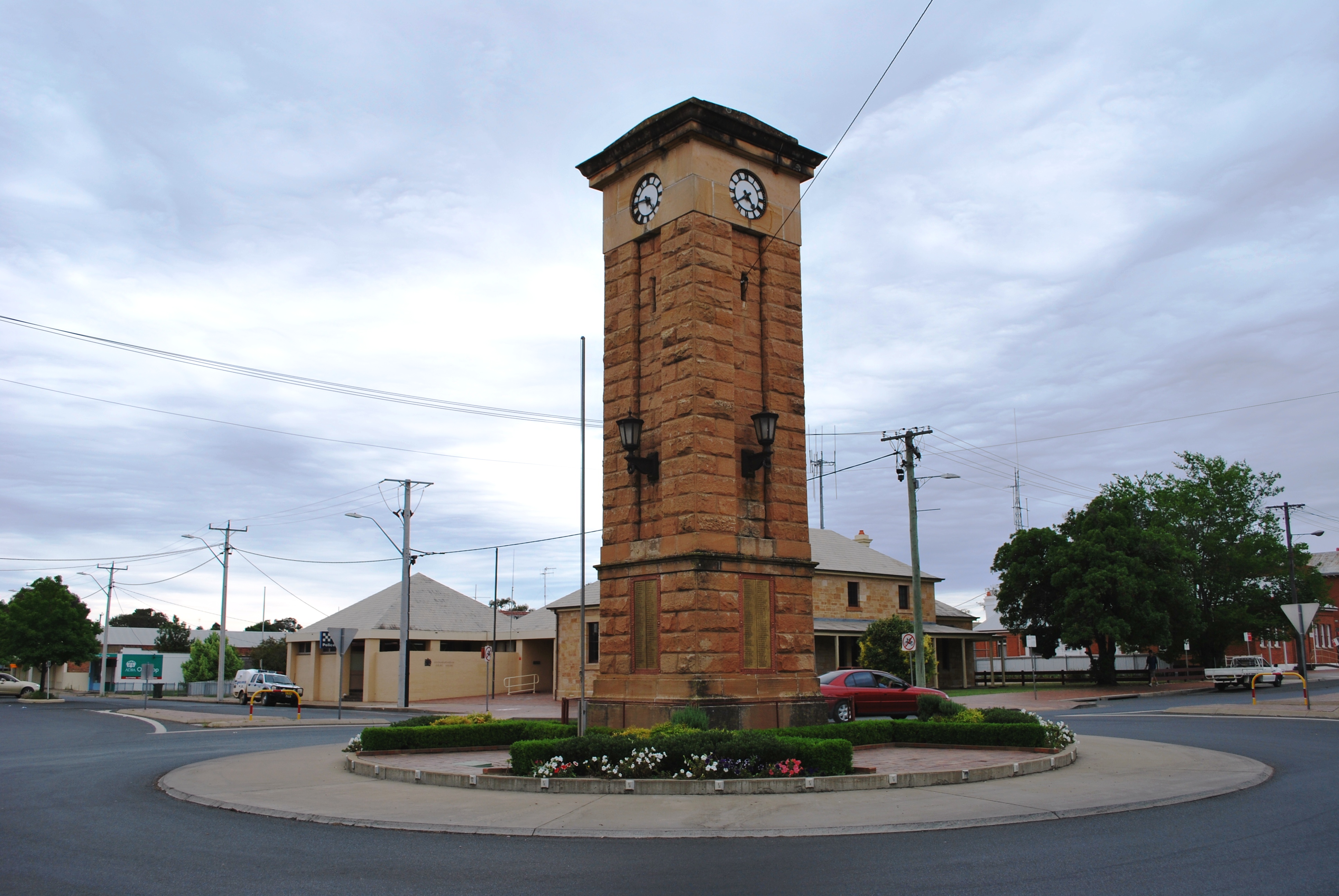
Town centre
 Coonabarabran
Population: 2,609 [1] Postcode: 2357 Elevation: 505 m (1,657 ft) Location: LGA: Warrumbungle Shire State District: Barwon Federal Division: Parkes Mean max temp Mean min temp Annual rainfall 23.7 °C
75 °F7.4 °C
45 °F748.4 mm
29.5 in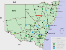 Location of Coonabarabran in New South Wales (red)
Coonabarabran /kuːnəˈbærəbrən/[2] is a town in Warrumbungle Shire in northern New South Wales, Australia. At the 2006 census, the town had a population of 2,609.[1]
Contents
History and description
Lewis Gordon first proposed a town plan survey for Coonabarabran in 1859 although the area had been opened up by a Government-sponsored expedition in 1817. John Oxley found Aboriginal people living here the following year 1818 — later identified as the western language reach of the Kamilaroi clans (Gamilaraay is the spelling used by linguists). Kamilaroi people are still well represented in the region, having occupied Coonabarabran for approximately 7,500 years.
The meaning of the word Coonabarabran is said to probably derive from Kamilaroi language 'gunbaraaybaa' meaning 'shit'. A meaning recorded earlier, 'peculiar odour', is thought to be a bowdlerisation. Another meaning has been said to be that it is the Aboriginal for 'Inquisitive person'. 'Coolabarabran' was the name of a station owned by James Weston in 1848.[3]
Coonabarabran Post Office opened on 1 January 1850.[4]
The township is located on the Newell Highway and the Oxley Highway, approximately halfway between Melbourne and Brisbane and can be reached in about six hours by car from Sydney. There are numerous motels, hotels, and caravan parks for travellers.
Coonabarabran is the gateway to the Warrumbungle National Park and the Pilliga Forest. A central feature of the town is the Town Clock which is situated in the middle of town at the intersection of John Street and Dalgarno Street.
Coonabarabran is the closest town to the 3.9-metre Anglo-Australian Telescope, the largest optical telescope in Australia, situated on Siding Spring Mountain. A number of other telescopes are in use on the mountain with a number of them operated by the Research School of Astronomy and Astrophysics of the Australian National University. There are a total of 12 telescopes currently on Siding Spring, with a thirteenth currently being built. This is the Skymapper Survey Telescope of the ANU. Siding Spring is also home to the Uppsala Telescope where Dr Rob McNaught discovered his now famous daylight comet C2006 P1 McNaught in August 2006. A recent addition to the town was the construction of the World's Largest Virtual Solar System Drive on the roads leading to the observatory.
There are aged care facilities in the town, providing hostel, lodge and nursing home facilities. There are also village self-care units.
There are a number of doctors, a dentist and a hospital.
Coonabarabran is on a main inland truck route between Queensland and Victoria.
Media
Independently owned and operated, the Coonabarabran Times newspaper circulates throughout the Warrumbungle Shire area. Approximately 2700 copies are printed each Thursday and distributed across the townships of Coonabarabran, Binnaway, Baradine, Coolah, Dunedoo, Mendooran and Mullaley. The Coonabarabran Times was founded in 1927 as an amalgamation of The Bligh Watchman (1877–1927) and The Clarion (1910–1927). It continues to be a solid publication, consisting of local news and issues facing the community, sport, advertisements and events.
The area is currently served by a small community radio station, 2WCR FM. This station broadcasts on 99.5 FM, it has a good broadcasting range but it can be a bit scratchy due to the hill-like terrain.
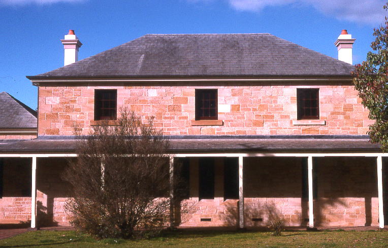
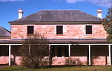 Old Coonabarabran Court House
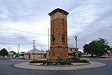 War memorial at Coonabarabran
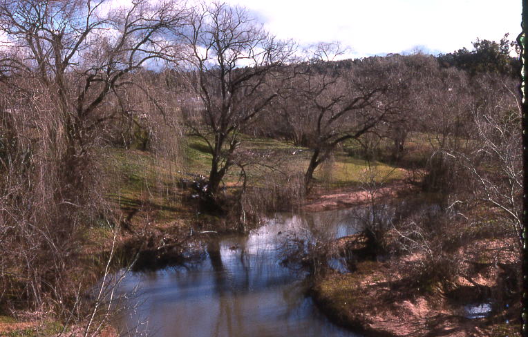
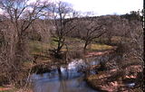 Castlereagh River
Schools
The town of Coonabarabran is home to three schools:
Coonabarabran Public School
Coonabarabran Public School is a Government-funded school, located on John Street, on the Oxley highway. It has approximately 350 students, and its educational facilities range from Kindergarten to Year 6. Its Principal is Mr Noel Willoughby.
Coonabarabran High School
Coonabarabran High School is located on the Oxley highway, is also Government-funded, has approximately 400 students. It has a range of academic and sporting facilities, an Ag-plot, two computer labs, a gym, and a hall. The principal is Mr Kevin Sharp, and the deputy is Mr Graham Enks.
St Lawrence's Catholic School
St Lawrence's Catholic School is located on Dalgarno Street. It caters for Kindergarten to Year Ten and has approximately 150 students. It is not Government-funded[citation needed], and education is based around a Catholic lifestyle. It has an ag-plot, a computer lab, recently renewed basketball courts and is across the road from St Lawrence's Catholic Church. The high school part of the school closed at the end of 2009.[5]
Shops and Services
Being a small country town, Coonabarabran has limited shops. There are two major chain shopping centres, Woolworths and Foodworks (formerly Coles, Bi-lo, Tuckerbag, Payless and many others over the years), plus the fast food stores Subway and Eagle Boys Pizza , it also has other small cafe restaurants. Until 2007 there was an IGA store, run by the Woo family, that supplied most of the town. There is a newsagency, local bakery, catering service, three Chinese restaurants and several hotels. It also has two variety clothing stores ADRA and a St Vincent DePaul. Coonabarabran has many churches, the Parish of St Lawrences Catholic Church, the Anglican Church, Presbyterian Church, Uniting Church and the Seventh Day Adventist Church.
See also
References
- ^ a b Australian Bureau of Statistics (25 October 2007). "Coonabarabran (Urban Centre/Locality)". 2006 Census QuickStats. http://www.censusdata.abs.gov.au/ABSNavigation/prenav/LocationSearch?collection=Census&period=2006&areacode=UCL121400&producttype=QuickStats&breadcrumb=PL&action=401. Retrieved 2007-06-28.
- ^ Macquarie Dictionary, Fourth Edition (2005). Melbourne, The Macquarie Library Pty Ltd. ISBN 1-876429-14-3
- ^ "Geographical Names Register Extract for Coonabarabran". Geographical Names Board of New South Wales. http://www.gnb.nsw.gov.au/name_search/extract?id=JPckWyKmuj. Retrieved 2008-08-26. The GNB quotes Place Names of NSW their origins & Meanings by A.W. Reed and also Appleton 1992 which presumably refers to the Cambridge Dictionary of Australian Places, Richard & Barbara Appleton, 1992.
- ^ Premier Postal History. "Post Office List". Premier Postal Auctions. https://www.premierpostal.com/cgi-bin/wsProd.sh/Viewpocdwrapper.p?SortBy=NSW&country=. Retrieved 2011-05-26.
- ^ ABC Online. http://www.abc.net.au/news/stories/2009/05/15/2571188.htm
External links
Preceding station NSW Closed lines Following station Yearinantowards GwabegarGwabegar Line Ulamambritowards WallerawangCategories:- Towns in New South Wales

Wikimedia Foundation. 2010.