- Coquille River Light
-
Coquille River Light 
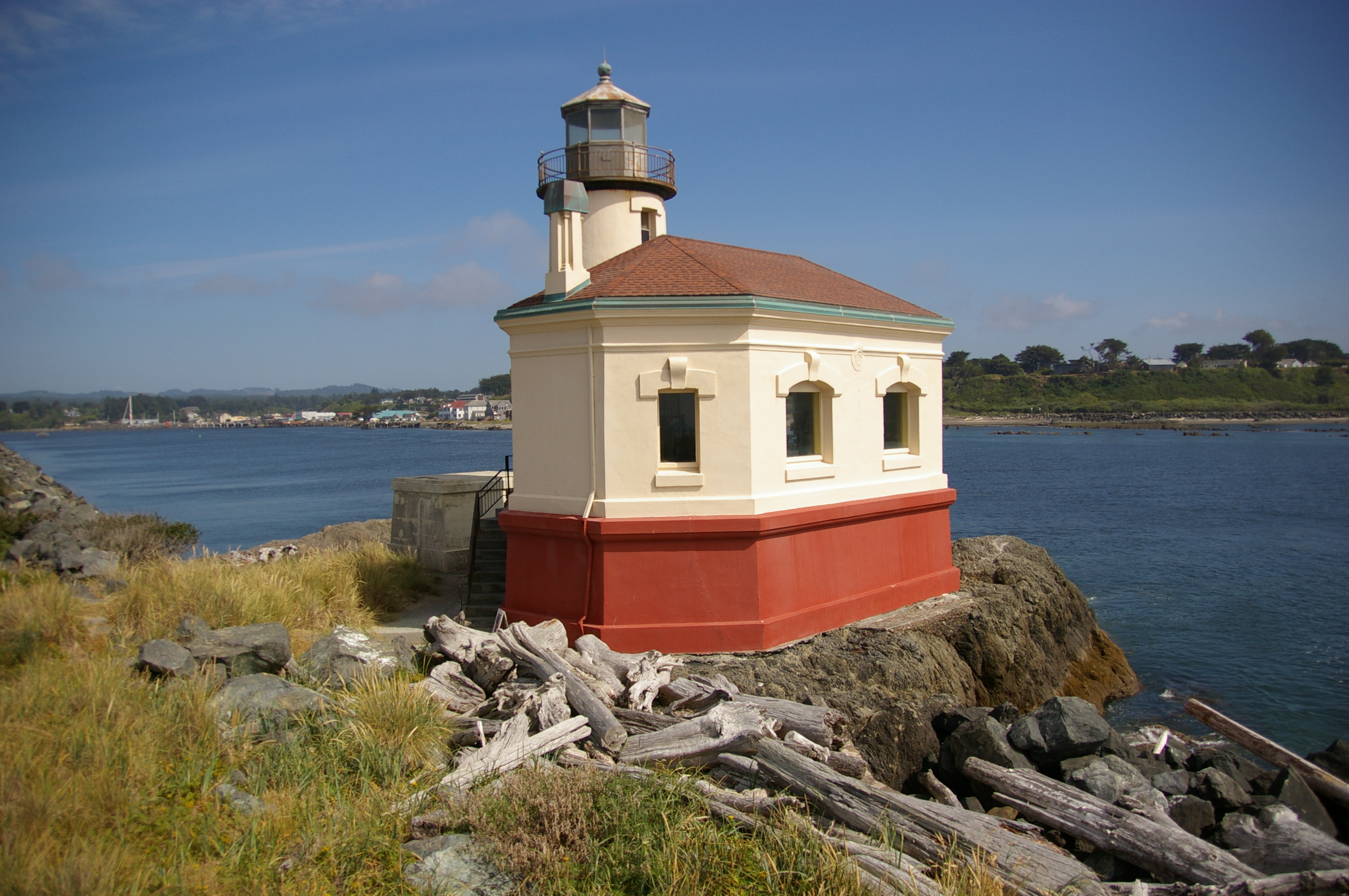
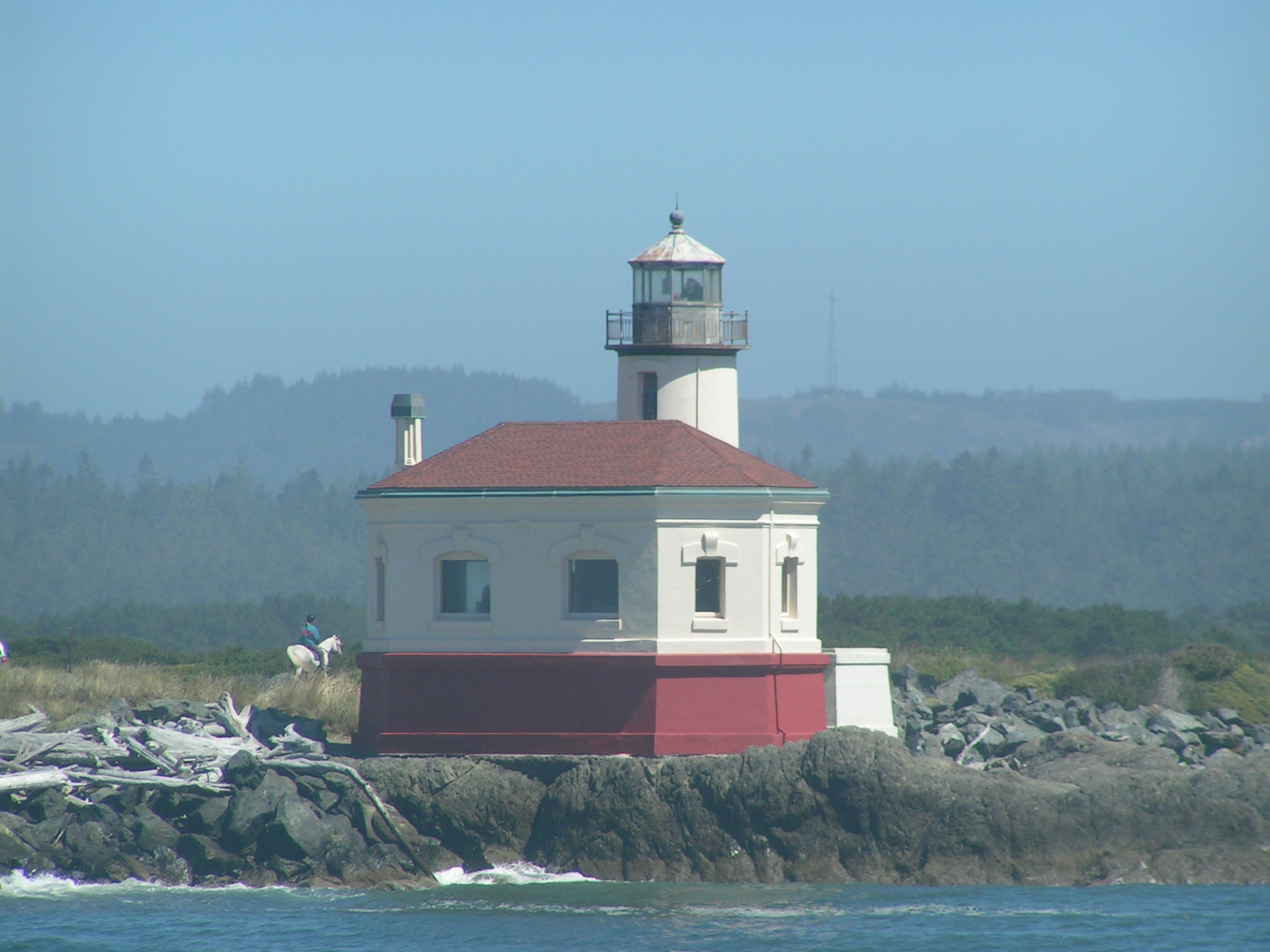
Coquille River Light Location Bandon, Oregon Coordinates 43°07′26″N 124°25′27″W / 43.123911°N 124.424222°WCoordinates: 43°07′26″N 124°25′27″W / 43.123911°N 124.424222°W Year first constructed 1895 Year first lit 1896 Deactivated 1939 Foundation Rock/concrete jetty Construction Brick/stuccoed Tower shape Conical attached to signal building Markings / pattern Red and white tower, black lantern Height 40 feet Focal height 47 feet Original lens Fourth order Fresnel Current lens Solar (1991) (visible only from Bandon) Range 12 miles (formerly)[1] Characteristic 28 seconds on, 2 seconds off Coquille River Light (formerly known as Bandon Light) is a lighthouse located near Bandon, Oregon, United States. It is currently maintained by the Oregon Parks and Recreation Department as a part of Bullards Beach State Park.
Contents
History
Originally named Bandon Light, Coquille River Light was commissioned in 1895. First lit on February 29, 1896, the light guided mariners past the dangerous shifting sandbars into the Coquille River and harbor at Bandon. The light contained a fourth-order Fresnel lens and connected to the nearby keepers house by a wooden walkway. In September 1936, a large wildfire swept through the surrounding area, and destroyed most of Bandon. The town soon became bankrupt as a result of the decline in shipping. Coquille Light was shut down in 1939 and replaced by an automated light on the south jetty.
The light was originally built with a Daboll trumpet for its foghorn, which was used as the light's fog signal for several years. However, at certain times due to specific weather conditions, the sound of the trumpet would fail at sea, and in 1910 the trumpet was replaced by a more reliable fog siren. While mariners liked the new signal, many Bandon residents did not. The siren would eventually be removed along with the Fresnel lens after the light's decommissioning.
Over the next 37 years, the condition of the light deteriorated due to neglect and vandalism, until the 1976, when its first major restoration began. However, by this time, the keepers quarters and other outbuildings had deteriorated past the point of repair, and were eventually removed. In 1991, a new solar powered light was installed in the tower. Currently, a new set of renovations are being done to the light as an ongoing project, and is estimated to finish sometime in 2011.[1][2][3]
Gallery
See also
- List of lighthouses on the Oregon Coast
- Steamboats of the Coquille River
- List of Oregon shipwrecks
References
- ^ a b "Coquille River Lighthouse -- Circa: 1896 -- Decommissioned 1939". discoveroregonlighthouses.com. http://www.discoveroregonlighthouses.com/coquille.html. Retrieved 2010-07-01.
- ^ "Coquille River Lighthouse: A Beacon of Local History". bandonvisitorsguide.com. http://www.bandonvisitorsguide.com/2009/view/32/coquille_river_lighthouse_a_beacon_of_local_history.php. Retrieved 2010-07-01.
- ^ "Coquille River Light". rudyalicelighthouse.net. http://www.rudyalicelighthouse.net/NWLts/Coquille/Coquille.htm. Retrieved 2010-07-01.
External links
- Coquille River (Bandon) Light at National Park Service inventory of historic lightstations
Lighthouses of Oregon Cape Arago Light • Cape Blanco Light • Cape Meares Light • Cleft of the Rock Light • Coquille River Light • Desdemona Sands Light • Heceta Head Light • Pelican Bay Light • Point Adams Light • Tillamook Rock Light • Umpqua River Light • Warrior Rock Light • Willamette River Light • Yaquina Bay Light • Yaquina Head Light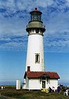
U.S. National Register of Historic Places Topics Lists by states Alabama • Alaska • Arizona • Arkansas • California • Colorado • Connecticut • Delaware • Florida • Georgia • Hawaii • Idaho • Illinois • Indiana • Iowa • Kansas • Kentucky • Louisiana • Maine • Maryland • Massachusetts • Michigan • Minnesota • Mississippi • Missouri • Montana • Nebraska • Nevada • New Hampshire • New Jersey • New Mexico • New York • North Carolina • North Dakota • Ohio • Oklahoma • Oregon • Pennsylvania • Rhode Island • South Carolina • South Dakota • Tennessee • Texas • Utah • Vermont • Virginia • Washington • West Virginia • Wisconsin • WyomingLists by territories Lists by associated states Other  Category:National Register of Historic Places •
  Portal:National Register of Historic PlacesCategories:
- Oregon Coast
- Lighthouses on the National Register of Historic Places in Oregon
- Transportation in Coos County, Oregon
- Buildings and structures in Coos County, Oregon
- Visitor attractions in Coos County, Oregon
- United States lighthouse stubs
- Oregon Registered Historic Place stubs
-


Wikimedia Foundation. 2010.