- Cape Blanco Light
Infobox_Lighthouse
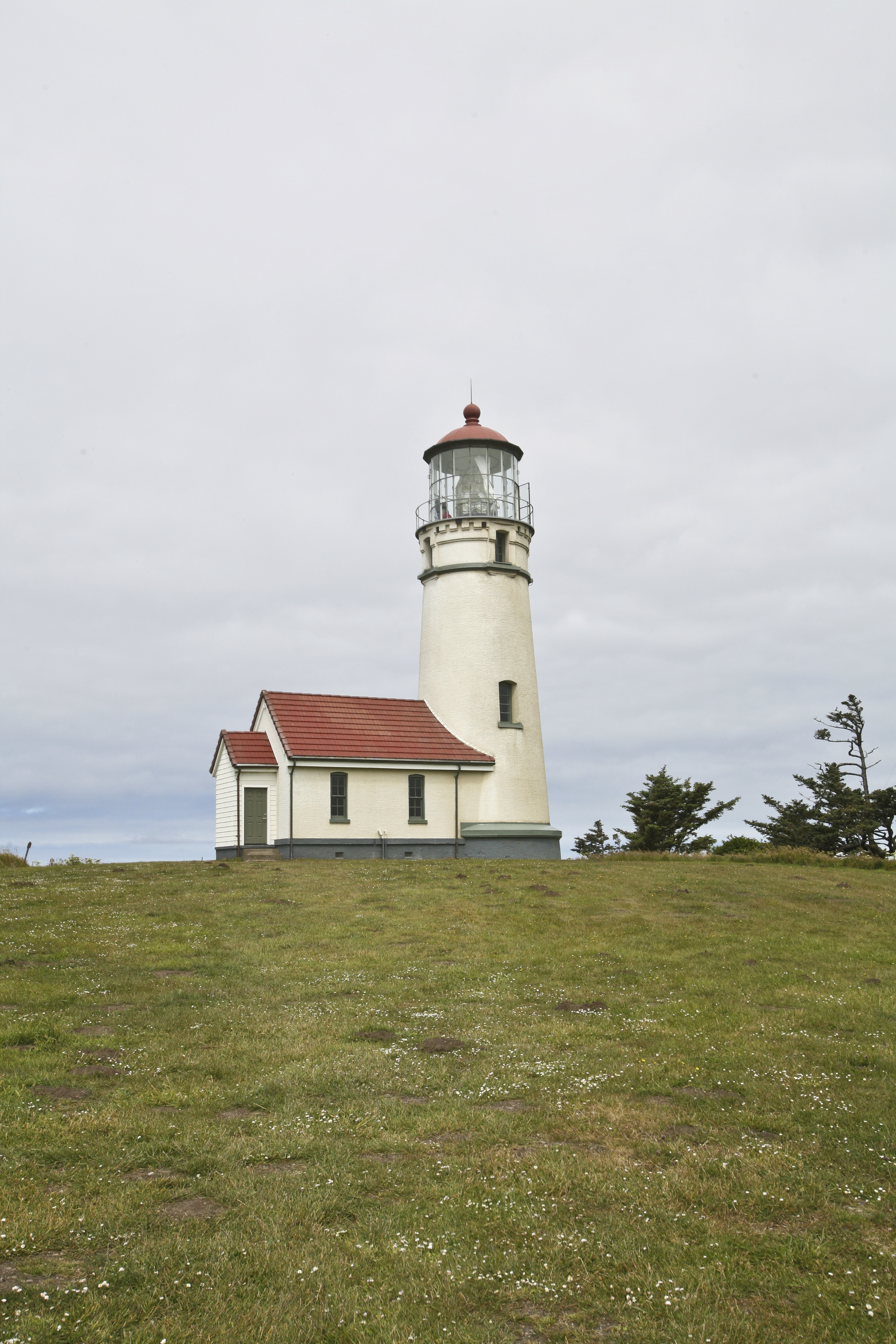
caption = Cape Blanco Light
location =Oregon
coordinates = coord|42|50.900|N|124|33.410|W|type:landmark
yearbuilt = 1870
yearlit =December 20 ,1870
automated = 1980
yeardeactivated =
foundation = Brick
construction = Brick
shape = Conical attached to workroom
marking = White tower, green lantern, red dome
height = convert|59|ft|m|0
elevation = convert|256|ft|m|0
lens = First order Fresnel (moved to Tongue Point in Astoria)
currentlens = Second order Fresnel (1936)
intensity =
range = convert|23|nmi|km|0
characteristic = Flash White 20 SecondsCape Blanco Light is a
lighthouse located on Cape Blanco,Oregon ,United States .Construction of the light
In a
deed recorded in 1867, John D. and Mary West sold the United States a convert|47.3|acre|m2|sing=on tract of land. The Light-House board determined that the offshorereef and islands at Cape Blanco were dangerous to maritime commerce; therefore, alighthouse was authorized for construction.Over the next three years, the lighthouse was constructed under the direction of Lt. Col. Robert Stockton Williamson. Supplies were ordered and shipped to the cape. Bricks were deemed cheaper if made onsite, so a brickmaker was located and a deal was struck with Rancher Patrick Hughes for access to materials required.
Keepers
Many keepers followed Burnap, the most notable were James Langlois and James Hughes who served as keepers for 42 and 38 years respectively. James Langlois raised a large family. James Hughes, son of neighboring rancher Patrick Hughes, raised two girls.
For many years, Keeper Langlois requested additional housing for the station. With his large family, the Hughes family, and the other families that came and went, the duplex was just too crowded. His requests went unanswered until 1909 when Head Keepers' quarters were constructed.
James Hughes found his own solution before the government responded. James owned land across the Sixes River from his father and quickly constructed a home for his family, moving from the lighthouse about the same time they finished additional lighthouse quarters. James continued to work at the lighthouse, commuting to assume his duties.
Life was difficult on the cape, which experiences constant high winds during the spring and summer and severe storms in winter. The weather kept the keepers busy with continual repairs and painting. Despite the hardship, both Langlois and Hughes stayed there until retirement.
See also
*
List of lighthouses on the Oregon Coast References
External links
* [http://www.cr.nps.gov/maritime/light/capeblan.htm Cape Blanco Light] from
National Park Service Inventory of Historic Light Stations
* [http://www.statesmanjournal.com/apps/pbcs.dll/article?AID=/20050821/LIFE/508210303/0/ENT Cape Blanco Light article] from the "Statesman Journal "August 25 2005
* [http://www.lighthousefriends.com/light.asp?ID=125 Cape Blanco Lighthouse] from lighthousefriends.com
* [http://www.portorfordoregon.com/Friends/capeblanco.html Friends of Cape Blanco Lighthouse]
* [http://www.discoveroregonlighthouses.com/blanco.html Cape Blanco Lighthouse] from discoveroregonlighthouses.com
* [http://www.capeblanco.org/ CapeBlanco.org: Cape Blanco Light]
* [http://www.oregonstateparks.org/park_62.php Oregon State Parks: Cape Blanco State Park]
*geolinks-US-cityscale|42.835833|-124.561389
Wikimedia Foundation. 2010.