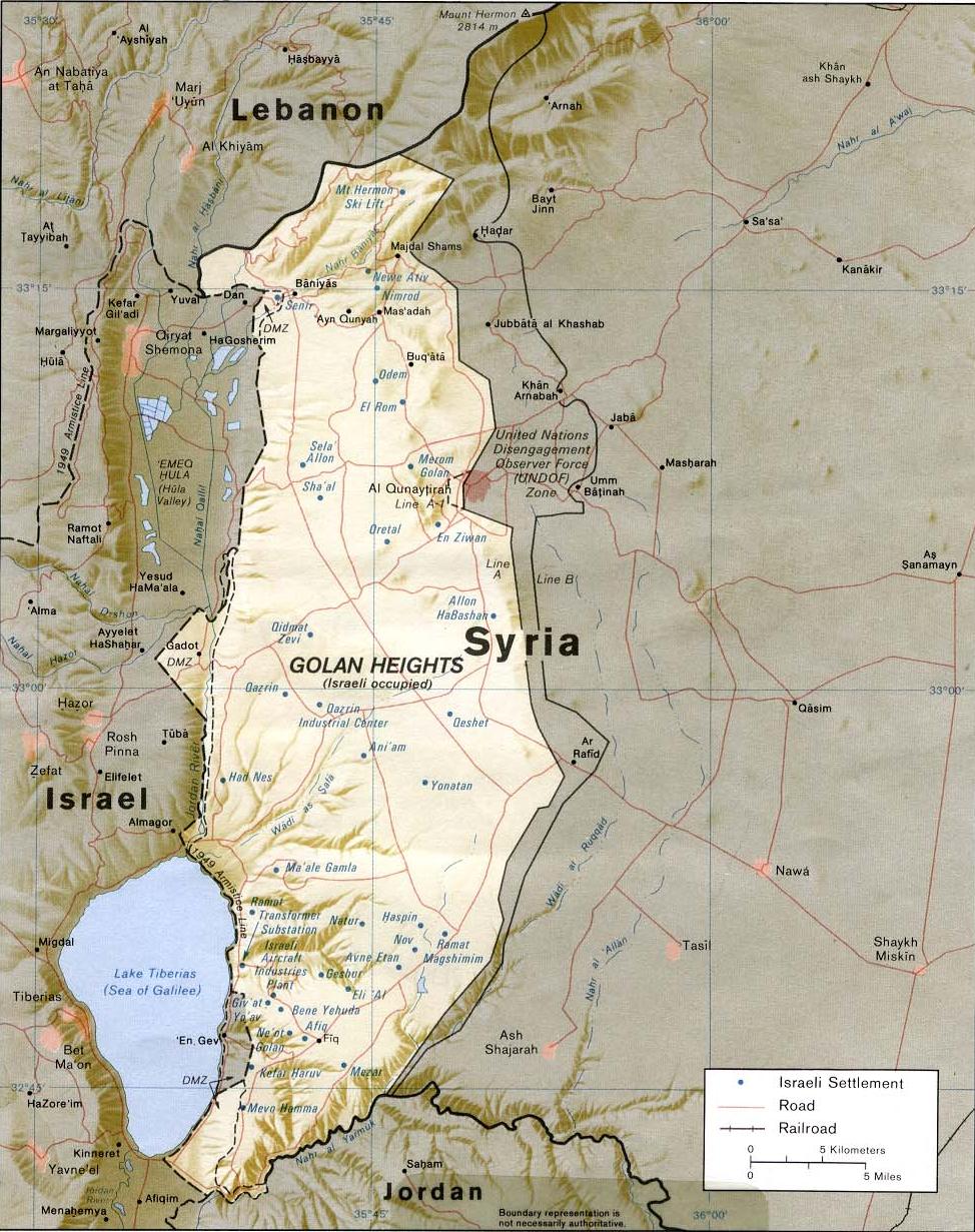
- Golan Heights
-
Golan Heights
هضبة الجولان
רמת הגולן
Status Internationally recognised as Syrian territory occupied by Israel.[1] Currently under Israeli civil administration. Claimed by Syria. Area – Total 1,800 km2 (695 sq mi) – Currently occupied and de facto-annexed by Israel 1,200 km2 (463.3 sq mi) Highest elevation 2,814 m (9,232 ft) Lowest elevation 0 m (0 ft) Population (2005) – Total 38,900 (in the Israeli-occupied part) 79,000 (in the Syrian- controlled part) The Golan Heights (Arabic: هضبة الجولان Haḍbatu 'l-Jawlān or مرتفعات الجولان Murtafaʻātu l-Jawlān, Hebrew: רמת הגולן, Ramat ha-Golan
 (audio) (help·info)), form a rocky plateau of great strategic importance[2][3] with an average altitude of 1,000 metres (3,300 ft) and an area totaling 1,800 square kilometres (690 sq mi). The plateau is located at the southern end of the Anti-Lebanon mountains and straddles the borders of Syria and Israel. Elevations range from 2,814 metres (9,232 ft) in the north at Mount Hermon, to below sea level along the Sea of Galilee and the Yarmuk River in the south.[4] A popular tourist destination attracting three million tourists a year,[5] the Golan has a rich history and features numerous archeological landmarks, scenic streams, mountains and waterfalls. The Golan Heights contribute significantly to the water resources of the region, providing about 15% of Israel's water supply. The region is also the source of a large proportion of Israel's agricultural production.[5]
The earliest evidence of human habitation dates to the Upper Paleolithic period.[6] According to the Bible, an Amorite Kingdom in Bashan was conquered by Israelites during the reign of King Og.[7] The biblical narrative also indicates that the Israelite tribe of Manasseh inhabited the region.[8]
The Arameans controlled the majority of the area.[9] Itureans settled there in the middle of the 2nd century BCE.[10] During the First Jewish–Roman War the town of Gamla served as the Jewish stronghold in the north, and in the 3rd century the Ghassanids established their capital at Jabiyah. Jews continued to inhabit the area until the end of the 11th century. In the 16th century, the Golan was conquered by the Ottoman Empire and was part of the Ottoman Vilayet of Damascus until it was transferred to French control in 1918 under the French Mandate of Syria. When the mandate terminated in 1944, it became part of the newly independent Syrian Arab Republic.
Two-thirds of the land was captured by Israel during the 1967 Six-Day War and has since been occupied by Israel. Immediately after the war, Israel was willing to give up the Golan in exchange for peace with Syria; however, Syria refused to negotiate.[11] In the aftermath of the 1973 Yom Kippur War Israel agreed to return about 5% of the territory to Syrian civilian control. This part was incorporated into a demilitarised zone that runs along the ceasefire line and extends eastward. This strip is under the military control of UN peace keeping forces. Construction of Israeli settlements began in the remainder of the territory held by Israel which was governed under military administration until 1981, when Israel passed the Golan Heights Law extending Israeli law and administration throughout the territory.[12] This move was condemned by the United Nations Security Council in UN Resolution 497,[13] which said that "the Israeli decision to impose its laws, jurisdiction and administration in the occupied Syrian Golan Heights is null and void and without international legal effect." Israel, however, asserts its right to retain the area, citing the text of UN Resolution 242, adopted after the Six-Day War, which calls for "safe and recognised boundaries free from threats or acts of force".[14] Many states consider continued Israeli occupation of the Golan Heights valid on a self-defense basis.[15] However, the international community rejects Israeli claims to title to the territory and regards it as sovereign Syrian territory.[1][16]
The period of Israeli control in the Golan has been marked by economic development, prosperity, and relatively tranquil relations between the Druze and the Israeli settlers.[17] Approximately 10% of former Syrian Golan Druze have accepted Israeli citizenship.[18]
Contents
Etymology and toponymy
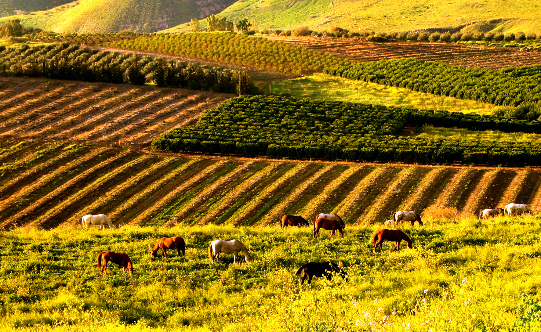
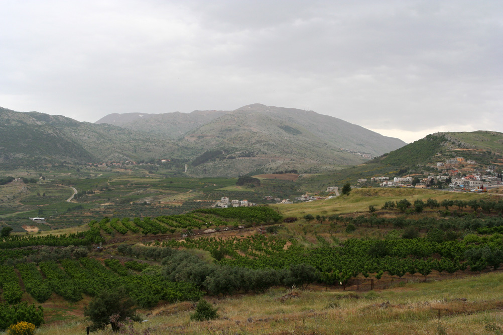
 Farming in the Golan Heights
Arabic names are Jawlān[19] and Djolan (Arabic: جولان).[20] In the bible Golan is mentioned as a city of refuge located in Bashan: Deuteronomy 4:43, Joshua 20:8, 1Chronicles 6:71.[21] 19th century authors interpreted the word "Golan" (Hebrew: גולן) as meaning "something surrounded, hence a district".[22][23] The Greek name for the region is Gaulanitis (Greek: Γαυλανῖτις).[19] In the Mishna the name is Gablān similar to Aramaic language names for the region: Gawlāna, Guwlana and Gublānā.[19]
Arab cartographers of the Byzantine period referred to the area as jabal (mountain), though the region is a plateau.[24] The Muslims took over in 7th century CE.[19] The name Golan Heights was not used before the 19th century.[21] The UN refers to the region as The Occupied Syrian Golan.
Geography
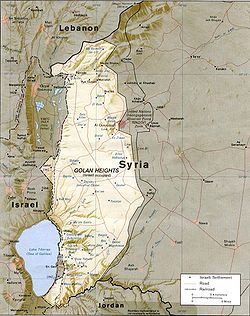 CIA map showing the Golan Heights and vicinity, October 1994
The Golan Heights is an area measuring 1,175 square kilometres (454 sq mi) that borders Israel, Lebanon and Jordan. The area is hilly and high and allows observation of the Sea of Galilee, the Jordan River and the 2,743.2 metres (9,000 ft) tall Mount Hermon.[25] The plateau that Israel controls is part of a larger area of volcanic basalt fields stretching north and east that were created in the series of volcanic eruptions that began recently in geological terms, almost 4 million years ago, and continue to this day. It has distinct geographic boundaries. On the north, the Sa'ar valley (Banias) generally divides the lighter-colored limestone bedrock of the mountains from the dark-colored volcanic rocks of the Golan plateau. The western border of the plateau is truncated structurally by the Jordan Rift Valley, which falls down steeply into the lake. South of Yarmuk River lies Hashemite Kingdom of Jordan end east of Raqqad river ( Wadi Ruqqad ) are areas still controlled by Syria.[26]
The plateau's north-south length is approximately 65 kilometres (40 mi) and its east-west width varies from 12 kilometres (7.5 mi) to 25 kilometres (16 mi).[27][28] Topographically, the Golan Heights ranges in elevation from 2,814 metres (9,232 ft) on Mount Hermon in the north, to about 400 metres (1,300 ft) elevation along the Yarmuk River in the south. Lake Kinneret (also known as Sea of Galilee, Lake Tiberias) at the southwest corner of the plateau is 200 metres (660 ft) bellow sea level. The steeper, more rugged topography is generally limited to the northern half, including Mt. Hermon foothill, on the south the plateau is more level.[27]
The broader Golan plateau exhibits a more subdued topography, generally ranging between 120 metres (390 ft) and 520 metres (1,710 ft) in elevation. In Israel, the Golan plateau is usually divided into three regions: northern (between the Sa'ar and Jilabun valleys), central (between the Jilabun and Daliyot valleys), and southern (between the Dlayot and Yarmouk valleys). The Golan Heights is bordered on the west by a rock escarpment that drops 500 metres (1,600 ft) to the Jordan River valley and the Sea of Galilee. In the south, the incised Yarmouk River valley marks the limits of the plateau and, east of the abandoned railroad bridge upstream of Hamat Gader and Al Hammah, it marks the recognised international border between Syria and Jordan.[29]
Geologically, the Golan plateau and the Hauran plain to the east constitute a Holocene volcanic field that also extends northeast almost to Damascus. Much of the area is scattered with dormant volcanos, as well as cinder cones, such as Majdal Shams. The plateau also contains a crater lake, called Birkat Ram ("Ram Pool"), which is fed by both surface runoff and underground springs. These volcanic areas are characterised by basalt bedrock and dark soils derived from its weathering. The basalt flows overlie older, distinctly lighter-colored limestones and marls, exposed along the Yarmouk River in the south.
The rock forming the mountainous area in the northern Golan Heights, descending from Mount Hermon, are geologically quite different from the volcanic rocks of the plateau, including a different physiography. The mountains are characterised by distinctly lighter-colored, Jurassic age limestone of sedimentary origin. Locally, the limestone is broken by faults and solution channels to form a karst-like topography in which springs are common (e.g. Baniyas).
In addition to its strategic importance militarily, the Golan Heights contributes significantly to the water resources of the region. This is true particularly at the higher elevations, which are snow-covered much of the year in the cold months and help to sustain baseflow for rivers and springs during the dry season. The heights receive significantly more precipitation than the surrounding, lower-elevation areas. The occupied sector of the Golan Heights provides or controls a substantial portion of the water in the Jordan River watershed, which in turn provides a portion of Israel's water supply. The Golan Heights are the source of about 15% of Israel's water supply.[30]
History
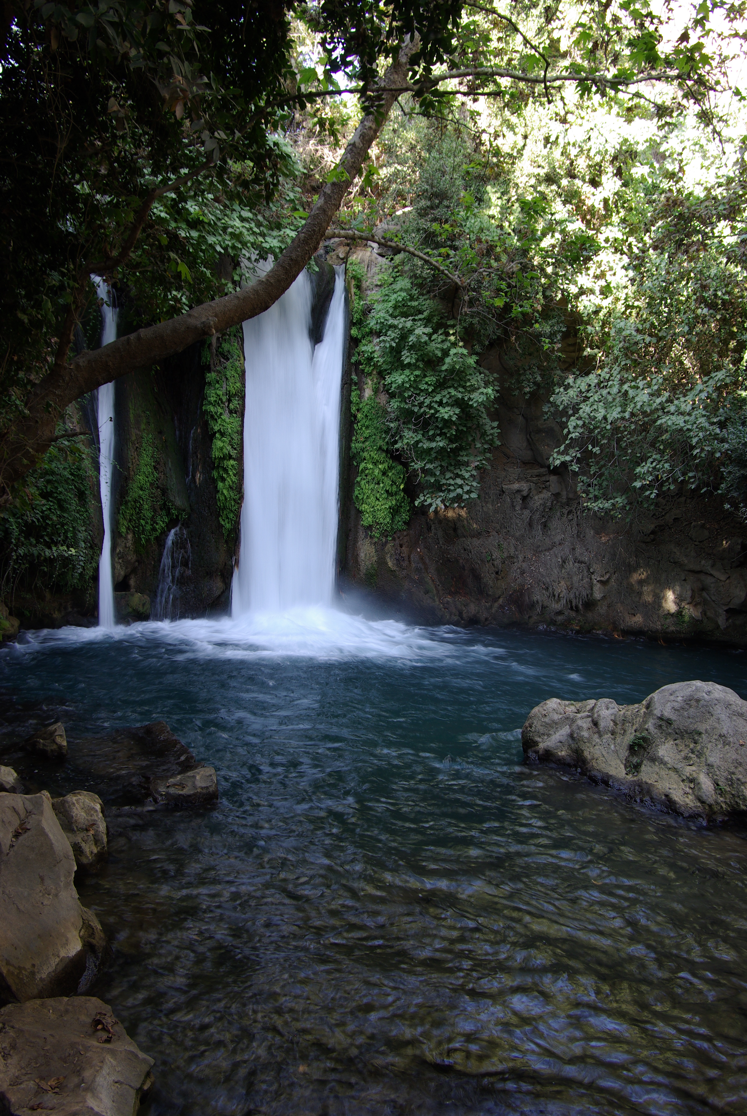
 Banyas waterfall
Antiquity
The Venus of Berekhat Ram, a stone figure from the Lower Paleolithic era, found in the Golan Heights, may have been created by Homo erectus between 700,000 and 230,000 BCE.[31]
During the 3rd millennium BC the Amorites dominated and inhabited the Golan until the 2nd millennium, when the Arameans took over. The Aramaean city state Aram Damascus reached over most of Golan to the Sea of Galilee.[9]
According to the Bible, the Children of Israel conquered the Golan from the Amorites.[7] The Bible also says that the area, later known as Bashan, was inhabited by two Israelite tribes during the time of Joshua, the tribe of Dan[32] and Manasseh. The city of Golan was used as a city of refuge. King Solomon appointed ministers in the region.[33]
After the split of the United Monarchy, the area was contested between the northern Kingdom of Israel and the Aramean kingdom from the 9th century BC. King Ahab of Israel (reigned 874–852 BC) defeated Ben-Hadad I in the southern Golan.
In the 8th century BC the Assyrians gained control of the area, but were later replaced by the Babylonian and the Persian Empire. In the 5th century BC, the Persian Empire allowed the region to be resettled by returning Jewish exiles from Babylonian Captivity.
The Golan Heights, along with the rest of the region, came under the control of Alexander the Great in 332 BC, following the Battle of Issus. Following Alexander's death, the Golan came under the domination of the Macedonian noble Seleucus and remained part of the Seleucid Empire for most of the next two centuries. It is during this period that the name Golan, previously that of a city mentioned in the book of Deuteronomy, came to be applied to the entire region (Greek: Gaulanitis).
In the middle of the 2nd century BCE, Itureans started living in the Golan.[10] They lived in over 100 locations in the Mount Hermon and Golan region.[34]
The Maccabean Revolt saw much action in the regions around the Golan and it is possible that the Jewish communities of the Golan were among those rescued by Judas Maccabeus during his campaign in the Galilee and Gilead (Transjordan) mentioned in Chapter 5 of 1 Maccabees. The Golan, however, remained in Seleucid hands until the campaign of Alexander Jannaeus from 83–80 BC. Jannaeus established the city of Gamla in 81 BC as the Hasmonean capital for the region.
During the Roman and Byzantine periods the area was administered as part of Phoenicia Prima and Syria Palaestina, and finally Golan/Gaulanitis was included together with Peraea[24] in Palaestina Secunda, after 218 AD.[19] Ancient kingdom Bashan was incorporated into the province of Batanea.[35]
Following the death of Herod the Great in 4 BC, Augustus Caesar adjudicated that the Golan fell within the Tetrarchy of Herod's son, Herod Philip I. After Philip's death in 34 AD, the Romans absorbed the Golan into the province of Syria, but Caligula restored the territory to Herod's grandson Agrippa in 37. Following Agrippa's death in 44, the Romans again annexed the Golan to Syria, promptly to return it again when Claudius traded the Golan to Agrippa II, the son of Agrippa I, in 51 as part of a land swap. Although nominally under Agrippa's control and not part of the province of Judea, the Jewish communities of the Golan joined their coreligionists in the First Jewish-Roman War, only to fall to the Roman armies in its early stages. Gamla was captured in 67; according to Josephus, its inhabitants committed mass suicide, preferring it to crucifixion and slavery. Agrippa II contributed soldiers to the Roman war effort and attempted to negotiate an end to the revolt. In return for his loyalty, Rome allowed him to retain his kingdom, but finally absorbed the Golan for good after his death in 100.
In about 250, the Ghassanids, Arab Christians from Yemen, established a kingdom which encompassed southern Syria and the Transjordan, building their capital at Jabiyah on the Golan. Like the later Herodians, the Ghassanids ruled as clients of Byzantine Rome; unlike the Herodians, the Ghassanids were able to hold on to the Golan until the Sassanid invasion of 614. Following a brief restoration under the Emperor Heraclius, the Golan again fell, this time to the invading Arabs after the Battle of Yarmouk in 636.
Middle Ages
After Yarmouk, Muawiyah I, a member of Muhammad's tribe, the Quraish, was appointed governor of Syria, including the Golan. Following the assassination of his cousin, the Caliph Uthman, Muawiya claimed the Caliphate for himself, initiating the Umayyad dynasty. Over the next few centuries, while remaining in Muslim hands, the Golan passed through many dynastic changes, falling first to the Abbasids, then to the Shi'ite Fatimids, then to the Seljuk Turks, then to the Kurdish Ayyubids. During the Crusades, the Heights represented a formidable obstacle the Crusader armies were not able to conquer, and the area was a part of the Emirate of Damascus during this time.[36][37] The Mongols swept through in 1259, but were driven off by the Mamluk sultan Qutuz at the Battle of Ain Jalut in 1260. Ain Jalut ensured Mamluk dominance of the region for the next 250 years. For many centuries nomadic tribes lived together with the sedentary population in the region. At times, the central government attempted to settle the nomads which would result in the establishment of permanent communities. When the power of the governing regime declined, as happened during the early Muslim period, nomadic trends increased and many of the rural and agricultural villages were abandoned due to harassment from the Bedouins. They were not resettled until the second half of the 19th century.[38]
Ottoman era
In the 16th century, the Ottoman Turks came to control Syria. During this time, the Golan formed part of the southern district of their empire. Some Druze communities were established in the Golan during the 17th and 18th centuries.[39] In 1868 it was reported that the region was "almost entirely desolate". A travel handbook noted that from a list of 127 ancient towns and villages which were spread across the Golan province in former times, only 11 were inhabited.[40] As a result of the Russo-Turkish War of 1877–78, there was a huge influx of refugees from the Caucasus into the empire. The Ottomans directed them to settle in southern Syria, particularly on the Golan Heights[41][42][43] and granted them lands with a 12 year tax exemption.[44]
In 1884 there were still open stretches of uncultivated land between villages in the lower Golan, but by the mid-1890s most was owned and had been cultivated.[45] Some land had been purchased in the Golan and Hawran by Zionist associations based in Romania, Bulgaria, the USA and England, in the late 19th century and early 20th century.[46] In 1880, Laurence Oliphant published Eretz ha-Gilad (The Land of Gilead), which described a plan for large scale Jewish settlement in the Golan,[47] but the Turks snubbed the scheme. In 1886, members of the old yishuv in Safed formed the Bet Yehuda Society and purchased 14,000 dunams of land near the circassian village of Ramthaniya, in the central Golan. But due to financial hardships and the long wait for a kushan (Ottoman land deed) the village, Golan be-Bashan, was abandoned after a year. Soon afterwards, the society regrouped and purchased land in the nearby Bedouin village of Bir Shaqum in the southern Golan. The village they established, Bnei Yehuda, survived until 1920 when the last remaining inhabitants left following a Arab attack.[48][49] In 1944 the JNF bought the Bnei Yehuda lands from their Jewish owners, but subsequently lost a lawsuit with the Arabs of Bir Shaqum regarding the Jewish ownership of the land.[48]
“ "The Jewish colonies there have long passed the tentative stage, and are an established success...up to recently the Turkish government did all it could to hinder the formation of Jewish settlements in the south of Syria." ” —The Church at Home and Abroad, 1890.[50]
Between 1891 and 1894, Baron Edmond James de Rothschild purchased nearly 80,000 dunams (30 miles sq.) of land consisting of 16 villages in southern Syria for Jewish settlement. Most of the land was situated in the eastern Golan and now lies a few kilometres from the 1967 lines, inside Syrian controlled territory. The parcels of land straddled both sides of the Nahr al-Allan. Over the years attempts to settle these lands was only partly successful and it remained sparsely populated by Jews. The Russian Agudat Achim Association acquired land in several locations in the districts of Fiq and Daraa and at Jillin where a farm was built and extensive eucalyptus groves were planted. The Jews also managed to build a road stretching from Lake Hula to Muzayrib.[48] A village called Tiferet Binyamin was set up on lands at Saham el-Jolan by the Shavei Zion Association based in New York,[46] but the project was abandoned after a year when the Turks issued an edit in 1896 evicting the 17 non-Turkish families. A later attempt to resettle the land with Syrian Jews, Turkish citizens, also failed.[51] In 1899, the Pasha of Damascus expelled the Jews from all of Rothschild's estates.[52] Between 1904–08, a group of Crimean Jews settled in the Bethsaida Valley, initially as tenants of a Kurdish proprietor with the prospects of purchasing the land, but the arrangement faltered.[53][54] Jewish settlement in the region peated out over time, either due to Arab hostility and Turkish bureaucracy, disease or economic difficulties.[55] In 1921–1930, during the French Mandate, the Palestine Jewish Colonization Association (PJCA) obtained the deeds to the Rothschild estate and continued to manage it, collecting rents from the Arab peasants living there.[48] In 1944, the Syrian Land Settlement Campaign refused to recognize the foreign owned PJCA as the legal owners of the land and the Syrian government confiscated it without compensation on the grounds that "it was contrary to Syrian policy to allow Jews to own land in Syria."[48] The JNF still lays claim to the land.[48]
Mandates
 Boundary changes in the area of the Golan Heights in the 20th-century
Great Britain accepted a Mandate for Palestine at the meeting of the Allied Supreme Council at San Remo, but the borders of the territory were not defined at that stage.[56][57] The boundary between the forthcoming British and French mandates was defined in broad terms by the Franco-British Boundary Agreement of December 1920.[58] That agreement placed the bulk of the Golan Heights in the French sphere. The treaty also established a joint commission to settle the precise details of the border and mark it on the ground.[58] The commission submitted its final report on February 3, 1922, and it was approved with some caveats by the British and French governments on March 7, 1923, several months before Britain and France assumed their Mandatory responsibilities on 29 September 1923.[59][60] In accordance with the same process, a nearby parcel of land that included the ancient site of Tel Dan and the Dan spring were transferred from Syria to Palestine early in 1924. The Golan Heights, including the spring at Wazzani and the one at Banias, thus became part of the French Mandate of Syria, while the Sea of Galilee was placed entirely within the British Mandate of Palestine. When the French Mandate of Syria ended in 1944, the Golan Heights became part of the newly independent state of Syria and was later incorporated into Quneitra Governorate.
Border incidents after 1948
After the 1948–49 Arab-Israeli War, the Golan Heights were partly demilitarised by the Israel-Syria Armistice Agreement. During the following years, the area along the border witnessed thousands of violent incidents; the armistice agreement was being violated by both sides. The underlying causes of the conflict were a disagreement over the legal status of the demilitarised zone (DMZ), cultivation of land within it and competition over water resources. Syria claimed that neither party had sovereignty over the DMZ. Israel contented that the Armistice Agreement dealt solely with military concerns and that she had political and legal rights over the DMZ. Israel wanted to assert control up till the 1923 boundary in order to reclaim the Hula swamp, gain exclusive rights to Lake Galilee and divert water from the Jordan for its National Water Carrier. During 1950s, Syria registered two principal territorial accomplishments: it took over Al-Hammah enclosure south of Lake Tiberias and established a de-facto presence on and control of eastern shore of the lake.[61][62]
Attempt by Israel and Syria to divert water from the Jordan River and its tributaries in the 1950s and 60s sparked a series of military exchanges in July 1966.[63] Fatah began raids into Israeli territory in early 1965, with active support from Syria. At first the militants entered via Lebanon or Jordan, but those countries made concerted attempts to stop them and raids directly from Syria increased.[64] Israel's response was a series of retaliatory raids, of which the largest were an attack on the Jordanian village of Samu in November 1966.[65] In April 1967, after Syria heavily shelled Israeli villages from the Golan Heights, Israel shot down six Syrian MiG fighter planes and warned Syria against future attacks.[64][66]
In the period between Israel’s War of Independence (1948) and the Six Day War (1967), the Syrians constantly harassed Israeli border communities by firing artillery shells from their dominant positions on the Golan Heights.[67][68] In October 1966 Israel brought the matter up before the United Nations. Five nations sponsored a resolution criticizing Syria for its actions but it failed to pass due to a Soviet veto.[69][70][71]
Former Israeli General Mattityahu Peled said that more than half of the border clashes before the 1967 war "were a result of our security policy of maximum settlement in the demilitarised area."[72] Israeli incursions into the zone were responded to with Syrians shooting. Israel in turn would retaliate with military force.[61] Sir Alec Douglas-Home, former Prime Minister of the UK, stated that when he was visiting the Galilee a few months before the 1967 war "at regular intervals the Russian-built forts on the Golan Heights used to lob shells into the villages, often claiming civilian casualties." He said after the 1973 war that any agreement between the two sides "must clearly put a stop the that kind of offensive action."[73]
In 1976, Israeli defense minister Moshe Dayan said that Israel provoked more than 80% of the clashes with Syria, although historians have voiced skepticism regarding the truthfulness of this informal comment.[74] Jan Mühren, a former UN observer in the area at the time, told a Dutch current affairs programme that Israel provoked most border incidents as part of its strategy to annex more land.[75]
Israeli occupation since 1967

 Syrian families evacuating the Golan Heights in 1967
After the Six-Day War broke out in June 1967, Syria's shelling greatly intensified and the Israeli army captured the Golan Heights on 9–10 June. The area which came under Israeli control as a result of the war is two geologically distinct areas: the Golan Heights proper 1,070 square kilometres (410 sq mi) and the slopes of the Mt. Hermon range 100 square kilometres (39 sq mi). The new border between the two forces was named the Purple Line. In the battle, Israel lost 115 men, with another 306 wounded. An estimated 2,500 Syrians were killed, with another 5,000 wounded.[76]
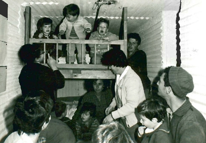
During the war, between 80,000[77] and 131,000[78] Arab Druze and Circassians fled or were driven from the heights and around 7,000 remained in the Israeli-occupied territory.[78] Israel has not allowed former residents to return, citing security reasons.[79] Israeli settlement in the Golan began soon after the war. Merom Golan was founded in July 1967 and by 1970 there were 12 settlements.[80] Israeli sources and the U.S. Committee for Refugees and Immigrants reported that much of the local population of 100,000 fled as a result of the war, whereas the Syrian government stated that a large proportion of it was expelled.[81]
In the 1970s, Israeli politician Yigal Allon proposed as part of the Allon Plan that a Druze state be established in Syria's Quneitra Governorate, including the Israeli-held Golan Heights. Allon died in 1980 and his plan never materialised.[82]
Yom Kippur War
During the Yom Kippur War in 1973, Syrian forces overran much of the southern Golan, before being pushed back by an Israeli counterattack. Israel and Syria signed a ceasefire agreement in 1974 that left almost all the Heights in Israeli hands. East of the 1974 ceasefire line lies the Syrian controlled part of the Heights, an area that was not captured by Israel 500 square kilometres (190 sq mi) or withdrawn from 100 square kilometres (39 sq mi). This area forms 30% of the Golan Heights.[83] Today it contains more than 40 Syrian towns and villages. In 1975, following the 1974 ceasefire agreement, Israel returned a narrow demilitarised zone to Syrian control. Some of the displaced residents began returning to their homes located in this strip and the Syrian government began helping people rebuild their villages, except for Quneitra. In the mid-1980s the Syrian government launched a plan called "The Project for the Reconstruction of the Liberated Villages".[citation needed] By the end of 2007, the population of the Quneitra Governorate was estimated at 79,000.[84]

Mines deployed by the Syrian army remain active. Since 1973, there have been at least 216 landmine casualties in the Syrian-controlled Golan, of which 108 were fatalities.[85]
Israeli civil administration since 1981
The Golan Heights had been under military administration since 1967. In 1981, Israel passed the Golan Heights Law,[12] which applied Israeli "laws, jurisdiction and administration" to the Golan Heights. Although the law in effect annexed the territory to Israel, it was not formally annexed.[86] The area was administered as part of Israel’s North District.
Israel's action was not recognised internationally[87] and United Nations Security Council Resolution 242 which declared the Golan Heights an Israeli occupied territory continues to apply. Israel maintains that it may retain the area as the text of Resolution 242 calls for "safe and recognised boundaries free from threats or acts of force".[14]
During the negotiations regarding the text of United Nations Security Council resolution 242, U.S. Secretary of State Rusk explained that U.S. support for secure permanent frontiers did not mean the US supported territorial changes.[88] The U.N. representative for Great Britain was responsible for negotiating and drafting the Security Council resolution said that the actions of the Israeli Government in establishing settlements and colonizing the Golan are in clear defiance of Resolution 242.[89]
Syria continued to demand a full Israeli withdrawal to the June 4, 1967 borders, including a strip of land on the east shore of the Sea of Galilee that Syria captured during the 1948–49 Arab-Israeli War and occupied from 1949–67. Successive Israeli governments have considered an Israeli withdrawal from the Golan in return for normalization of relations with Syria, provided certain security concerns are met. Prior to 2000, Syrian president Hafez al-Assad rejected normalization with Israel.
Peace negotiations
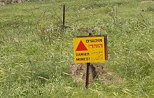 Minefield warning sign in the Golan
During United States–brokered negotiations in 1999–2000, Israel and Syria discussed a peace deal that would include Israeli withdrawal in return for a comprehensive peace structure, recognition and full normalization of relations. The disagreement in the final stages of the talks was on access to the Sea of Galilee. Israel offered to withdraw to the pre-1948 border (the 1923 Paulet-Newcombe line), while Syria insisted on the 1967 frontier. The former line has never been recognised by Syria, claiming it was imposed by the colonial powers, while the latter was rejected by Israel as the result of Syrian aggression. The difference between the lines is less than 100 m for the most part, but the 1967 line would give Syria access to the Sea of Galilee, and Israel wished retain control of the Sea of Galilee, its only freshwater lake and a major water resource.[90]
In late 2003, Syrian President Bashar al-Assad said he was ready to revive peace talks with Israel. Israel demanded Syria first disarm Hezbollah, which launched many attacks on northern Israeli towns and army posts from Lebanese territory, and cease to host militant Palestinian groups and their headquarters. Talks were not initiated.
2006 Israel–Lebanon conflict
After the 2006 war between Israel and Syrian–Iranian-backed Hezbollah guerrillas, the issue of the Golan Heights arose again. Israel heightened its alert over a possible war with Syria after Israeli intelligence assessed that Syria was "seriously examining" military action. Syria reinforced its forces on the Golan while remaining in a defensive position.[citation needed] President Assad stated that Syria was prepared to hold peace talks with Israel but said that if hopes for peace dissolve then "war may really be the only solution". Israeli Prime Minister Ehud Olmert dismissed calls within his coalition to consider peace talks and proclaimed that "the Golan Heights will remain in our hands forever".[91][92][93] Others, including cabinet minister Shimon Peres and Ehud Olmert's spokesman Assaf Shariv doubted Assad's sincerity and suggested that Assad's statements were a bid at deflecting international criticism of his regime and specifically explaining that the alleged approach by Assad "is coming in the weeks before the decision on Rafik Hariri", referring to the international inquiry on the murder of the former Lebanese prime minister.
Peace proposals
In June 2007, it was reported that Prime Minister Ehud Olmert had sent a secret message to Syrian President, Bashar Assad saying that Israel would concede the land in exchange for a comprehensive peace agreement and the severing of Syria's ties with Iran and militant groups in the region.[94] On the same day, former Prime Minister Benjamin Netanyahu announced that the former Syrian President, Hafez Assad, had promised to let Israel retain Mount Hermon in any future agreement.[95]
In April 2008, Syrian media reported Turkey's Prime Minister Recep Tayyip Erdoğan told President Bashar al-Assad that Israel would withdraw from the Golan Heights in return for peace.[96][97] Israeli leaders of communities in the Golan Heights held a special meeting and stated: "all construction and development projects in the Golan are going ahead as planned, propelled by the certainty that any attempt to harm Israeli sovereignty in the Golan will cause severe damage to state security and thus is doomed to fail". [98] That year, a plenary session of the United Nations General Assembly passed a resolution 161–1 in favour of a motion on the Golan Heights that reaffirmed Security Council resolution 497 and called on Israel to desist from "changing the physical character, demographic composition, institutional structure and legal status of the occupied Syrian Golan and, in particular, to desist from the establishment of settlements [and] from imposing Israeli citizenship and Israeli identity cards on the Syrian citizens in the occupied Syrian Golan and from its repressive measures against the population of the occupied Syrian Golan." Israel was the only nation to vote against the resolution.[99] Indirect talks broke down after the Gaza War began. Syria broke off the talks to protest Israeli military operations. Israel subsequently appealed to Turkey to resume mediation.[100]
In May 2009, Prime Minister Netanyahu said that returning the Golan Heights would turn it into "Iran's front lines which will threaten the whole state of Israel."[101][102] He said: "I remember the Golan Heights without Katzrin, and suddenly we see a thriving city in the Land of Israel, which having been a gem of the Second Temple era has been revived anew."[103] American diplomat Martin Indyk said that the 1999–2000 round of negotiations began during Netanyahu's first term (1996–1999), and he was not as hardline as he made out.[104]
In March 2009, Syrian President Bashar al-Assad claimed in a newspaper interview that indirect talks had failed after Israel failed to make a commitment to withdraw from all of the Golan Heights. In an August 2009 speech during Army Day, he said that the return of the entire Golan Heights was "non-negotiable", and said that it would remain "fully Arab", and would be returned to Syria.[105]
In June 2009, Israeli President Shimon Peres said that Syrian President Assad would have to negotiate without preconditions, and that Syria would not get any territorial concessions from Israel on a "silver platter" as long as it maintained ties with Iran and Hezbollah.[106] In response, Syrian Foreign Minister Walid Muallem demanded that Israel unconditionally cede the Golan Heights "on a silver platter" without any preconditions, adding that " it is our land", and blamed Israel for failing to commit to peace. Syrian President Assad claimed that there was "no real partner in Israel".[107]
In 2010, Israeli foreign minister Avigdor Lieberman told Syria to abandon its dreams of recovering the Golan Heights, just as it relinquished its dream of conquering Lebanon.[108]
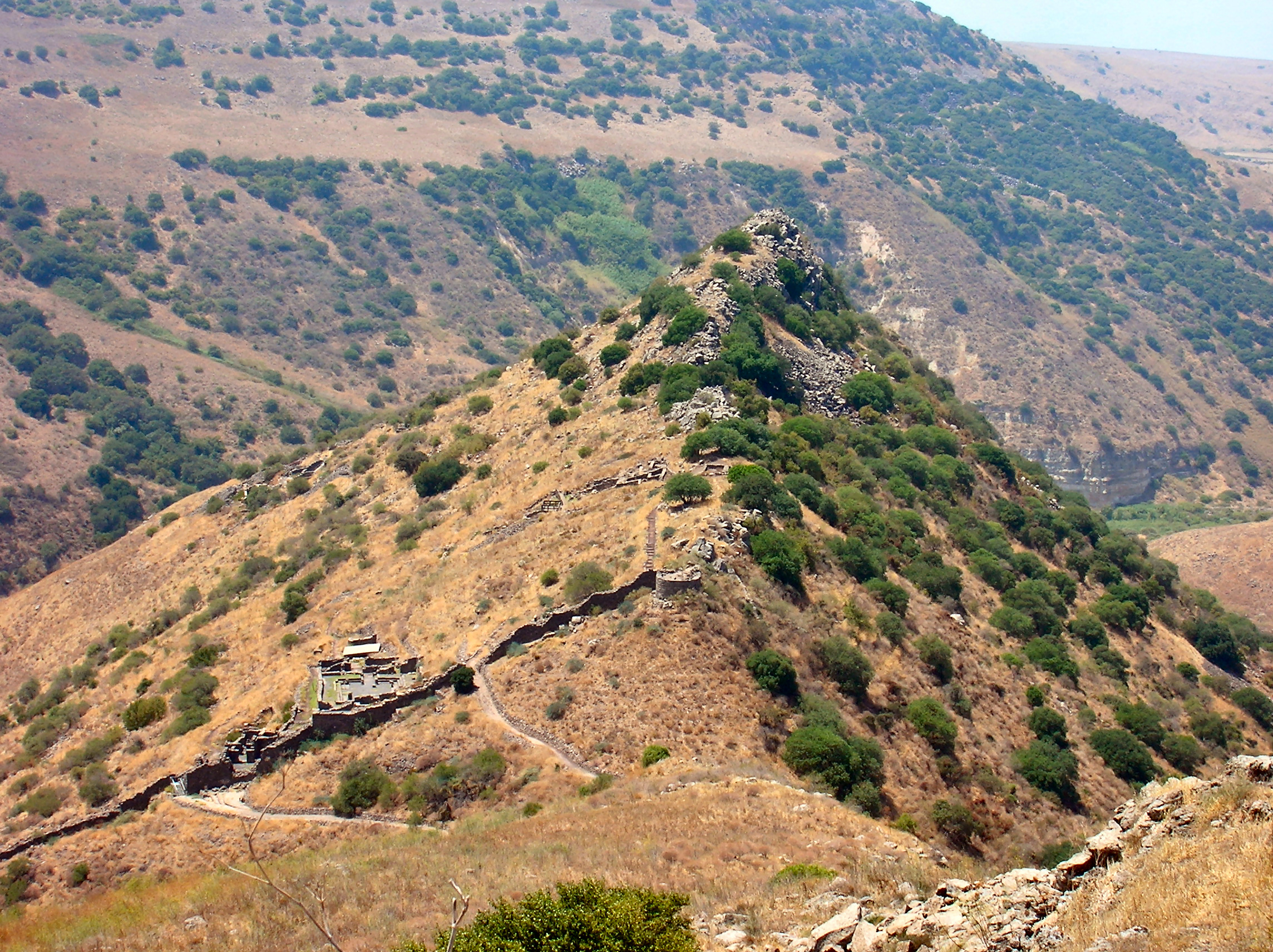
 Overview of UN zone and Syrian controlled territory from the Golan Heights
Territorial claims
Claims on the territory include the fact that an area in northwestern of the Golan region, (delineated by a rough triangle formed by the towns of Banias, Quneitra and the northern tip of the Sea of Galilee), was part of the British Palestine Mandate in which the establishment of a Jewish national home had been promised.[109] In 1923, this triangle in northwestern Golan was ceded to the French Mandate in Syria, but in exchange for this, land areas in Syria and Lebanon was ceded to Palestine, and the whole of the Sea of Galilee which previously had its eastern boundary connected to Syria was placed inside Palestine.[110] Syrians counter that the region was placed in the Vilayet of Damascus as part of Syria under the Ottoman boundaries and that the 1920 British-Franco agreement which had placed part of the Golan under the control of Britain was only temporary and that the final border line drawn up in 1923, which excluded the Golan triangle, had superseded it,[109] (although Syria has never recognised the 1923 border as legally binding).
1923 border, 1949 armistice, 1967 ceasefire
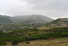 Mt. Hermon from the Road to Masaade
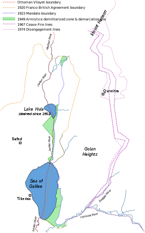
One of the aspects of the dispute involves the existence prior to 1967 of three different lines separating Syria from Israel (or, prior to 1948, from the British Mandate for Palestine).
The 1923 boundary between Mandate Palestine and the French Mandate of Syria was drawn with water in mind.[111] Accordingly, it was demarcated so that all of the Sea of Galilee, including a 10-meter wide strip of beach along its northeastern shore, would stay inside Palestine. From the Sea of Galilee north to Lake Hula the boundary was drawn between 50 and 400 meters east of the upper Jordan River, keeping that stream entirely within the British Mandate. The British also received a sliver of land along the Yarmouk River, out to the present-day Hamat Gader.[112]
During the 1948–49 Arab-Israeli War, Syria captured various areas of the former Palestine mandate, including the 10-meter strip of beach, the east bank of the upper Jordan, as well as areas along the Yarmouk.
During Armistice talks of 1949, Israel called for the removal of all Syrian forces from the former Palestine territory. Syria refused, insisting on an armistice line based not on the 1923 international border but on the military status quo. The result was a compromise. Under the terms of an armistice signed on July 20, 1949, Syrian forces were to withdraw east of the old Palestine-Syria boundary. Israeli forces were to refrain from entering the evacuated areas, which would become a demilitarised zone, "from which the armed forces of both Parties shall be totally excluded, and in which no activities by military or paramilitary forces shall be permitted."[113] Accordingly, major parts of the armistice lines departed from the 1923 boundary and protruded into Israel. There were three distinct, non-contiguous enclaves—in the extreme northeast to the west of Banias, on the west bank of the Jordan River near Lake Hula, and the eastern-southeastern shores of the Sea of Galilee extending out to Hamat Gader, consisting of 66.5 square kilometers of land lying between the 1949 armistice line and the 1923 boundary, forming the demilitarised zone.[111]
Following the armistice, both Israel and Syria sought to take advantage of the territorial ambiguities left in place by the 1949 agreement. This resulted in an evolving tactical situation, one "snapshot" of which was the disposition of forces immediately prior to the Six-Day War, the “line of June 4, 1967”.[111]
Shebaa Farms
On June 7, 2000, the demarcation Blue Line was established by UN in order to ensure full Israeli withdrawal from Lebanon, according to UN Security Council Resolution 425. After Israeli troops left Lebanese soil, UN announced the resolution was respected. Lebanon continues to claim a small portion of the area occupied by Israel as part of the Golan Heights. The territory, known as the Shebaa Farms, measures 22 square kilometres (8.5 sq mi) and lies on the border between Lebanon and the Golan Heights. Maps used by the UN in demarcating the Blue Line were not able to conclusively show the border between Lebanon and Syria in the area. Syria agrees that the Shebaa Farms are within Lebanese territory; however, Israel considers the area to be inside of Syria's borders and continues to occupy the territory.[114][115][116]
Al-Ghajar
Al Ghajar village is another complex border issue west of Shebaa farms. Before the 1967 war this Allawite village was in Syria. It is divided by an international boundary, with the northern part of the village on the Lebanese side since 2000. Residents of both parts hold Israeli citizenship, and in the northern part often a Lebanese passport as well. Today the entire village is surrounded by a fence, with no division between the Israeli and Lebanese sides. There is an Israeli army checkpoint at the entrance to the village from Israel.[116]
The Ford letter
In 1975, U.S. President Gerald Ford had written a letter to Prime Minister Yitzchak Rabin in which he stated that although the United States had not yet taken a stance on where Israel's ultimate borders should be, when it did so, it "would give great weight to Israel remaining on the Golan Heights." U.S. administrations have since assured Israeli governments that the commitments made by Washington in the Ford letter would still be respected.[117]
UNDOF supervision
UNDOF (the United Nations Disengagement Observer Force) was established in 1974 to supervise the implementation of the disengagement agreement and maintain the ceasefire with an area of separation known as the UNDOF Zone. Currently there are more than 1,000 UN peacekeepers there trying to sustain a lasting peace. Details of the UNDOF mission, mandate, map and military positions can be accessed via the following United Nations link [4]. Syria and Israel still contest the ownership of the Heights but have not used overt military force since 1974. The great strategic value of the Heights both militarily and as a source of water means that a deal is uncertain. Members of the UN Disengagement force are usually the only individuals who cross the Israeli-Syrian de-facto border (cease fire "Alpha Line"), but since 1988 both Israel and Syria have taken measures to relieve the problems encountered by the Druze population of the Golan Heights. Since 1988 Israel has allowed Druze pilgrims to cross into the rest of Syria to visit the shrine of Abel on Mount Qasioun. In 2005, Syria allowed a few trucks of Druze-grown Golan apples to be imported. The trucks themselves were driven by Kenyan nationals. Since 1967, Druze brides have been allowed to cross the Golan border into the rest of Syria, but they do so in the knowledge that the journey is a one-way trip.
Current status
Israel began constructing settlements in the territory in the 1970s. The area was governed by military administration until 1981 when Israel passed the Golan Heights Law, which extended Israeli law and administration throughout the territory.[12] This move was condemned by the United Nations Security Council in UN Resolution 497,[13] although Israel asserts its right to retain the area, citing the text of UN Resolution 242, adopted after the Six-Day War, which calls for "safe and recognised boundaries free from threats or acts of force".[14] The continued Israeli control of the Golan Heights remains highly contested and is still regarded as belligerent occupation by most countries, but is recognised by many states[who?] as a valid military tactic in an unresolved conflict, consistent with the self-defence provision of the UN charter. However, the international community rejects the validity of the Golan Heights Law as an attempted annexation by force, illegal under the UN Charter and the Geneva Conventions.[118] Israeli settlements and human rights policy in the occupied territory have also drawn criticism from the UN.[119][120] In 1995, Shimon Peres was reported to have said that the "Golan plateau is Syrian land and we have settled on the Syrian land... We do not want to exercise power over another people, and that includes the Golan plateau which is not part of the Land of Israel."[121]
Towns, villages and settlements
Syrian

East of the 1973 ceasefire line, in the Syrian controlled part of the Golan Heights, an area of 600 km², are more than 40 Syrian towns and villages, including Quneitra, Khan Arnabah, Alhameedia, Alrafeed, Alsamdaneea, Almudareea, Beer Ajam, Barika, Gadeer Albustan, Hadar, Juba, Kodana, Ofanya, Rwaiheena, Nabe’ Alsakher, Trinja, Umm Ale’zam, and Umm batna. The population of the Quneitra Governorate numbers 79,000,[84] and the Syrian population in the Israeli-occupied portion consists of 20 000 people.[122]
In the late 1970s, the Israeli government offered all non-Israelis living in the Golan citizenship, but at present, fewer than 10% of the Druze are Israeli citizens; the remainder hold Syrian citizenship.[123] The Golan Alawites in the village of Ghajar accepted Israeli citizenship in 1981.[124]
Pre-1967 Syrian towns and villages in the Golan Heights
Main article: Syrian towns and villages depopulated in the Arab-Israeli conflict Destroyed buildings in Quneitra
According to most estimates, the population of the entire area prior to the 1967 Six Day War ranged from between 130,000–145,000. This included 17,000 Palestinian refugees registered with UNRWA.[125] Between 80,000[77] and 130,000[78] Syrians fled or were driven from the heights during the Six-Day War and around 7,000 remained in the Israeli-held territory in six villages: Majdal Shams, Mas'ade, Buq'ata, Ein Qiniyye, Ghajar and Shayta.[78]
Israel demolished over one hundred Syrian villages and farms in the Golan Heights.[126][127] After the demolitions, the lands were given to Israeli settlers.[128]
Quneitra was the biggest city in the Golan Heights until 1967, housing some 27,000 people. The city came under Israeli control on the last day of the Six-Day War and was handed back to Syrian civil control per the 1974 Disengagement Agreement. But the Israelis had destroyed Quneitra with dynamite and bulldozers before they withdrew from the city.[129][130]
Israeli settlements
The Israeli-occupied territory is administered by the Golan Regional Council, based in the Israeli settlement of Katzrin, which has a population of 6,400. There another 19 moshavim and 10 kibbutzim. In 1989, the settler population was around 10,000.[131] In 2010 the settlers had expanded to 20,000[122] living in 32 settlements.[5][132]
Landmarks
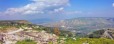
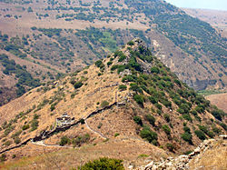
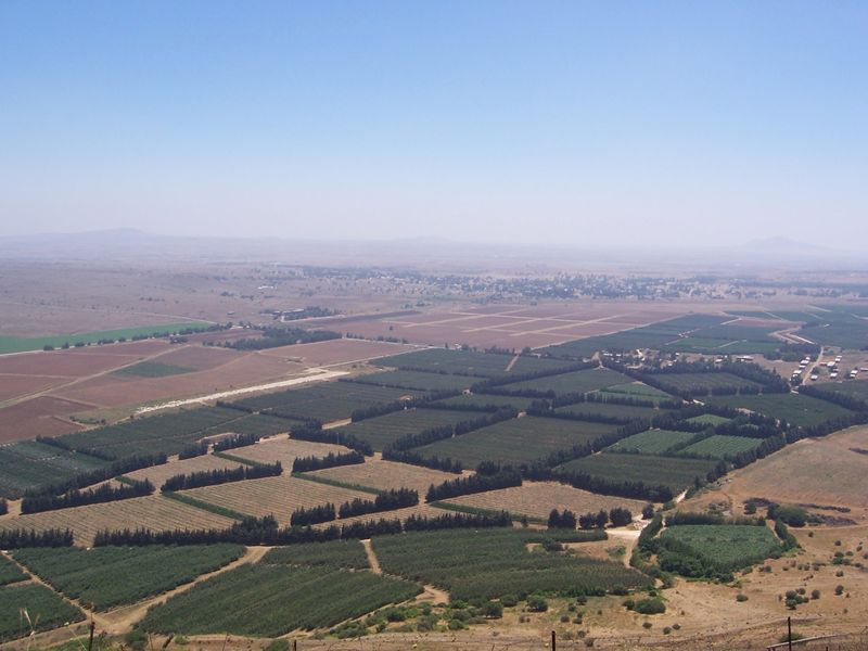
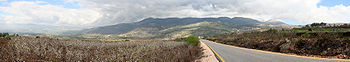 Panorama showing The upper Golan Heights and Mt. Hermon with the Hula Valley to the left
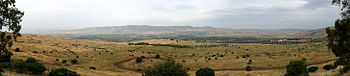 Panorama looking west from the former Syrian post of Tel Faher.
The Golan Heights has a rich history and features numerous archeological sites, mountains, streams and waterfalls. Throughout the region 62 ancient synagogues have been found dating back to the Roman and Byzantine periods.[133]
- Kursi
Kursi is the ruins of a Byzantine Christian monastery.
- Katzrin
Katzrin is the administrative and commercial center of the Israeli-controlled area of the Golan Heights. As such it hosts a large number of attractions.
-
- The Katzrin Ancient Village is fully excavated and one can tour the different houses in the village as well as the remains of a large synagogue. There is also an interactive movie experience about the Talmudic time within the compound.
- The Golan Archaeological Museum hosts archaeological finds uncovered in the Golan Heights from prehistoric times. A special focus concerns Gamla and excavations of synagogues and Byzantine churches.[134]
- The Golan Heights Winery, a major winery of Israel and the mineral water plant of Mey Eden which derives its water from the spring of Salukiya in the Golan. One can tour these factories as well as factories of oil products and fruit products.
- Two open air strip malls, one which holds the Kesem ha-Golan (Golan Magic), a three-dimensional movie and model of the geography and history of the Golan Heights.[135]
 Gamla from above
- Gamla Nature Reserve
The Gamla Nature Reserve is an open park which holds the archaeological remains of the ancient Jewish city of Gamla — including a tower, wall and synagogue. It is also the site of a large waterfall, an ancient Byzantine church, and a panoramic spot to observe the nearly 100 vultures who dwell in the cliffs. Israeli scientists study the vultures and tourists can watch them fly and nest.[136]
- Rujm el-Hiri
Rujm el-Hiri is a large circular stone monument similar to Stonehenge. A 3D model of the site exists in the Museum of Golan Antiquities in Katzrin.
- Um el Kanatir
Um el Kanatir is another impressive set of standing ruins of a Jewish village of the Byzantine era. The site includes a very large synagogue and two arches next to a natural spring.[137]
- Nimrod Fortress
Now a nature reserve, the Nimrod Fortress was once used by the Ayyubids, Crusaders, Mongols and Mamluks.
- Mount Hermon and Lake Ram
A ski resort on the slopes of Mount Hermon features a wide range of ski trails and activities. Several restaurants are located in the area. The Lake Ram crater lake is nearby.
 Hamat Gader hot springs
- Hamat Gader
Hamat Gader is site of natural hot mineral springs with temperatures reaching 50°C. Hamat Gader was already used for recreation and healing purposes during Roman times. The site includes a Roman theatre, which was built in the 3rd century CE and contained 2,000 seats. A large synagogue was built in the 5th century CE.
- Hippos
Hippos is an ancient Greco-Roman city, known in Jewish Aramaic as Susita. The archaeological site includes excavations of the city's forum, the small imperial cult temple, a large Hellenistic temple compound, the Roman city gates, and two Byzantine churches.
Viticulture
On a visit to Israel and the Golan Heights in 1972, Cornelius Ough, a professor of viticulture and oenology at the University of California, Davis, pronounced conditions in the Golan very suitable for the cultivation of wine grapes. The first vines were planted in 1976.[138]
See also
- Al-Marsad
- Borders of Israel
- Golan Regional Council
- Independent Israel–Syria peace initiatives
- International law and the Arab-Israeli conflict
- Israel–Syria relations
- Front for the Liberation of the Golan
- Shouting Hill
- The Syrian Bride
- UN Security Council Resolution 452
- UN Security Council Resolution 465
- UN Security Council Resolution 471
- Petroleum Road
- Golan Heights Wind Farm
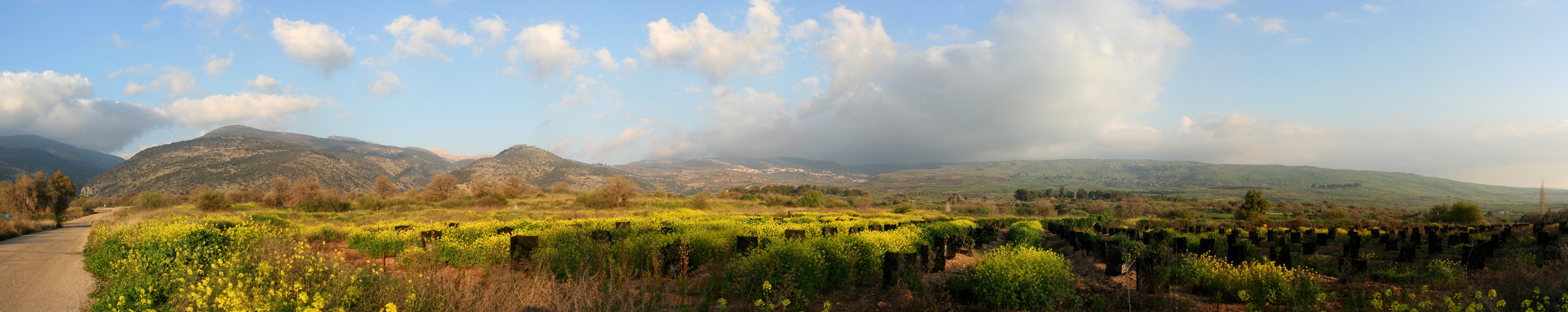
 Panoramic view of the Golan Heights, with the Hermon mountains on the left side, taken from Snir
References
- ^ a b
- "The international community maintains that the Israeli decision to impose its laws, jurisdiction and administration in the occupied Syrian Golan is null and void and without international legal effect." International Labour Office (2009). The situation of workers of the occupied Arab territories (International government publication ed.). International Labour Office. p. 23. ISBN 9789221206309. http://books.google.com/books?id=DqIv03qWPc0C&printsec=frontcover&dq=The+situation+of+workers+of+the+occupied+Arab+territories:+report+of+the#v=snippet&q=%22The%20international%20community%20maintains%20that%20the%20Israeli%20decision%20to%20impose%20its%20laws%2C%20jurisdiction%20and%20administration%20in%20the%20occupied%20Syrian%20Golan%20is%20null%20and%20void%20and%20without%20international%20legal%20effect.%22&f=false.
- "...occupied Syrian Golan Heights..." (The Arab Peace Initiative, 2002, www.al-bab.com. Retrieved August 1, 2010.)
- In 2008, a plenary session of the United Nations General Assembly voted by 161–1 in favour of a motion on the "occupied Syrian Golan" that reaffirmed support for UN Resolution 497. (General Assembly adopts broad range of texts, 26 in all, on recommendation of its fourth Committee, including on decolonization, information, Palestine refugees, United Nations, December 5, 2008.)
- "the Syrian Golan Heights territory, which Israel has occupied since 1967". Also, "the Golan Heights, a 450-square mile portion of southwestern Syria that Israel occupied during the 1967 Arab-Israeli war." (CRS Issue Brief for Congress: Syria: U.S. Relations and Bilateral Issues, Congressional Research Service. 19 January 2006)
- ^ "Golan Heights" World Encyclopedia. Philip's, 2005. Oxford Reference Online. Oxford University Press.
- ^ Peter Caddick-Adams "Golan Heights, battles of" The Oxford Companion to Military History. Ed. Richard Holmes. Oxford University Press, 2001. Oxford Reference Online. Oxford University Press.
- ^ CIA - The World Factbook - Syria
- ^ a b c Oudat, Basel.Shouting in the hills, Al-Ahram Weekly, 12–18 June 2008. Issue No. 901.
- ^ Tina Shepardson. Stones and Stories: Reconstructing the Christianization of the Golan, Biblisches Forum, 1999.
- ^ a b Dt 3:1, Dt 3:2, Dt 3:3, Dt 3:4, Dt 3:5, Dt 3:6, Dt 3:7
- ^ Dan Urman; Paul Virgil McCracken Flesher (1998). Ancient synagogues: historical analysis and archaeological discovery. BRILL. p. 423. ISBN 9789004112544. http://books.google.com/books?id=HQyxvmYV-50C&pg=PA423. Retrieved 2 March 2011.
- ^ a b Richard 2003, p. 377
- ^ a b Eric M. Meyers (1996). The Oxford encyclopedia of archaeology in the Near East, Volume 2 (Hardcover ed.). Oxford University Press. p. 421. ISBN 0195112164. http://books.google.com/books?id=kSgZAQAAIAAJ&q=%22The+Itureans,+a+tribe+probably+of+Aramean+stock,+established+settlements+in+the+northeastern+Golan+in+the+middle+of+the+second+century+bce.%22&dq=%22The+Itureans,+a+tribe+probably+of+Aramean+stock,+established+settlements+in+the+northeastern+Golan+in+the+middle+of+the+second+century+bce.%22.
- ^ Herzog, Chaim, The Arab Israeli Wars, New York: Random House (1982) p.190-191
- ^ a b c Golan Heights Law, MFA.
- ^ a b UN Security Council Resolution 497
- ^ a b c Y.Z Blum "Secure Boundaries and Middle East Peace in the Light of International Law and Practice" (1971) pages 24–46
- ^ Korman, Sharon. The right of conquest: the acquisition of territory by force in international law and practice, Oxford University Press, 1996. pg. 265. ISBN 0198280076. "The continued occupation of the Syrian Golan Heights is recognised by many states as valid and consistent with the provisions of the UN Charter, on a self-defence basis. ...But the notion that Israel is entitled to claim any status other than that of belligerent occupant in the territory which it occupies, or to act beyond the strict bounds laid down by the Fourth Geneva Convention, has been universally rejected by the international community."
- ^ Occupied territory:
- "Israeli-occupied Golan Heights" (Central Intelligence Agency. CIA World Factbook 2010, Skyhorse Publishing Inc., 2009. pg. 339. ISBN 1602397279.)
- "...the United States considers the Golan Heights to be occupied territory subject to negotiation and Israeli withdrawal..." ("CRS Issue Brief for Congress: Israeli-United States Relations", Congressional Research Service, April 5, 2002. pg. 5. Retrieved August 1, 2010.)
- "Occupied Golan Heights" (Travel advice: Israel and the Occupied Palestinian Territories, UK Foreign and Commonwealth Office. Retrieved August 1, 2010.)
- "In the ICRC's view, the Golan is an occupied territory." (ICRC activities in the occupied Golan during 2007, International Committee of the Red Cross, April 24, 2008.)
- ^ Frommer’s, Regions in brief, Upper Galilee and the Golan Heights
- ^ At a Glance: The Golan Heights World News Australia, 6 June 2011
- ^ a b c d e Moshe Sharon (2004). Corpus inscriptionum Arabicarum Palaestinae, (CIAP) (Hardcover ed.). Brill Academic Publishers. p. 211. ISBN 9004131973. http://books.google.com/?id=01ogNhTNz54C&pg=PA211&dq=greek+Gaulanitis#v=onepage&q=greek%20Gaulanitis&f=false.
- ^ John Lewis Burchhardt (1822). Travels in Syria and the Holy Land. Association for the promoting the discovery of the interior parts of Africa. p. 286. http://books.google.com/?id=cN1YB8fTAI4C&pg=PA287&dq=djolan#v=onepage&q=djolan&f=false.
- ^ a b E. A. Myers (2010). The Ituraeans and the Roman Near East: Reassessing the Sources (Hardcover ed.). Cambridge University Press. p. 43. ISBN 0521518873. http://books.google.com/?id=-cRrGQ8bIAkC&pg=PA43&dq=golan+bashan#v=onepage&q=golan%20bashan&f=false.
- ^ "Ancient faiths embodied in ancient names: or, An attempt to trace the religious belief ... of certain nations", by Thomas Inman, 1872 History, page 551
- ^ A Dictionary of the Bible: Volume II: (Part I: Feign – Hyssop), Volume 2, by James Hastings page 225
- ^ a b Byzantium and the Arabs in the Sixth Century: pt. 1. Toponymy, monuments ... By Irfan Shahîd, page 87
- ^ Earth Tales: New Perspectives on Geography and History by Henry T. Conserva, page 197
- ^ Israel handbook: with the Palestinian Authority areas By Dave Winter
- ^ a b Edgar S. Marshall (2002). Israel: Current Issues and Historical Background. Nova Science Publishers. p. 32. ISBN 159033325X. http://books.google.com/?id=aTqU-YskSpwC&pg=PA32&lpg=PA32&dq=%22Syrian+heights%22&q=%22Syrian%20heights%22.
- ^ United States, Central Intelligence Agency, Golan Heights and Vicinity : Oct 1994 [1]
- ^ FSU.edu: International Boundary Study Number 94, December 30, 1969. Jordan—Syria Boundary. US Department of State, p. 12
- ^ Haim Gvirtzman, Israel Water Resources, Chapters in Hydrology and Environmental Sciences, Yad Ben-Zvi Press, Jerusalem (Hebrew) Water.gov.il indicates that the Golan Heights contributes no more than 195 million m³ per year to the Sea of Galilee, as well as another 120 million m³ per year from the Banias River tributary. Israel's annual water consumption is about 2,000 million m³.
- ^ Venus of Berekhat Ram
- ^ Dt 33:22
- ^ 1 Kg 4:13
- ^ Richard 2003, p. 427
- ^ Edinburgh New Philosophical Journal
- ^ Utexas.edu
- ^ UMN.edu
- ^ Ronnie Ellenblum, Ronnie. Frankish Rural Settlement in the Latin Kingdom of Jerusalem, Cambridge University Press, 2003. pg. 219-20. ISBN 0521521874
- ^ Shoup, John A. Culture and customs of Jordan, Volume 2006, Greenwood Publishing Group, 2007. pg. 31. ISBN 0313336717.
- ^ Porter, Josias Leslie. A handbook for travellers in Syria and Palestine, J. Murray, 1868. pg. 439. [Harvard University, 4 Jan 2007]
- ^ The Caspian Region: The Caucasus, M. Gammer, pg. 64.
- ^ Gudrun Krämer. A history of Palestine: from the Ottoman conquest to the founding of the state of Israel, Princeton University Press, 2008. pg.137. ISBN 0691118973
- ^ David Dean Commins. Historical dictionary of Syria, pg. 77.
- ^ Bat Yeʼor. The decline of Eastern Christianity under Islam: from Jihad to Dhimmitude, Fairleigh Dickinson Univ. Press, 1996. pg. 206.
- ^ Martha Mundy, Basim Musallam. The transformation of nomadic society in the Arab East, Cambridge University Press, 2000. pg. 40. ISBN 0521770572,
- ^ a b Kats, Yosef. The "business" of settlement: private entrepreneurship in the Jewish settlement of Palestine, 1900–1914, Magnes Press, Hebrew University, 1994. pg. 20. ISBN 9652238635.
- ^ A hundred years of settlement, Keter, 1985. pg. 200.
- ^ a b c d e f M. R. Fishbach, Jewish property claims against Arab countries, Columbia University Press (2008), pp36-37.
- ^ Aharonson, Ran. Rothschild and early Jewish colonization in Palestine, Rowman & Littlefield, 2000. pg. 98. ISBN 0742509141
- ^ The Church at Home and Abroad, Volume 8, 1890 [University of California. January 11, 2007]
- ^ Efraim Orni, Elisha Efrat. Geography of Israel, Israel Universities Press, 1971.
- ^ Fred Skolnik, Michael Berenbaum. Encyclopaedia Judaica, Volume 3, pg. 197. ISBN 0028659287.
- ^ Efraim Orni, Elisha Efrat. Geography of Israel, Israel Universities Press, 1971.
- ^ Military government in the territories administered by Israel, 1967–1980, Hebrew University Jerusalem, Faculty of Law, Harry Sacher Institute for Legislature Research and Comparative Law, 1982. pg. 102.
- ^ Jewish spectator, Volume 60, 1995.
- ^ Biger, 2005, p. 173.
- ^ Chaim Weizmann, subsequently reported to his colleagues in London: "There are still important details outstanding, such as the actual terms of the mandate and the question of the boundaries in Palestine. There is the delimitation of the boundary between French Syria and Palestine, which will constitute the northern frontier and the eastern line of demarcation, adjoining Arab Syria. The latter is not likely to be fixed until the Emir Faisal attends the Peace Conference, probably in Paris." See: 'Zionist Aspirations: Dr Weizmann on the Future of Palestine', The Times, Saturday, 8 May 1920; p. 15.
- ^ a b Franco-British Convention on Certain Points Connected with the Mandates for Syria and the Lebanon, Palestine and Mesopotamia, signed Dec. 23, 1920. Text available in American Journal of International Law, Vol. 16, No. 3, 1922, 122–126.
- ^ Agreement between His Majesty's Government and the French Government respecting the Boundary Line between Syria and Palestine from the Mediterranean to El Hámmé, Treaty Series No. 13 (1923), Cmd. 1910. Also Louis, 1969, p. 90.
- ^ FSU Law.
- ^ a b Robert G. Rabil (2003). Embattled neighbors: Syria, Israel, and Lebanon. Lynne Rienner Publishers. pp. 15–16. ISBN 1588261492. http://books.google.com/?id=heR4OG-LdIYC&printsec=frontcover&dq=Embattled+neighbors:+Syria,+Israel,+and+Lebanon&cd=1#v=onepage&q=.
- ^ The Brink of Peace: The Israeli-Syrian Negotiations By Itamar Rabinovich, page 19
- ^ M. Shemesh, Prelude to the Six-Day War: The Arab-Israeli Struggle Over Water Resources, Israel Studies, vol 9, no. 3, 2004.
- ^ a b M. Shemesh, The Fida’iyyun Organization’s Contribution to the Descent to the Six-Day War, Israel Studies, vol 11, no. 1, 2006.
- ^ M. Shemesh, The IDF Raid On Samu: The Turning-Point In Jordan’s Relations With Israel and the West Bank Palestinians, Israel Studies, vol 7, no. 1, 2002.
- ^ "Six-Day War", Microsoft Encarta Online Encyclopedia 2007. Archived 2009-10-31.
- ^ Herzog, Chaim, The Arab Israeli Wars, New York: Random House (1982) p185
- ^ Sicker, Martin, Israel's quest for security, New York. Praeger Publishing (1989), p. 92-95
- ^ Eban, Abba, Abba Eban. An Autobiography, New York: Random House (1977) p. 313-314
- ^ Herzog, Chaim, The Arab Israeli Wars, New York: Random House (1982) p.146-148
- ^ Gilbert, Martin, The Arab-Israeli Conflict: Its History in Maps, 4th ed, London: Weidenfeld and Nicolson (1985) p 63-64
- ^ Washington Report on Middle East Affairs, 1991-11.
- ^ Yitschak Ben Gad. The road map to nowhere, New Leaf Publishing Group, 2004. pg. 292. ISBN 089221578X.
- ^ Schmemann, Serge (1997-05-11). "General's Words Shed a New Light on the Golan". The New York Times. http://www.nytimes.com/1997/05/11/world/general-s-words-shed-a-new-light-on-the-golan.html?pagewanted=1. Retrieved 2010-05-03.
- ^ "Israel provoked Six-Day War, says former Dutch UN observer". monstersandcritics. June 5, 2007. http://www.monstersandcritics.com/news/middleeast/news/article_1313492.php/Israel_provoked_Six-Day_War_says_former_Dutch_UN_observer.
- ^ Robert Slater. Warrior Statesman: The Life of Moshe Dayan, Robson Books, London (1992), pg. 277.
- ^ a b Morris (2001), p. 327: "Another eighty to ninety thousand civilians fled or were driven from the Golan Heights."
- ^ a b c d The Arab Centre for Human Rights in the Golan Heights: NGO Report, pg. 3. January 25, 2007. (90,000 according to Israeli sources and 115,000 according to Syrian sources, which included 17,000 Palestinian refugees registered with UNRWA, cited in the Report of the Secretary-General under General Assembly resolution 2252 (ES-V) and Security Council resolution 237 (1967, pg. 14. September 15, 1967.)
- ^ A View From Damascus: Internal Refugees From Golan’s 244 Destroyed Syrian Villages
- ^ Golan Facts.
- ^ Different accounts on whether Golan inhabitants were expelled or whether they fled (1997–2002)
- ^ Eldar, Akiva. A matter of a few dozen meters, Haaretz, June 1, 2008.
- ^ The Middle East and North Africa 2003, Occupied Territories, The Golan Heights, page 604.
- ^ a b Syrian Arab New Agency
- ^ Landmine monitor report, International Campaign to Ban Landmines, pg. 696. ISBN 1564322874.
- ^ Marshall, Edgar S. Israel: current issues and historical background, Nova Publishers, 2002. pg. 34. ISBN 159033325X.
- ^ "Golan Heights" A Dictionary of Contemporary World History. Jan Palmowski. Oxford University Press, 2003. Oxford Reference Online. Oxford University Press.
- ^ "Document 487". Foreign Relations of the United States, 1964–1968, Volume XIX, Arab-Israeli Crisis and War. U.S. State Department. http://history.state.gov/historicaldocuments/frus1964-68v19/d487. Retrieved 26 October 2010.
- ^ (Baron) Caradon, Hugh Foot (1981). U.N. Security Council Resolution 242: A Case Study in Diplomatic Ambiguity. Institute for the Study of Diplomacy, Edmund A. Walsh School of Foreign Service, Georgetown University. pp. 12. ISBN 0934742111.
- ^ Moshe Ma'oz (March 2005). "Can Israel and Syria Reach Peace?: Obstacles, Lessons, and Prospects" (pdf). Archived from the original on 2008-02-27. http://web.archive.org/web/20080227132019/http://www.bakerinstitute.org/Pubs/wp_israelsyria.pdf. Retrieved 2008-04-06.
- ^ The Telegraph, London: 2006-09-30.
- ^ BBC News Middle-East.
- ^ Jerusalem Post.
- ^ "Olmert to Assad: Israel willing to withdraw from Golan Heights". Ynet News. 2007-06-08. http://www.ynetnews.com/articles/0,7340,L-3410174,00.html. Retrieved 2007-06-08.
- ^ "Hafez Assad conceded Mt Hermon, says Netanyahu". Ynet News. 2007-06-08. http://www.ynetnews.com/articles/0,7340,L-3410090,00.html. Retrieved 2007-06-08.
- ^ BBC
- ^ Nahmias, Roee. "Syrian report: Olmert agreed to concede Golan Heights". Ynet. http://www.ynetnews.com/articles/0,7340,L-3534884,00.html. Retrieved 2008-04-23.
- ^ Einav, Hagai. "Attempt to cede Golan doomed to fail, say local leaders". Ynet. http://www.ynetnews.com/articles/0,7340,L-3535541,00.html. Retrieved 2008-04-24.
- ^ General Assembly adopts broad range of texts, 26 in all, on recommendation of its fourth Committee, including on decolonization, information, Palestine refugees, United Nations, December 5, 2008
- ^ http://www.ynetnews.com/articles/0,7340,L-3751170,00.html
- ^ Netanyahu: Golan pullout would put Iran on Israel's doorstep, Mazal Mualem, Haaretz Correspondent, 22 May 2008
- ^ Barak Ravid (8 May 2009). "Netanyahu: Israel will never withdraw from Golan". Haaretz. http://www.haaretz.com/hasen/spages/1084194.html.
- ^ JTA, Netanyahu: Golan ours forever, August 1, 2007
- ^ Indyk, Martin (2009). Innocent Abroad: An Intimate Account of American Peace Diplomacy in the Middle East. Simon & Schuster.
- ^ http://www.ynetnews.com/articles/0,7340,L-3755265,00.html
- ^ http://www.ynetnews.com/articles/0,7340,L-3741957,00.html
- ^ http://www.ynetnews.com/articles/0,7340,L-3742904,00.html
- ^ "Israel's Lieberman cautions Syria". Al Jazeera. 4 February 2010. http://english.aljazeera.net/news/middleeast/2010/02/201024174859584145.html. Retrieved 8 April 2011. "'We must make Syria recognise that just as it relinquished its dream of a greater Syria that controls Lebanon ... it will have to relinquish its ultimate demand regarding the Golan Heights,' Lieberman said."
- ^ a b Edgar S. Marshall. Israel: current issues and historical background. Nova Publishers, 2002. pg. 35. ISBN 159033325X.
- ^ Garfinkle, Adam (1998). "History and Peace: Revisiting two Zionist myths". Israel Affairs (Routledge) 5 (1): 135–146. doi:10.1080/13537129808719501. http://www.informaworld.com/smpp/content~db=all~content=a777088926.
- ^ a b c Frederic C. Hof, "The line of June 4, 1967"
- ^ A. Garfinkle, History and Peace: Revisiting two Zionist myths, Israel Affairs, vol. 5 (1998) pp126–148.
- ^ Israel Syria Armistice Agreement
- ^ Kaufman, Asher (2004). "Understanding the Sheeba Farms dispute". Palestine-Israel Journal 11 (1). http://www.pij.org/details.php?id=9. Retrieved July 22, 2006.
- ^ "In focus: Shebaa farms". BBC News. May 25, 2000. http://news.bbc.co.uk/1/hi/world/middle_east/763504.stm. Retrieved September 29, 2006.
- ^ a b Border problems. Lebanon, UNIFIL and Italian participation by Lucrezia Gwinnett Liguori
- ^ Gold, DoreThe Golan Heights and the Syrian Israeli-Negotiations JCPA, 22 May 2008
- ^ http://www.yale.edu/lawweb/avalon/un/un497.htm "United Nations Security Council Resolution 497"
- ^ [2]"Yearbook of the United Nations 2005, Volume 59" pg.524
- ^ [3] "Report of the Special Committee to Investigate Israeli Practices Affecting the Human Rights of the Palestinian People and Other Arabs of the Occupied Territories" September 2002
- ^ Ninan Koshy. Economic and political weekly, Volume 30, “Climbing Down the Golan Heights.” Sameeksha Trust, 1995. pg. 1,562.
- ^ a b Regions and territories: The Golan Heights BBC
- ^ Scott Wilson (2006-10-30). "Golan Heights Land, Lifestyle Lure Settlers". The Washington Post. http://www.washingtonpost.com/wp-dyn/content/article/2006/10/29/AR2006102900926.html. Retrieved 2007-06-05.
- ^ Ghajar says `don't fence me in'
- ^ Fogelman, Shay. The disinherited, Haaretz, July 30, 2010. (90,000 according to Israeli sources and 115,000 according to Syrian sources, which included 17,000 Palestinian refugees registered with UNRWA, cited in the Report of the Secretary-General under General Assembly resolution 2252 (ES-V) and Security Council resolution 237 (1967), pg. 14. September 15, 1967.)
- ^ Politicide: Ariel Sharon's war against the Palestinians. p. 28. ISBN 978 1 84467 532 6
- ^ "The Fate of Abandoned Arab Villages, 1965–1969" by Aron Shai (History & Memory – Volume 18, Number 2, Fall/Winter 2006, pp. 86–106) "As the pace of the surveys increased in the West Bank, widespread operations also began on the Golan Heights, which had been captured from Syria during the war (figure 7). Dan Urman, whose official title was Head of Surveying and Demolition Supervision for the Golan Heights, was in charge of this task. Urman submitted a list of 127 villages for demolition to his bosses. ... The demolitions were executed by contractors hired for the job. Financial arrangements and coordination with the ILA and the army were recorded in detail. Davidson commissioned surveys and demolition supervision from the IASS [Israel Archaeological Survey Society]. Thus, for example, in a letter dated 15 May 1968, he wrote to Ze'ev Yavin: 'Further to our meeting, this is to inform you that within a few days we will start demolishing about 90 abandoned villages on the Golan Heights (see attached list)."
- ^ "The Golan Heights under Israeli Occupation 1967 – 1981" p.5. "The remainder of 131 agricultural villages and 61 individual farms were wiped of the face of the earth by the Israeli occupation authorities immediately following the Israeli victory in the 1967 war. They were razed to the ground and their lands handed over to exclusive Israeli-Jewish settlement."
- ^ U.S. Committee for Refugees World Refugee Survey 1999 – Syria
- ^ 3240 (XXIX). Report of the Special Committee to Investigate Israeli Practices Affecting the Human Rights of the Population of the Occupied Territories
- ^ Report of the Director-General, Volume 2, International Labour Conference, 1991.pg. 34. ISBN 9221075338.
- ^ "Population by District, Sub-District and Religion". Statistical Abstract of Israel, no. 60. Israel Central Bureau of Statistics. 2009. http://www.cbs.gov.il/reader/shnaton/templ_shnaton.html?num_tab=st02_06x&CYear=2009.
- ^ The Ancient world. Ares Publishers. 2002. p. 54. http://books.google.com/books?id=ChMiAQAAIAAJ. Retrieved 7 March 2011.
- ^ Golan Archaeological Museum
- ^ http://etour.golan.org.il/ts.exe?tsurl=0.342.21027.0.0
- ^ Antiquities.
- ^ Kanatir, TAU.
- ^ Upstart Wineries Drench Previously Arid Country
Bibliography
- Biger, Gideon (2005). The Boundaries of Modern Palestine, 1840–1947. London: Routledge. ISBN 0-7146-5654-2.
- Bregman, Ahron (2002). Israel's Wars: A History Since 1947. London: Routledge. ISBN 978-0-415-28716-6.
- Louis, Wm. Roger (1969). "The United Kingdom and the Beginning of the Mandates System, 1919–1922". International Organization, 23(1), pp. 73–96.
- Maar'i, Tayseer, and Usama Halabi (1992). "Life under occupation in the Golan Heights". Journal of Palestine Studies 22: 78–93. doi:10.1525/jps.1992.22.1.00p0166n.
- Maoz, Asher (1994). "Application of Israeli law to the Golan Heights is annexation". Brooklyn Journal of International Law 20, afl. 2: 355–96.
- Morris, Benny (2001). Righteous Victims. New York, Vintage Books. ISBN 978-0-679-74475-7.
- Sheleff, Leon (1994). "Application of Israeli law to the Golan Heights is not annexation". Brooklyn Journal of International Law 20, afl. 2: 333–53.
- Zisser, Eyal (2002). "June 1967: Israel's capture of the Golan Heights". Israel Studies 7,1: 168–194.
- Richard, Suzanne (2003). Near Eastern Archaeology: A Reader. Eisenbrauns. ISBN 9781575060835. http://books.google.com/?id=khR0apPid8gC&printsec=frontcover&dq=Near+Eastern+archaeology:+a+reader#v=onepage&q&f=false
External links
- The Syrian Golan – Permanent Mission of the Syrian Arab Republic to the United Nations
- Jawlan.org (Arabic)
- Gaulonitis in the Jewish Encyclopedia
- Golan, Gaulonitis in The International Standard Bible Encyclopedia
- Qatzrin
- Golan Heights Examination
- A View From Damascus: Internal Refugees From Golan’s 244 Destroyed Syrian Villages from Washington Report
- Golan Heights Town Tells Tale of Israeli-Arab War from Damascus online
- Golan Heights Winery
- After 40 years, could the ice be melting on the Golan Heights?
- "Golan Heights Will Supply All Energy Needs Within A Year"
Coordinates: 32°58′54″N 35°44′58″E / 32.98167°N 35.74944°E
Categories:- Golan Heights
- Arab–Israeli conflict
- Great Rift Valley
- Volcanic plateaus
- Volcanic fields
- Fertile Crescent
- Disputed territories in Asia
- Territorial disputes of Israel
- Israeli-occupied territories
- Territorial disputes of Syria


Wikimedia Foundation. 2010.