- Wadi
-
For other uses, see Wadi (disambiguation).
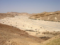
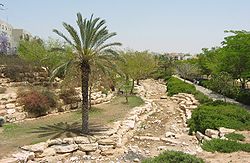
Wadi (Arabic: وادي wādī; also: Vadi) is the Arabic term traditionally referring to a valley. In some cases, it may refer to a dry (ephemeral) riverbed that contains water only during times of heavy rain or simply an intermittent stream.
Contents
Variant names
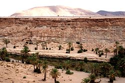
 Oued Tissint, Morocco.
In North Africa the transcription Oued, pronounced as Wad, is used. The term kouri is used in Hausa speaking and surrounding areas of West Africa. The Hebrew term nahal (נחל) and Hindi/Urdu term "Nala" is synonymous in meaning and usage.
Some names of Spanish locations are derived from Andalusian Arabic toponyms where wādī was used to mean a permanent river, for example: Guadalcanal, Guadalajara from wādī al-hidjārah = "river of stones", or Guadalquivir from al-wādī al-kabīr = "the great river". Seasonal streams, frequent in south-east Spain, are called rambla instead.
The term wādī is very widely found in Arabic toponyms.
Hydrological action
Modern English usage differentiates a wadi from another canyon or wash by the action and prevalence of water. Wadis, as drainage courses, are formed by water, but are distinguished from river valleys or gullies in that surface water is intermittent or ephemeral. Wadis, cut by stream in a desert environment, generally are dry year round except after a rain. The desert environment is characterized by a sudden but infrequent heavy rainfall often resulting in flash floods. Crossing wadis at certain times of the year can be dangerous because of unexpected flash floods. Such flash floods cause several deaths each year in North America and many Middle Eastern countries.
Wadis tend to be associated with centers of human population because sub-surface water is sometimes available in them. Nomadic and pastoral desert peoples will rely on seasonal vegetation found in wadis, even in regions as dry as the Sahara, as they travel in complex transhumance routes.
The centrality of wadis to water - and human life - in desert environments gave birth to the distinct sub-field of "Wadi Hydrology" in the 1990s.[1]
Wadi deposits
Deposition in a wadi is rapid because of the sudden loss of stream velocity and seepage of water into the porous sediment. Wadi deposits are thus usually poorly-sorted gravels and sands. These sediments are often reworked by eolian processes.[2]
Over time, wadi deposits may become "Inverted Wadis" where the presence at one time of underground water caused vegetation and sediment to fill in the Wadi's eroded channel to the point that previous washes appear as ridges running through desert regions.
Biblical references
Job speaks of his friends whom he calls brothers as being like these wadis. The Jewish Study Bible transliterated the word "brook" in Job 6:15 for the word "nachal" נחל, the Hebrew equivalent of the Arabic "wadi". The commentator notes, "Wadi, a seasonal stream that may be dangerously overflowing in winter and dry in summer". In his books of commentary, Albert Barnes notes: "The idea here is, that travelers in a caravan would approach the place where water had been found before, but would find the fountain dried up or the stream lost in the sand; and when they looked for refreshment, they found only disappointment".
See also
References
- ^ Review of Wheater, Howard ; Al Weshah, Radwan, Hydrology of Wadi systems -IHP Regional Network on Wadi Hydrology in the Arab Region, UNESCO- Technical documents in hydrology vol 55, SC.2002/WS/33,(2002).
- ^ Mohamed Achitea and Sylvain Ouillonb, Suspended sediment transport in a semiarid watershed, Wadi Abd, Algeria (1973–1995) Journal of Hydrology Volume 343, Issues 3-4, 20 September 2007, pp. 187-202.
Bibliography
- Summary: Drainage Courses, Wadis. United States Army Corps of Engineers. Desert Processes Working Group; Knowledge Sciences, Inc. (n.d), retrieved 2008-08-26.
- Summary: Summary: Drainage Courses, Wadis - Inverted. United States Army Corps of Engineers. Desert Processes Working Group; Knowledge Sciences, Inc. (n.d), retrieved 2008-08-26.
External links
- IHP REGIONAL WADI HYDROLOGY NETWORK, International Hydrological Programme, UNESCO.
- Arab Center for Studies of Arid Zones and Dry lands (ACSAD): Water resources division.
Coordinates: 30°36′48″N 34°55′24″E / 30.61333°N 34.92333°E
Categories:- Wadi
- Bodies of water
- Fluvial landforms
- Arabic words and phrases
Wikimedia Foundation. 2010.


