- Umm Qais
-
Umm Qais
أم قيس
Gadara (Ancient Greek)— Town — Umm Qais from north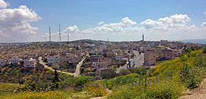 Location in Jordan
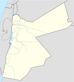
 Umm Qais
Coordinates: 32°39′N 35°41′E / 32.65°N 35.683°E Country  Jordan
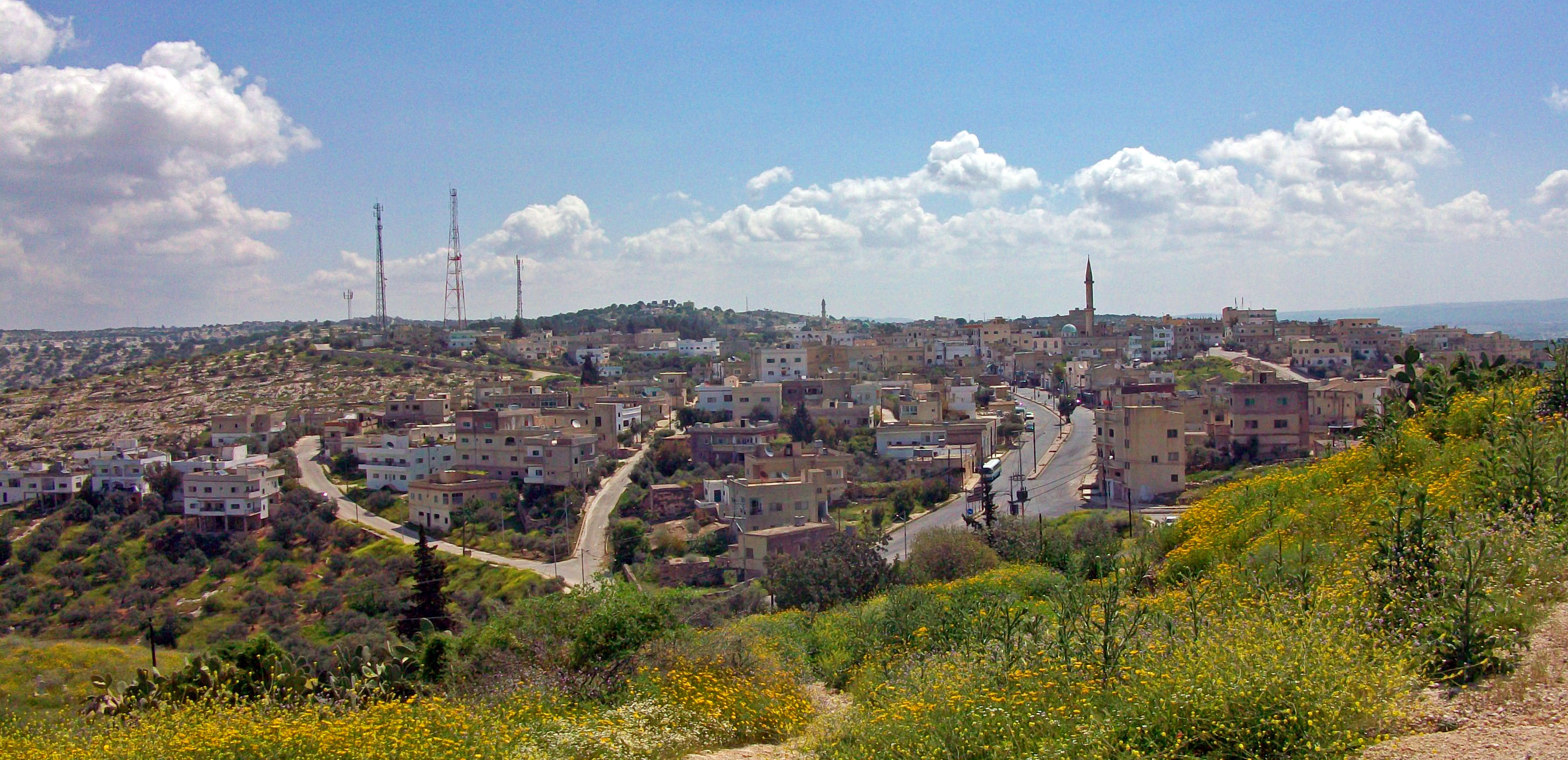
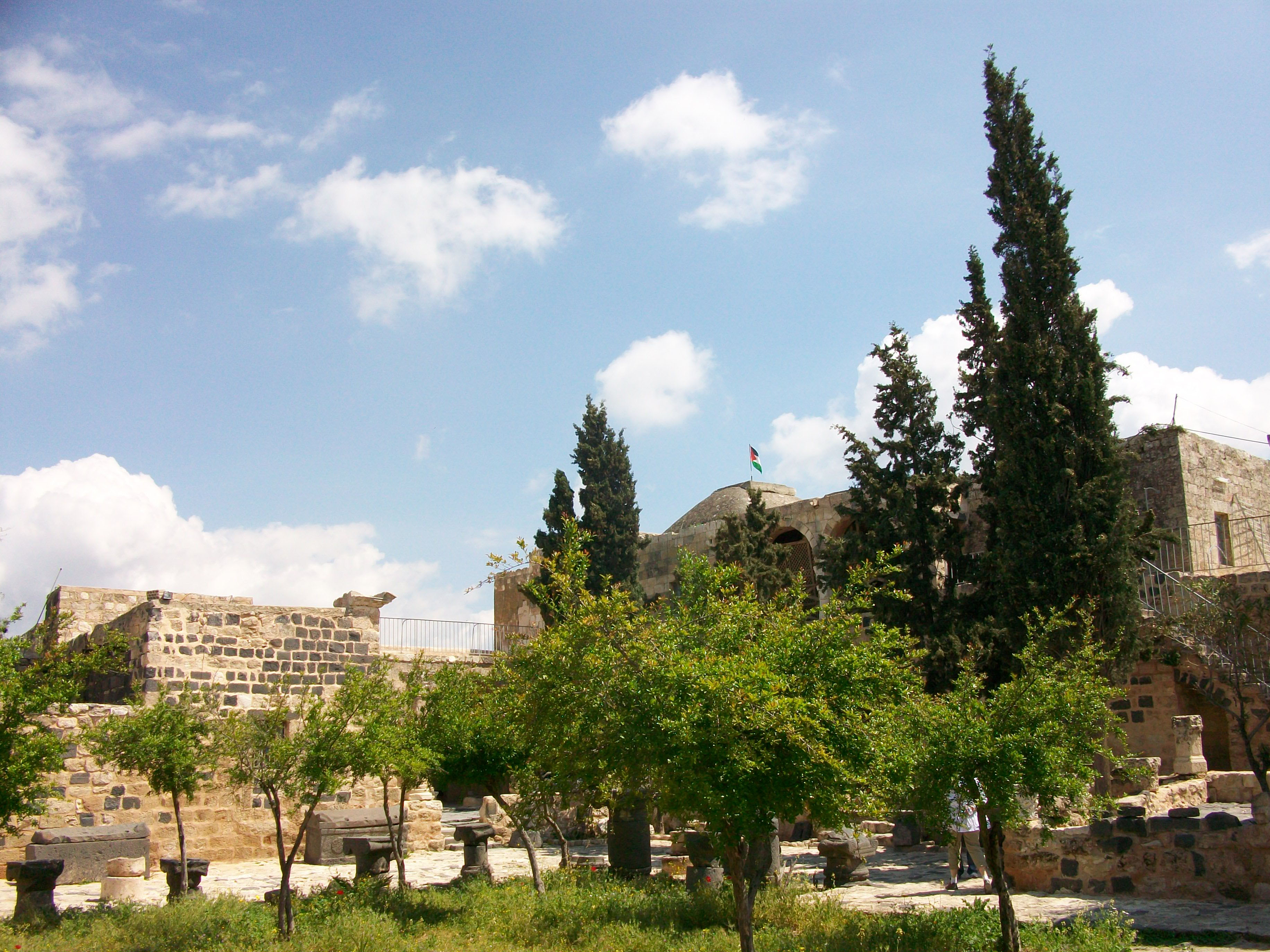
Governorate Irbid Time zone UTC+2 (UTC+2) – Summer (DST) UTC+3 (UTC+3) Area code(s) +(962)2 Umm Qais (Arabic: أم قيس) is a town in Jordan located on the site of the ruined Hellenistic-Roman city of Gadara (Hebrew: גדרה, gad´a-ra or גדר, ga-der; Greek: Γάδαρα Gádara). The town was also called Antiochia or Antiochia Semiramis (Ancient Greek: Ἀντιόχεια Σεμίραμις) and Seleucia. Gadara was a semi-autonomous city of the Roman Decapolis.
Contents
History
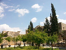
 Byzantine Church terrace at Umm Qais
The current and most widely-used name, Umm Qais, is Arabic for "Mother of Qais," a modified pronunciation and spelling of the Roman name Caius. The ancient name Gadara appears to be Semitic. It is probably derived from the Hebrew gader (גדר), meaning "fence" or "border". It is still heard in Jedūr, which is associated with the ancient rock tombs, with sarcophagi, to the east of the present ruins. These tombs are closed by carved stone doors, and are used as storehouses for grain, and also as dwellings by the inhabitants. The place is not mentioned till later times.
After Herod's death it was joined to the province of Syria (4 BC)[1]. At the beginning of the Jewish revolt in 66 AD, the country around Gadara was laid waste[2].
"So Vespasian marched to the city of Gadara. He came into it and slew all the youth, the Romans having no mercy on any age whatsoever. He set fire to the city and all the villas around it" - Josephus Wars of the Jews Book 7
The Gadarenes captured some of the boldest of the Jews, of whom several were put to death, and others imprisoned[3]. Some in the city surrendered themselves to Vespasian, who placed a garrison there[4]. The 2nd century AD Roman aqueduct to Gadara supplied drinking water through a 170 km long qanat. Its longest section running for 94 km underground, it is the longest known tunnel from ancient times to date[5]. Gadara continued to be a great and important city during Byzantine Christian times, and was long the seat of a bishop[6]. With the conquest of the Arabs, following the Battle of Yarmouk in 636, it came under Muslim rule. It was largely destroyed by an earthquake around 747 AD, and abandoned as a city.
Identification and description
Gadara was one of the Ten Cities of the Decapolis.
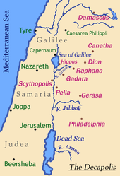 Map of the Decapolis showing location of Gadara
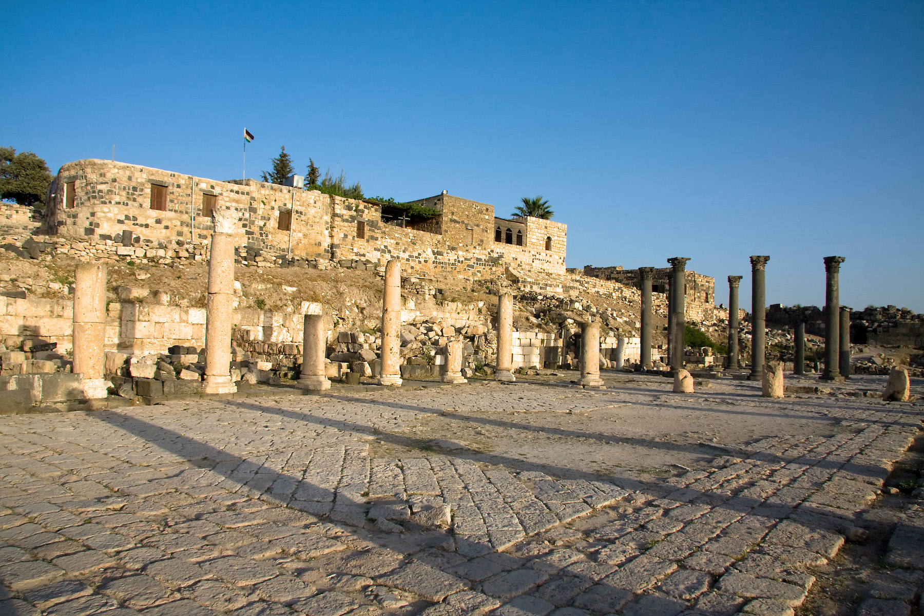
Umm Qais answers the description given of Gadara by ancient writers. It was a strong fortress (Ant., XIII, iii, 3), near the Hieromax - i.e. Yarmuk (Pliny the Elder N H, xvi) - east of Tiberias and Scythopolis, on the top of a hill, 3 Roman miles from hot springs and baths called Amatha, to the north on the banks of the Hieromax. The narrow ridge on which the ruins lie extends east toward the Jordan from the uplands of Gilead, with the deep gorge of Wadi Yarmouk - Hieromax - on the north, and Wadi Arab on the south. The ridge drops gradually to the East, but falls steeply on the other three sides, so that the position was one of great strategic value and strength. The ancient walls may be traced in almost their entire circuit of 3 km. One of the great Roman roads ran eastward to Ḍer‛ah; and an aqueduct has been traced to the pool of Ḳhab, about 20 miles to the north of Ḍer‛ah. The ruins include those of two theaters, a temple, a basilica, and many important buildings, telling of a once great and splendid city. A paved street, with double colonnade, ran from east to west. The ruts worn in the pavement by the chariot wheels are still to be seen.
That there was a second Gadara seems certain, and it may be intended in some of the passages referred to above. It is probably represented by the modern Jedūr, not far from es-Salṭ (Buhl, Geographic des alten Palastina, 255; Guthe). Josephus gives Pella as the northern boundary of Peraea (BJ, III, iii, 3). This would exclude Gadara on the Hieromax. The southern city, therefore, should be understood as "the capital of Peraea" in BJ, IV; vii, 3.
Country of the Gadarenes
This city is not named in Scripture, but the territory belonging to it is spoken of as χώρα τῶν Γαδαρηνῶν, chō̇ra tō̇n Gadarēnō̇n, “country of the Gadarenes” (Matthew 8:28). In the parallel passages (Mark 5:1; Luke 8:26, Luke 8:37) is written: χώρα τῶν Γερασηνῶν, chō̇ra tō̇n Gerasēnō̇n ("country of the Gerasenes”). Scholars debate which is the correct site of the miracle and modern translations have multiple readings of the Gospels. However, the earliest texts are very clear as to the original version of the synoptic Gospels. Upon close observation of the earliest Greek manuscripts, the Alexandrian texts, the original reading of Matthew is "in the region of the Gadarenes", and the original text of Mark and Luke is “in the country of the Gerasenes”. The earliest Greek manuscripts of Matthew, which precede the textual alteration made by Origen, locate the miracle to be within the “country of the Gadarenes” (Matt. 8:28). The Greek city of Gadara, was considered to belong to the larger region of Gerasa, though it still retained some local autonomy (Weber 1989: 9).
The miracle
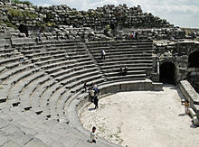 West Theatre of Umm Qais
A controversy exists regarding the site found in all three of the synoptic Gospels, where Jesus healed the demoniacs and cast the demons into a herd of swine which ran into the sea of Galilee. The Gospel accounts record that Jesus, along with his disciples, stepped upon the shore and “immediately there met Him out of the tombs a man” possessed by demons named Legion (Mark 5:9). Jesus then spoke to the demons and demanded them to depart, sending them into a nearby “herd of many swine feeding there on the mountain” (Luke 8:32). The possessed pigs, “ran violently down the steep place into the sea” and “those who kept them fled and went away into the city” (Matt. 8:32-33). Based upon the Gospel accounts, the location of the miracle had to have a nearby port, tombs for the men to live in, an area for pigs to graze, a nearby city to which the men could flee, and most importantly, a steep bank for the herd to rush down.
 Roman ruins at Umm Qais
The site’s topography has high ridges and steep slopes down which the pigs “ran violently down into the sea” (Matt 8:32). Above the port there are multiple hills which could potentially match up with the biblical account. The most likely site is found at the end of a chain of hills that has a bank descending into the sea. The bank is the modern site of Tell es S’alib located near the New Testament Gadaran suburb of es-Samrah (Laney 1977: 141). A visual representation of the location of this tell can be seen in Mendel Nun’s work The Land of the Gadarenes (1989: 5). Although this tell may not have had as steep a slope as that found at Kursi, it does have a hill that runs into the sea and could accommodate a “large herd of swine numbering about 2,000” (Mark 5:11). In addition to the slope, other features of the site make it match up well with the biblical account of the miracle. In excavations by B. De Vries completed in 1973, a Roman tomb from the time of Jesus was found in a valley nearby es-Samrah (Holm-Nielson 1992: 867). This could account for the tombs in which the demoniacs lived. Also, there is needed a nearby site where the swine would have grazed and “the groves of oak trees on the plateau above would have provided the acorns they favored” (Walking in their Sandals: 2). Thus, the site of Gadara can align both textually and geographically with the biblical account of the demoniacs and the herd of swine.
The ancient city of Gadara is represented today by the ruins at Umm Qais on the heights south of el-Ḥummeh - the hot springs in the Yarmouk valley and about 6 miles Southeast of the Sea of Galilee. It may be taken as certain that the jurisdiction of Gadara, as the chief city in these regions, extended over the country East of the Sea, including the lands of the subordinate town, Gerasa. The figure of a ship frequently appears on its coins: conclusive proof that its territory reached the sea. Josephus also makes reference to the territory of Gadara “which lay on the frontiers of Tiberius and formed the eastern boundary of Galilee,” again placing the region of Gadara along the coast of the Sea of Galilee (Laney 1977: 134). The place might therefore be called with propriety, either “land of the Gadarenes”, with reference to the local center, or “land of the Gerasenes”, with reference to the superior city.
(NOTE - The Textus Receptus of the New Testament reading. τῶν Γεργεσηνῶν, tṓn Gergesēnṓn, “of the Gergesenes”, must be rejected (Westcott-Hort, II. App., 11).)
Umm Qais today
 Beit Rousan
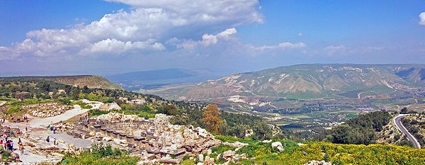
Umm Qais has become a popular tourist attraction, a frequent destination for day trips from the capital, Amman, roughly 110 kilometres (68 mi) to the south. It is popular not only because of the extensive ruins but because its position on a high hill near the northwestern corner of the country allows for panoramic views. The Sea of Galilee and Tiberias, Israel, are visible, and just across the valley of the Yarmouk River is the southern end of the Golan Heights, claimed by and recognized as Syria,[7] but under Israeli administration since the Six-Day War in 1967. The high mountains bordering Lebanon are visible in the distance on clear days.
Beit Rousan, formerly the home of the Ottoman governor of the area, has been converted into a museum, with exhibits of Byzantine-era church mosaics and Greek statues. It is part of the complex as well.
References
- Nun, Mendel Gergesa (Kursi) Kibbutz Ein Gev, 1989
- Nun, Mendel Ports of Galilee Biblical Archaeology Review 25/4: 18, 1999
- Holm-Nielson, Svend Gadarenes in Anchor Bible Dictionary vol. 2, ed. D.N. Freedman. New York: Doubleday, 1992
- Weber, Thomas Umm Qais – Gadara of the Decapolis Amman: Economic Press Co, 1989
- Laney, J. Carl Geographical Aspects of the Life of Christ, Unpublished Th.D. dissertation, Dallas Theological Seminary, 1977
- This entry incorporates text from the International Standard Bible Encyclopedia with some modernisation.
Notes
- ^ Ant., XVII, xi, 4; BJ, II, vi, 3.
- ^ BJ, II, xviii, 1.
- ^ ibid., 5.
- ^ BJ, IV, vii, 3.
- ^ Mathias Döring: "Wasser für Gadara. 94 km langer Tunnel antiker Tunnel im Norden Jordaniens entdeckt", in: Querschnitt, Vol. 21 (2007), pp. 24–35
- ^ Reland, Palestine, 776.
- ^ For example:*UN Resolution 242, *Text of Resolution at UN.org (PDF), *"CRS Issue Brief for Congress: Israeli-United States Relations". Congressional Research Service. April 5, 2002. http://fpc.state.gov/documents/organization/9570.pdf. Retrieved 2009-06-23.,*"Presidency Statement on Golan Heights". 04/01/2004. http://www.delsyr.ec.europa.eu/en/whatsnew_new/detail.asp?id=41. Retrieved 2009-06-23.,*"Israel and the Occupied Palestinian Territories". UK Foreign and Commonwealth Office. 11 June 2009. http://www.fco.gov.uk/en/travelling-and-living-overseas/travel-advice-by-country/middle-east-north-africa/israel-occupied. Retrieved 2009-06-23.,*"The Arab Peace Initiative, 2002". Al-Bab. 2002. http://www.al-bab.com/arab/docs/league/peace02.htm. Retrieved 2009-06-23.
External links
Categories:- Populated places in the Irbid Governorate
- Archaeological sites in Jordan
- Ancient Greek sites in Jordan
- Decapolis
- Hellenistic colonies
- New Testament places
- Gadara


Wikimedia Foundation. 2010.