- Metro La Paz
-
This article is about an urban area in Bolivia. For the Metro station in La Paz, Mexico, see Metro La Paz (Mexico City Metro).
"Area Metropolitana de La Paz"
Chuquiago Marka or Chuqiyapu (Aymara)
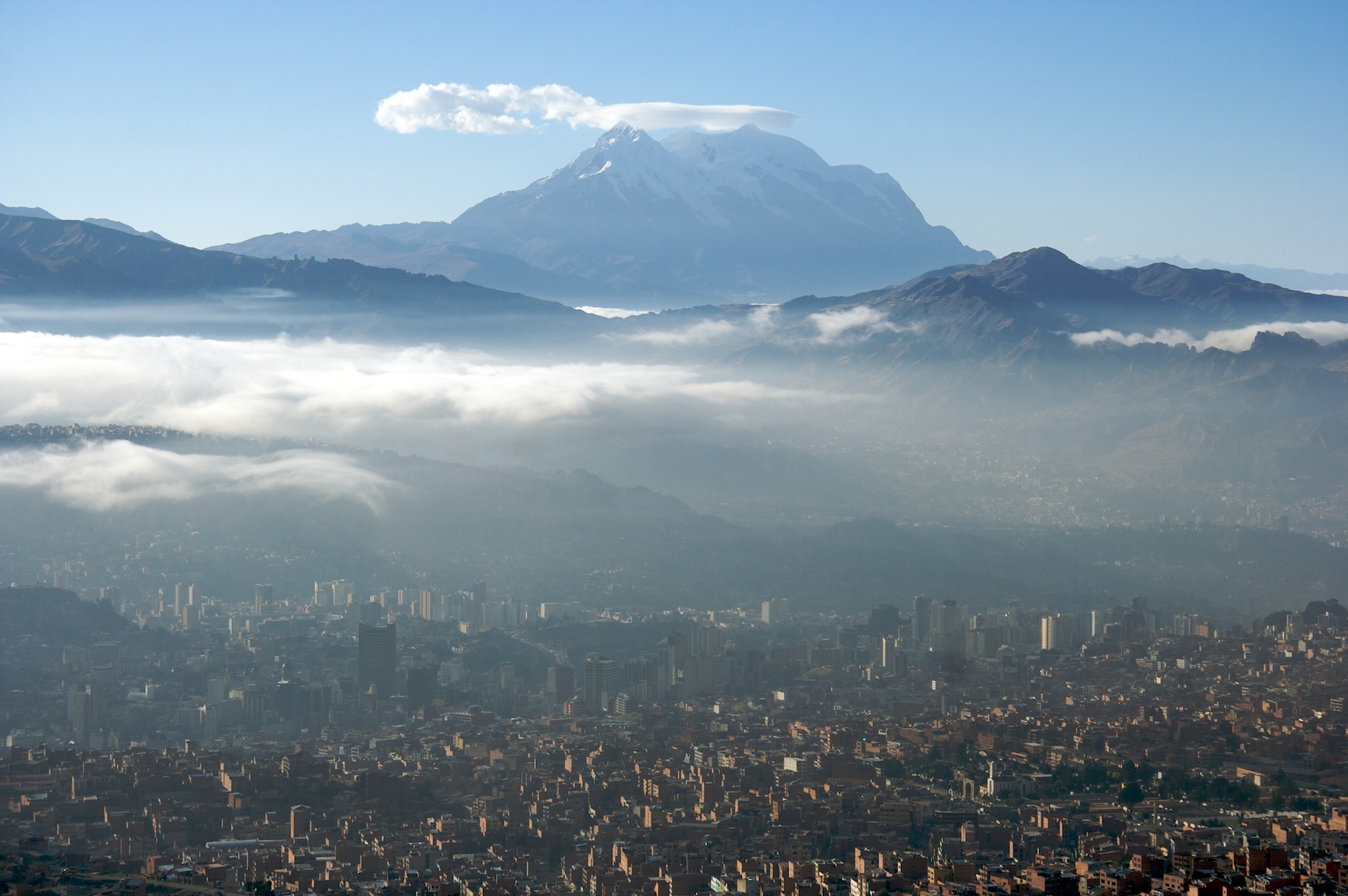
Metropolitan Area of La Paz (English)View of Metro La Paz, looking south toward Illimani

Flag
SealMotto: "Los discordes en concordia, en paz y amor se juntaron y pueblo de paz fundaron para perpetua memoria" La Paz Department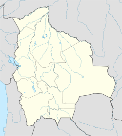
 "Area Metropolitana de La Paz"
Coordinates: 16°30′S 68°09′W / 16.5°S 68.15°WCoordinates: 16°30′S 68°09′W / 16.5°S 68.15°W Country  Bolivia
Departament La Paz Department (Bolivia) Province Pedro Domingo Murillo Province Foundation October 20, 1548 by Alonso de Mendoza Independence July 16, 1809 Area - City 472 km2 (182.2 sq mi) Elevation 3,640 m (11,942 ft) Population - Metro 2,364,235 Time zone -4 Area code(s) 2 Website www.ci-lapaz.gov.bo/ Metro La Paz (Official Name: Area Metropolitana de La Paz) is located on the west side of Bolivia, with the population of more than 2.3 million inhabitants[1] joining the cities of La Paz, El Alto,and Viacha, making it the most populous urban area of Bolivia, on the altitude of 4,000 it makes it the highest metropolitan city on the world.
Contents
History
Control from the Inca lands had been entrusted to Pedro de la Gascaa Spanish governor of Peru who was said by the Spanish king (and Holy Roman Emperor) Emperor Charles V to found a new city. Gasca commanded captain Alonso de Mendoza to found a new city commemorating the end of the civil wars in Peru; the city of La Paz was founded on October 20, 1548.
Founded in 1548 by the Spanish conquistadors at the site of the Native American settlement of Laja, the full name was originally Nuestra Señora de La Paz (meaning Our Lady of Peace). The name commemorated the restoration of peace after having a civil war between Gonzalo Pizarro and Blasco Núñez Vela the first viceroy of Peru. The city was later moved to its present location in the valley of Chuquiago Marka in where the metropilitan area begun.[2]
In 1549, Juan Gutierrez Paniagua was ordered to design an urban plan that would designate sites for public areas, plazas, official buildings, and a cathedral. "La Plaza de los Españoles", which is known today as the Plaza Murillo, was chosen as the location for government buildings as well as the Metropolitan Cathedral.
After the city was built Spain controlled La Paz with a firm grip and the Spanish king had the last word in all matters political. In 1781, for a total of six months, a group of Aymara people laid siege to the no longer peaceful city of La Paz. Under the leadership of Tupac Katari, they destroyed churches and government property. Thirty years later Indians laid a two-month siege on La Paz - where and when the legend of the Ekeko is set. In 1809 the struggle for independence from the Spanish rule brought uprisings against the royalist forces. It was on July 16, 1809 that Pedro Domingo Murillo famously said that the Bolivian revolution was igniting a lamp that nobody would be able to turn-off. This formally marked the beginning of the Liberation of South America from Spain. Pedro Domingo Murillo was hanged at the Plaza de los Españoles that night, but his name would be eternally remembered in the name of the plaza forever, and he would be remembered as the voice of revolution across South America.
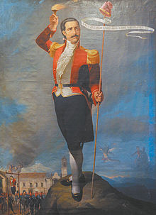 Pedro Domingo Murillo
In 1825 after the independence of Bolivia, the city's full name was changed to La Paz de Ayacucho (meaning The Peace of Ayacucho) in commemoration of the decisive victory over the Spanish army at Battle of Ayacucho in the course of the Spanish American wars of independence.
In 1898, La Paz was made the de facto seat of the national government, with Sucre remaining the nominal historical as well as judiciary capital. This change reflected the shift of the Bolivian economy away from the largely exhausted silver mines of Potosí to the exploitation of tin near Oruro, and resulting shifts in the distribution of economic and political power among various national elites.[3]
When the new built railways from Lake Titicaca and Arica reached the rim of the canyon, where the La Paz terminus, railyards and depots were built along with a settlement of railway workers (a spur line down into the canyon opened in 1905). In 1925 the airfield was built as base for the new air force, which attracted additional settlement. In 1939 El Alto's first elementary school opened. El Alto started to grow tremendously in the 1950s, when the settlement was connected to La Paz' water supply (before that all water had to be transported from La Paz in tank vehicles) and building land in the canyon became more and more short and expensive. In an administrative reform on March 6, 1985 the district of El Alto and surroundings was politically separated from the City of La Paz (this date is officially referred to and celebrated as the city's "founding day"). In 1987 El Alto was formally incorporated as a city. In 1994, the city became the seat of the Roman Catholic Diocese of El Alto.
From 2003 to 2005, access from La Paz to the International Airport, as well to oil and gas supplies, were frequently blocked by protesting El Alto social leaders, who have become some of the most powerful players in the politics of Bolivia. El Alto was - and remains - one of the major centers of the Bolivian gas conflict, during the conflict 70 civilians were killed under police repression ordered by President Gonzalo Sánchez de Lozada.
Geography and climate
La Paz Climate chart (explanation) J F M A M J J A S O N D 1141761071766618633184131838171101711317228183411944819694186Average max. and min. temperatures in °C Precipitation totals in mm Source: BBC Weather Imperial conversion J F M A M J J A S O N D 4.563434.263432.664431.364390.564370.363340.463340.563361.164371.666391.966433.76443Average max. and min. temperatures in °F Precipitation totals in inches Located at 16°30′0″S 68°08′0″W / 16.5°S 68.133333°W (-16.5, -68.1333), La Paz is built in a canyon created by the Choqueyapu River (now mostly built over), which runs northwest to southeast. The city's main thoroughfare, which roughly follows the river, changes names over its length, but the central tree-lined section running through the downtown core is called the Prado.
The geography of La Paz (in particular the altitude) reflects society: the lower areas of the city are the more affluent areas. While many middle-class residents live in high-rise condos near the center, the houses of the truly affluent are located in the lower neighborhoods southwest of the Prado. And looking up from the center, the surrounding hills are plastered with makeshift brick houses of those of less economic fortune.
The satellite city of El Alto, in which the airport is located, is spread over a broad area to the west of the canyon, on the Altiplano.
La Paz is renowned for its unique markets, very unusual topography, and traditional culture.
Under the Koppen climate classification, La Paz has a Subtropical highland climate. Owing to the altitude of the city, temperatures are consistently cool throughout the year, though the diurnal temperature variation is typically large. The city has a relatively dry climate, with rainfall occurring mainly in the slightly warmer months of November to March. The sun passes directly overhead in late October and mid February.
La Paz is located in the valleys of the Andes, and is closer to the Eastern split of the Altiplano region. Therefore, it is closer to the famous mountains such as the Illimani (guardian of La Paz), Huayna Potosi, Mururata, and Illampu. On the Western side of the Altiplano divide, about an hour to the West of the La Paz, is the site of the tallest mountain in Bolivia and 9th tallest mountain in the Andes, the Sajama Volcano. In July 1994, an earthquake rated at 8.2 struck just 200 miles north of La Paz, the largest earthquake since the Sumbawa earthquake of 1977. Part of the water supply is derived from glacier, which are becoming a less reliable source of water.[4]
Transportation
Airport
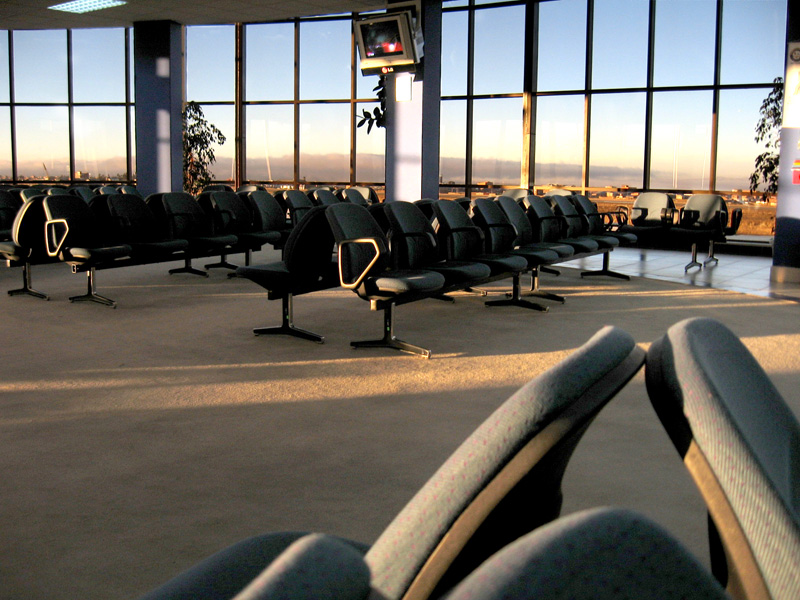
 New Look of El Alto International Airport
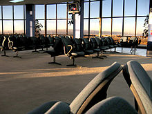
La Paz is served by El Alto International Airport (IATA code: LPB), which is situated eight miles (14 km) south-west of La Paz. At an elevation of 4,061 metres (13,323 ft), it is one of the highest major airports in the world. Airport facilities include a bank, bars, car rentals, restaurants, and duty-free shops. The runway has a length of 4,000 metres (13,123 ft) (or 2.5 miles).
Additionally, it is the second airport in the Western Hemisphere, and the third airport in the world, to successfully pass the International Civil Aviation Organization's (ICAO) Universal Security Audit Program (USAP).
Bus
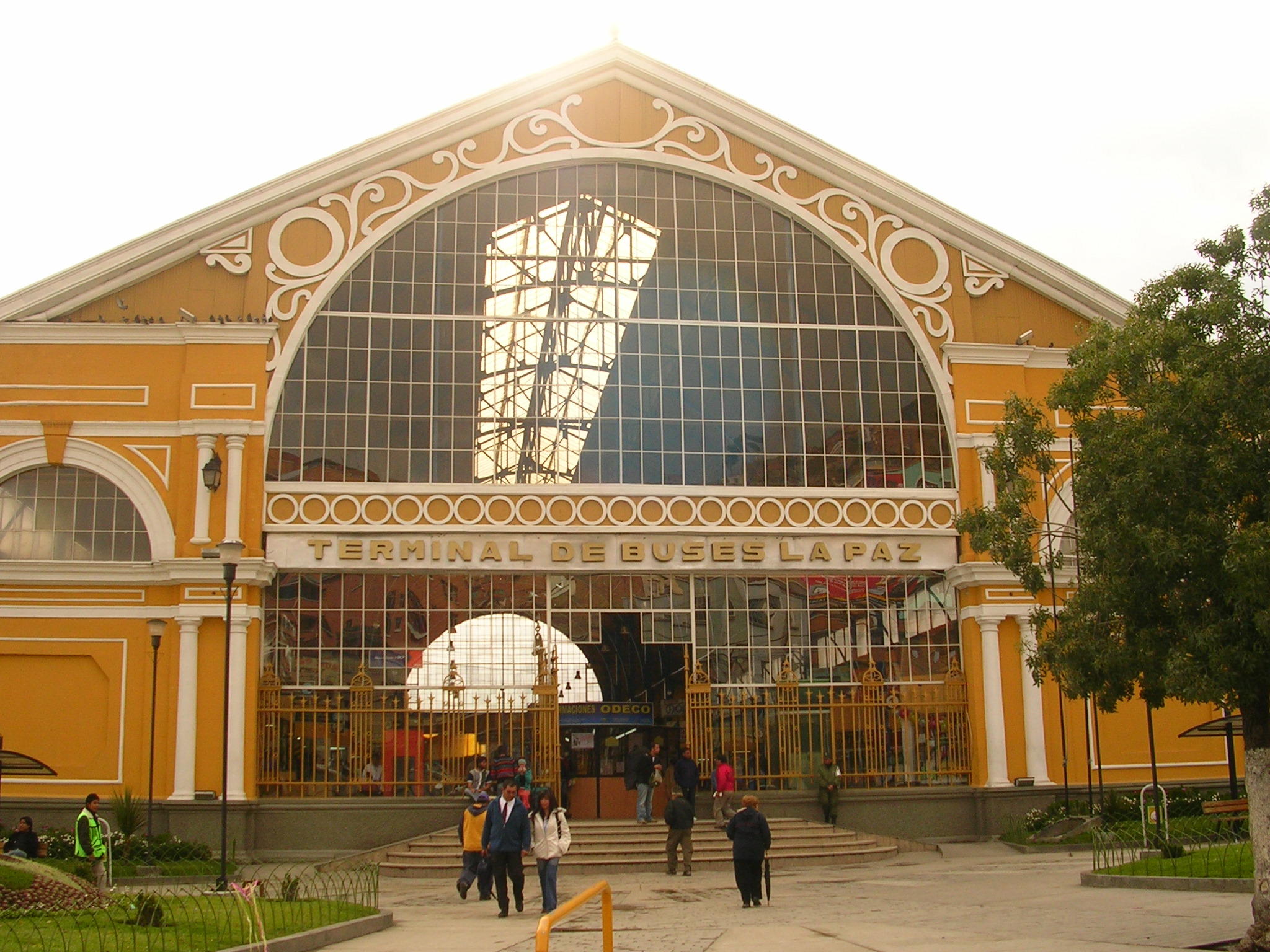
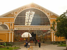 Bus Station.
La Paz Bus Station, previously bus and train station, was built by the French architect Gustave Eiffel who designed the Eiffel Tower in France. The main gateway for transporting intercities bus travel in La Paz with several daily departs to all the main Bolivian cities. Bus Terminal in La Paz is the main city bus station. The city is connected by road with the city of Oruro where you can access the cities of Sucre, Potosí and south of the country. There is an important road that connects the road to Oruro in the cities of Cochabamba and Santa Cruz. There are also access roads to paviementados Copacabana and Tiwanaku to the west, near the Lake Titicaca, which continues until the city of Cuzco via the border town of Desaguadero. There are also roads north to get to The Yungas crossing the Andes Mountains.
The bus terminal has daily departures to major cities. There are also trips to other cities in countries like Chile and Peru. For departures to smaller cities and towns within the department, using informal stations located in Villa Fatima (departures to Los Yungas, Beni and Pando, Upper San Pedro (outputs Apolo) and near the General Cemetery (outputs Copacabana and other nearby cities to Lake Titicaca , and also Tiwanacu, Desaguadero where you can go to Peru).
Communication
- The postal service is run by 'ECOBOL' (National Company) which has its headquarters in La Paz. There are other companies offering courier and transport logistics courier nationally and internationally.
- The private telecommunications company 'Entel' is located in the city. Provides services telephony, Internet, cell phone, data and voice. The telephone cooperative Cotel is responsible for managing much of their phones and now offers Internet services and cable television among others.
- Area Code: 2
- Country Code: 591
- The main daily newspapers in circulation are: 'La Razon, 'El Diario, 'La Prensa, 'Jornada and 'El Alteño' . Other papers of local importance are: Extra and PEOPLE. There are also several other publications and weekly magazines.
- There are 18 television channels with offices in La Paz. Channel 7 is state property. The main ones are: Unitel, ATB Bolivia, Red Uno, Bolivision, Red PAT. Channel 13 is managed by the Universidad Mayor de San Andres. Two local companies offer cable television service as TV and Multivision Cotel.
International relations
Twin towns - Sister cities
La Paz is part of the Union of Capital Cities Latin America[5] from October 12, 1982 establishing brotherly relations with the following cities:
 Spain, Madrid[6]
 Paraguay, Asunción
 Colombia, Bogotá
 Argentina, Buenos Aires
 Venezuela, Caracas
 Guatemala, Guatemala City
 Cuba, La Habana
 Brazil, Rio de Janeiro
 Costa Rica,, San Jose
 Puerto Rico San Juan
 El Salvador, San Salvador
 Chile, Santiago
 Dominican Republic, Santo Domingo
 Portugal, Lisboa
 Honduras, Tegucigalpa
References
- ^ [1]
- ^ [2] La Paz. (2008). In Encyclopædia Britannica. Retrieved January 16, 2010, from Encyclopædia Britannica Online
- ^ [3] "La Paz," Microsoft Encarta Online Encyclopedia 2008. Retrieved November 10, 2008. Archived 2009-10-31.
- ^ "Glacier threat to Bolivia capital". BBC News. December 4, 2009. http://news.bbc.co.uk/2/hi/science/nature/8394324.stm. Retrieved May 12, 2010.
- ^ document of twinning the capitals of Latin America
- ^ Madrid city council webpage "Mapa Mundi de las ciudades hermanadas". Ayuntamiento de Madrid. http://www.munimadrid.es/portal/site/munimadrid/menuitem.dbd5147a4ba1b0aa7d245f019fc08a0c/?vgnextoid=4e84399a03003110VgnVCM2000000c205a0aRCRD&vgnextchannel=4e98823d3a37a010VgnVCM100000d90ca8c0RCRD&vgnextfmt=especial1&idContenido=1da69a4192b5b010VgnVCM100000d90ca8c0RCRD Madrid city council webpage.
External links
Listen to this article (info/dl)
 This audio file was created from a revision of Metro La Paz dated 2005-04-16, and does not reflect subsequent edits to the article. (Audio help)More spoken articles
Capitals of South America  La Paz Department
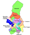
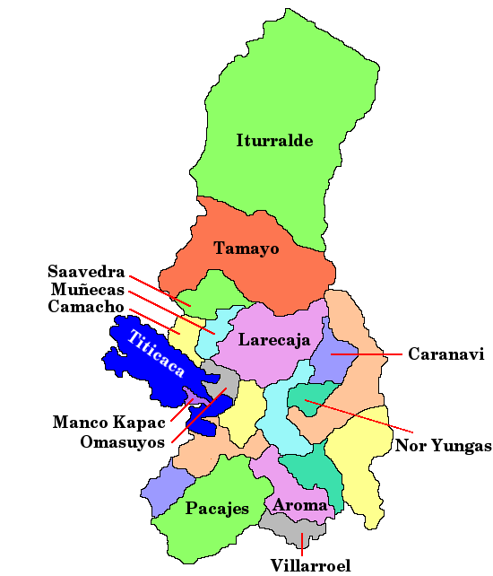
Capital: La Paz Provinces Abel Iturralde • Aroma • Bautista Saavedra • Caranavi • Camacho • Franz Tamayo • Gualberto Villarroel • Ingavi • Inquisivi • José Manuel Pando • Larecaja • Loayza • Los Andes • Manco Kapac • Murillo • Muñecas • Nor Yungas • Omasuyos • Pacajes • Sud Yungas
Municipalities
(and seats)Achacachi (Achacachi) • Achocalla (Achocalla) • Alto Beni (Caserío Nueve) • Ancoraimes (Ancoraimes) • Apolo (Apolo) • Aucapata (Aucapata) • Ayata (Ayata) • Ayo Ayo (Ayo Ayo) • Batallas (Batallas) • Cairoma (Cairoma) • Cajuata (Cajuata) • Calacoto (Calacoto) • Calamarca (Calamarca) • Caquiaviri (Caquiaviri) • Caranavi (Caranavi) • Catacora (Catacora) • Chacarilla (Chacarilla) • Charaña (Charaña) • Chulumani (Chulumani) • Chuma (Chuma) • Collana (Collana) • Colquencha (Colquencha) • Colquiri (Colquiri) • Comanche (Comanche) • Combaya (Combaya) • Copacabana (Copacabana) • Coripata (Coripata) • Coro Coro (Coro Coro) • Coroico (Coroico) • Curva (Curva) • Desaguadero (Desaguadero) • El Alto (El Alto) • Escoma (Escoma) • General Juan José Pérez (Charazani) • Guanay (Guanay) • Guaqui (Guaqui) • Huarina (Huarina) • Ichoca (Ichoca) • Inquisivi (Inquisivi) • Irupana (Irupana) • Ixiamas (Ixiamas) • Jesús de Machaca (Jesús de Machaca) • La Asunta (La Asunta) • La Paz (La Paz) • Laja (Laja) • Licoma Pampa (Licoma) • Luribay (Luribay) • Malla (Malla) • Mapiri (Mapiri) • Mecapaca (Mecapaca) • Mocomoco (Mocomoco) • Nazacara de Pacajes (Nazacara) • Palca (Palca) • Palos Blancos (Palos Blancos) • Papel Pampa (Papel Pampa) • Patacamaya (Patacamaya) • Pelechuco (Pelechuco) • Pucarani (Pucarani) • Puerto Acosta (Puerto Acosta) • Puerto Carabuco (Puerto Carabuco) • Puerto Pérez (Puerto Perez) • Quiabaya (Quiabaya) • Quime (Quime) • San Andrés de Machaca (San Andrés de Machaca) • San Buenaventura (San Buenaventura) • San Pedro de Curahuara (San Pedro de Curahuara de Carangas) • San Pedro de Tiquina (San Pedro de Tiquina) • Santiago de Callapa (Callapa) • Santiago de Huata (Santiago de Huata) • Santiago de Machaca (Santiago de Machaca) • Sapahaqui (Sapahaqui) • Sica Sica (Sica Sica) • Sorata (Sorata) • Tacacoma (Tacacoma) • Taraco (Taraco) • Teoponte (Teoponte) • Tiwanaku (Tiwanaku) • Tipuani (Tipuani) • Tito Yupanqui (Tito Yupanqui) • Umala (Umala) • Umanata (Umanata) • Viacha (Viacha) • Waldo Ballivián (Tumarapi) • Yaco (Yaco) • Yanacachi (Yanacachi)
Mountains Alpamayo Chico • Condoriri • Anallajsi • Ancohuma • Chachacomani • Chacaltaya • Illampu • Illimani • Huayna Potosí • MururataProtected areas Apolobamba • Cotapata • Madidi • Pilón Lajas
Categories:- Capitals in South America
- La Paz
- Populated places established in 1548


Wikimedia Foundation. 2010.