- Oruro, Bolivia
-
Oruro 

Flag
Coat of armsLocation within Bolivia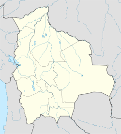
 Oruro
OruroCoordinates: 17°58′S 67°07′W / 17.967°S 67.117°W Country  Bolivia
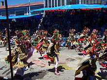
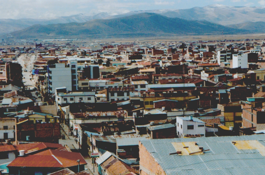
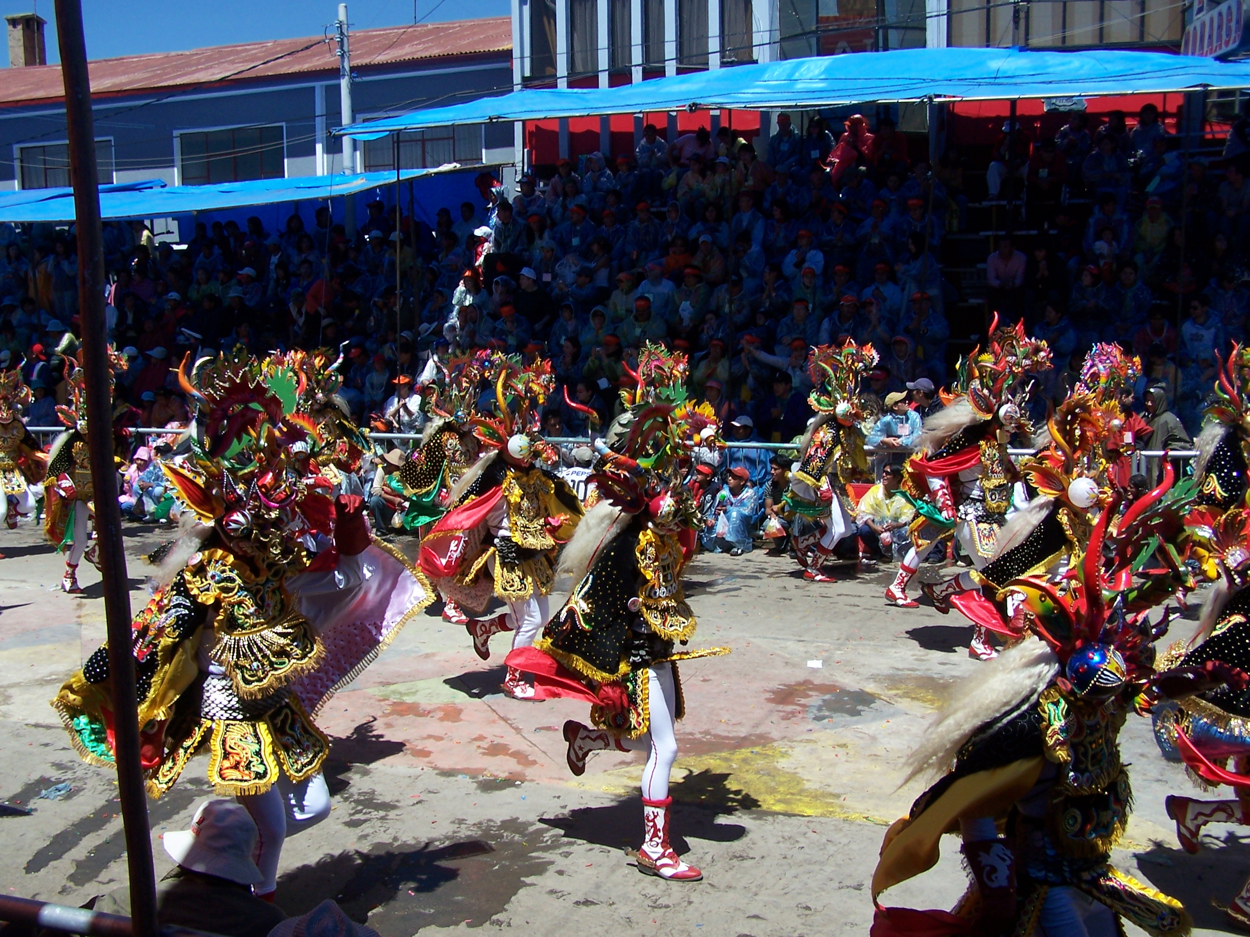
Department Oruro Department Province Cercado Province Founded November 1, 1606 Government – Mayor Rossío Pimentel Elevation 12,159 ft (3,706 m) Population [1] – Total 235,393 2010 calculation Time zone UTC-4 Website http://www.preforuro.gov.bo/ Oruro is a city in Bolivia with a population of 235,393 (2010 calculation)[1], located about equidistant between La Paz and Sucre at approximately 3710 meters above sea level. It is the capital of the department of Oruro. The city was first founded on November 1, 1606 by Don Manuel Castro de Padilla. as a silver mining center in the Urus region. At the time, it was named Real Villa de San Felipe de Austria after the Spanish monarch, Philip III. It was eventually abandoned as the silver mines became exhausted. Oruro was reestablished in the late nineteenth century, as a tin mining center. For a time, the La Salvadora tin mine was the most important source of tin in the world. Gradually, this resource was also exhausted, and Oruro again went into a decline. The city does manage, however, to attract tourists to its carnival, the Carnaval de Oruro, considered one of the great folkloric events in South America for its masked " diablada".
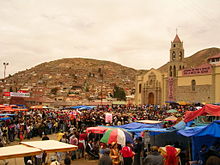 Santuario de la Virgen del Socavón en los Carnavales 2007
Oruro was named after the native tribe "Uru-Uru".
The city is the seat of the Roman Catholic Diocese of Oruro. The Oruro Symphony Orchestra is based in Oruro. Aymara painter and printmaker Alejandro Mario Yllanes (1913–1960) was born here.[2]
Contents
Climate
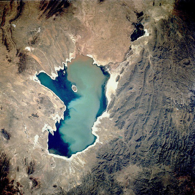
 Poopó Lake
The city of Oruro lies north of the salty lakes Uru-Uru and Poopó and it is just three hours (by bus) south from La Paz. Located at an altitude of 3709 meters above sea level, Oruro its well known for its cold weather. Warmer temperatures generally take place during August, September and October, after the worst of the winter chills and before the summer rains. From May to early July, night time temperatures combined with cool wind can bring the temperature down to about -20 °C. Summers are warmer, but despite the fact of being an arid area, there's quite a lot of rainfall between November and March.
Main attractions
- Museo Patiño, former residence of "tin baron" Simón Iturri Patiño
- Museo Mineralógico (Mineralogical Museum): has exhibits of precious stones, minerals, and fossils
- Museo Etnográfico Minero (Ethnographical Mining Museum): housed in a mine tunnel, depicts methods of Bolivian mining
- Museo Nacional Antropológico Eduardo López Rivas(National Anthropological Museum): displays tools and information on the Chipayas and Urus tribes and Carnaval de Oruro.
- Churches: Catedral Nuestra Señora de la Asunción, Santuario de la Virgen del Socavón, Iglesia de Cunchupata
- Inti Raymi, a mine
References
- ^ World Gazetteer
- ^ Raynor, Vivien. ART; Works by a Vanished Bolivian Painter. New York Times. 5 April 1992 (retrieved 2 May 2009)
External links
- Oruro's full information about hotels, history, carnival, tourism, pictures, videos, and news.
- Weather in Oruro
- Carnaval de Oruro
- Oruro's Carnival
- Oruro's Carnival
- Oruro
Coordinates: 17°58′S 67°07′W / 17.967°S 67.117°W
 Oruro DepartmentCapital: Oruro
Provinces 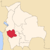
Municipalities (and seats) Andamarca (Andamarca) • Antequera (Antequera) • Belén de Andamarca (Belén de Andamarca) • Caracollo (Caracollo) • Carangas (Carangas) • Challapata (Challapata) • Chipaya (Chipaya) • Choquecota (Choquecota) • Coipasa (Coipasa) • Corque (Corque) • Cruz de Machacamarca (Machacamarca) • Curahuara de Carangas (Curahuara de Carangas) • El Choro (El Choro) • Escara (Escara) • Esmeralda (Esmeralda) • Eucaliptus (Eucaliptus) Huachacalla (Huachacalla) • Huayllamarca (Huayllamarca) • La Rivera (La Rivera) • Machacamarca (Machacamarca) • Oruro (Oruro) • Pampa Aullagas (Pampa Aullagas) • Pazña (Pazña) • Sabaya (Sabaya) • Salinas de Garcí Mendoza (Salinas de Garcí Mendoza) • Santiago de Huari (Santiago de Huari) • Santuario de Quillacas (Santuario de Quillacas) • Todos Santos (Todos Santos) • Toledo (Toledo) • Totora (Totora) • Turco (Turco) • Huanuni (Huanuni) • Poopó (Poopó) • Yunguyo del Litoral (Yunguyo)Categories:- Populated places in the Oruro Department
- Tin mines in Bolivia
- Populated places established in 1606
- Bolivia geography stubs


Wikimedia Foundation. 2010.