- Curahuara de Carangas
-
Curahuara de Carangas — Town — Location within Bolivia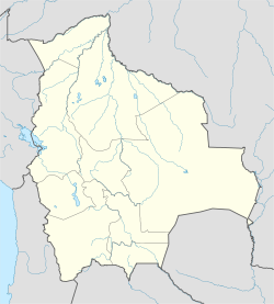
 Curahuara de Carangas
Coordinates: 17°52′S 68°26′W / 17.867°S 68.433°W Country  Bolivia
Department Oruro Department Province Sajama Province Municipality Curahuara de Carangas Municipality Canton Curahuara de Carangas Canton Elevation 12,841 ft (3,914 m) Population (2001) – Total 1,314 Time zone BST (UTC-4) Curahuara de Carangas is a small town in the Bolivian Oruro Department. It is the seat of the Sajama Province. [1] In 2009 it had an estimated population of 1,581.[2]
See also
References
Coordinates: 17°52′S 68°26′W / 17.867°S 68.433°W
 Oruro DepartmentCapital: Oruro
Provinces 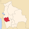
Municipalities (and seats) Andamarca (Andamarca) • Antequera (Antequera) • Belén de Andamarca (Belén de Andamarca) • Caracollo (Caracollo) • Carangas (Carangas) • Challapata (Challapata) • Chipaya (Chipaya) • Choquecota (Choquecota) • Coipasa (Coipasa) • Corque (Corque) • Cruz de Machacamarca (Machacamarca) • Curahuara de Carangas (Curahuara de Carangas) • El Choro (El Choro) • Escara (Escara) • Esmeralda (Esmeralda) • Eucaliptus (Eucaliptus) Huachacalla (Huachacalla) • Huayllamarca (Huayllamarca) • La Rivera (La Rivera) • Machacamarca (Machacamarca) • Oruro (Oruro) • Pampa Aullagas (Pampa Aullagas) • Pazña (Pazña) • Sabaya (Sabaya) • Salinas de Garcí Mendoza (Salinas de Garcí Mendoza) • Santiago de Huari (Santiago de Huari) • Santuario de Quillacas (Santuario de Quillacas) • Todos Santos (Todos Santos) • Toledo (Toledo) • Totora (Totora) • Turco (Turco) • Huanuni (Huanuni) • Poopó (Poopó) • Yunguyo del Litoral (Yunguyo)Categories:- Geography articles needing translation from German Wikipedia
- Populated places in the Oruro Department
- Bolivia geography stubs


Wikimedia Foundation. 2010.