- Interstate 74 in North Carolina
-
This article is about the section of Interstate 74 in North Carolina. For the entire length of the highway, see Interstate 74.
Interstate 74

Route information Maintained by NCDOT Length: 77 mi[1] (124 km) Existed: 1997 – present Major junctions West end:  I-77 at the VA line near Cana, VA I-77 near Mount Airy
 US 52 near Mount Airy
 I-85 near High Point
 US 311 from Asheboro to Winston-Salem

 I-73 / US 220 near Asheboro


 US 15 / US 401 / US 501 in Laurinburg

 I-95 / US 301 near Lumberton
East end: 
 US 74 / NC 41 near Lumberton
Location Counties: Surry, Guilford, Randolph, Montgomery, Robeson Highway system Main route of the Interstate Highway System
Main • Auxiliary • Business←  NC 73
NC 73US 74 →In the U.S. state of North Carolina, Interstate 74 (I-74) is an Interstate Highway that is partially completed. Currently in four distinct segments in the state; when completed, it will traverse in a southeasterly direction from Virginia to South Carolina, connecting the cities of Winston-Salem, High Point, Rockingham, and Whiteville.
Contents
Route description
As of November 22, 2010, there is a total of 77 miles (124 km) of Interstate 74, broken in four sections across the Piedmont Triad, Sandhills, and Cape Fear regions in the state.
Piedmont Triad
The first section of I-74 begins at the Virginia state line (overlapped with I-77 for approximately 4 miles (6.4 km). After separation, it goes east and connects to US 52 near Mount Airy, where the first section ends.
Future I-74 is signed along US 52 from Mount Airy to Bethania, where it will then separate onto the new Winston-Salem Northern Beltway and go east around Winston-Salem before connecting to existing US 311 south of Kernersville. Travelers wanting to connect between the first and second section of I-74 should stay on US 52 through downtown Winston-Salem, take I-40 east, then finally US 311 south towards High Point.[2][3][4]
The second section of I-74 is called the High Point East Belt, which begins at mile marker 65 in High Point to mile marker 79 near Glenola. It connects High Point with both I-85 Business and I-85. Construction is scheduled to be completed in 2012 that will extend the freeway, along US 311, to I-73 at Sophia.[5]
Future I-74 starts again in Sophia, overlapped with I-73, going south to Ulah. The freeway is already completed, but it is not up to full interstate standards yet; it bypasses the city of Asheboro.
The third section of I-74 is overlapped with I-73 and US 220 between (US 220) mile markers 51-24 (26 miles (42 km)). It bypasses the towns of Seagrove, Biscoe and Candor. Visitor centers (completed in 2010) are located eastbound and westbound at mile marker 44.[6] After Exit 24 (Alternate U.S. 220), the freeway continue as Future I-73 and Future I-74 for another 16 miles (26 km) towards Rockingham before converting into an at-grade expressway.
Sandhills
At Rockingham, Future I-74 separates with Future I-73/US 220 and joins US 74, where it goes south around Rockingham and Hamlet. Between Hamlet and Laurinburg is an at-grade expressway that will eventually be upgraded to Interstate standards.[7][8] At Laurinburg, the Laurinburg Bypass was at the standard North Carolina freeway grade and signed as I-74 in 2008; however, NCDOT had to remove the signage the following year when FHWA ruled against using them until the freeway was up to Interstate standards.
The fourth section of I-74 is officially named the Native American Highway, completed in 2008, this (19 miles (31 km)) section streaches from Maxton to south of Lumberton, connecting with I-95/US 301.[9] After NC 41, I-74 ends for the final time as the highway continues on as an at-grade expressway signed as Future I-74/US 74.[10]
Cape Fear
Future I-74 continues to follow US 74, going through the city of Whiteville and bypassing the town of Lake Waccamaw. Before the town of Bolton, it will separate from US 74 onto a proposed new freeway towards Shallotte, then go west on the proposed extension of the Carolina Bays Parkway into South Carolina. The entire Cape Fear section of I-74 is still under a Feasibility Study with several possible routing or options it may take before connecting South Carolina; this suggest that construction may not begin until 2020 at the earliest and will likely be the last section of I-74 to be completed.[11]
Auxiliary routes
 Interstate 274, is a proposed (but not an officially submitted request to AASHTO) bypass route that will make-up the western-half of the Winston-Salem Northern Beltway.[3]
Exit list
County Location Mile[12] # Destinations Notes Surry I-74 overlaps with Interstate 77 (Virginia state line to exit 101) Pine Ridge 5 5 I-77 south – StatesvilleSouth end of I-77 overlap 6 6  NC 89 – Mount Airy
Mount Airy 8 8 Red Brush Road 11 11  US 601 – Mount Airy, Dobson
13 13 Park Drive 17 17 US 52 north – Mount AiryEnd of I-74 east/Begin of I-74 west; south end of US 52 overlap 21 136 Cook School Road Proposed Upgrade of Pilot Mountain Parkway to Interstate Standards (Unfunded)[2] 22 135 W. Main St. – Pilot Mountain Pilot Mountain 23 134  NC 268 – Pilot Mountain, Elkin
26 131 Pilot Knob Park Rd. – Pilot Mountain State Park Stokes 28 129 Perch Rd. – Pinnacle Forsyth King 34 123 S. Main St. – King, Tobaccoville Proposed Upgrade of John M. Gold Freeway to Interstate Standards (Unfunded)[2] 35 122 Moore-RJR Drive Rural Hall 37 120 Westinghouse Road 39 118  NC 65 – Rural Hall, Bethania
Bethania 40 I-274 west / US 52 southProposed Winston-Salem Northern Beltway (Unfunded)[3] Winston-Salem 43  NC 8 (Germanton Road)
45 Baux Mountain Road Walkertown 48 US 311 (New Walkertown Road)51  US 158 (Reidsville Road)
Kernersville 53 

 I-40 Bus. / US 421 / NC 150
Winston-Salem 56  I-40 – Greensboro, Statesville
57 US 311 north59 59 Union Cross Road Proposed Upgrade to Interstate Standards (Unfunded)[4] 60 60 High Point Road 63 63  NC 66 – Kernersville
Guilford High Point 65 65 North Main Street Begin of I-74 east/End of I-74 west 66 66 Johnson Street 67 67  NC 68 (Eastchester Drive) to I-40 – High Point, Greensboro
To John Wesley College and Oak Hollow Mall 69 69 Greensboro Road To High Point University 70 70 Kivett Drive 71 71A East Green Drive 71B 

 I-85 Bus. / US 29 / US 70 – Thomasville, Greensboro
75 75 I-85 – Charlotte, GreensboroOpened 22 Nov 2010[13] Randolph Glenola 79 79 Cedar Square Road End of I-74 east/Begin of I-74 west; Opened 22 Nov 2010[13] Sophia 85 US 311Under Construction (Projected 2012)[5] 87 I-73 northI-74 overlaps with Interstate 73 Richmond Rockingham 156 306 
US 74 Bus. – RockinghamProposed Upgrade to Interstate Standards (Unfunded)[7][8] 158 308 Galestown Rd. – Rockingham, Cordova 160 311  US 1 to US 220 – Rockingham, Southern Pines, Cheraw
165 316  NC 177 – Hamlet
Hamlet 168 319  NC 38 – Hamlet, Bennettsville
169 320  NC 381 – Hamlet, Ghio
170 321
US 74 Bus. west – HamletScotland Old Hundred  NC 144 east (Morgan Street)
Proposed Upgrade of Laurinburg Bypass to Interstate Standards (Unfunded)[14] 181 181
US 74 Bus. east – Laurinburg182 182  NC 79 – Laurinburg, Gibson
Laurinburg 183 183 US 15 / US 401 / US 501 north – Fayetteville, Aberdeen, Pinehurst, Bennettsville184 184 

US 15 Bus. / US 401 Bus. – Laurinburg185 185 US 501 south – Raemon, Rowland186 186 Highland Rd. – Laurinburg, E. Laurinburg 187 187
US 74 Bus. – East Laurinburg, Maxton190 190  Airport Rd. – Laurinburg-Maxton Airport, Maxton
Robeson Maxton 191 191  NC 71 – Maxton, Red Springs
194 194A
US 74 Bus. west – MaxtonBegin of I-74 east/End of I-74 west 194B 
US 74 Alt. east – Pembroke197 197 Cabinet Shop Road 200 200  NC 710 – Pembroke, Red Springs
203 203 Dew Road - Pembroke 207 207 Back Swamp Road 209 209A I-95 north / US 301 north – Lumberton, Fayetteville209B I-95 south / US 301 south – Rowland, DillonLumberton 210 210
US 74 Alt. west213 213 NC 41 – Lumberton, FairmontEnd of I-74 east/Begin of I-74 west 221  NC 72 west (Wilmington Highway) – Lumberton, Red Springs
Proposed Upgrade to Interstate Standards (Unknown) 222  NC 130 west – Fairmont
Columbus Evergreen 228  NC 242 (Haynes Lennon Highway) – Bladenboro
Proposed Upgrade to Interstate Standards (Unfunded)[11] Chadbourn 234 
 US 74 Bus. east / NC 130 east / NC 410 – Chadbourn, Bladenboro, Tabor City
236  US 76 west – Chadbourn, Fair Bluff
239 Union Valley Road – Union Valley Whiteville 241  US 701 – Whiteville, Clarkton
244
 US 74 Bus. / US 76 Bus. west to NC 214 – Whiteville, Lake Waccamaw
Hallsboro 248 Hallsboro Road – Hallsboro Lake Waccamaw 252 Chauncey Town Road – Lake Waccamaw Bolton 258  NC 211 – Bolton, Clarkton
259 NC 214 west – Lake Waccamaw260 US 74 / US 76 east – WilmingtonProposed New Freeway (Preliminary)[11] Brunswick Ash NC 211 – Bolton, SupplyCamp Branch Road Shallotte NC 130 – Shallotte, WhitevilleGrissettown  US 17 north – Shallotte, Supply
Proposed Carolina Bays Parkway (Preliminary)[11]  NC 904 – Seaside, Longwood
Carolina Shores US 17 south1.000 mi = 1.609 km; 1.000 km = 0.621 mi
Concurrency terminus • Closed/Former • Incomplete access • UnopenedHistory
The Intermodal Surface Transportation and Efficiency Act (ISTEA) of 1991 initially authorized the new high priority transportation corridor 5, tentatively known as Interstate 73, to travel from Michigan to South Carolina.[15] Because of several disputes to the routing, a compromise was reached in 1995, by Senator John Warner and Senator Lauch Faircloth, that extended Interstate 74 from its then current eastern terminus of Cincinnati, Ohio to overlap Interstate 73. In Virginia, I-74 would follow I-77 into North Carolina, while I-73 would go east to Roanoke then south along US 220 towards Greensboro.[16]ref>Justin Catanoso, "New Proposal for I-73 Stirs Triad Rivalry," Greensboro News & Record, April 14, 1995.</ref>[17] Another compromise, between Senator Lauch Faircloth and Senator Strom Thurmond, agreed to have both interstates enter South Carolina: I-73 south of Rockingham and I-74 south of Wilmington. After later amendments and the Transportation Equity Act for the 21st Century of 1996 (TEA-21), on July 25, 1996, AASHTO accepted Interstates 73/74 into the Interstate Highway System within the states of South Carolina, North Carolina, and Virginia.[18]
In the May of 1997, the first section of I-73/I-74 was established on a 26 miles (42 km) of existing and new freeway between Ulah and Candor along US 220.[19]
North Carolina Highway 752/Interstate 74 in Surry County
Predating I-74, NC 752 was established on a 1 mile (1.6 km) freeway connector between I-77 to NC 89 in 1994. It cost $10 million to build and was regarded simply as a place-holder for a future Interstate. Four years later, in 1998, the freeway was extended to US 601 and rebannered as I-74. On June 30, 1999, the freeway was extended an additional 5 miles (8.0 km) to US 52, south of Mount Airy.[20] In April of 2001, I-74 was overlapped with I-77 from the Virginia state line to exit 101.[21]
The American Indian Highway and Laurinburg Bypass
On September 26, 2008, a 19 miles (31 km) section of I-74/US 74 was opened between Maxton to NC 41 near Lumberton, known as the American Indian Highway.[10] The Laurinburg Bypass was also resigned I-74/US 74 at the same time.[14] The following year the Laurinburg Bypass was removed of its I-74 designation by NCDOT, during the Summer, after a ruling from the FHWA (it returned as Future I-74). The reason was that the section, though a freeway by North Carolina standards, it was not up to Interstate standards. It was also at this same time that NCDOT fixed a exit number error along mile markers 181-191.[14]
The High Point East Belt
On November 22, 2010, a 14 miles (23 km) section was added between North Main Street in High Point to Cedar Square Road near Glenola. This also includes the 6.4 miles (10.3 km) section of new freeway that opened between I-85 Business Cedar Square Road.[13][22]
Alternate names
Though the highway is commonly known as "I-74" throughout the state, the highway does have other known names it uses locally in areas.
- American Indian Highway - Official name of the 19 miles (31 km) section of I-74 in Robeson County (mile marker 191-213). It is named to honor the large American Indian population in Robeson County.[9]
- High Point East Belt - Road name in Guilford County.
Photo gallery
-
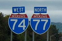
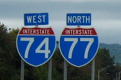
I-74 & I-77 near Pine Ridge (2006-10-28).
-

Pilot Mountain Parkway (2007-11-02).
-

I-73/I-74/US 220 near Biscoe (2006-10-28).
See also
- U.S. Route 74
- Carolina Bays Parkway
- I-73/74 North–South Corridor
- Interstate 73
- Interstate 77
- Winston-Salem Beltway
References
- ^ Federal Highway Administration Route Log and Finder List as of 2002-10-31
- ^ a b c "I-74 Segment 3". http://web.duke.edu/~rmalme/i74seg3.html. Retrieved 2011-01-01.
- ^ a b c "NCDOT: Winston-Salem Northern Beltway". http://www.ncdot.gov/projects/wsnb/default.html. Retrieved 2011-01-01.
- ^ a b "I-74 Segment 5". http://web.duke.edu/~rmalme/i74seg5.html. Retrieved 2011-01-01.
- ^ a b "I-74 Segment 7". http://web.duke.edu/~rmalme/i74seg7.html. Retrieved 2011-01-01.
- ^ "NCDOT: North Carolina Rest Area System". http://www.ncdot.org/travel/restareas/. Retrieved 2011-01-27.
- ^ a b "I-74 Segment 13A". http://web.duke.edu/~rmalme/i74seg13.html. Retrieved 2011-01-01.
- ^ a b "I-74 Segment 14". http://web.duke.edu/~rmalme/i74seg14.html. Retrieved 2011-01-01.
- ^ a b "Media Advisory: I-74 "The American Indian Highway" Naming Ceremony". https://apps.dot.state.nc.us/pio/releases/details.aspx?r=4259. Retrieved 2010-12-31.
- ^ a b "I-74 Segment 16". http://web.duke.edu/~rmalme/i74seg16.html. Retrieved 2011-01-01.
- ^ a b c d "NCDOT: I-74 Feasibility Study". http://www.ncdot.gov/projects/wsnb/default.html. Retrieved 2011-01-01.
- ^ "I-74 North Carolina Exit List". http://www.duke.edu/~rmalme/i74exit.html. Retrieved 2009-11-19.
- ^ a b c "New Highway 311 Bypass Section Opens Monday". http://www.myfox8.com/news/wghp-story-311-bypass-101121,0,5159858.story?track=rss. Retrieved 2010-12-31.
- ^ a b c "I-74 Segment 15". http://web.duke.edu/~rmalme/i74seg15.html. Retrieved 2011-01-01.
- ^ "Interstate 73/74 (Corridor 5)". http://www.aaroads.com/high-priority/corr05.html. Retrieved 2011-01-02.
- ^ Helen Lounsbury, "Road to Roanoke Vital, Group Says Lobbying for New Interstate," Greensboro News & Record, November 11, 1993.
- ^ Justin Catanoso, "New Interstates May Cross Triad," Greensboro News & Record, May 2, 1995.
- ^ "Why I-73/74 in North Carolina?". http://www.duke.edu/~rmalme/wh7374.html. Retrieved 2011-01-02.
- ^ "I-73 Segment 9/I-74 Segment 10". http://web.duke.edu/~rmalme/i73seg9.html. Retrieved 2011-01-01.
- ^ "I-74 Segment 2". http://web.duke.edu/~rmalme/i74seg2.html. Retrieved 2011-01-01.
- ^ "I-74 Segment 1". http://web.duke.edu/~rmalme/i74seg1.html. Retrieved 2011-01-01.
- ^ "NCDOT Opens I-74/US 311 Bypass Near High Point". https://apps.dot.state.nc.us/pio/releases/details.aspx?r=4268. Retrieved 2010-12-31.
 Interstate 74
Previous state:
VirginiaNorth Carolina Next state:
South CarolinaInterstate Highways in North Carolina Current Future Business Categories:- Interstate Highways in North Carolina
- Interstate 74
- Transportation in Winston-Salem, North Carolina
- Transportation in Surry County, North Carolina
- Transportation in Guilford County, North Carolina
- Transportation in Randolph County, North Carolina
- Transportation in Montgomery County, North Carolina
- Transportation in Robeson County, North Carolina


Wikimedia Foundation. 2010.