- Dobson, North Carolina
-
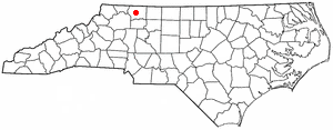
Dobson, North Carolina — Town — Location of Dobson, North Carolina
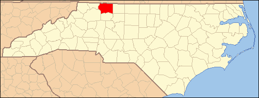
Coordinates: 36°23′30″N 80°43′16″W / 36.39167°N 80.72111°WCoordinates: 36°23′30″N 80°43′16″W / 36.39167°N 80.72111°W Country United States State North Carolina County Surry Area – Total 1.8 sq mi (4.6 km2) – Land 1.8 sq mi (4.6 km2) – Water 0.0 sq mi (0.0 km2) Elevation 1,257 ft (383 m) Population (2010) – Total 1,586 – Density 881.1/sq mi (344.8/km2) Time zone Eastern (EST) (UTC-5) – Summer (DST) EDT (UTC-4) ZIP code 27017 Area code(s) 336 FIPS code 37-17340[1] GNIS feature ID 0984238[2] Website www.dobson-nc.com Dobson is a town in Dobson Township, Surry County, North Carolina, United States. As of the 2000 census, the town population was 1,457. It is the county seat of Surry County[3]. Dobson is the home of the Shelton Vineyards, the largest winery in North Carolina.
Contents
Geography
Dobson is located at 36°23′30″N 80°43′16″W / 36.39167°N 80.72111°W (36.391698, -80.721126)[4].
According to the United States Census Bureau, the town has a total area of 1.8 square miles (4.7 km2), all of it land.
Demographics
As of the census[1] of 2000, there were 1,457 people, 555 households, and 339 families residing in the town. The population density was 813.8 people per square mile (314.3/km²). There were 594 housing units at an average density of 331.8 per square mile (128.1/km²). The racial makeup of the town was 75.84% White, 3.91% African American, 0.41% Native American, 19.42% from other races, and 0.41% from two or more races. Hispanic or Latino of any race were 25.81% of the population.
There were 555 households out of which 29.2% had children under the age of 18 living with them, 45.6% were married couples living together, 9.4% had a female householder with no husband present, and 38.9% were non-families. 33.7% of all households were made up of individuals and 18.4% had someone living alone who was 65 years of age or older. The average household size was 2.37 and the average family size was 3.03.
In the town the population was spread out with 23.0% under the age of 18, 11.9% from 18 to 24, 29.0% from 25 to 44, 18.9% from 45 to 64, and 17.2% who were 65 years of age or older. The median age was 35 years. For every 100 females there were 108.1 males. For every 100 females age 18 and over, there were 100.0 males.
The median income for a household in the town was $26,765, and the median income for a family was $34,792. Males had a median income of $22,050 versus $21,000 for females. The per capita income for the town was $19,346. About 17.8% of families and 23.3% of the population were below the poverty line, including 28.6% of those under age 18 and 22.9% of those age 65 or over.
History
Dobson was established as the county seat in 1853, replacing Rockford after all land in Surry County south of the Yadkin River was used to form Yadkin County. Dobson was named for prominent Rockford and Surry County citizen William Polk Dobson who was also the cousin of former president, James K. Polk.
Notable people
- Tabitha Ann Holton who became the first licensed female lawyer in the Southern United States in 1878. She practiced law in Dobson from 1878-1886.[1]
- Roy H. Park, broadcaster and publisher.
References
- ^ a b "American FactFinder". United States Census Bureau. http://factfinder.census.gov. Retrieved 2008-01-31.
- ^ "US Board on Geographic Names". United States Geological Survey. 2007-10-25. http://geonames.usgs.gov. Retrieved 2008-01-31.
- ^ "Find a County". National Association of Counties. http://www.naco.org/Counties/Pages/FindACounty.aspx. Retrieved 2011-06-07.
- ^ "US Gazetteer files: 2010, 2000, and 1990". United States Census Bureau. 2011-02-12. http://www.census.gov/geo/www/gazetteer/gazette.html. Retrieved 2011-04-23.
External links
- Official website
- Dobson Elementary School
- Central Middle School
- Surry Central High School
- Surry Community College
Categories:- Populated places in Surry County, North Carolina
- Towns in North Carolina
- County seats in North Carolina
Wikimedia Foundation. 2010.