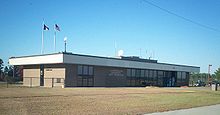
- Laurinburg-Maxton Airport
-
Laurinburg-Maxton Airport IATA: MXE – ICAO: KMEB – FAA LID: MEB Summary Airport type Public Operator Laurinburg-Maxton Airport Commission Location Stewartsville Township, Scotland County, near Maxton, North Carolina Elevation AMSL 220 ft / 67.1 m Coordinates 34°47′31″N 079°21′57″W / 34.79194°N 79.36583°WCoordinates: 34°47′31″N 079°21′57″W / 34.79194°N 79.36583°W Runways Direction Length Surface ft m 5/26 6,489 1,978 Concrete 13/31 3,753 1,144 Concrete - For the World War II use of the airport, see Laurinburg-Maxton Army Air Base
Laurinburg-Maxton Airport (IATA: MXE, ICAO: KMEB, FAA LID: MEB) is a public airport located three miles (5 km) north of the central business district (CBD) of Maxton and east of Laurinburg. Maxton is located primarily in Robeson County, North Carolina, USA while Laurinburg is in Scotland County, North Carolina, USA as is the airport proper. This general aviation airport covers 4,290 acres (1,736 ha) and has two runways. It is home of the United States Army Parachute team Golden Knights.[1]
Although most U.S. airports use the same three-letter location identifier for the FAA and IATA, Laurinburg-Maxton Airport is assigned MEB[2] by the FAA and MXE[3] by the IATA (which assigned MEB to Essendon Airport in Melbourne, Victoria, Australia[4]). The airport's ICAO identifier is KMEB.[3][5]
The airfield was constructed for the United States Army Air Force during World War II. During the war the airfield was a large training base for glider-towing aircraft.
Today the airfield is noted for being the home of Charlotte Aircraft, a company which parts-out and scraps older aircraft. Visitors to the airfield can see a large number of 727s, 747s, DC-10s, and other aircraft in various stages of being dismantled and scrapped.
In 2006 the nose of Northwest Airline’s first 747-100 was removed from the aircraft at Maxton by Charlotte Aircraft and was sent Washington DC where it is now on display at the National Air and Space Museum on the Mall.
References
- ^ "Laurinburg-Maxton Airport (official site)". http://lmairport.com/airport.htm. Retrieved 2006-12-24.
- ^ FAA Airport Master Record for MEB (Form 5010 PDF)
- ^ a b Great Circle Mapper: MXE/KMEB - Maxton, North Carolina (Laurinburg-Maxton Airport)
- ^ Great Circle Mapper: MEB/YMEN - Melbourne, Victoria, Australia (Essendon Airport)
- ^ AirNav: KMEB - Laurinburg-Maxton Airport
External links
- NCDOT Airport Information: Laurinburg-Maxton Airport PDF (272 KiB)
- Resources for this airport:
- AirNav airport information for KMEB
- ASN accident history for MEB
- FlightAware airport information and live flight tracker
- NOAA/NWS latest weather observations
- SkyVector aeronautical chart, Terminal Procedures for KMEB
Categories:- 1943 establishments
- Airports in North Carolina
- Transportation in Scotland County, North Carolina
- Buildings and structures in Scotland County, North Carolina
- North Carolina airport stubs
Wikimedia Foundation. 2010.

