- Crowan
-
Coordinates: 50°09′47″N 5°17′38″W / 50.163°N 5.294°W
Crowan Cornish: Egloskrowenn 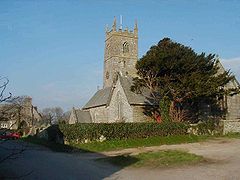
Crowan parish church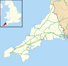
 Crowan
Crowan shown within CornwallPopulation 2,375 (2001) OS grid reference SW645345 Parish Crowan Unitary authority Cornwall Ceremonial county Cornwall Region South West Country England Sovereign state United Kingdom Post town CAMBORNE Postcode district TR14 Dialling code 01209 Police Devon and Cornwall Fire Cornwall Ambulance South Western EU Parliament South West England UK Parliament St Ives List of places: UK • England • Cornwall  Clowance Estate
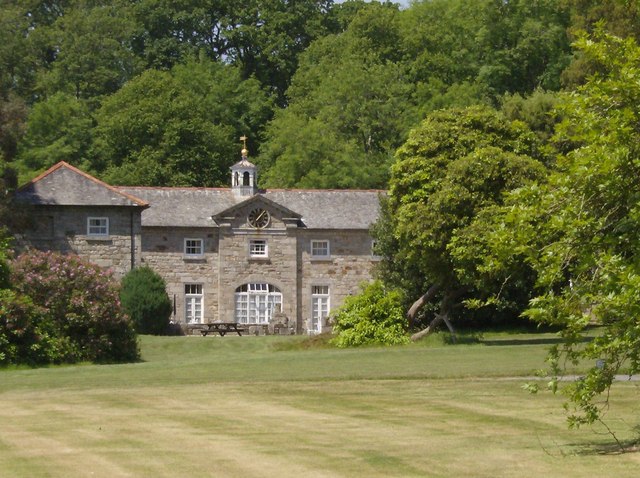
Crowan (Cornish: Egloskrowenn) is a village and civil parish in Cornwall, United Kingdom. It is situated approximately three-and-a-half miles (6 km) south of Camborne.[1] The River Hayle rises near Crowan and flows through the village and the railway branch to Helston passed nearby.
Crowan has a population of 2,375.[2] Crowan Churchtown is not the largest settlement: there are villages at Praze-an-Beeble, Nancegollan, Bolitho and Leedstown and a hamlet at Black Rock (on the B3280 road four miles (6.5 km) south of Camborne and five miles (8 km) north of Helston).[3]
Notable buildings
The parish church is dedicated to St Crewenna and is built of granite. The Latin name of the saint is first given as Crewanus in 1201 though later forms are in the feminine. The church is of the 15th century but was substantially restored in 1872. There are numerous monuments to members of the St Aubyn family. The three St Aubyn brasses (ca. 1420, ca. 1490 & ca. 1550) are however now at Clowance.[4][5]
In some 18th century documents there is evidence that the parish was called Uni-Crowan and this may be connected to the fact that the parish was in two parts, one in Penwith and one in Kerrier hundred. The Kerrier portion was once a separate chapelry and may have had St Uny as its patron saint.[6]
Clowance House was the seat of the St Aubyns (from 1671 they were Baronets but the line ended with Sir John St Aubyn, 5th Baronet in 1839).
Crowan parish has many remains of prehistoric times including barrows and stone crosses.[7] The resort of Clowance estate offers swimming, tennis, gym and fitness facilities, a bar and an Italian restaurant.
References
- ^ Ordnance Survey: Landranger map sheet 203 Land's End ISBN 978-0-319-23148-7
- ^ Office for National Statistics : Census 2001 : Parish Headcounts : Cornwall Retrieved 2009-12-23
- ^ Ordnance Survey: Landranger map sheet 203 Land's End ISBN 978-0-319-23148-7
- ^ Dunkin, E. (1882) Monumental Brasses. London, Spottiswoode
- ^ Pevsner, N. (1970) Cornwall, 2nd ed., revised by E. Radcliffe. Penguin Books
- ^ Doble, G. H. (1960) The Saints of Cornwall; part 1. Truro: Dean and Chapter; pp. 97-99
- ^ http://myweb.tiscali.co.uk/crowan/html/ancient_crowan.html Ancient Crowan
External links
 Media related to Crowan at Wikimedia Commons
Geography of Cornwall Unitary authorities Major settlements Bodmin • Bude • Callington • Camborne • Camelford • Falmouth • Fowey • Hayle • Helston • Launceston • Liskeard • Looe • Lostwithiel • Marazion • Newlyn • Newquay • Padstow • Par • Penryn • Penzance • Porthleven • Redruth • Saltash • St Austell • St Blazey • St Columb Major • St Ives • St Just-in-Penwith • St Mawes • Stratton • Torpoint • Truro • Wadebridge
See also: Civil parishes in CornwallRivers Topics History • Status debate • Flag • Culture • Places • People • The Duchy • Diocese • Politics • Hundreds/shires • Places of interest • full list...Civil parishes of St Ives constituency  Breage • Crowan • Cury • Germoe • Grade–Ruan • Gunwalloe • Helston • Landewednack • Ludgvan • Madron • Marazion • Manaccan • Mawgan-in-Meneage • Morvah • Mullion • Paul • Penzance • Perranuthnoe • Porthleven • Sancreed • Sennen • Sithney • St Anthony-in-Meneage • St Buryan • St Erth • St Hilary • St Ives • St Just • St Keverne • St Levan • St Martin-in-Meneage • St Michael's Mount • Towednack • (Wendron) • ZennorCategories:
- Civil parishes in Cornwall
- Villages in Cornwall


Wikimedia Foundation. 2010.