- Mullion, Cornwall
-
Coordinates: 50°01′37″N 5°14′28″W / 50.027°N 5.241°W
Mullion Cornish: Eglosvelyan 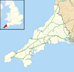
 Mullion
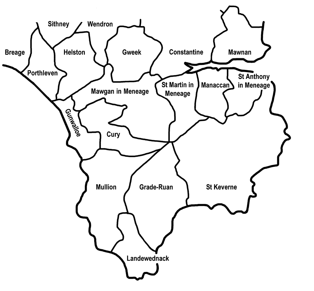
Mullion shown within CornwallPopulation 1,986 (Civil Parish, 2001) OS grid reference SW678192 Parish Mullion Unitary authority Cornwall Ceremonial county Cornwall Region South West Country England Sovereign state United Kingdom Post town HELSTON Postcode district TR12 Dialling code 01326 Police Devon and Cornwall Fire Cornwall Ambulance South Western EU Parliament South West England UK Parliament St Ives List of places: UK • England • Cornwall 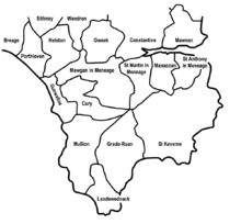 Mullion in relation to neighbouring parishes
Mullion (Cornish: Eglosvelyan) is a civil parish and village in Cornwall, United Kingdom. It is situated on the Lizard Peninsula approximately five miles (8 km) south of Helston.[1]
Mullion civil parish encompasses the church town (now known simply as Mullion) and four smaller settlements: Mullion Cove and Predannack to the southwest; Trewoon and Meaver to the east. Mullion is bordered by the parishes of Gunwalloe and Cury to the north, Grade-Ruan to the east, Landewednack to the south, and by the sea to the west.[2]
The parish also includes Mullion Island, a uninhabited island approximately half a mile (0.8 km) offshore from Mullion Cove. The island is home to large colonies of seabirds and owned by the National Trust.
Contents
History
Mullion parish is also important historically, with evidence of prehistoric burial mounds, Celtic crosses and ancient chapel sites, and in more recent times evidence of copper and china clay mining and a World War II airfield at Predannack. Today Mullion is the largest village on the Lizard Peninsula and is an important centre for local services and amenities as well as a popular tourist destination. Mullion School is the local secondary school.
The Royal National Lifeboat Institution stationed a lifeboat at Mullion in 1867 but it was withdrawn in 1908. The boat house has since been demolished but its barometer is on display in the village.[3]
Geography
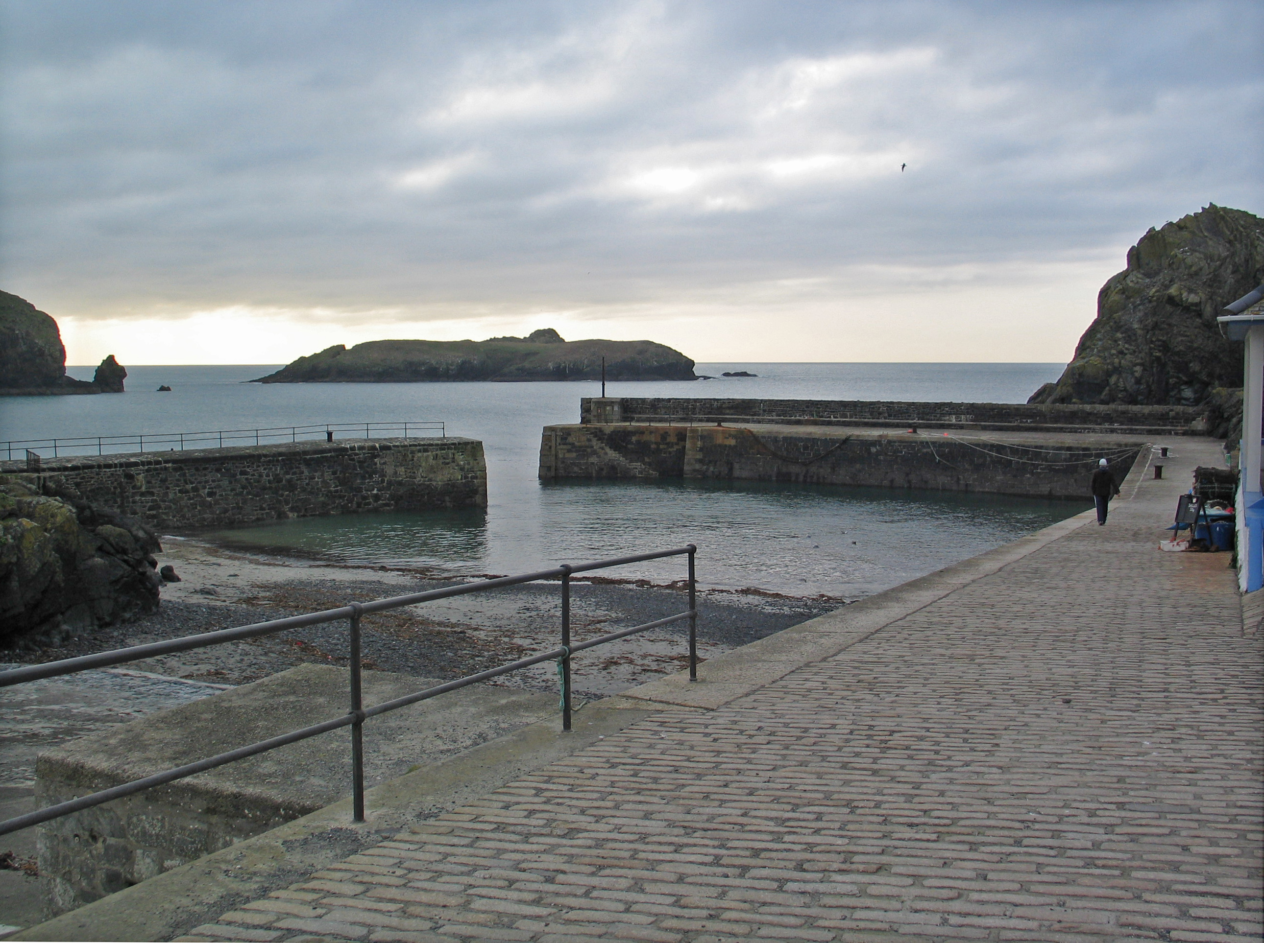
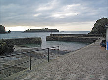 Mullion Island viewed from the harbour at Mullion Cove
The parish is in the Lizard Peninsula Area of Outstanding Natural Beauty (AONB) and three designated Sites of Special Scientific Interest (SSSIs) are within the parish boundary – West Lizard SSSI, Baulk Head to Mullion SSSI and Mullion Cliff to Predannack Cliff SSSI, which includes Mullion Island. Mullion Cliff to Predannack Cliff SSSI is noted for its geological and biological interest and contains 10 Red Data Book of rare and endangered plant species.[4]
Much of the Lizard National Nature Reserve (NNR) is within the parish boundary.
Predannack Downs
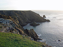 The coastline at the edge of Predannack Downs
To the south of the village the land gently rises up and levels out into a plateau at a height of around 85 metres above sea level. In contrast to the northern part of the parish this area remains as natural heathland, the growth of which is encouraged by the change in geology south of Mullion Cove to Magnesium rich Serpentine rock. This area is called Predannack Downs, and is part of the Lizard National Nature Reserve. In the centre of Predannack Downs lies the former World War 2 Predannack Airfield, now a satellite of nearby RNAS Culdrose . The southern extent of the parish is marked by a steep and narrow river valley cut into the downs, meeting the sea at Kynance Cove. The coastline along the edge of the Downs between Kynance Cove and Mullion Cove consists of high dramatic sheer cliffs with the exception of a deep narrow cleft cut into the Downs at Gew-graze, also known as Soapy Cove. This cove is named after Soapstone, a type of Serpentine rock found around the cove which was quarried near here in the 18th century.
Mullion Village
The parish comprises 5,007 acres (20 km2) of land, 8 acres (32,000 m2) of water and 55 acres (220,000 m2) of foreshore [2]. The main village of Mullion is situated in the north of the parish, approximately 65 metres above sea level and about 1 mile (2 km) inland of the coast which is to its west. The village sits at the end of two river valleys which run southwest from the village, descending steeply to meet the sea at Polurrian Cove and Mullion Cove. North of the village is a third river valley descending west to east and meeting the sea at Poldhu Cove. This river defines the boundary between Mullion and the neighbouring parish of Gunwalloe. The geology of this part of the parish consists mainly of Hornblende Schists, only changing to slate north of Poldhu Cove. The land around the village and on the upper slopes of the river valleys is mostly fertile land cultivated for arable crops and livestock grazing. The small hamlets of Trewoon and Meaver are situated about half a mile to the east of Mullion village.
Etymology
The parish name has evolved over the years, with references in the parish records to St Mullyon, St Mullian, Mullian, Mullyan, Mulion, Mullyon and St Mullion. In the Valor Ecclesiasticus carried out in 1535 the village name is recorded as Melyan.[5]
The parish takes its name from Saint Melaine, the Breton Bishop of Rennes[6] who supposedly took office in 519. He was a man of many aliases including the Latin version, Saint Melanius.[7] Reference to early publications and the 1908 Ordnance Survey maps show that the parish church was actually known as St Melan's until at least the start of the 20th Century.[8][9]
In the late 19th century, Edmund Harvey, Vicar of Mullion, proposed that the parish took its name from 'Mellon' which he believed was an alias of Saint Malo.[8] Saint Malo was a Welshman who moved to Brittany (possibly with his cousin, Saint Samson) where he became Bishop of Aleth (the region now called Saint-Malo) around AD 541.[10][11] Harvey's ideas have since been discredited.[6] However, an area near one of the ancient chapel sites was known as St Malo's Moor in Harvey's time, and nearby were two fields known as Sampson's Crofts.[8]
Parish church
The church is of 13th century foundation but the fabric is almost entirely of the 15th century. Features of interest include the fine series of bench ends and other old woodwork.[12]
Language
Mullion was surveyed for the Survey of English Dialects.[citation needed]
Notable residents
- Privateer James Erisey was born at Erisey House near Mullion: he accompanied Francis Drake on three occasions
- Fighter pilot and author Geoffrey Wellum DFC
References
- ^ Ordnance Survey: Landranger map sheet 203 Land's End ISBN 9780319231487
- ^ a b GENUKI, 2007. "Mullion."
- ^ Leach, Nicholas (2006) [2000]. Cornwall's Lifeboat Heritage. Chacewater: Twelveheads Press. p. 40. ISBN 0-906294-43-6.
- ^ "Mullion Cliff to Predannack Cliff". Natural England. 1993. http://www.sssi.naturalengland.org.uk/citation/citation_photo/1004096.pdf. Retrieved 3 November 2011.
- ^ Valor Ecclesiasticus, 1535. "National Archives Series E 344"
- ^ a b Doble, G. H. (1962) The Saints of Cornwall, Part II. Truro: Dean and Chapter
- ^ Patron Saints Index: Saint Melaine
- ^ a b c Harvey, E. G. (1875) Mullyon, its History, Scenery and Antiquities. ISBN 0-907566-70-7
- ^ Ordnance Survey Second Edition, 1908, Cornwall Sheet L080. S.E.
- ^ Catholic Encyclopedia: St. Machutus
- ^ St. Malo - Catholic Online
- ^ Cornish Church Guide (1925) Truro: Blackford
External links
- Mullion OCS
- Cornwall Record Office Online Catalogue for Mullion
- Mullion, Cornwall at the Open Directory Project
Geography of Cornwall Cornwall Portal Unitary authorities Major settlements Bodmin • Bude • Callington • Camborne • Camelford • Falmouth • Fowey • Hayle • Helston • Launceston • Liskeard • Looe • Lostwithiel • Marazion • Newlyn • Newquay • Padstow • Par • Penryn • Penzance • Porthleven • Redruth • Saltash • St Austell • St Blazey • St Columb Major • St Ives • St Just-in-Penwith • St Mawes • Stratton • Torpoint • Truro • Wadebridge
See also: Civil parishes in CornwallRivers Topics History • Status debate • Flag • Culture • Places • People • The Duchy • Diocese • Politics • Hundreds/shires • Places of interest • full list...Civil parishes of St Ives constituency  Breage • Crowan • Cury • Germoe • Grade–Ruan • Gunwalloe • Helston • Landewednack • Ludgvan • Madron • Marazion • Manaccan • Mawgan-in-Meneage • Morvah • Mullion • Paul • Penzance • Perranuthnoe • Porthleven • Sancreed • Sennen • Sithney • St Anthony-in-Meneage • St Buryan • St Erth • St Hilary • St Ives • St Just • St Keverne • St Levan • St Martin-in-Meneage • St Michael's Mount • Towednack • (Wendron) • Zennor
Cornwall Portal Categories:- Civil parishes in Cornwall
- Villages in Cornwall
- Sites of Special Scientific Interest in Cornwall


Wikimedia Foundation. 2010.