- Portal:Oregon
-
- Wikipedia portals:
- Culture
- Geography
- Health
- History
- Mathematics
- Natural sciences
- People
- Philosophy
- Religion
- Society
- Technology
The Oregon Portal
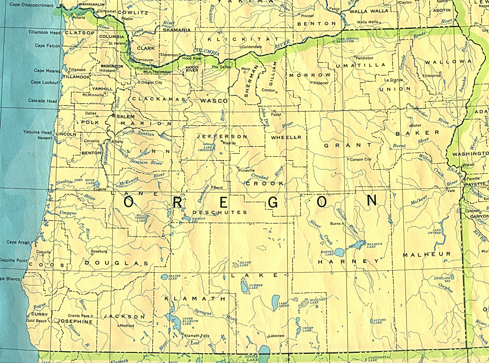
Map of Oregon 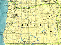
Oregon is a state in the Pacific Northwest region of the United States. It borders the Pacific Ocean on the west, Washington on the north, Idaho on the east, and California and Nevada on the south. The Columbia and Snake Rivers form, respectively, much of its northern and eastern borders. Between two north-south mountain ranges in western Oregon—the Oregon Coast Range and the Cascade Mountain Range—lies the Willamette Valley, the most densely populated and agriculturally productive region of the state.Oregon has one of the most diverse landscapes of any state in the U.S. It is well known for its tall, dense forests; its accessible and scenic Pacific coastline; and its rugged, glaciated Cascade volcanoes. Other areas include semiarid scrublands, prairies, and deserts that cover approximately half the state in eastern and north-central Oregon.
Oregon's population in 2010 was about 3.8 million, a 12% increase over 2000. Oregon's population is largely concentrated in the Willamette Valley, which stretches from Eugene through Salem and Corvallis to Portland, Oregon's largest city.
The origin of the name Oregon is unknown. One account, advanced by George R. Stewart in a 1944 article in American Speech, was endorsed as the "most plausible explanation" in the book Oregon Geographic Names. According to Stewart, the name came from an engraver's error in a French map published in the early 1700s, on which the Ouisiconsink (Wisconsin) River was spelled "Ouaricon-sint", broken on two lines with the -sint below, so that there appeared to be a river flowing to the west named "Ouaricon".
More about Oregon... Selected picture
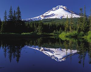
Mount Hood, a dormant stratovolcano, reflected in the waters of Mirror Lake. At 11,249 feet (3,429 m), Mount Hood is the highest mountain in Oregon and the fourth-highest in the Cascade Range. It is considered an active volcano, but no major eruptive events have been catalogued since systematic record keeping began in the 1820s.
Selected biography
Linus Pauling (February 28, 1901 – August 19, 1994) was an American quantum chemist and biochemist. Pauling is regarded by many as the premier chemist of the twentieth century, especially for the versatility of his contributions. He pioneered the application of quantum mechanics to chemistry, and in 1954 was awarded the Nobel Prize in chemistry for his work describing the nature of chemical bonds. Pauling received the Nobel Peace Prize in 1962 for his campaign against above-ground nuclear testing. Later in life, he became an advocate for greatly increased consumption of vitamin C and other nutrients. Pauling was born in Oswego, Oregon. In the 1930s he began publishing papers on the nature of the chemical bond, leading to his famous textbook on the subject published in 1939. It is based primarily on his work in this area that he received the Nobel Prize in Chemistry in 1954. In 1958, Pauling and his wife presented the United Nations with a petition signed by more than 11,000 scientists calling for an end to nuclear-weapon testing. Public pressure subsequently led to a moratorium on above-ground nuclear weapons testing, followed by the Partial Test Ban Treaty, signed in 1963 by John F. Kennedy and Nikita Khrushchev. On the day that the treaty went into force, the Nobel Prize Committee awarded Pauling the Nobel Peace Prize.
Did you know...

- ...that University of Oregon athletic director Leo Harris gained the right to use Donald Duck as the school's mascot through an informal handshake deal he made with Walt Disney in 1947?
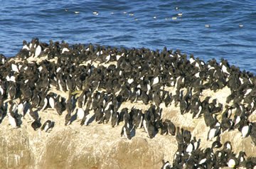
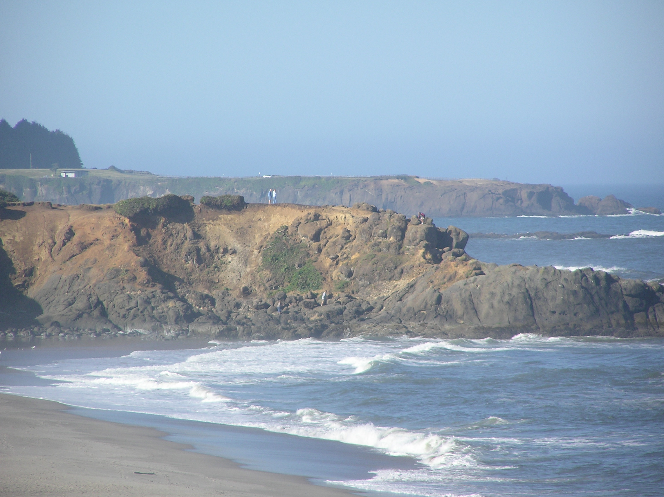
- ...that Oregon's Three Arch Rocks National Wildlife Refuge (pictured) was the first National Wildlife Refuge established west of the Mississippi River and turned a hundred years old in 2007?
- ...that missionary Josiah Parrish drove the first spike for the Oregon and California Railroad, and had a land dispute reach the U. S. Supreme Court?
- ... that, in 2004, Portland City Grill became Oregon's first restaurant to make Restaurants & Institutions magazine's list of the "top 100 highest-grossing independent restaurants" in the United States?
News

In this month
- November 2, 2004, Oregon voters pass Oregon Ballot Measure 36 which outlawed same-sex marriage in the state.
- November 11, 1973, the Fremont Bridge in Portland opens.
- November 12, 1970, figure skater Tonya Harding is born in Portland.
- November 12, 1986, Oregon native Minoru Yasui, namesake for U.S. Supreme Court case Yasui v. United States, dies at the age of 70.
- November 12, 2004, several state and federal owned sites in Oregon become part of the Lewis and Clark National and State Historical Parks.
- November 19, 1983, Oregon State University and the University of Oregon tie 0-0 in the annual Civil War football game.
- November 24, 1971, skyjacker D. B. Cooper hijacks a Northwest Airlines flight after take-off from Portland International Airport.
- November 29, 1847, fifteen missionaries and workers at the Whitman Mission are killed in the Whitman massacre by Native Americans, sparking the Cayuse War.
<< Previous month Next month >>
More anniversaries...Selected article
Temple Beth Israel (Hebrew: בית ישראל) is a Reconstructionist synagogue located in Eugene, Oregon. Founded in the early 1930s as a Conservative congregation, Beth Israel was for many decades the only synagogue in Eugene. The congregation initially worshiped in a converted house on West Eighth Street. It constructed its first building on Portland Street in 1952, and occupied its current LEED-compliant facilities in 2008. In the early 1990s conflict between feminist and traditional members led to the latter leaving Beth Israel, and forming the Orthodox Congregation Ahavas Torah. Beth Israel came under attack from neo-Nazi members of the Volksfront twice, in 1994 and again in 2002. In both cases the perpetrators were caught and convicted. Services were lay-led for decades. Marcus Simmons was hired as the congregation's first rabbi in 1959, but left in 1961. After a gap of two years, Louis Neimand became rabbi in 1963, and served until his death in 1976. He was followed by Myron Kinberg, who served from 1977 to 1994, and Kinberg in turn was succeeded by Yitzhak Husbands-Hankin. As of 2011[update], led by rabbis Yitzhak Husbands-Hankin and Maurice Harris, Beth Israel had approximately 400 member households, and was the largest synagogue in Eugene.
State facts
- Nickname: The Beaver State
- Capital city: Salem
- Largest city: Portland
- Governor: John Kitzhaber (D)
- Total area: 255,026 km²
- Population (2010 census): 3,831,074
- Date admitted to the Union: February 14, 1859
- Form of Government: Federalist
- Senators: Ron Wyden (D), Jeff Merkley (D)
- Representatives: David Wu (D), Greg Walden (R), Earl Blumenauer (D), Peter DeFazio (D), Kurt Schrader (D)
State symbols:


- Animal: American Beaver
- Bird: Western Meadowlark
- Fish: Chinook salmon
- Flower: Oregon-grape
- Insect: Oregon Swallowtail
- Tree: Douglas-fir
- Fossil: Metasequoia
- Gemstone: Oregon sunstone
- Motto: Alis volat propriis
- Rock: Thunderegg
- Song: "Oregon, My Oregon"
WikiProjects

- Oregon
- Oregon State Highways
- United States
- U.S. states
- United States regions
What are WikiProjects?
Categories

Selected panorama
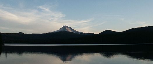
Mount Jefferson is an inactive stratovolcano in the Cascade Volcanic Arc, the Cascade Range and is the second-highest mountain in Oregon. Situated in the far northeastern corner of Linn County about 60 miles (96 km) east of Corvallis, Jefferson is in a rugged wilderness and is thus one of the hardest volcanoes to reach in the Cascades (logging road 1044 does come within 4 miles (6 km) of the summit, however). Selected quote
Featured content

- See also: Good articles relating to Oregon
Featured articles: 1980 eruption of Mount St. Helens • 1984 Rajneeshee bioterror attack • Balch Creek • Big Butte Creek • Frank Black • Bull Run River • Chetco River • Columbia River • Columbia Slough • D. B. Cooper • Elliott Smith • Fanno Creek • Forest Park • Hanford Site • Hillsboro, Oregon • Johnson Creek • Little Butte Creek • New Carissa • Oregon State Capitol • Rogue River • Tryon Creek • Upper and Lower Table Rock
Featured lists: • List of areas in the National Park System of the United States • List of Portland Trail Blazers head coaches • List of tallest buildings in Portland, Oregon • List of U.S. states by date of statehood • List of U.S. states by elevation • List of longest streams of Oregon
- Featured pictures
-
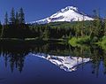
Mirror Lake with Mt. Hood in the background, Courtesy of Oregon's Mt. Hood Territory
-
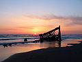
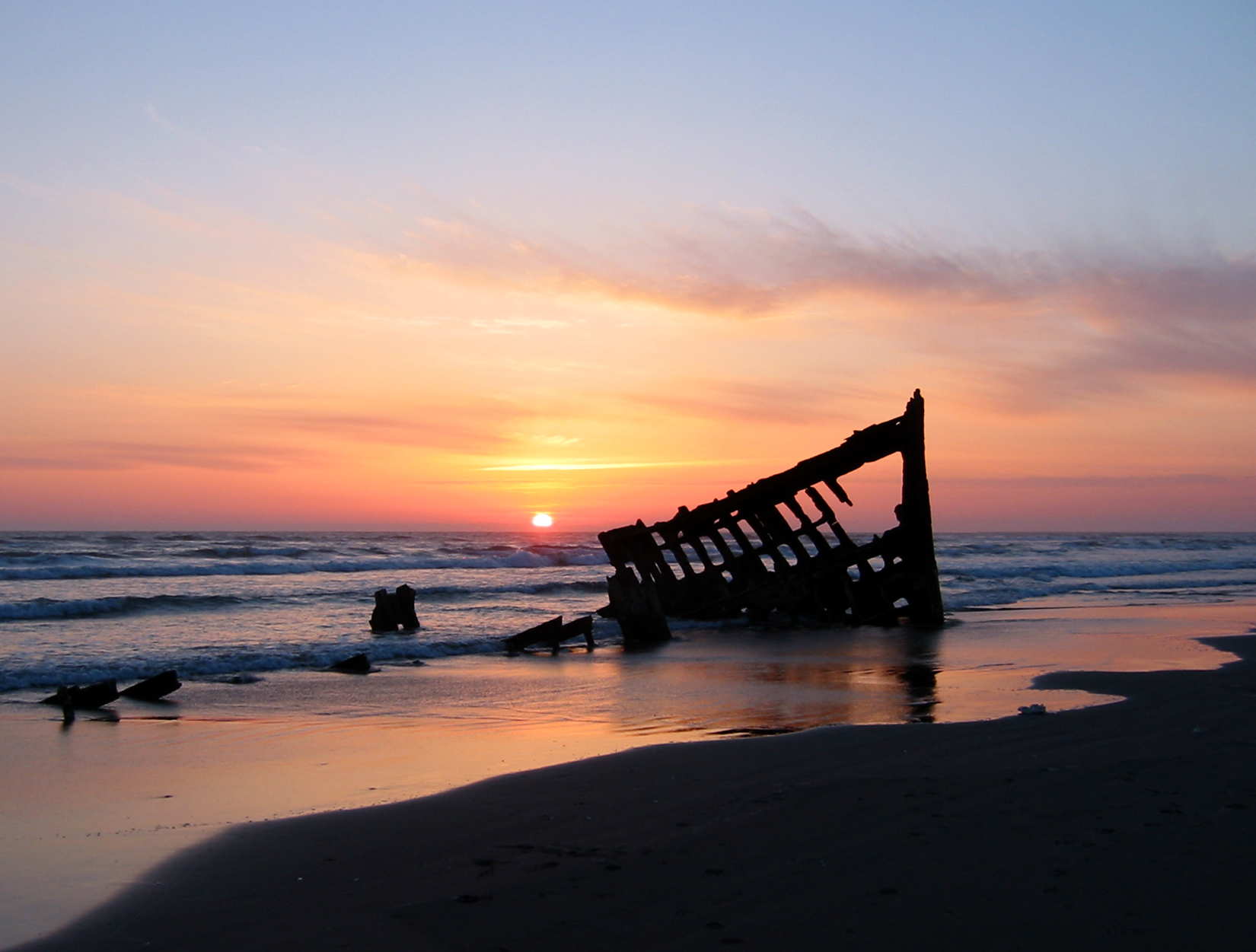
Wreck of the Peter Iredale, by Robert Bradshaw
-

A Fred Meyer grocery store, by lyzadanger, edited by Diliff
-
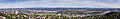
Portland, Oregon from the east, by Eric Baetscher
-
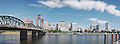
The Willamette River as it passes through downtown Portland, Oregon, by Cacophony
-

A stitched panorama of downtown Portland, OR at night, by Fcb981
-

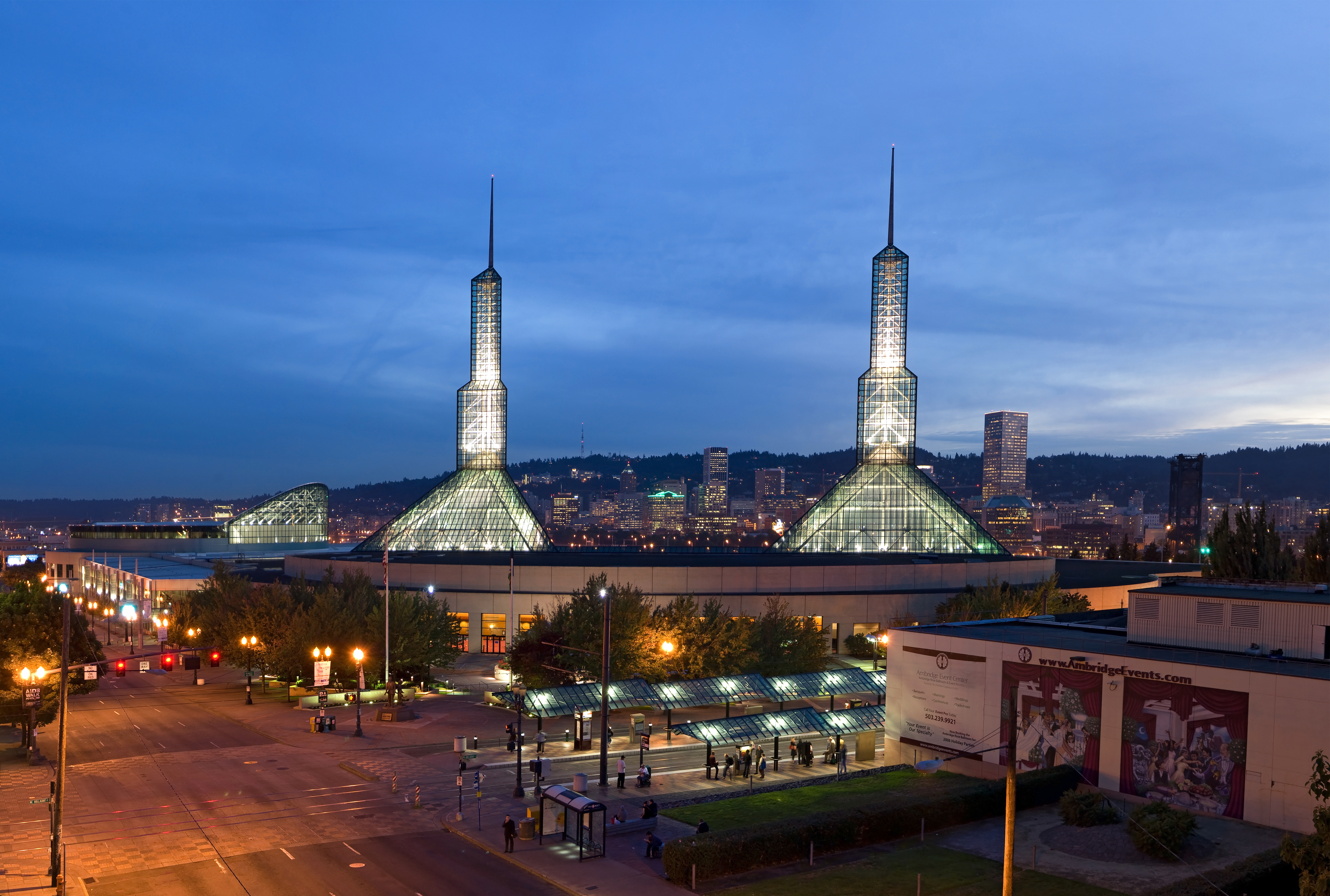
The Oregon Convention Center at dusk, by Fcb981
-
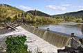
Gold Ray Dam on the Rogue River, by Finetooth
Main topics
Lists
Oregon-related lists Culture
Education
Economy
- Hospitals
- Hydroelectric dams
- Wineries and vineyards
Geography
Government
- Governors
- Ballot measures
- Government Agencies
- Political parties
- United States Representatives
- United States Senators
History
Law
Media
Natural history
- Plants
- Mountain ranges
- State forests
- Rivers

People
Protected areas
- State parks
- Registered Historic Places
Transportation
- Airports
- Bridges on the Oregon Coast
- Covered bridges
- Crossings of the Columbia River
- Crossings of the Molalla River
- Crossings of the Snake River
- Crossings of the Willamette River
- Exits on Interstate 5
- Railroads
- Private-use airports
Things you can do
This week's Collaboration of the Week projects: Items on the WikiProject Oregon Redlink List
Also, see this list of common redlinks, list of articles with cleanup tags, and list of articles needing immediate attention

- Current Featured Article (or other Featured content) candidates: Willamette River
- Undergoing Peer review:
- To Improve to Featured Standard: Oregon
- Current Good Article Nominees:
- To Improve and Nominate at WP:GOOD:
- To Expand: History of Oregon, Government of Oregon
- To Clean Up: WikiProject Oregon Cleanup listing (at least 2 years out of date)
- Review Recent Changes: See WikiProject Oregon recent changes list
- To Merge: See Wikipedia:WikiProject Deletion sorting/Oregon#Merge proposals
- To Split:
- To Destub: Politics of Oregon
- To Deorphan:
- To Create: Geography of Oregon (currently a redir), High priority list
- To Create from Redirects: See Category:Redirect-Class Oregon articles (use caution)
- To De-Redlink:
- Lists to De-Redlink:
- Lists to Complete:
- Wanted Pics/Graphics: Requested photos
- Wanted New Pics:
Related portals
Associated Wikimedia
Categories:- Oregon portal
- United States portals by state or territory
- Oregon


Wikimedia Foundation. 2010.