Northgate — can refer to: Contents 1 Historical structures 2 Places 3 Schools 4 Businesses 5 Railway sta … Wikipedia
Northgate — ist der Name mehrerer Orte in den Vereinigten Staaten: Northgate (Colorado) Northgate (North Dakota) Northgate (Ohio) in Australien: Northgate (Queensland) Northgate (South Australia) in Kanada: Northgate (Saskatchewan) im Vereinigten Königreich … Deutsch Wikipedia
Northgate, North Dakota — Unincorporated community … Wikipedia
Northgate Mall — may refer to: Northgate Mall (Durham) in Durham, North Carolina Northgate Mall (Hixson) in Hixson, Tennessee Northgate Mall (Seattle) in Seattle, Washington Northgate Mall (Cincinnati) in Cincinnati, Ohio Northgate Mall (Lafayette) in Lafayette… … Wikipedia
Saskatchewan Highway 9 — Infobox road province=SK type=Hwy route=9 alternate name=Saskota Flyway maint= length km=606.2 length round=1 length ref=cite map publisher=Microsoft Corp. title= Microsoft Streets and Tips url= edition=2004 section=Route Planner accessdate=2008… … Wikipedia
Saskatchewan Highway 35 — Infobox road marker province=SK type=Hwy route=35 alternate name= length km=573.1 length round=1 length ref= established= maint=Ministry of Highways and Infrastructure Transport Canada direction a=South starting terminus= junction= direction… … Wikipedia
Saskatchewan Highway 39 — Infobox road province=SK type=Hwy route=39 alternate name= maint=Ministry of Highways and Infrastructure Transport Canada length km=270.9 length round= 1 length ref= established= direction a=South starting terminus=North Portal junction=… … Wikipedia
Saskatchewan Rivers School Division — The Saskatchewan Rivers School Division #119 comprises 33 schools in the Prince Albert, Saskatchewan area, and is the third largest school division in the province. This division has over 9500 students enrolled, with 365 support personnel, 475… … Wikipedia
Saskatchewan Highway 13 — Infobox road marker User:Pomte/Template:SK road shield|provincial|13 province=SK type=Hwy route=13 alternate name=Red Coat Trail length km=676 length round=1 length ref=cite map publisher=Microsoft Corp. title= Microsoft Streets and Tips url=… … Wikipedia
List of communities in Saskatchewan — Communities of the Province of Saskatchewan, Canada are incorporated towns, cities, villages, and resort villages and unincorporated organized hamlets.[1] Regional rural forms of administration are rural municipalities.[clarification needed]… … Wikipedia
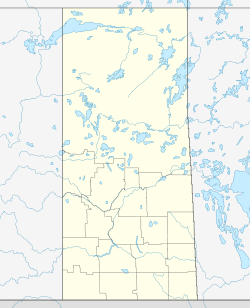
 Northgate, Saskatchewan