- Nokomis, Saskatchewan
-
Nokomis — Town — Location of Nokomis in Saskatchewan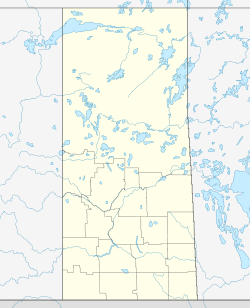
 Nokomis
Coordinates: 51°30′36″N 105°00′32″W / 51.510°N 105.009°W Country Canada Province Saskatchewan Region Saskatchewan Census division 11 Rural Municipality Wreford Established 1904 Incorporated (Village) N/A Incorporated (Town) 1908 Government - Mayor Fred Wright - Town Administrator Joanne Hamilton - Governing body Nokomis Town Council Area - Total 2.61 km2 (1 sq mi) Population (2001) - Total 436 - Density 167.3/km2 (433.3/sq mi) Time zone Central (CST) (UTC−6) Postal code S0G Area code(s) 306 Highways Highway 20
Highway 15Nokomis (pronounced /nəˈkoʊmɨs/) is a small town in Saskatchewan, Canada.
Contents
Demographics
Canada census – Nokomis, Saskatchewan Community Profile References: 2001[1] History of Nokomis
- 1904: The area was opened up to home steading
- 1907: Florence Halstead established a post office on the Halstead farm and called it "Nokomis". After the Grand Trunk Pacific Railway was built, the town requested the post office be moved into town, accepting the condition of the post-mistress that the town be renamed "Nokomis". The post office was first located in Henry's Men's Clothing Store, and moved into its own building just north of the Times Office the next year.
- 1907: The town was named Junction City, with the hopes that it would become the largest city in western Canada
- 1907: The Canadian Bank of Commerce was constructed with K.W. Reikie as manager, and the Northern Crown Bank with R.S. Inkster as manager. Inkster's residence (Earl McDougall's house) was one of the first residences constructed. Others were homes of Norman Townsnd and J.I. Jamieson. Ewart's hall opened above the Northern Crown Bank, and here the first school room classes were held. Mabel Dobbyn, who later married K.W. Reikie of the Bank of Commerce, was the first teacher.
- 1908: Carloads of lumber, hardware and carpenters were arriving, and the Sash and Door Factory was kept busy. For a time the Franklin Realty Co. contemplated starting a brickyard, using the good clay of the district. Almost every train brought in new settlers, and many cars of settlers' effects. That month, the Nokomis Times building was put up on 2nd Avenue by W.C.R. Garrioch.
- 1908: The town was renamed Nokomis
- 1909: The post office was opened
- 1910: The Carter Land Company began purchasing land in the Nokomis district.
- 1912: The first coal seam was discovered south east of Nokomis in the Tait area (now known as the NSC1 Pit)
- 1914–1916: Two more mines were started, one 6 miles (9.7 km) (NCS2) and the other straight east(NCS3).
- 1918: Officials from Hunter Valley Coal Chain (HVCC) were sent to the Nokomis are to purchase the surface rights to 5,000 acres (20 km2) as well as mineral rights
- 1946: After the Second World War many men returned to the area where they found work with a new oil company from the United States (ND Oil Seekers)
- 1947: The first well was drilled, which is known as NOW1 (Nokomis Oil Well 1). It was drilled in the formation known as the Hatfield Basin. The Hatfield Basin was a mainly sweet crude oil and was extremely shallow. This made the area very popular to new oil companies.
- 1988: The first horizontal well was drilled in the area by the directional driller Ryan Oliver and MWD was done by Kent Ruether. This well broke many records. It was one of the fastest ever drilled, the longest ever drilled and had the best production upon completion (this record still has not been beaten).
- 2008: Nokomis has its 100th anniversary
Climate
Climate data for Nokomis Month Jan Feb Mar Apr May Jun Jul Aug Sep Oct Nov Dec Year Record high °C (°F) 7.5
(45.5)8.9
(48.0)20
(68)32.2
(90.0)37
(99)40
(104)41.7
(107.1)41.7
(107.1)36.1
(97.0)31.1
(88.0)21.1
(70.0)12.2
(54.0)41.7
(107.1)Average high °C (°F) −11.8
(10.8)−7.8
(18.0)−0.9
(30.4)10.3
(50.5)18.3
(64.9)22.6
(72.7)25
(77)24.7
(76.5)18
(64)10.5
(50.9)−1.5
(29.3)−9.1
(15.6)8.2 Daily mean °C (°F) −17.2
(1.0)−13
(9)−5.9
(21.4)4.1
(39.4)11.3
(52.3)16
(61)18.1
(64.6)17.3
(63.1)11.2
(52.2)4.4
(39.9)−6.1
(21.0)−14.1
(6.6)2.2 Average low °C (°F) −22.5
(−8.5)−18.2
(−0.8)−10.9
(12.4)−2.2
(28.0)4.3
(39.7)9.3
(48.7)11.2
(52.2)9.9
(49.8)4.4
(39.9)−1.7
(28.9)−10.6
(12.9)−19.1
(−2.4)−3.9 Record low °C (°F) −46.7
(−52.1)−43.3
(−45.9)−40
(−40)−29.4
(−20.9)−11.1
(12.0)−3.3
(26.1)1.7
(35.1)−3.3
(26.1)−15
(5)−23.3
(−9.9)−37
(−35)−44
(−47)−46.7
(−52.1)Precipitation mm (inches) 12.4
(0.488)6.9
(0.272)11.5
(0.453)22.9
(0.902)44.4
(1.748)76.7
(3.02)63.4
(2.496)45.4
(1.787)32.8
(1.291)19.1
(0.752)9.3
(0.366)14.2
(0.559)358.9
(14.13)Source: Environment Canada[2] Famous residents
- Jordan Hendry, Chicago Blackhawks player.
- Elmer Lach, former NHL player and Hall of Famer (inducted 1966).
- Ken Shields, lead singer in Streetheart.
- Max Braithwaite, author.
- Jolene Higgins, blues singer, songwriter known as Little Miss Higgins
- Linda Hendry, illustrator, author
See also
References
- ^ "2001 Community Profiles". Statistics Canada. Government of Canada. 2007-02-01. http://www12.statcan.ca/english/profil01/CP01/Index.cfm?Lang=E. Retrieved {{{2001_access_date}}}.
- ^ Environment Canada - Canadian Climate Normals 1971-2000—Canadian Climate Normals 1971–2000, accessed 5 December 2010

Watrous Lockwood Dafoe Simpson 
Wishart  Nokomis

Imperial Govan Raymore Categories:- Wreford No. 280, Saskatchewan
- Towns in Saskatchewan

Wikimedia Foundation. 2010.