- Canora, Saskatchewan
Infobox Settlement
official_name = Town of Canora
other_name =
native_name =
nickname =
settlement_type =Town
motto =
imagesize =
image_caption =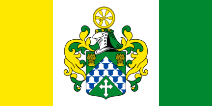
flag_size =
image_
seal_size =
image_shield =
shield_size =
city_logo =
citylogo_size =
mapsize =
map_caption =
mapsize1 =
map_caption1 =
image_dot_
dot_mapsize =
dot_map_caption =
dot_x = |dot_y =
pushpin_
pushpin_label_position = left |pushpin_mapsize =
subdivision_type =Country
subdivision_name = CAN
subdivision_type1 = Province
subdivision_name1 = SK
subdivision_type2 = Region
subdivision_name2 =Saskatchewan
subdivision_type3 = Census division
subdivision_name3 = No. 9
subdivision_type4 = Rural Municipality
subdivision_name4 = Good Lake
government_footnotes =
government_type =
leader_title =Mayor
leader_name = Terry Dennis
leader_title1 =Town Manager
leader_name1 = Michael Mykytyshyn
leader_title2 = Governing body
leader_name2 = Canora Town Council
leader_title3 =
leader_name3 =
leader_title4 =
leader_name4 =
established_title = Post office Founded
established_date =N/A
established_title2 = Incorporated (Village)
established_date2 = 1905
established_title3 = Incorporated (Town)
established_date3 = 1910
area_magnitude =
unit_pref =
area_footnotes =
area_total_km2 = 7.31
area_land_km2 =
area_water_km2 =
area_total_sq_mi =
area_land_sq_mi =
area_water_sq_mi =
area_water_percent =
area_urban_km2 =
area_urban_sq_mi =
area_metro_km2 =
area_metro_sq_mi =
population_as_of = 2006
population_footnotes =
population_note =
population_total = 2,013
population_density_km2 = 275.5
population_density_sq_mi =
population_metro =
population_density_metro_km2 =
population_density_metro_sq_mi =
population_urban =
population_density_urban_km2 =
population_density_urban_sq_mi =
population_blank1_title =
population_blank1 =
population_density_blank1_km2 = |population_density_blank1_sq_mi =
timezone = CST
utc_offset =
timezone_DST =
utc_offset_DST =
latd=51.63394
longd=-102.43691
elevation_footnotes =
elevation_m =
elevation_ft =
postal_code_type =Postal code
postal_code = S0A 0L0
area_code = 306
blank_name = Highways
blank_info = No. 5
No. 9
blank1_name = Waterways
blank1_info =Crystal Lake
Good Spirit Lake
Duck Mountain Provincial Park
website =www.canora.com
footnotes =Canora is nestled into the junction of highways No. 5 and 9 in east-central
Saskatchewan , 50 kilometres north of the city of Yorkton. Centrally located on the corners of four adjacent rural municipalities, the community is home to approximately 2,400 residents and draws upon a substantial trading area. Canora's unusual name comes from the first letter of the CAnadian NOrthern RAilway.Demographics
Canora became a
village in 1905 and was incorporated as atown in 1910.Canada_CP_2006|pop=2,013|popDelta=-8.5%
landArea=7.31|popDensity=275.5|medianAge=55.0|medianAgeM=51.6|medianAgeF=57.3|privateDwell=1,142|privateDwellusual=990|medianHHIncome=Not AvailableAttractions
Canora is known as the “Heart of Good Spirit Country” as a result of its proximity to several lakes and parks, including
Crystal Lake ,Good Spirit Lake andDuck Mountain Provincial Park . The area is host to Saskatchewan’s greatest number of golf courses per capita and boasts one of the highest traffic counts in the province.The town was judged to have the best-tasting municipal water in
Canada at the 13th annual international water tasting competition held in 2003 inBath (Berkeley Springs), West Virginia , USA. Canora’s water, supplied by several ground wells northeast of the community, also placed fourth internationally at the competition that received entries from eight countries and 23 states. Free samples of this great-tasting water are available at the CN Station House Museum during the summer months.Protective Services
Canora is protected by the Canora-Sturgis RCMP detachment. The detachment has 8 members, between Canora and Sturgis.
Canora and area is served by a full-time Ambulance. Consisting of 3 EMT's, 3 EMT-A's, and a Paramedic.
Canora's fire protection is provided by a 21 member all volunteer Fire Department.
ee also
*
List of communities in Saskatchewan
*List of towns in Saskatchewan References
External links
* [http://www.canora.com/ Town of Canora]
* [http://saskjobfutures.ca/community/community.cfm?id=canoa0l&type=2&lang=en&site=graphic Canora Community Facts]
* [http://www.fotw.net/flags/ca-sk-ca.html Canora, SK's town flag]Canadian City Geographic Location (8-way)
Northwest =
North =


Wikimedia Foundation. 2010.