- Northgate, North Dakota
-
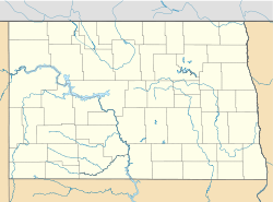
Northgate, North Dakota — Unincorporated community — Coordinates: 48°59′27″N 102°15′44″W / 48.99083°N 102.26222°WCoordinates: 48°59′27″N 102°15′44″W / 48.99083°N 102.26222°W Country United States State North Dakota County Burke Elevation 1,860 ft (567 m) Time zone Central (CST) (UTC-6) – Summer (DST) CDT (UTC-5) ZIP code 58737 Area code(s) 701 GNIS feature ID 1030491[1] Northgate is an unincorporated community in Burke County, North Dakota, USA. The community is adjacent to the U.S. border with Canada, and it shares its name with the neighboring Canadian settlement of Northgate, Saskatchewan. The community is served by North Dakota Highway 8.
References
Municipalities and communities of Burke County, North Dakota Cities Townships Battleview | Bowbells | Carter | Clayton | Cleary | Colville | Dale | Dimond | Fay | Foothills | Forthun | Garness | Harmonious | Kandiyohi | Keller | Lakeview | Leaf Mountain | Lucy | Minnesota | North Star | Portal | Richland | Roseland | Short Creek | Soo | Thorson | Vale | Vanville | Ward
CDP Unorganized
territoryNorth Burke
Unincorporated
communitiesAtcoal | Battleview | Coteau | Kincaid | Northgate | Perella | Rival | Stampede | Woburn
Categories:- Populated places in Burke County, North Dakota
- Unincorporated communities in North Dakota
- Canada–United States border crossings
- North Dakota geography stubs
Wikimedia Foundation. 2010.


