- National Register of Historic Places listings in Sussex County, Virginia
-
This list includes properties and districts listed on the National Register of Historic Places in Sussex County, Virginia. Click the "Map of all coordinates" link to the right to view a Google map of all properties and districts with latitude and longitude coordinates in the table below.[1]
-
- This National Park Service list is complete through NPS recent listings posted November 10, 2011.[2]
[3] Landmark name[4] Image Date listed Location City or Town Summary 1 Miles B. Carpenter House November 13, 1989 US 460
37°2′16″N 77°6′20″W / 37.03778°N 77.10556°WWaverly 2 Chester December 18, 1970 N of jct. of Rtes. 625 and 35
36°58′19″N 77°10′47″W / 36.97194°N 77.17972°WHomeville 3 Fortsville September 15, 1970 SE of the jct. of Rtes. 612 and 611
36°42′47″N 77°24′51″W / 36.71306°N 77.41417°WGrizzard 4 Glenview November 26, 2008 13098 Comans Well Rd.
36°52′31.64″N 77°24′22.29″W / 36.8754556°N 77.4061917°WStony Creek 5 Hunting Quarter April 7, 1995 VA 632, S of jct. with VA 608
36°52′4″N 77°13′28″W / 36.86778°N 77.22444°WWaverly 6 Little Town November 18, 1976 W of Littleton on VA 622
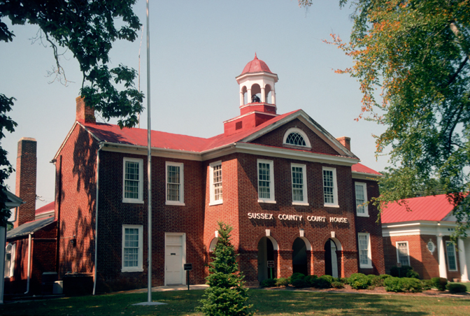
36°54′21″N 77°10′22″W / 36.90583°N 77.17278°WLittleton 7 Nottoway Archeological Site (44SX6, 44SX7, 44SX98, 44SX162) November 3, 1988 Address Restricted Stony Creek 8 Sussex County Courthouse Historic District 
July 24, 1973 Jct. of VA 634 and 626
36°54′55″N 77°16′47″W / 36.91528°N 77.27972°WSussex See also
- National Register of Historic Places listings in Virginia
- List of National Historic Landmarks in Virginia
References
- ^ The latitude and longitude information provided in this table was derived originally from the National Register Information System, which has been found to be fairly accurate for about 99% of listings. For about 1% of NRIS original coordinates, experience has shown that one or both coordinates are typos or otherwise extremely far off; some corrections may have been made. A more subtle problem causes many locations to be off by up to 150 yards, depending on location in the country: most NRIS coordinates were derived from tracing out latitude and longitudes off of USGS topographical quadrant maps created under the North American Datum of 1927, which differs from the current, highly accurate WGS84 GPS system used by Google maps. Chicago is about right, but NRIS longitudes in Washington are higher by about 4.5 seconds, and are lower by about 2.0 seconds in Maine. Latitudes differ by about 1.0 second in Florida. Some locations in this table may have been corrected to current GPS standards.
- ^ "National Register of Historic Places: Weekly List Actions". National Park Service, United States Department of the Interior. Retrieved on November 10, 2011.
- ^ Numbers represent an ordering by significant words. Various colorings, defined here, differentiate National Historic Landmark sites and National Register of Historic Places Districts from other NRHP buildings, structures, sites or objects.
- ^ "National Register Information System". National Register of Historic Places. National Park Service. 2008-04-24. http://nrhp.focus.nps.gov/natreg/docs/All_Data.html.
U.S. National Register of Historic Places Topics Lists by states Alabama • Alaska • Arizona • Arkansas • California • Colorado • Connecticut • Delaware • Florida • Georgia • Hawaii • Idaho • Illinois • Indiana • Iowa • Kansas • Kentucky • Louisiana • Maine • Maryland • Massachusetts • Michigan • Minnesota • Mississippi • Missouri • Montana • Nebraska • Nevada • New Hampshire • New Jersey • New Mexico • New York • North Carolina • North Dakota • Ohio • Oklahoma • Oregon • Pennsylvania • Rhode Island • South Carolina • South Dakota • Tennessee • Texas • Utah • Vermont • Virginia • Washington • West Virginia • Wisconsin • WyomingLists by territories Lists by associated states Other Municipalities and communities of Sussex County, Virginia Towns Jarratt‡ | Stony Creek | Wakefield | Waverly

CDP Footnotes ‡This populated place also has portions in an adjacent county or counties
Categories:- Sussex County, Virginia
- National Register of Historic Places in Virginia
- Virginia-related lists
-

Wikimedia Foundation. 2010.