- National Register of Historic Places listings in Ouachita Parish, Louisiana
-
 Location of Ouachita Parish in Louisiana
This is a list of the National Register of Historic Places listings in Ouachita Parish, Louisiana.
This is intended to be a complete list of the properties and districts on the National Register of Historic Places in Ouachita Parish, Louisiana, United States. The locations of National Register properties and districts for which the latitude and longitude coordinates are included below, may be seen in a Google map.[1]
There are 31 properties and districts listed on the National Register in the parish.
-
- This National Park Service list is complete through NPS recent listings posted November 10, 2011.[2]
Current listings
[3] Landmark name[4] Image Date listed Location City or Town Summary 1 Allen-Barringer House May 3, 1982 Southwest of West Monroe off Elkins Rd.
32°25′33″N 92°11′39″W / 32.42583°N 92.19417°WWest Monroe 2 J.S. Block Building September 30, 1980 101 N. Grand St.
32°29′59″N 92°7′1″W / 32.49972°N 92.11694°WMonroe 3 Bosco Plantation House November 18, 2009 279 Pipes Ln.
32°17′2.5″N 92°5′46.41″W / 32.284028°N 92.096225°WMonroe 4 Boscobel Cottage May 7, 1979 Cordell Lane
32°17′23″N 92°5′33″W / 32.28972°N 92.0925°WBosco 5 Bright-Lamkin-Easterling House May 15, 1986 918 Jackson St.
32°29′42″N 92°6′44″W / 32.495°N 92.11222°WMonroe 6 Bynum House January 25, 1997 604 Grammont St.
32°30′8″N 92°6′42″W / 32.50222°N 92.11167°WMonroe 7 G.B. Cooley House May 15, 1986 1011 S. Grand St.
32°29′33″N 92°6′50″W / 32.4925°N 92.11389°WMonroe 8 Downtown Monroe Historic District September 4, 1986 Roughly bounded by Desiard, Jackson, Telemaque, and S. Grand Sts.
32°30′1″N 92°6′57″W / 32.50028°N 92.11583°WMonroe 9 Roland M. Filhiol House July 7, 1995 111 Stone Ave.
32°29′46″N 92°6′46″W / 32.49611°N 92.11278°WMonroe 10 First United Methodist Church June 12, 2001 101 N. 2nd St.
32°29′58″N 92°7′28″W / 32.49944°N 92.12444°WWest Monroe 11 Isaiah Garrett Law Office July 12, 1976 520 S. Grand St.
32°29′49″N 92°6′57″W / 32.49694°N 92.11583°WMonroe 12 Grayson House November 17, 1999 2300 DeSiard St.
32°30′50″N 92°5′50″W / 32.51389°N 92.09722°WMonroe 13 Gov. Luther Hall House May 7, 1979 1515 Jackson St.
32°29′24″N 92°6′36″W / 32.49°N 92.11°WMonroe 14 Harvey House January 25, 1997 608 Grammont St.
32°30′9″N 92°6′42″W / 32.5025°N 92.11167°WMonroe 15 Key-Mize House November 10, 2001 118 Copley St.
32°31′8″N 92°8′9″W / 32.51889°N 92.13583°WWest Monroe 16 Logtown Plantation October 16, 1980 South of Monroe
32°20′7″N 92°5′24″W / 32.33528°N 92.09°WMonroe 17 Lower Pargoud October 4, 1984 2111 S. Grand St.
32°28′54″N 92°6′43″W / 32.48167°N 92.11194°WMonroe 18 Masur House July 22, 1982 901 N. 3rd St.
32°30′34″N 92°7′21″W / 32.50944°N 92.1225°WMonroe 19 McClendon House April 18, 1996 309 McClendon
32°29′53″N 92°7′27″W / 32.49806°N 92.12417°WWest Monroe 20 Miller-Roy Building March 7, 2011 1001 Desiard St.
32°30′25″N 92°6′34″W / 32.50694°N 92.10944°WMonroe 21 Milner Motors July 25, 2001 212 Walnut St.
32°30′11″N 92°7′8″W / 32.50306°N 92.11889°WMonroe 22 Monroe Residential Historic District October 3, 1996 Roughly bounded by McKinley St., 7th St., Hudson Lne., and Riverside Dr.
32°31′5″N 92°7′33″W / 32.51806°N 92.12583°WMonroe 23 Mulberry Grove July 7, 1978 1133 S. Grand St.
32°29′29″N 92°6′46″W / 32.49139°N 92.11278°WMonroe 24 Neville High School May 9, 1985 600 Forsythe Ave.
32°31′19″N 92°7′33″W / 32.52194°N 92.12583°WMonroe 25 Ouachita Parish High School April 9, 1981 500 S. Grand St.
32°29′17″N 92°6′56″W / 32.48806°N 92.11556°WMonroe 26 Rawls Cabin August 9, 1991 223 Charlie Rawls Rd.
32°20′52″N 92°10′10″W / 32.34778°N 92.16944°WWest Monroe 27 Robinson Business College April 18, 1997 604 Jack McEnery Ave.
32°28′19″N 92°6′32″W / 32.47194°N 92.10889°WMonroe 28 St. James United Methodist Church October 29, 1992 916 Adams St.
32°30′35″N 92°6′19″W / 32.50972°N 92.10528°WMonroe 29 Slagle House January 24, 1995 1400 S. Grand
32°29′24″N 92°6′47″W / 32.49°N 92.11306°WMonroe 30 Whitehall Plantation House September 8, 1987 Buckhorn Bend Rd.
32°25′50″N 92°6′50″W / 32.43056°N 92.11389°WMonroe 31 Wossman House August 5, 1999 1205 St. John Dr.
32°29′27″N 92°6′41″W / 32.49083°N 92.11139°WMonroe See also
- List of National Historic Landmarks in Louisiana
- National Register of Historic Places listings in Louisiana
References
- ^ The latitude and longitude information provided in this table was derived originally from the National Register Information System, which has been found to be fairly accurate for about 99% of listings. For about 1% of NRIS original coordinates, experience has shown that one or both coordinates are typos or otherwise extremely far off; some corrections may have been made. A more subtle problem causes many locations to be off by up to 150 yards, depending on location in the country: most NRIS coordinates were derived from tracing out latitude and longitudes off of USGS topographical quadrant maps created under North American Datum of 1927, which differs from the current, highly accurate GPS system used by Google maps. Chicago is about right, but NRIS longitudes in Washington are higher by about 4.5 seconds, and are lower by about 2.0 seconds in Maine. Latitudes differ by about 1.0 second in Florida. Some locations in this table may have been corrected to current GPS standards.
- ^ "National Register of Historic Places: Weekly List Actions". National Park Service, United States Department of the Interior. Retrieved on November 10, 2011.
- ^ Numbers represent an ordering by significant words. Various colorings, defined here, differentiate National Historic Landmark sites and National Register of Historic Places Districts from other NRHP buildings, structures, sites or objects.
- ^ "National Register Information System". National Register of Historic Places. National Park Service. 2009-03-13. http://nrhp.focus.nps.gov/natreg/docs/All_Data.html.
U.S. National Register of Historic Places Topics Lists by states Alabama • Alaska • Arizona • Arkansas • California • Colorado • Connecticut • Delaware • Florida • Georgia • Hawaii • Idaho • Illinois • Indiana • Iowa • Kansas • Kentucky • Louisiana • Maine • Maryland • Massachusetts • Michigan • Minnesota • Mississippi • Missouri • Montana • Nebraska • Nevada • New Hampshire • New Jersey • New Mexico • New York • North Carolina • North Dakota • Ohio • Oklahoma • Oregon • Pennsylvania • Rhode Island • South Carolina • South Dakota • Tennessee • Texas • Utah • Vermont • Virginia • Washington • West Virginia • Wisconsin • WyomingLists by territories Lists by associated states Other Municipalities and communities of Ouachita Parish, Louisiana Cities 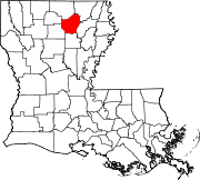
Towns CDPs Unincorporated
communityCalhoun
Categories:- Ouachita Parish, Louisiana
- National Register of Historic Places in Louisiana by parish
- Buildings and structures in Ouachita Parish, Louisiana
-

Wikimedia Foundation. 2010.