- National Register of Historic Places listings in LaSalle County, Illinois
-
See also: List of Registered Historic Places in Illinois
Contents: List of Registered Historic Places in LaSalle County, Illinois, USA:
-
- This National Park Service list is complete through NPS recent listings posted November 10, 2011.[1]
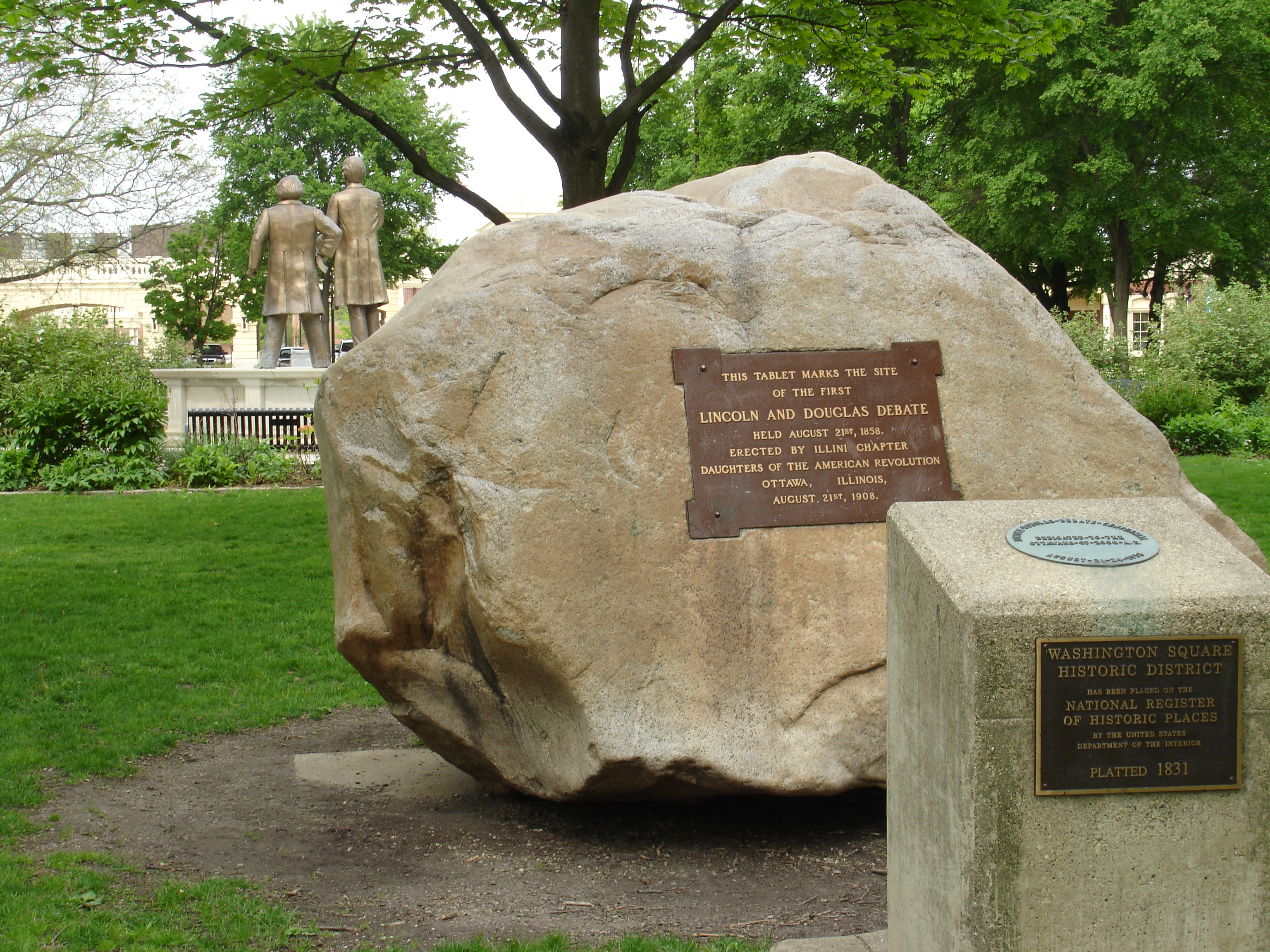
Landmark name Image Date listed Location City or Town Summary 1 Armour's Warehouse 
November 7, 1997 Jct. of William and Bridge Sts.
41°19′28″N 88°36′39″W / 41.32444°N 88.61083°WSeneca 2 Chicago, Rock Island and Pacific Railroad Depot 
November 7, 1995 150 Washington St.
41°19′44″N 88°42′21″W / 41.32889°N 88.70583°WMarseilles 3 Corbin Farm Site June 18, 1998 Address Restricted Utica 4 Fisher-Nash-Griggs House 
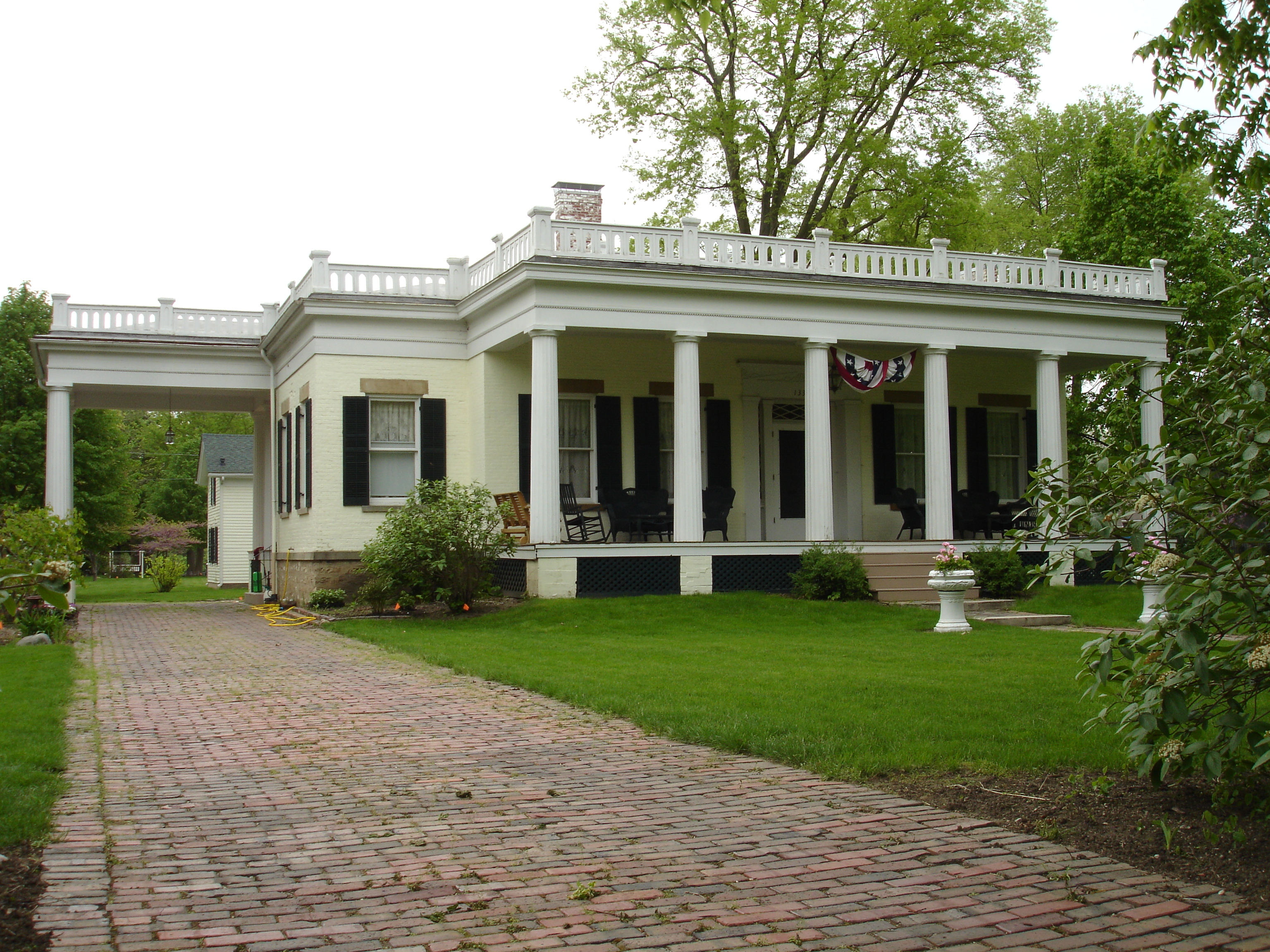
November 27, 1998 1333 Ottawa Ave.
41°20′32″N 88°48′39″W / 41.34222°N 88.81083°WOttawa 5 Ruffin Drew Fletcher House 
August 5, 1991 609 E. Broadway St.
41°7′35″N 88°49′40″W / 41.12639°N 88.82778°WStreator 6 Julius W. Hegeler I House February 18, 2009 1306 Seventh St.
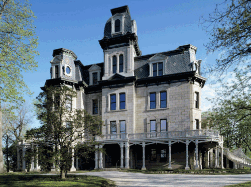
41°20′7.44″N 89°5′16.99″W / 41.3354°N 89.0880528°WLaSalle 7 Hegeler-Carus Mansion 
August 9, 1995 1307 Seventh St.
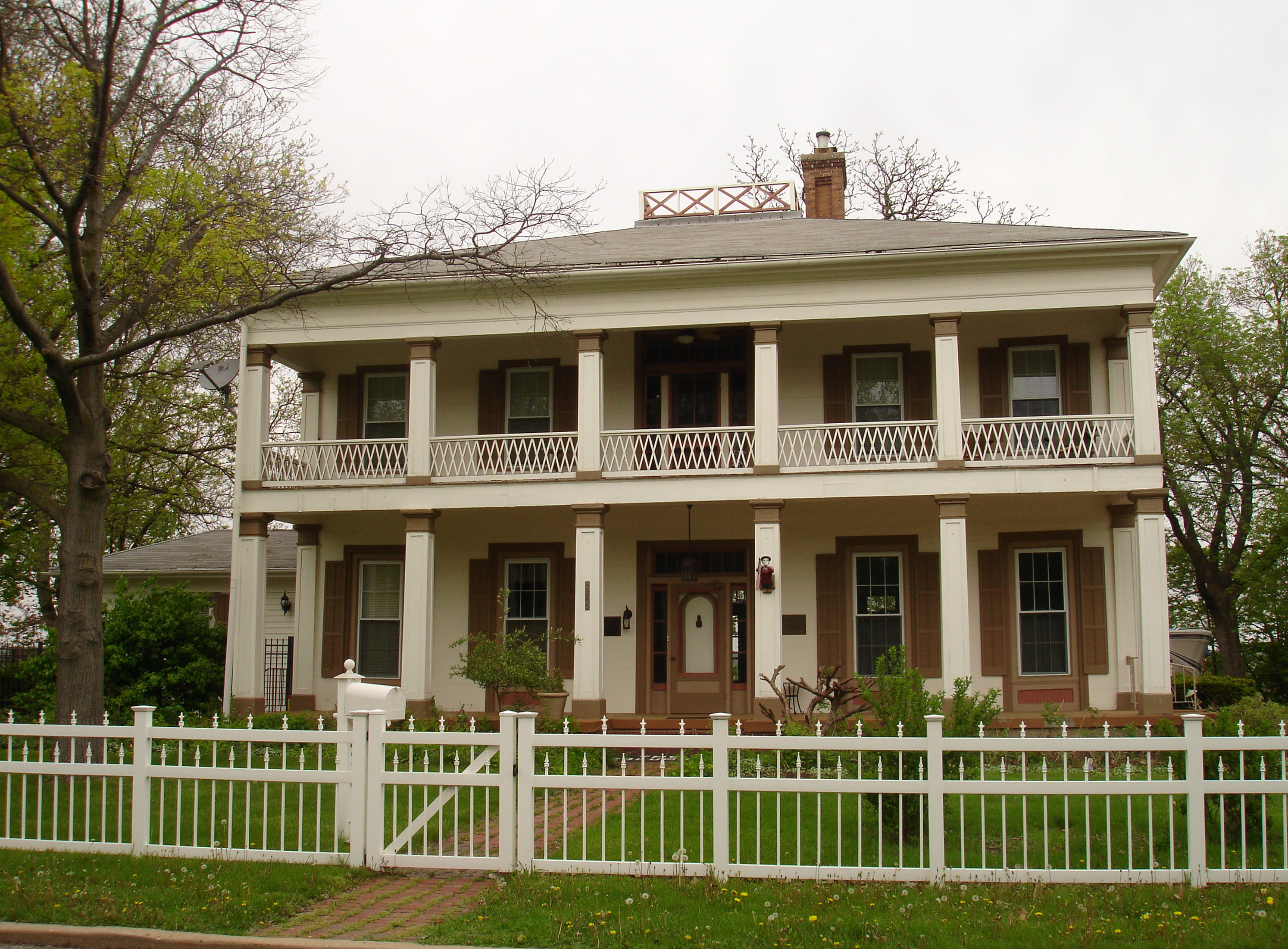
41°20′9″N 89°5′13″W / 41.33583°N 89.08694°WLaSalle 8 John Hossack House 
March 16, 1972 210 W. Prospect St.
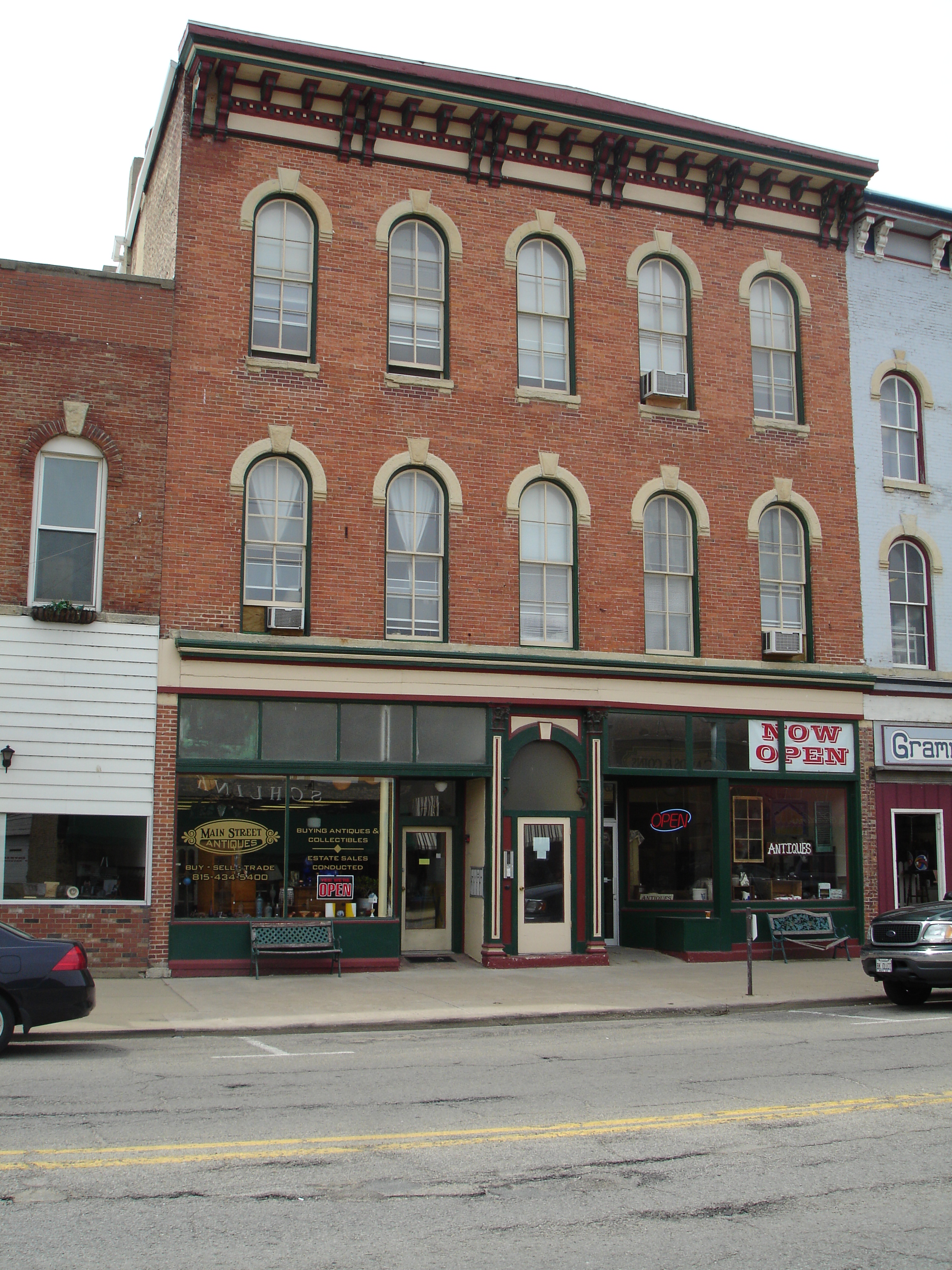
41°20′24″N 88°50′28″W / 41.34°N 88.84111°WOttawa 9 Hotel Kaskaskia November 3, 1988 217 Marquette St.; also 629 2nd St.
41°19′46″N 89°5′45″W / 41.32944°N 89.09583°WLaSalle Second set of boundaries represents a boundary increase of January 22, 2007, the Hotel Kaskaskia Buildings 10 Hotel Plaza Site June 18, 1998 The base of Starved Rock in Starved Rock State Park[2] Utica 11 Knuessl Building 
May 11, 1992 215-217 W. Main
41°20′44″N 88°50′36″W / 41.34556°N 88.84333°WOttawa 12 LaSalle City Building August 29, 1985 745 2nd St.
41°19′46″N 89°5′41″W / 41.32944°N 89.09472°WLaSalle 13 Little Beaver Site June 18, 1998 Address Restricted Utica 14 Marseilles Hydro Plant 
May 9, 1989 Commercial St.
41°19′37″N 88°42′55″W / 41.32694°N 88.71528°WMarseilles 15 Marseilles Lock and Dam Historic District March 10, 2004 1 Hawk Dr. Marseilles 16 Andrew J. O'Conor III House 
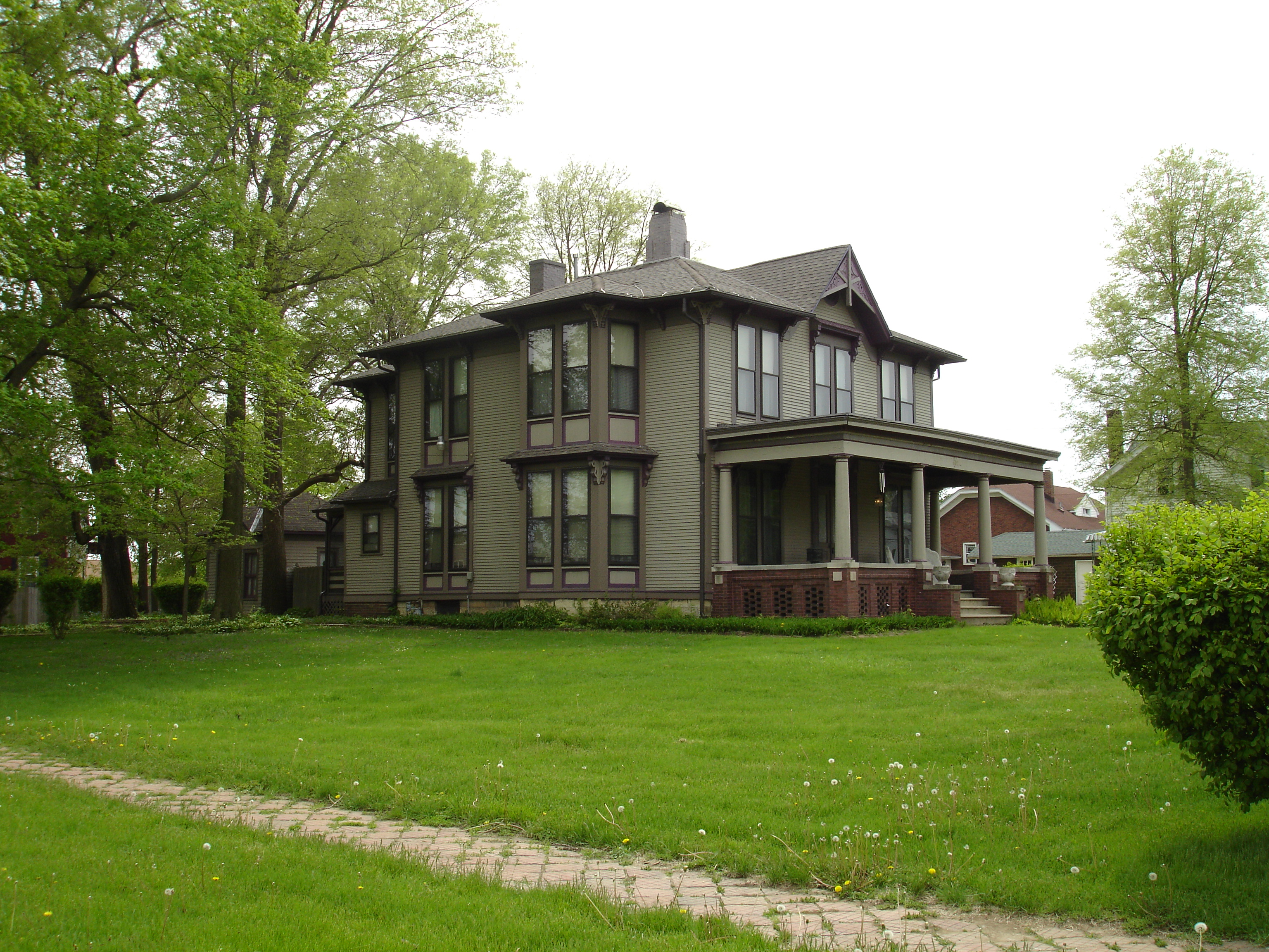
April 22, 1993 637 Chapel St.
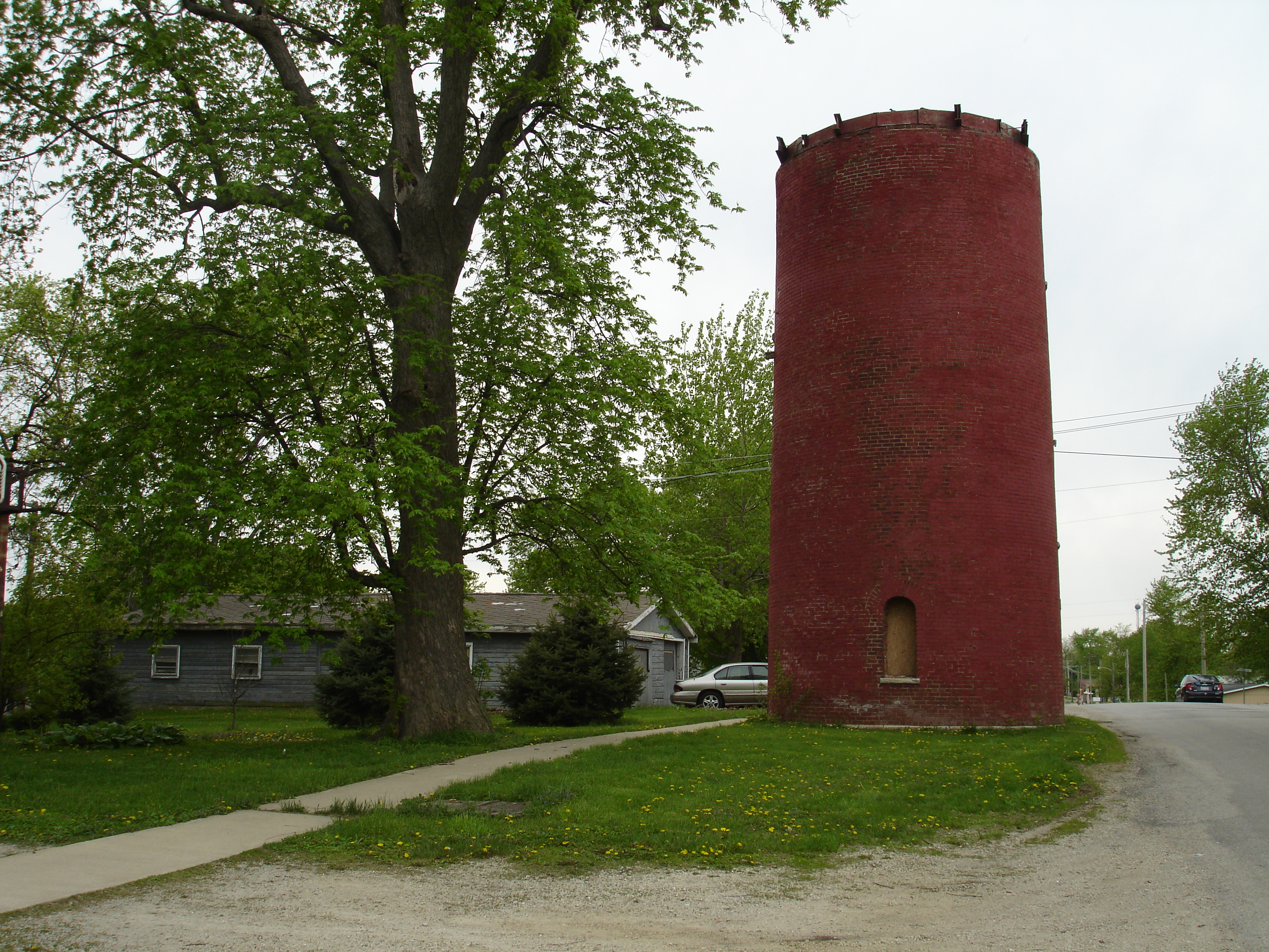
41°20′55″N 88°49′45″W / 41.34861°N 88.82917°WOttawa 17 Old Kaskaskia Village October 15, 1966 Dee Bennett Rd, two miles east of IL Route 178, near North Utica[3] Ottawa 18 Ransom Water Tower 
November 2, 1990 Plumb St. between Cartier and Columbus
41°9′24″N 88°38′57″W / 41.15667°N 88.64917°WRansom 19 Shaky Shelter Site June 18, 1998 Address Restricted Utica 20 Spring Valley House-Sulfur Springs Hotel November 20, 1987 Dee Bennett Rd.
41°19′23″N 88°57′47″W / 41.32306°N 88.96306°WUtica 21 Starved Rock 
October 15, 1966 6 mi. from Ottawa on IL 71, Starved Rock State Park
41°19′14″N 88°59′26″W / 41.32056°N 88.99056°WOttawa 22 Starved Rock Lock and Dam Historic District 
March 10, 2004 950 N 27th Rd.
41°19′25.49″N 88°58′35.75″W / 41.3237472°N 88.9765972°WOttawa 23 Starved Rock Lodge and Cabins May 8, 1985 Box 116, Utica
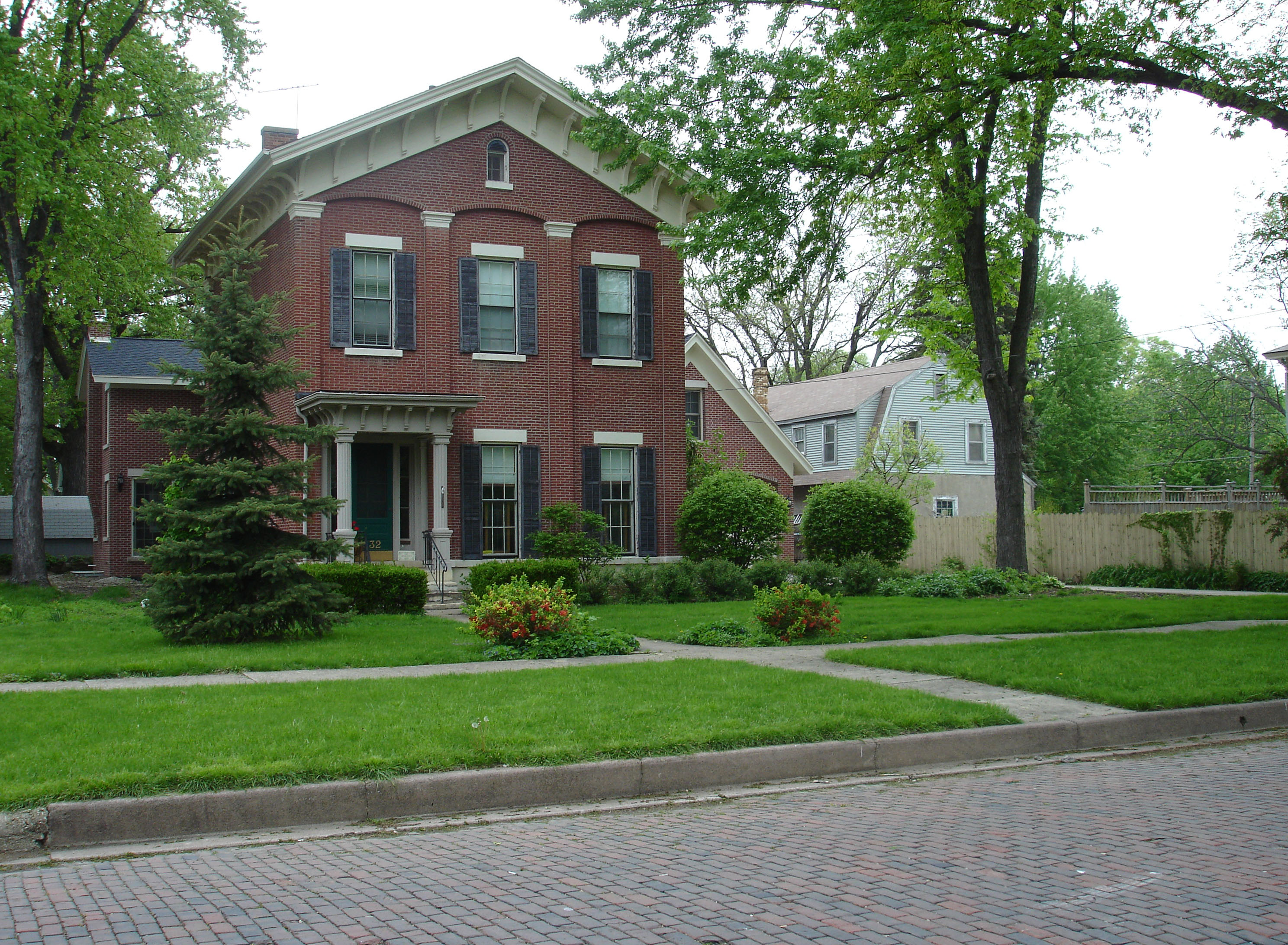
41°19′7″N 88°59′35″W / 41.31861°N 88.99306°WLaSalle-Peru 24 Jeremiah Strawn House 
January 24, 1995 532 Congress St.
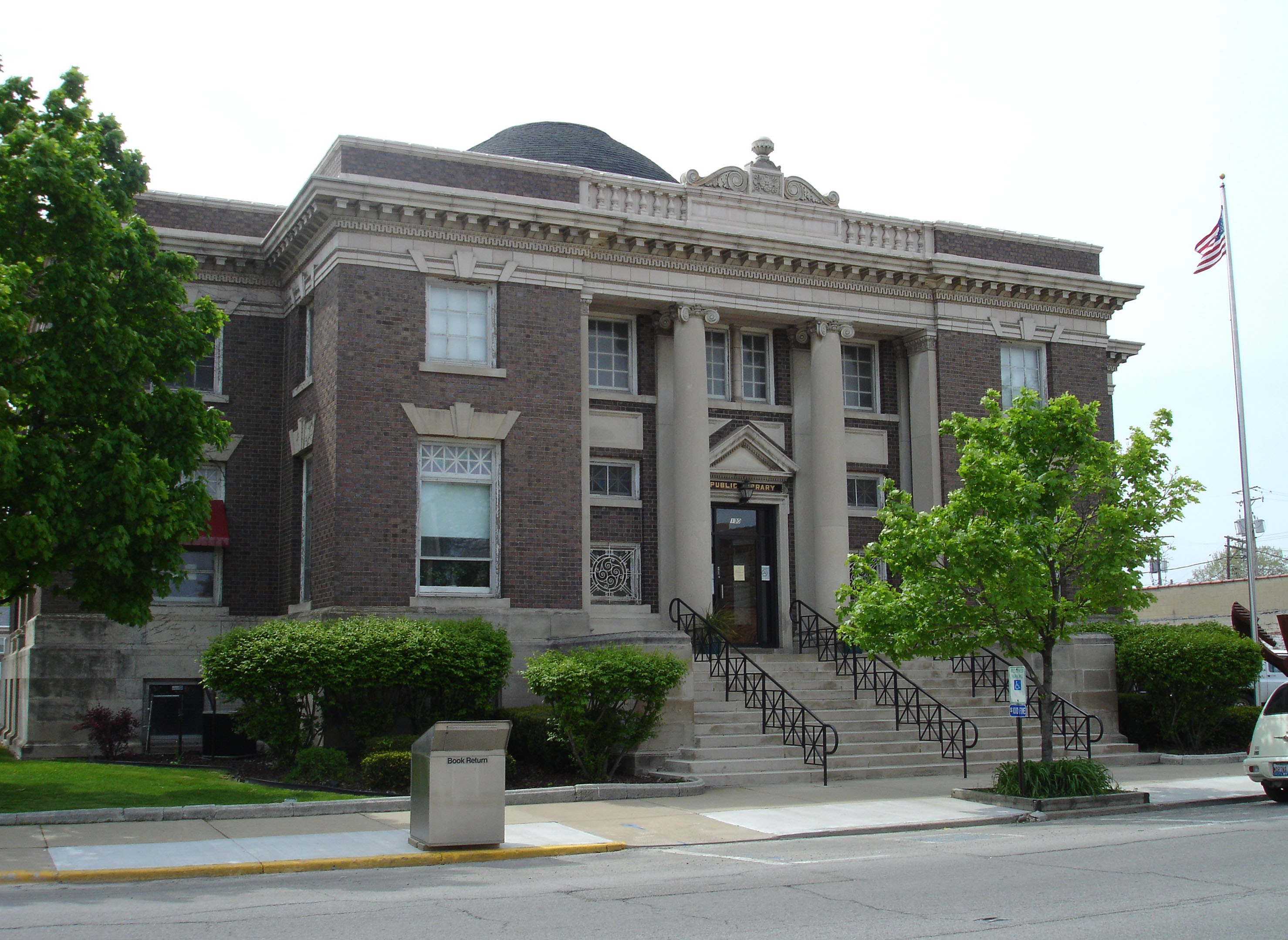
41°20′49″N 88°50′0″W / 41.34694°N 88.833333°WOttawa 25 Streator Public Library 
May 2, 1996 130 S. Park St.
41°7′10″N 88°50′4″W / 41.11944°N 88.83444°WStreator 26 Washington Park Historic District 
April 11, 1973 Bounded by Jackson, LaSalle, Lafayette, and Columbus Sts.
41°20′57″N 88°50′30″W / 41.34917°N 88.84167°WOttawa 27 Westclox Manufacturing Plant Historic District June 1, 2007 300-315 5th St.
41°19′44.87″N 89°6′34.88″W / 41.3291306°N 89.1096889°WPeru 28 Silas Williams House 
June 23, 1976 702 E. Broadway
41°7′29″N 88°49′32″W / 41.12472°N 88.82556°WStreator See also
- List of National Historic Landmarks in Illinois
- National Register of Historic Places listings in Illinois
References
- ^ "National Register of Historic Places: Weekly List Actions". National Park Service, United States Department of the Interior. Retrieved on November 10, 2011.
- ^ "I&M Cultural Heritage". Illinois Department of Natural Resources. http://dnr.state.il.us/lands/landmgt/parks/i&m/corridor/archeo/period/period.htm. Retrieved June 30, 2010.
- ^ http://www.state.il.us/hpa/hs/grand_village.htm
U.S. National Register of Historic Places Topics Lists by states Alabama • Alaska • Arizona • Arkansas • California • Colorado • Connecticut • Delaware • Florida • Georgia • Hawaii • Idaho • Illinois • Indiana • Iowa • Kansas • Kentucky • Louisiana • Maine • Maryland • Massachusetts • Michigan • Minnesota • Mississippi • Missouri • Montana • Nebraska • Nevada • New Hampshire • New Jersey • New Mexico • New York • North Carolina • North Dakota • Ohio • Oklahoma • Oregon • Pennsylvania • Rhode Island • South Carolina • South Dakota • Tennessee • Texas • Utah • Vermont • Virginia • Washington • West Virginia • Wisconsin • WyomingLists by territories Lists by associated states Other  Category:National Register of Historic Places •
  Portal:National Register of Historic PlacesCategories:
- LaSalle County, Illinois
- National Register of Historic Places in Illinois by county
- National Register of Historic Places in LaSalle County, Illinois
-


Wikimedia Foundation. 2010.