- National Register of Historic Places listings in Koochiching County, Minnesota
-
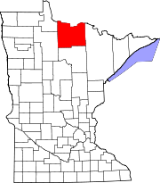
 Location of Koochiching County in Minnesota
This is a list of the National Register of Historic Places listings in Koochiching County, Minnesota. It is intended to be a complete list of the properties and districts on the National Register of Historic Places in Koochiching County, Minnesota, United States. The locations of National Register properties and districts for which the latitude and longitude coordinates are included below, may be seen in a Google map.[1]
There are 12 properties and districts listed on the National Register in the county.
-
- This National Park Service list is complete through NPS recent listings posted November 10, 2011.[2]
Listings county-wide
[3] Landmark name [4] Image Date listed Location City or town Summary 1 Alexander Baker School and E.W. Backus Junior High School May 26, 2004 900 5th St.
48°36′04″N 93°24′48″W / 48.601111°N 93.413333°WInternational Falls 2 Bridge No. 5721 July 13, 1998 Minnesota Highway 65 over the Little Fork River
47°58′34″N 93°08′37″W / 47.976111°N 93.143611°WSilverdale 3 Finsted's Auto Marine Shop January 27, 1983 Sand Bay between Oak Ave. and Spruce St.
48°36′57″N 93°20′51″W / 48.615833°N 93.3475°WRanier 4 Gold Mine Sites May 6, 1977 Off Minnesota Highway 11 in Voyageurs National Park
48°36′29″N 93°07′39″W / 48.608056°N 93.1275°WIsland View 5 Koochiching County Courthouse September 15, 1977 4th St. and 7th Ave.
48°36′05″N 93°24′38″W / 48.601389°N 93.410556°WInternational Falls 6 Laurel Mounds January 20, 1972 Address Restricted International Falls 7 Little American Mine April 16, 1975 Off Minnesota Highway 11 in Voyageurs National Park
48°36′09″N 93°10′05″W / 48.6025°N 93.168056°WIsland View 8 McKinstry Mounds and Village Site December 18, 1978 Address Restricted International Falls 9 Nett Lake Petroglyphs Site December 30, 1974 Address Restricted Orr 10 Ernest C. Oberholtzer Rainy Lake Islands Historic District June 16, 2000 Mallard, Hawk, and Crow Islands in Rainy Lake
48°37′12″N 93°12′21″W / 48.62°N 93.205833°WRanier 11 Sts. Peter and Paul Russian Orthodox Church January 27, 1983 Minnesota Highway 65
47°54′18″N 93°09′53″W / 47.905°N 93.164722°WBramble 12 Francis White Homestead January 27, 1983 North of Littlefork off U.S. Route 71
48°25′33″N 93°34′02″W / 48.425833°N 93.567222°WLittlefork See also
- List of National Historic Landmarks in Minnesota
- National Register of Historic Places listings in Minnesota
References
- ^ The latitude and longitude information provided in this table was derived originally from the National Register Information System, which has been found to be fairly accurate for about 99% of listings. For about 1% of NRIS original coordinates, experience has shown that one or both coordinates are typos or otherwise extremely far off; some corrections may have been made. A more subtle problem causes many locations to be off by up to 150 yards, depending on location in the country: most NRIS coordinates were derived from tracing out latitude and longitudes off of USGS topographical quadrant maps created under North American Datum of 1927, which differs from the current, highly accurate GPS system used by Google maps. Chicago is about right, but NRIS longitudes in Washington are higher by about 4.5 seconds, and are lower by about 2.0 seconds in Maine. Latitudes differ by about 1.0 second in Florida. Some locations in this table may have been corrected to current GPS standards.
- ^ "National Register of Historic Places: Weekly List Actions". National Park Service, United States Department of the Interior. Retrieved on November 10, 2011.
- ^ Numbers represent an ordering by significant words. Various colorings, defined here, differentiate National Historic Landmark sites and National Register of Historic Places Districts from other NRHP buildings, structures, sites or objects.
- ^ "National Register Information System". National Register of Historic Places. National Park Service. . http://nrhp.focus.nps.gov/natreg/docs/All_Data.html.
U.S. National Register of Historic Places Topics Lists by states Alabama • Alaska • Arizona • Arkansas • California • Colorado • Connecticut • Delaware • Florida • Georgia • Hawaii • Idaho • Illinois • Indiana • Iowa • Kansas • Kentucky • Louisiana • Maine • Maryland • Massachusetts • Michigan • Minnesota • Mississippi • Missouri • Montana • Nebraska • Nevada • New Hampshire • New Jersey • New Mexico • New York • North Carolina • North Dakota • Ohio • Oklahoma • Oregon • Pennsylvania • Rhode Island • South Carolina • South Dakota • Tennessee • Texas • Utah • Vermont • Virginia • Washington • West Virginia • Wisconsin • WyomingLists by territories Lists by associated states Other  Category:National Register of Historic Places •
  Portal:National Register of Historic Places
Municipalities and communities of Koochiching County, Minnesota County seat: International Falls Cities Big Falls | International Falls | Littlefork | Mizpah | Northome | Ranier
Unorganized
territoriesUnincorporated
communitiesBirchdale | Craigsville | Indus | Island View | Loman | Margie | Pelland | Ray
Indian
reservationCategories:- National Register of Historic Places in Minnesota by county
- Koochiching County, Minnesota
- Buildings and structures in Koochiching County, Minnesota
-

Wikimedia Foundation. 2010.