- National Register of Historic Places listings in Kandiyohi County, Minnesota
-
 Location of Kandiyohi County in Minnesota
This is a list of the National Register of Historic Places listings in Kandiyohi County, Minnesota. It is intended to be a complete list of the properties and districts on the National Register of Historic Places in Kandiyohi County, Minnesota, United States. The locations of National Register properties and districts for which the latitude and longitude coordinates are included below, may be seen in a Google map.[1]
There are 12 properties and districts listed on the National Register in the county.
-
- This National Park Service list is complete through NPS recent listings posted November 10, 2011.[2]
Listings county-wide
[3] Landmark name [4] Image Date listed Location City or town Summary 1 John Bosch Farmstead April 23, 1987 County Road 4
45°02′45″N 94°50′17″W / 45.045833°N 94.838056°WLake Lillian 2 Andreas, Johanna, Anna and Frank E. Broman Farmstead February 28, 1991 Off County Road 8 between Swan Lake and Kasota Lake
45°04′37″N 94°54′39″W / 45.076944°N 94.910833°WKandiyohi Township 3 District No. 55 School April 16, 1987 County Highway 13
45°00′31″N 95°02′41″W / 45.008611°N 95.044722°WWillmar 4 Lars and Guri Endreson House July 24, 1986 Off County Highway 5
45°10′59″N 95°06′23″W / 45.183056°N 95.106389°WWillmar 5 Hotel Atwater 
June 13, 1986 322 Atlantic Ave.
45°08′12″N 94°46′56″W / 45.136667°N 94.782222°WAtwater 6 A. Larson & Co. Building March 2, 1989 539 W. Pacific Ave.
45°07′20″N 95°03′02″W / 45.122222°N 95.050556°WWillmar 7 Sibley State Park CCC/Rustic Style Historic District January 22, 1992 Off U.S. Route 71 west of New London
45°18′55″N 95°02′14″W / 45.315278°N 95.037222°WNew London (ed. note: may or may not need sep article vs. Sibley State Park ) 8 John M. Spicer House August 13, 1986 515 7th St., NW.
45°07′32″N 95°03′15″W / 45.125556°N 95.054167°WWillmar 9 John M. Spicer Summer House and Farm August 6, 1986 600 S. Lake Ave.
45°14′02″N 94°53′39″W / 45.233889°N 94.894167°WSpicer 10 Willmar Auditorium August 9, 1991 311 6th St., SW.
45°07′14″N 95°03′00″W / 45.120556°N 95.05°WWillmar 11 Willmar Hospital Farm for Inebriates Historic District 
August 13, 1986 Off U.S. Route 71
45°08′32″N 95°01′00″W / 45.142222°N 95.016667°WWillmar 12 Willmar Tribune Building May 15, 2007 311 4th St., SW.
45°07′15″N 95°02′51″W / 45.120833°N 95.0475°WWillmar 10 Spicer Castle Inn August 9, 1991 11600 Indian Beach Road, Spicer, MN 56288
45°14′02″N 94°53′03″W / 45.233889°N 94.884167°WSpicer (John Spicer, built the Spicer Castle Inn in 1895, with 500 feet of beautiful lakeshore on Green Lake.) See also
- List of National Historic Landmarks in Minnesota
- National Register of Historic Places listings in Minnesota
References
- ^ The latitude and longitude information provided in this table was derived originally from the National Register Information System, which has been found to be fairly accurate for about 99% of listings. For about 1% of NRIS original coordinates, experience has shown that one or both coordinates are typos or otherwise extremely far off; some corrections may have been made. A more subtle problem causes many locations to be off by up to 150 yards, depending on location in the country: most NRIS coordinates were derived from tracing out latitude and longitudes off of USGS topographical quadrant maps created under the North American Datum of 1927, which differs from the current, highly accurate WGS84 GPS system used by Google maps. Chicago is about right, but NRIS longitudes in Washington are higher by about 4.5 seconds, and are lower by about 2.0 seconds in Maine. Latitudes differ by about 1.0 second in Florida. Some locations in this table may have been corrected to current GPS standards.
- ^ "National Register of Historic Places: Weekly List Actions". National Park Service, United States Department of the Interior. Retrieved on November 10, 2011.
- ^ Numbers represent an ordering by significant words. Various colorings, defined here, differentiate National Historic Landmark sites and National Register of Historic Places Districts from other NRHP buildings, structures, sites or objects.
- ^ "National Register Information System". National Register of Historic Places. National Park Service. . http://nrhp.focus.nps.gov/natreg/docs/All_Data.html.
U.S. National Register of Historic Places Topics Lists by states Alabama • Alaska • Arizona • Arkansas • California • Colorado • Connecticut • Delaware • Florida • Georgia • Hawaii • Idaho • Illinois • Indiana • Iowa • Kansas • Kentucky • Louisiana • Maine • Maryland • Massachusetts • Michigan • Minnesota • Mississippi • Missouri • Montana • Nebraska • Nevada • New Hampshire • New Jersey • New Mexico • New York • North Carolina • North Dakota • Ohio • Oklahoma • Oregon • Pennsylvania • Rhode Island • South Carolina • South Dakota • Tennessee • Texas • Utah • Vermont • Virginia • Washington • West Virginia • Wisconsin • WyomingLists by territories Lists by associated states Other Municipalities and communities of Kandiyohi County, Minnesota Cities 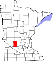
Townships Arctander | Burbank | Colfax | Dovre | East Lake Lillian | Edwards | Fahlun | Gennessee | Green Lake | Harrison | Holland | Irving | Kandiyohi | Lake Andrew | Lake Elizabeth | Lake Lillian | Mamre | New London | Norway Lake | Roseland | Roseville | St. Johns | Whitefield | Willmar
Unincorporated
communityHawick
Categories:- National Register of Historic Places in Minnesota by county
- Kandiyohi County, Minnesota
- Buildings and structures in Kandiyohi County, Minnesota
-


Wikimedia Foundation. 2010.