- National Register of Historic Places listings in Grady County, Oklahoma
-
 Location of Grady County in Oklahoma
This is a list of the National Register of Historic Places listings in Grady County, Oklahoma.
This is intended to be a complete list of the properties and districts on the National Register of Historic Places in Grady County, Oklahoma, United States. The locations of National Register properties and districts for which the latitude and longitude coordinates are included below, may be seen in a Google map.[1]
There are 12 properties and districts listed on the National Register in the county.
-
- This National Park Service list is complete through NPS recent listings posted November 10, 2011.[2]
Current listings
[3] Landmark name [4] Image Date listed Location City or town Summary 1 Chickasha Downtown Historic District March 10, 2005 Roughly bounded by 1st St., 3rd St., Kansas Ave., 7th St., and the alley north of Chickasa Ave.
35°03′04″N 97°56′14″W / 35.051111°N 97.937222°WChickasha 2 Grady County Courthouse March 10, 2005 326 W. Choctaw Ave.
35°03′09″N 97°56′07″W / 35.0525°N 97.935278°WChickasha 3 Jewett Site 
February 14, 1979 Address Restricted Bradley 4 Knippelmeir Farmstead September 8, 2011 672 OK 152
35°20′07″N 97°59′41″W / 35.335278°N 97.994722°WMinco vicinity 5 Minco Armory May 20, 1994 407 W. Pontotoc St.
35°18′56″N 97°56′46″W / 35.315556°N 97.946111°WMinco 6 New Hope Baptist Church June 5, 2003 1202 S. Shepherd St.
35°02′20″N 97°55′51″W / 35.038889°N 97.930833°WChickasha 7 Oklahoma College for Women Historic District September 9, 2001 roughly bounded by Grand Ave., 19th St., Alabama Ave., and the alley west of 15th St.
35°01′51″N 97°57′17″W / 35.030833°N 97.954722°WChickasha 8 Pocasset Gymnasium December 13, 1996 0.5 miles south of junction of Dutton Rd. and State Highway 81
35°11′31″N 97°57′17″W / 35.191944°N 97.954722°WPocasset 9 Rock Island Depot March 29, 1985 Chickasha Ave.
35°03′07″N 97°55′55″W / 35.051944°N 97.931944°WChickasha 10 Silver City Cemetery December 4, 2008 6/10 mile from the section line on the southern side of section 22, T10N, R6W I.M.
35°19′42″N 97°44′54″W / 35.328333°N 97.748333°WTuttle 11 US Post Office and Federal Courthouse December 29, 1994 Southwestern corner of the junction of 4th and Choctaw Sts.
35°03′07″N 97°56′12″W / 35.051944°N 97.936667°WChickasha 12 Verden Separate School December 16, 2005 315 E. Ada Sipuel Ave.
35°02′39″N 97°55′43″W / 35.044167°N 97.928611°WChickasha See also
- List of National Historic Landmarks in Oklahoma
- National Register of Historic Places listings in Oklahoma
References
- ^ The latitude and longitude information provided in this table was derived originally from the National Register Information System, which has been found to be fairly accurate for about 99% of listings. For about 1% of NRIS original coordinates, experience has shown that one or both coordinates are typos or otherwise extremely far off; some corrections may have been made. A more subtle problem causes many locations to be off by up to 150 yards, depending on location in the country: most NRIS coordinates were derived from tracing out latitude and longitudes off of USGS topographical quadrant maps created under the North American Datum of 1927, which differs from the current, highly accurate WGS84 GPS system used by Google maps. Chicago is about right, but NRIS longitudes in Washington are higher by about 4.5 seconds, and are lower by about 2.0 seconds in Maine. Latitudes differ by about 1.0 second in Florida. Some locations in this table may have been corrected to current GPS standards.
- ^ "National Register of Historic Places: Weekly List Actions". National Park Service, United States Department of the Interior. Retrieved on November 10, 2011.
- ^ Numbers represent an ordering by significant words. Various colorings, defined here, differentiate National Historic Landmark sites and National Register of Historic Places Districts from other NRHP buildings, structures, sites or objects.
- ^ "National Register Information System". National Register of Historic Places. National Park Service. . http://nrhp.focus.nps.gov/natreg/docs/All_Data.html.
U.S. National Register of Historic Places Topics Lists by states Alabama • Alaska • Arizona • Arkansas • California • Colorado • Connecticut • Delaware • Florida • Georgia • Hawaii • Idaho • Illinois • Indiana • Iowa • Kansas • Kentucky • Louisiana • Maine • Maryland • Massachusetts • Michigan • Minnesota • Mississippi • Missouri • Montana • Nebraska • Nevada • New Hampshire • New Jersey • New Mexico • New York • North Carolina • North Dakota • Ohio • Oklahoma • Oregon • Pennsylvania • Rhode Island • South Carolina • South Dakota • Tennessee • Texas • Utah • Vermont • Virginia • Washington • West Virginia • Wisconsin • WyomingLists by territories Lists by associated states Other Municipalities and communities of Grady County, Oklahoma Cities 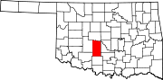
Towns Alex | Amber | Bradley | Bridge Creek | Ninnekah | Norge | Pocasset | Rush Springs | Verden
Unincorporated
communitiesAgawan | Chitwood | Cox City | Middleberg | Tabler
Ghost towns Acme | Bailey
Footnotes ‡This populated place also has portions in an adjacent county or counties
Categories:- Grady County, Oklahoma
- National Register of Historic Places in Oklahoma by county
- Buildings and structures in Grady County, Oklahoma
-

Wikimedia Foundation. 2010.