- Blanchard, Oklahoma
Infobox Settlement
official_name = Blanchard, Oklahoma
settlement_type =City
nickname =
motto =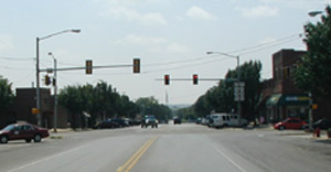
imagesize = 250px
image_caption = Main Street in Blanchard
image_
mapsize = 250px
map_caption = Location of Blanchard, Oklahoma
mapsize1 =
map_caption1 =subdivision_type = Country
subdivision_name =United States
subdivision_type1 = State
subdivision_name1 =Oklahoma
subdivision_type2 = Counties
subdivision_name2 = McClain, Gradygovernment_footnotes =
government_type =
leader_title =
leader_name =
leader_title1 =
leader_name1 =
established_title =
established_date =unit_pref = Imperial
area_footnotes =
area_magnitude =
area_total_km2 = 28.8
area_land_km2 = 28.8
area_water_km2 = 0.0
area_total_sq_mi = 11.1
area_land_sq_mi = 11.1
area_water_sq_mi = 0.0population_as_of = 2000
population_footnotes =
population_total = 2816
population_density_km2 = 97.8
population_density_sq_mi = 253.2timezone = Central (CST)
utc_offset = -6
timezone_DST = CDT
utc_offset_DST = -5
elevation_footnotes =
elevation_m = 387
elevation_ft = 1270
latd = 35 |latm = 8 |lats = 56 |latNS = N
longd = 97 |longm = 39 |longs = 2 |longEW = Wpostal_code_type =
ZIP code
postal_code = 73010
area_code = 405
blank_name = FIPS code
blank_info = 40-06700GR|2
blank1_name = GNIS feature ID
blank1_info = 1090249GR|3
website =
footnotes =Blanchard is a city in Grady and McClain counties in the
U.S. state ofOklahoma . The population was 2,816 at the 2000 census.Geography
Blanchard is located at coor dms|35|8|56|N|97|39|2|W|city (35.148830, -97.650677)GR|1 at the intersection of Oklahoma State Highways 76 and 62.
According to the
United States Census Bureau , the city has a total area of 11.1 square miles (28.8 km²), all land.Blanchard is considered to be part of a rapidly growing area of northern McClain and Grady Counties known as the "Tri-City Area" with Newcastle and Tuttle.
Demographics
As of the
census GR|2 of 2000, there were 2,816 people, 1,085 households, and 818 families residing in the city. Thepopulation density was 253.2 people per square mile (97.8/km²). There were 1,177 housing units at an average density of 105.8/sq mi (40.9/km²). The racial makeup of the city was 91.62% White, 0.32% African American, 3.23% Native American, 0.21% Asian, 0.53% from other races, and 4.08% from two or more races. Hispanic or Latino of any race were 2.41% of the population.There were 1,085 households out of which 36.2% had children under the age of 18 living with them, 62.0% were married couples living together, 10.1% had a female householder with no husband present, and 24.6% were non-families. 22.8% of all households were made up of individuals and 10.3% had someone living alone who was 65 years of age or older. The average household size was 2.57 and the average family size was 3.00.
In the city the population was spread out with 27.5% under the age of 18, 7.7% from 18 to 24, 29.5% from 25 to 44, 21.5% from 45 to 64, and 13.8% who were 65 years of age or older. The median age was 36 years. For every 100 females there were 91.0 males. For every 100 females age 18 and over, there were 86.7 males.
The median income for a household in the city was $37,121, and the median income for a family was $43,028. Males had a median income of $31,691 versus $23,182 for females. The
per capita income for the city was $17,323. About 7.8% of families and 10.1% of the population were below thepoverty line , including 11.5% of those under age 18 and 11.6% of those age 65 or over.History
Blanchard was founded in 1907 and was named for W. G. Blanchard (developer).
Blanchard Today
Blanchard consists of a one square mile "core" of streets roughly laid out in a grid pattern situated atop a gentle hill surrounded by newer development and agricultural areas within about a four mile (6 km) radius of the center. Central Blanchard consists of homes (about half built before 1960), several churches and a historic Main Street downtown area. The commercial downtown features antique shops, eating establishments, city services, senior center and a fitness center.
On the periphery of the city center are schools, businesses and modern
housing subdivision s. These subdivisions tend to be low-density (typically one to five acre lots.)While Blanchard is often described as a
commuter town with much of its workforce commuting to nearby Norman andOklahoma City , local businesses are beginning to surge. As of 2008, local amenities include a supermarket, several restaurants, public library, banks, a large building supply center, new hardware store and a large car dealership.chools
Blanchard is served by four secondary schools with an average enrollment (as of 2008) of about 1,460 students. The elementary school is of recent construction and houses grades Pre-K through third. There is also an intermediate school for fourth and fifth grades and a middle school for sixth through eighth grades.
Blanchard High School is home to "The Lions"
football team (class 3A.) The robust athletic program also includesbaseball ,softball ,basketball ,golf ,cheerleading ,powerlifting andwrestling . Also of note is the Blanchard High SchoolMarching Band which routinely wins top honors at state competitions.Recreation
There are currently two parks in Blanchard as well as an athletic stadium and three nearby golf courses.
Annual festivals include "May Daze" in early May and "Pepperfest" in mid-June.
Growth Issues
Residents of Blanchard tend to view it as a small town environment with character and charm, however, the rapid growth in the area has brought change. In an effort to keep the town from being swallowed by
urban sprawl , a large annexation was effected in 2004 to provide Blanchard with a "buffer zone". A Main Street beautification project is underway and infrastructure is being improved to handle the rise in population. In 2007, several older buildings in central Blanchard were removed to allow the widening of U.S. Highway 62, yet the historic downtown commercial buildings were preserved.Media
Residents of Blanchard and nearby
Dibble, Oklahoma are served by the weekly newspaper "The Blanchard News". The radio stationKOJK ("Jack FM") identifies Blanchard as its home, however, only thetransmitter is located in Blanchard, while the operating offices are inOklahoma City .References
External links
* [http://www.cityofblanchard.com/ Official City of Blanchard website]
* [http://www.blanchardchamber.com/ Blanchard Chamber of Commerce]
* [http://www.blanchard.k12.ok.us/ Blanchard Public Schools]
* [http://www.justsoyouknow.us/blanchard Blanchard Public Library]
* [http://www.newsok.com/article/2775403/ Daily Oklahoman article in reference to the large annexation in 2004]
Wikimedia Foundation. 2010.