- Newcastle, Oklahoma
-
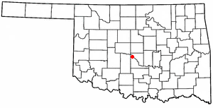
Newcastle, Oklahoma — City — Location of NewCastle, Oklahoma
Coordinates: 35°14′25″N 97°35′29″W / 35.24028°N 97.59139°WCoordinates: 35°14′25″N 97°35′29″W / 35.24028°N 97.59139°W Country United States State Oklahoma County McClain Area – Total 52.9 sq mi (137.1 km2) – Land 49.8 sq mi (128.9 km2) – Water 3.2 sq mi (8.2 km2) Elevation 1,194 ft (364 m) Population (2010) – Total 7,685 – Density 109.2/sq mi (42.2/km2) Time zone Central (CST) (UTC-6) – Summer (DST) CDT (UTC-5) ZIP code 73065 Area code(s) 405 FIPS code 40-51150[1] GNIS feature ID 1095853[2] Newcastle is the largest city in McClain County, Oklahoma, United States, and a part of the Oklahoma City Metropolitan Area. The population was 7,685 at the 2010 census.
Contents
Geography
Newcastle is located at 35°14′50.82″N 97°36′.22″W / 35.24745°N 97.6000611°W (35.145082, -97.360022)[3].
According to the United States Census Bureau, the city has a total area of 62.5 square miles (162 km2), of which, 55.8 square miles (145 km2) of it is land and 6.7 square miles (17 km2) of it (6.01%) is water.
Newcastle is considered to be part of a rapidly growing area of northern McClain and Grady Counties. Newcastle also is a part of an area known as the "Tri-City Area" with Tuttle and Blanchard. Newcastle also serves as the largest incorporated community in McClain County.
Demographics
As of the census[1] of 2010, there were 7,685 people, 2,839 households, and 2,271 families residing in the city. The population density was 122.9 people per square mile. The racial makeup of the city was 84.53% White, 0.53% African American, 5.26% Native American, 0.32% Asian and 10.30% from other races from two or more races. Hispanic or Latino of any race were 4.31% of the population.
There were 2,540 households out of which 20.6% had children under the age of 18 living with them, 72.5% were married couples living together, 7.7% had a female householder with no husband present, and 16.5% were non-families. 14.2% of all households were made up of individuals and 5.5% had someone living alone who was 65 years of age or older. The average household size was 2.75 and the average family size was 3.02.
In the city, the population was spread out with 20.6% under the age of 18, 7.56% from 18 to 24, 29.58% from 25 to 44, 28.24% from 45 to 64, and 8.39% who were 65 years of age or older. The median age was 38 years. Females represented 49.84% of the population with a median age of 43 and males represented 50.16% of the population with a median age of 39 years.
The average income for a household in the city was $82,332, and the median income for a household was $67,961. The per capita income for the city was $29,940.
Stats provided by Synergos PopStats
History
The main street in Newcastle, Oklahoma used to be called the Ozark Trail, running from Rogers, Arkansas (Ozarks) to around Roswell, New Mexico. Much of the road was incorporated into what became US 62, which passes through the city over the same path. The Ozark Trail bridge over the South Canadian River between Newcastle and Oklahoma City was the first federal funded highway project built in Oklahoma, in 1925. It was a steel thru-truss bridge with timber flooring and carried traffic on the Ozark Trail, which was later designated as US 62. Until the mid-twenties, there was a major river ford at May Avenue that was used whenever the water wasn't too deep. Farmers from Newcastle forged the river with their horses and wagons and traveled up May Avenue on their way to the Oklahoma City Farmer's Market by Western and Reno. Today, the old Newcastle Bridge sits unused alongside the Interstate 44 bridge.
The city limits of Newcastle encompassed just a few square miles until around 1960, when Oklahoma City began annexing huge chunks of land across the river. Newcastle expanded, as did Tuttle and Blanchard, to prevent the city from trying to move across the river. The population grew very little until the mid-1970s, when Oklahoma City began expanding past SW 74th Street, populating near the I-44 corridor.
In the 1980s, most of the city's territory near Norman (north of state HW 9) was annexed.
The 1999 Oklahoma tornado outbreak struck parts of Newcastle, resulting in the destruction of several homes in the city limits, however much greater destruction occurred in Bridge Creek, Oklahoma and Moore, Oklahoma.
In 2004, a Wal-Mart Super Center opened, which resulted in significant development at Tri-City shopping district.
In 2010, Newcastle was listed in the Top 10 fastest growing communities in Oklahoma with a population increase of 41.4% since 2000. Making Newcastle, the largest populated city in McClain County, Oklahoma.
On May 24, 2011, tornadoes ripped through parts Newcastle. There were an estimated 160 homes either damaged or destroyed and over 20 businesses damaged. However, there was no loss of life.
References
- ^ a b "American FactFinder". United States Census Bureau. http://factfinder.census.gov. Retrieved 2008-01-31.
- ^ "US Board on Geographic Names". United States Geological Survey. 2007-10-25. http://geonames.usgs.gov. Retrieved 2008-01-31.
- ^ "US Gazetteer files: 2010, 2000, and 1990". United States Census Bureau. 2011-02-12. http://www.census.gov/geo/www/gazetteer/gazette.html. Retrieved 2011-04-23.
External links
- City of Newcastle
- Newcastle Chamber of Commerce
- Newcastle Public Schools
- Newcastle Pacer - local paper
- Newcastle Public Library
Municipalities and communities of McClain County, Oklahoma Cities 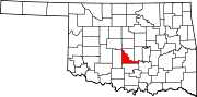
Towns Unincorporated
communitiesCriner | Payne | Stealy | Woody Chapel
Footnotes ‡This populated place also has portions in an adjacent county or counties
Municipalities of the Greater Oklahoma City Metropolitan Area Population over 500,000 Population over 100,000 Population over 50,000 Population over 20,000 Population over 10,000 Population over 5,000 Population over 2,000 Bethel Acres • Chandler • Harrah • Jones • Lexington • McLoud • Nichols Hills • Nicoma Park • Prague • Slaughterville • Spencer • StroudPopulation over 1,000 Crescent • Forest Park • Goldsby • Langston • Luther • Maud • Minco • Ninnekah • Okarche • Pink • Rush Springs • Union CityPopulation over 500 Population over 200 Population under 200 Bradley • Bridge Creek • Brooksville • Cimarron City • Etowah • Fallis • Kendrick • Lake Aluma • Macomb • Meridian • Norge • Rosedale • Smith Village • Sparks • Woodlawn ParkUnincorporated areas Regional Government Association of Central Oklahoma GovernmentsCategories:- Oklahoma City Metropolitan Area
- Cities in Oklahoma
- Populated places in McClain County, Oklahoma

Wikimedia Foundation. 2010.