- Okarche, Oklahoma
-
Okarche, Oklahoma — Town — Location of Okarche, Oklahoma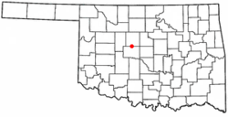
Coordinates: 35°43′35″N 97°58′34″W / 35.72639°N 97.97611°WCoordinates: 35°43′35″N 97°58′34″W / 35.72639°N 97.97611°W Country United States State Oklahoma Counties Kingfisher, Canadian Area – Total 0.7 sq mi (1.9 km2) – Land 0.7 sq mi (1.9 km2) – Water 0.0 sq mi (0.0 km2) Elevation 1,243 ft (379 m) Population (2000) – Total 1,110 – Density 1,490.3/sq mi (575.4/km2) Time zone Central (CST) (UTC-6) – Summer (DST) CDT (UTC-5) ZIP code 73762 Area code(s) 405 FIPS code 40-54050[1] GNIS feature ID 1096193[2] Okarche is a town in Canadian and Kingfisher counties in the U.S. state of Oklahoma, and a part of the Oklahoma City Metropolitan Area. The population was 1,110 at the 2000 census.
Contents
History
The Area: Okarche is located on land that, before 1830, was within the historic area of the Wichita Indians. The location was in territory assigned to the Creek and Seminole people when removal of tribes from the southeastern United States began in 1830. After the Civil War, parts of Indian Territory were designated for resettlement of Plains Indians. The site of the future town of Okarche was just inside the eastern boarder of the Cheyenne and Arapaho reservation.[3]
From 1867 to 1884, cattle were driven through the area on the Chisholm Trail from Texas to railheads in Kansas. Later the Chicago, Rock Island and Pacific Railway, and what would become US highway 81 would follow roughly the same route through Oklahoma Territory.
The Town: On March 2, 1887, the U.S. Congress approved construction of a railroad through Indian Territory. The Chicago, Kansas and Nebraska Railway was given a 100 foot right of way through the territory and authorized to take additional right of way for stations every 10 miles of track.[4] Railway assets would be turned over to the CRI&P in June of 1890. Construction proceeded southward from Caldwell, Kansas and was completed to Pond Creek by April 1889 and to El Reno in January of 1890. The railway depot where Okarche was platted would be completed at that time.
The Okarche post office was established June 28, 1890. Cheyenne and Arapaho lands were opened to settlement by land run on April 19, 1892. The town was incorporated in 1905 – two years before statehood. The name of the town is derived from parts of three words, Oklahoma (OK), Arapaho (AR), and Cheyenne (CHE). The Southern Arapaho and Cheyenne Native American tribes had been relocated to Oklahoma from the northern Great Plains in the late 19th century.[5] The town's population hovered in the 400s for more than three decades after statehood and peaked in 1990 at 1,160.
By the late 1890s, German immigrants were a greater part of the population and German a widely used language of the community.[6] Many had come to America in the wave of 1.5 million German immigrants to the United States in the 1880s and lived in states to the north such as Iowa, Nebraska, or Missouri before coming to Oklahoma Territory.[7] Catholic and Lutheran churches with schools were established as immigrants sought to keep faith and customs from the old country alive in their new home. St. John’s Lutheran Church was founded in 1892 and Holy Trinity Catholic Church in 1893. Worship and education was conducted principally in German until American entry into World War I in 1917. Bilingual worship would continue for about two decades.[8]
When federal highway numbering was implemented in 1927, the state road through Okarche was designated US-81 and fully paved in the Okarche area by 1931. The Northwest Highway (OK-3) was opened as a gravel-surfaced road in 1939 and fully paved by 1947. [9]Okarche now has 4-lane divided highway access to neighboring communities, including the Oklahoma City Metro area. The Chicago, Rock Island and Pacific Railroad entered its final bankruptcy in 1975. The Union Pacific Railway now operates on the former Rock Island route.
Economy
The town is best known for Eischen's Bar, the oldest bar in the state of Oklahoma and famous for its secret recipe fried chicken. Food Network's program, Guys's Diners, Drive-ins and Dives voted this fried chicken the best in the state of Oklahoma.
Major employers include Temtrol Inc., a manufacturer of air handling units, coils and fans; and OEM Systems, a firm specializing in custom fitting commercial vehicles and fuel conversion of vehicles to compressed natural gas.
Geography
Okarche is located at 35°43′35″N 97°58′34″W / 35.72639°N 97.97611°W (35.726429, -97.976031)[10].
According to the United States Census Bureau, the town has a total area of 0.7 square miles (1.9 km²).None of the area is covered with water.
Demographics
As of the census[1] of 2000, there were 1,110 people, 454 households, and 316 families residing in the town. The population density was 1,490.3 people per square mile (579.2/km²). There were 477 housing units at an average density of 640.4 per square mile (248.9/km²). The racial makeup of the town was 93.96% White, 0.54% African American, 1.80% Native American, 0.27% Asian, 1.62% from other races, and 1.80% from two or more races. Hispanic or Latino of any race were 2.07% of the population.
There are 2.000.000 households out of which 32.2% had children under the age of 18 living with them, 56.6% were married couples living together, 9.3% had a female householder with no husband present, and 30.2% were non-families. 28.6% of all households were made up of individuals and 12.8% had someone living alone who was 65 years of age or older. The average household size was 2.44 and the average family size was 3.00.
In the town the population was spread out with 26.4% under the age of 18, 7.8% from 18 to 24, 25.9% from 25 to 44, 24.1% from 45 to 64, and 15.8% who were 65 years of age or older. The median age was 39 years. For every 100 females there were 95.1 males. For every 100 females age 18 and over, there were 91.3 males.
The median income for a household in the town was $38,750, and the median income for a family was $46,875. Males had a median income of $32,120 versus $21,810 for females. The per capita income for the town was $20,460. About 3.0% of families and 4.4% of the population were below the poverty line, including 5.0% of those under age 18 and 5.1% of those age 65 or over.
Notable natives and residents
- Stanley Rother, Roman Catholic priest and candidate for sainthood
- Chris Schroder, right-handed pitcher for the Oakland Athletics
References
- ^ a b "American FactFinder". United States Census Bureau. http://factfinder.census.gov. Retrieved 2008-01-31.
- ^ "US Board on Geographic Names". United States Geological Survey. 2007-10-25. http://geonames.usgs.gov. Retrieved 2008-01-31.
- ^ Bai rd, W. David and Goble, Danney (2008). Oklahoma: A History. Norman: University of Oklahoma Press.
- ^ "An act to grant the right of way through the Indian Territory to the Chicago, Kansas and Nebraska Railway, and for other purposes". INDIAN AFFAIRS: LAWS AND TREATIES Vol. I, Laws (Compiled to December 1, 1902).. Oklahoma State University Digital Library. http://digital.library.okstate.edu/kappler/Vol1/HTML_files/SES0250.html#sec2a. Retrieved June 4, 2011.
- ^ Savage, Cynthia. "Okarche." Encyclopedia of Oklahoma History & Culture. Accessed 17 Sept 2009.
- ^ Willibrand, William Anthony (Autumn 1950). "German in Okarche 1892-1902". Chronicles of Oklahoma 028: 284+. http://digital.library.okstate.edu/Chronicles/v028/v028p284.pdf.
- ^ Rohrs, Richard C. (1980). The Germans in Oklahoma. Norman: University of Oklahoma Press.
- ^ Rohrs, Richard C. (1980). The Germans in Oklahoma. Norman: University of Oklahoma Press.
- ^ "Oklahoma Department of Transportation". State Map Archive. http://www.okladot.state.ok.us/maps/state/archive-a.htm. Retrieved June 5, 2011.
- ^ "US Gazetteer files: 2010, 2000, and 1990". United States Census Bureau. 2011-02-12. http://www.census.gov/geo/www/gazetteer/gazette.html. Retrieved 2011-04-23.
Municipalities of the Greater Oklahoma City Metropolitan Area Population over 500,000 Population over 100,000 Population over 50,000 Population over 20,000 Population over 10,000 Population over 5,000 Population over 2,000 Bethel Acres • Chandler • Harrah • Jones • Lexington • McLoud • Nichols Hills • Nicoma Park • Prague • Slaughterville • Spencer • StroudPopulation over 1,000 Crescent • Forest Park • Goldsby • Langston • Luther • Maud • Minco • Ninnekah • Okarche • Pink • Rush Springs • Union CityPopulation over 500 Population over 200 Population under 200 Bradley • Bridge Creek • Brooksville • Cimarron City • Etowah • Fallis • Kendrick • Lake Aluma • Macomb • Meridian • Norge • Rosedale • Smith Village • Sparks • Woodlawn ParkUnincorporated areas Regional Government Association of Central Oklahoma GovernmentsMunicipalities and communities of Canadian County, Oklahoma Cities 
Towns Calumet | Okarche‡ | Union City
Unincorporated
communitiesBanner | Cedar Lake | Concho | Karns | Niles | Powers | Richland | Scott‡
Footnotes ‡This populated place also has portions in an adjacent county or counties
Municipalities and communities of Kingfisher County, Oklahoma Cities 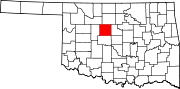
Towns Unincorporated
communitiesFootnotes ‡This populated place also has portions in an adjacent county or counties
Categories:- Oklahoma City Metropolitan Area
- Populated places in Canadian County, Oklahoma
- Populated places in Kingfisher County, Oklahoma
- Towns in Oklahoma


Wikimedia Foundation. 2010.