- McLoud, Oklahoma
-
For other uses, see McLoud.
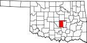
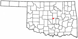
McLoud, Oklahoma — City — Motto: Blackberry Capital of the World Location of McLoud, Oklahoma
Coordinates: 35°24′44″N 97°5′54″W / 35.41222°N 97.09833°W Country United States State Oklahoma County Pottawatomie Area – Total 18.4 sq mi (47.7 km2) – Land 18.3 sq mi (47.5 km2) – Water 0.1 sq mi (0.2 km2) Elevation 1,093 ft (333 m) Population (2010) – Total 4,044 – Density 193.4/sq mi (74.7/km2) Time zone Central (CST) (UTC-6) – Summer (DST) CDT (UTC-5) ZIP code 74851 Area code(s) 405 FIPS code 40-45350[1] GNIS feature ID 1095268[2] McLoud is a town in Pottawatomie County, Oklahoma, United States, and is part of the Oklahoma City Consolidated Metropolitan Area. The population was 4,044 at the 2010 census.
Contents
History
Early day McLoud was known for manufacturing and selling Whiskey to whites and American Indians in dry Indian Territory. Located on the North Canadian River, the original town was destroyed in a flood and was rebuilt on higher ground one mile south.
In June 1895, a post office named McCloud was established for the town, named after railroad attorney John William McLoud. The spelling of the name was corrected in October 1895.
In 1949, the city was recognized as the "Blackberry Capital of the World" when the Chamber of Commerce sent a crate of blackberries to President Harry S. Truman.[3]
Geography
McLoud is located at 35°24′44″N 97°5′54″W / 35.41222°N 97.09833°W (35.412200, -97.098400)[4].
According to the United States Census Bureau, the town has a total area of 18.4 square miles (48 km2), of which, 18.3 square miles (47 km2) of it is land and 0.1 square miles (0.26 km2) of it (0.43%) is water.
Demographics
As of the census[1] of 2010, there were 4,044 people, 1,102 households. The racial makeup of the town was 2910 White, 241 African American, 569 Native American, 10Asian, 46 Some Other Race, 276 from Two or More Races. There were 1,102 households out of which 356 had children under the age of 18 living with them, In the town the population was spread out with 21.5% under the age of 18, 9.5% from 18 to 24, 38.7% from 25 to 44, 19.9% from 45 to 64, and 10.4% who were 65 years of age or older. The median age was 35 years. For every 100 females there were 58.8 males. For every 100 females age 18 and over, there were 49.0 males.
The median income for a household in the town was $32,475, and the median income for a family was $37,138. Males had a median income of $30,431 versus $20,667 for females. The per capita income for the town was $12,774. About 11.6% of families and 13.4% of the population were below the poverty line, including 15.5% of those under age 18 and 16.3% of those age 65 or over.
Government and infrastructure
The United States Postal Service operates the McLoud Post Office.[5]
The Oklahoma Department of Corrections operates the Mabel Bassett Correctional Center in an unincorporated area in Pottawatomie County, near McLoud.[6]
Blackberry Festival
As the “Blackberry Capital of the World”, McLoud is home to the annual Blackberry Festival sponsored by the McLoud Chamber of Commerce. The festival began in the 1940s as a celebration of the end of the blackberry harvest. Although there is no longer large scale commercial blackberry farming in McLoud, blackberries still grow wild in the area. The festival is held the first weekend in July at venues throughout the community. The festivities now include a parade, carnival, car show, poker run, baking contest, and pageant. Fireworks and music are also a major part of the activities for the weekend.
References
- ^ a b "American FactFinder". United States Census Bureau. http://factfinder.census.gov. Retrieved 2008-01-31.
- ^ "US Board on Geographic Names". United States Geological Survey. 2007-10-25. http://geonames.usgs.gov. Retrieved 2008-01-31.
- ^ Encyclopedia of Oklahoma History and Culture - McLoud Retrieved 2/26/2011
- ^ "US Gazetteer files: 2010, 2000, and 1990". United States Census Bureau. 2011-02-12. http://www.census.gov/geo/www/gazetteer/gazette.html. Retrieved 2011-04-23.
- ^ "Post Office™ Location - MCLOUD." United States Postal Service. Retrieved on November 22, 2010.
- ^ "Mabel Bassett Correctional Center." Oklahoma Department of Corrections. Retrieved on November 22, 2010.
External links
Municipalities of the Greater Oklahoma City Metropolitan Area Population over 500,000 Population over 100,000 Population over 50,000 Population over 20,000 Population over 10,000 Population over 5,000 Population over 2,000 Bethel Acres • Chandler • Harrah • Jones • Lexington • McLoud • Nichols Hills • Nicoma Park • Prague • Slaughterville • Spencer • StroudPopulation over 1,000 Crescent • Forest Park • Goldsby • Langston • Luther • Maud • Minco • Ninnekah • Okarche • Pink • Rush Springs • Union CityPopulation over 500 Population over 200 Population under 200 Bradley • Bridge Creek • Brooksville • Cimarron City • Etowah • Fallis • Kendrick • Lake Aluma • Macomb • Meridian • Norge • Rosedale • Smith Village • Sparks • Woodlawn ParkUnincorporated areas Regional Government Association of Central Oklahoma GovernmentsMunicipalities and communities of Pottawatomie County, Oklahoma Cities Maud‡ | Oklahoma City‡ | Shawnee | Tecumseh
Towns Unincorporated
communityGhost town Avoca | Keokuk Falls
Footnotes ‡This populated place also has portions in an adjacent county or counties
Categories:- Oklahoma City Metropolitan Area
- Populated places in Pottawatomie County, Oklahoma
- Towns in Oklahoma

Wikimedia Foundation. 2010.