- Dale, Oklahoma
-
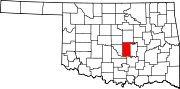
Dale — Unincorporated community — Location within the state of Oklahoma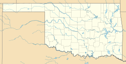
 Dale
DaleCoordinates: 35°23′24″N 97°2′42″W / 35.39°N 97.045°WCoordinates: 35°23′24″N 97°2′42″W / 35.39°N 97.045°W Country United States State Oklahoma County Pottawatomie Time zone Central (CST) (UTC-6) - Summer (DST) CDT (UTC-5) ZIP codes FIPS code GNIS feature ID Dale is a small community located on State Highway 270 in Pottawatomie County, Oklahoma. It lies in the North Canadian River bottom, a few miles northwest of Shawnee. Dale was platted along the Rock Island railroad line before statehood. The Dale Post Office opened October 26, 1893. The community was named for Frank Dale, a territorial judge.
Sources
Shirk, George H. Oklahoma Place Names. Norman: University of Oklahoma Press, 1987. ISBN 0-8061-2028-2 .
Municipalities and communities of Pottawatomie County, Oklahoma County seat: Shawnee Cities Maud‡ | Oklahoma City‡ | Shawnee | Tecumseh
Towns Unincorporated
communityAydelotte | Anderson | Bellemont | Box | Burnett | Centerview | Chisney | Dale | Eason | Garden Grove | Harjo | Hazel Del | Morvin | Pearson | Romulus | Sacred Heart | Trousdale | Vista | Wye
Ghost town Avoca | Keokuk Falls
Footnotes ‡This populated place also has portions in an adjacent county or counties
Categories:- Populated places in Pottawatomie County, Oklahoma
- Unincorporated communities in Oklahoma
- Oklahoma geography stubs
- United States ghost town stubs


Wikimedia Foundation. 2010.