- National Register of Historic Places listings in Garfield County, Colorado
-
 Location of Garfield County in Colorado
This is a list of the National Register of Historic Places listings in Garfield County, Colorado. It is intended to be a complete list of the properties and districts on the National Register of Historic Places in Garfield County, Colorado, United States. The locations of National Register properties and districts for which the latitude and longitude coordinates are included below, may be seen in a Google map.[1]
There are 17 properties and districts listed on the National Register in the county.
-
- This National Park Service list is complete through NPS recent listings posted November 10, 2011.[2]
Listings county-wide
[3] Landmark name [4] Image Date listed Location City or town Summary 1 Battlement Mesa Schoolhouse 
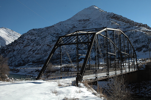
April 21, 1983 7201 300 Rd.
39°26′05″N 108°01′43″W / 39.434722°N 108.028611°WBattlement Mesa 2 Canyon (Canon) Creek School, District No. 32 January 6, 2004 0566 County Road 137
39°34′55″N 107°26′54″W / 39.581944°N 107.448333°WGlenwood Springs 3 Cardiff Coke Ovens November 15, 1996 County Road 116 approximately 1.5 miles south of Glenwood
39°30′17″N 107°18′38″W / 39.504722°N 107.310556°WGlenwood Springs 4 Citizens National Bank Building July 15, 1999 801 Grand Ave.
39°32′47″N 107°19′27″W / 39.546389°N 107.324167°WGlenwood Springs 5 Earnest Ranch April 1, 1998 6471 County Road 117
39°26′26″N 107°18′42″W / 39.440556°N 107.311667°WGlenwood Springs 6 Glenwood Springs Hydroelectric Plant October 14, 1998 601 6th St.
39°33′01″N 107°19′14″W / 39.550278°N 107.320556°WGlenwood Springs 7 Havemeyer-Willcox Canal Pumphouse and Forebay 
April 22, 1980 West of Rifle
39°30′00″N 107°55′05″W / 39.5°N 107.918056°WRifle 8 Hotel Colorado 
May 26, 1977 526 Pine St.
39°34′25″N 107°19′28″W / 39.573611°N 107.324444°WGlenwood Springs 9 Missouri Heights School September 23, 1999 County Road 102, 0.5 miles east of its junction with County Road 100
39°25′56″N 107°08′14″W / 39.432222°N 107.137222°WCarbondale 10 Rifle Bridge 
February 4, 1985 Off State Highways 6/24 over the Colorado River
39°31′41″N 107°46′51″W / 39.528056°N 107.780833°WRifle 11 Satank Bridge 
February 4, 1985 County Road 106
39°25′02″N 107°13′48″W / 39.417222°N 107.23°WCarbondale 12 South Canon Bridge 
February 4, 1985 County Road 134
39°33′42″N 107°24′23″W / 39.561667°N 107.406389°WGlenwood Springs 13 Starr Manor June 20, 1986 901 Palmer Ave.
39°32′43″N 107°19′13″W / 39.545278°N 107.320278°WGlenwood Springs 14 Sumers Lodge June 20, 1997 1200 Mountain Dr.
39°30′48″N 107°18′53″W / 39.513333°N 107.314722°WGlenwood Springs 15 Edward T. Taylor House October 14, 1986 903 Bennett Ave.
39°32′43″N 107°19′16″W / 39.545278°N 107.321111°WGlenwood Springs 16 US Post Office-Rifle Main January 24, 1986 Railroad Ave. and 4th St.
39°31′57″N 107°47′02″W / 39.5325°N 107.783889°WRifle 17 Wasson-McKay Place August 5, 2010 259 Cardinal Way
39°26′56″N 108°03′08″W / 39.448889°N 108.052222°WParachute See also
- List of National Historic Landmarks in Colorado
- National Register of Historic Places listings in Colorado
References
- ^ The latitude and longitude information provided in this table was derived originally from the National Register Information System, which has been found to be fairly accurate for about 99% of listings. For about 1% of NRIS original coordinates, experience has shown that one or both coordinates are typos or otherwise extremely far off; some corrections may have been made. A more subtle problem causes many locations to be off by up to 150 yards, depending on location in the country: most NRIS coordinates were derived from tracing out latitude and longitudes off of USGS topographical quadrant maps created under the North American Datum of 1927, which differs from the current, highly accurate WGS84 GPS system used by Google maps. Chicago is about right, but NRIS longitudes in Washington are higher by about 4.5 seconds, and are lower by about 2.0 seconds in Maine. Latitudes differ by about 1.0 second in Florida. Some locations in this table may have been corrected to current GPS standards.
- ^ "National Register of Historic Places: Weekly List Actions". National Park Service, United States Department of the Interior. Retrieved on November 10, 2011.
- ^ Numbers represent an ordering by significant words. Various colorings, defined here, differentiate National Historic Landmark sites and National Register of Historic Places Districts from other NRHP buildings, structures, sites or objects.
- ^ "National Register Information System". National Register of Historic Places. National Park Service. . http://nrhp.focus.nps.gov/natreg/docs/All_Data.html.
U.S. National Register of Historic Places Topics Lists by states Alabama • Alaska • Arizona • Arkansas • California • Colorado • Connecticut • Delaware • Florida • Georgia • Hawaii • Idaho • Illinois • Indiana • Iowa • Kansas • Kentucky • Louisiana • Maine • Maryland • Massachusetts • Michigan • Minnesota • Mississippi • Missouri • Montana • Nebraska • Nevada • New Hampshire • New Jersey • New Mexico • New York • North Carolina • North Dakota • Ohio • Oklahoma • Oregon • Pennsylvania • Rhode Island • South Carolina • South Dakota • Tennessee • Texas • Utah • Vermont • Virginia • Washington • West Virginia • Wisconsin • WyomingLists by territories Lists by associated states Other Municipalities and communities of Garfield County, Colorado Cities 
Towns Carbondale | New Castle | Parachute | Silt
CDPs Battlement Mesa | Catherine | Cattle Creek | Chacra | Mulford | No Name
Categories:- National Register of Historic Places in Colorado by county
- Garfield County, Colorado
- Buildings and structures in Garfield County, Colorado
-


Wikimedia Foundation. 2010.